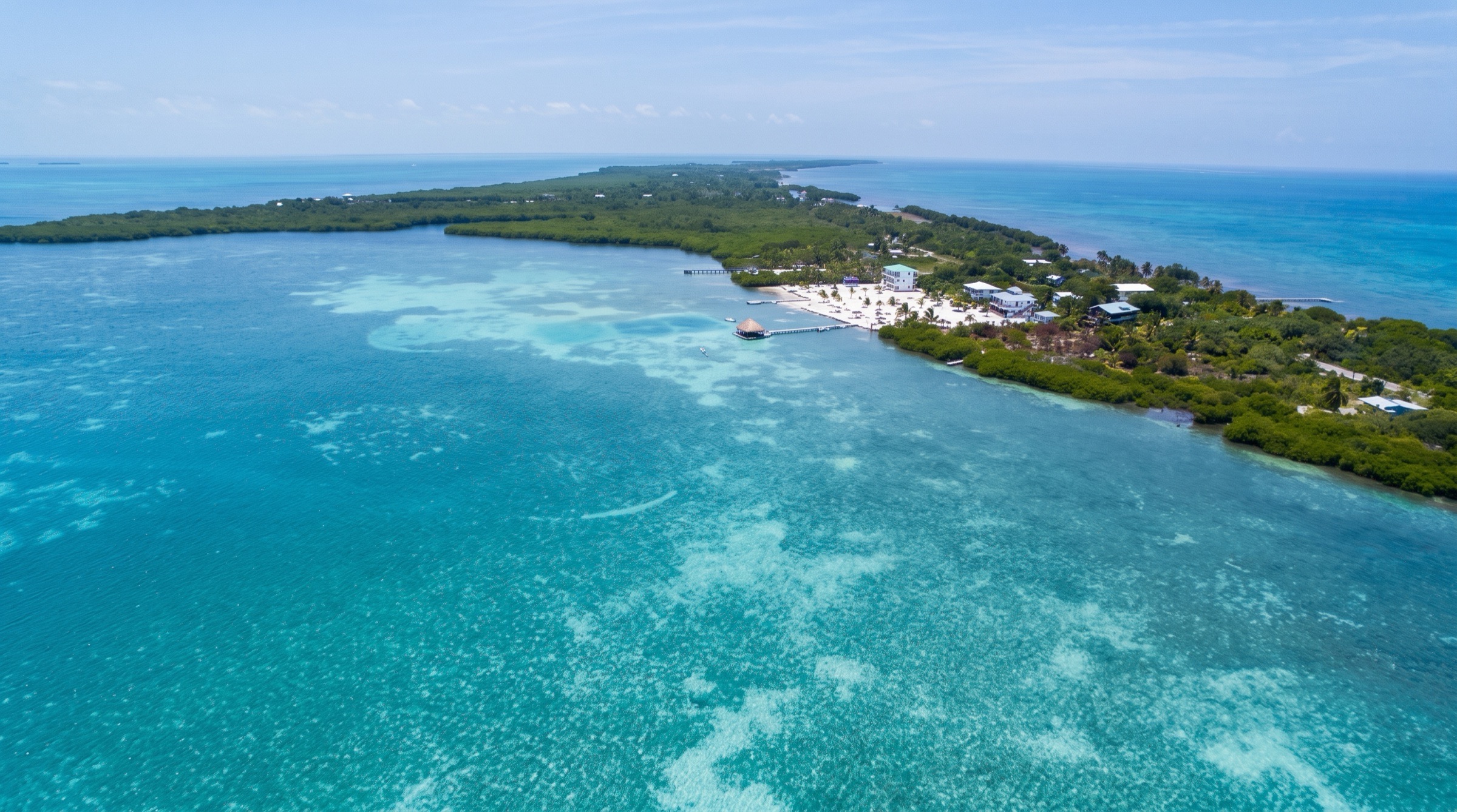
 AI image
Caribbean
Belize Barrier Reef
Belize has the longest barrier reef in the Western Hemisphere, with tiny palm-covered cays to anchor behind and some of the best snorkeling and diving in the Caribbean. Highlights include Tobacco Caye, the Cays near Placencia, and the remote Glover's and Lighthouse Reef atolls. Navigation is by eye through coral, so sunlight matters.
Best months
Difficulty
ModerateEyeball navigation through coral reefs and remote atolls.
Conditions
Northeast to east trades of 10-20 knots with calm mornings. Cold fronts, called northers, bring 25-35 knots from the north between November and March. Reef navigation requires good light, high sun and a lookout. Hurricane season is June to November.
Itineraries here
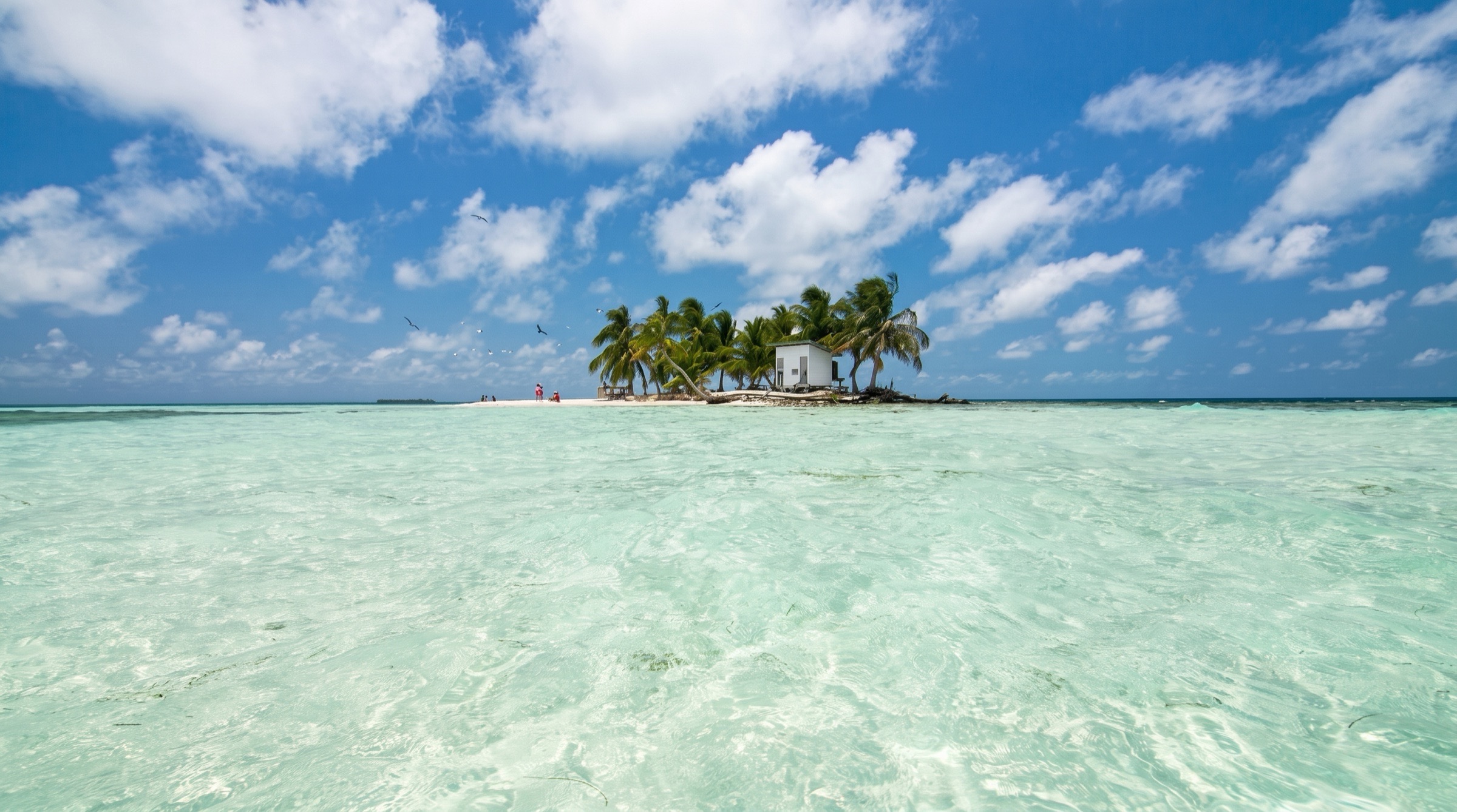
Area guide
Other Caribbean
Turks and Caicos Islands · Dominican Republic · Puerto Rico · Jamaica · Cayman Islands · Aruba · Bonaire (Caribbean Netherlands) · Curaçao · Belize · Honduras · Guatemala · Panama · Colombia
Everything in the Caribbean west and south of the Bahamas and the Eastern Caribbean chain, strung along the 'Thorny Path' and the Western Caribbean loop. Turks & Caicos is a Bahamas-style shallow-bank country: Providenciales, the 40-mile Caicos Bank crossing to South Caicos, then deep Turks Island Passage (over 2,200 m deep) to Grand Turk's wall and sleepy Salt Cay. Hispaniola's north coast offers the hurricane hole at Luperón and Samaná Bay, a humpback-whale breeding ground beside Los Haitises' mangroves and karst islets; the southeast has Punta Cana, Isla Saona and Catalina. Across the Mona Passage, Puerto Rico's south and west coasts (Boquerón, La Parguera's bioluminescent bay and cays, Ponce, Salinas, Caja de Muertos) are a protected US-territory staging ground. Jamaica (Port Antonio's twin harbours, Montego Bay) and the three Cayman Islands (Stingray City, Bloody Bay Wall) are open-ocean stops between the Windward Passage and Central America. In the south, the ABC islands sit below the main hurricane belt: Bonaire's mandatory-mooring marine park, Curaçao's landlocked Spanish Water and Willemstad, and windy Aruba. The western Caribbean is reef country: the Belize Barrier Reef (about 300 km, UNESCO since 1996) with Ambergris and Caye Caulker in the north, three offshore atolls (Turneffe, Lighthouse Reef with the Great Blue Hole, Glover's) and Placencia's southern cayes; Honduras' Bay Islands (Roatán, Utila, Guanaja); and Guatemala's Río Dulce, a jungle-gorge river and the region's classic hurricane-season hideout. Panama's Guna Yala (San Blas) is roughly 365 palm islands run by the Guna people, with legendary anchorages at the Lemmons, Holandes Cays, Coco Bandero and Chichime; Bocas del Toro is a mangrove archipelago near Costa Rica. Cartagena, Colombia is the walled-city gateway, with the Rosario and San Bernardo islands as its day-sail playground.
Top of the list
- 1Cayos Holandeses Anchorage (The Swimming Pool)The San Blas signature: turquoise 'swimming pool' between palm cays inside the outer reef, with nurse sharks, rays and the Guna selling molas and lobster from ulus.
- 2East Lemmon Cays AnchorageThe most sociable San Blas anchorage, a short hop from Porvenir, with reef-ringed islets and a cruiser beach bar.
- 3Coco Bandero Cays AnchoragePostcard palm islets on a reef shelf in the eastern Holandes area, quieter and some of the clearest water in Guna Yala.
- 4Chichime Cays AnchorageTwo palm cays with a Guna family settlement; the first anchorage for many boats arriving from Cartagena or Portobelo.
- 5Great Blue Hole (Lighthouse Reef)Near-circular 318 m wide, 124 m deep marine sinkhole made famous by Cousteau in 1970 — Belize's bucket-list dive.
- 6Half Moon Caye Natural MonumentLighthouse Reef's red-footed booby colony, white-sand anchorage and the wall dive next door.
- 7Hol Chan Marine Reserve & Shark Ray AlleyAmbergris Caye's reef-cut reserve, with nurse sharks and southern stingrays in a few feet of water.
- 8South Water Caye Marine ReserveTiny resort cay perched on the barrier reef within the World Heritage reserve system — reef snorkeling off the beach.
- 9Glover's Reef AtollRemote atoll and marine reserve: a reef-ringed lagoon studded with patch reefs, with wall diving outside.
- 10Bonaire National Marine Park Moorings (Kralendijk)Overnight visitor moorings off Kralendijk lie directly over one of the Caribbean's healthiest reefs; anchoring is replaced by moorings and there are 86 public dive sites.
- 11Klein BonaireUninhabited islet across the channel ringed by protected reef, with No Name Beach and boat-access dive sites.
- 12Spanish Water Anchorage (Curaçao)The ABC islands' great all-weather inland lagoon anchorage, with Caracasbaai, dive shops and a dinghy to provisioning.
- 13Stingray City Sandbar (North Sound)Stand in about 3 ft of water among southern stingrays inside Grand Cayman's North Sound reef.
- 14Bloody Bay Wall (Little Cayman)A legendary vertical wall that starts in shallow water — the Caymans' finest dive and snorkel.
- 15Samaná Bay Humpback Whale WatchingOne of the Caribbean's great humpback breeding grounds each winter, with Los Haitises' karst islets across the bay.
- 16Los Haitises National ParkMangrove channels, bird-nesting islets and caves with Taíno pictographs on the south side of Samaná Bay.
- 17Luperón Harbor AnchorageMangrove-lined, landlocked harbor that has served generations of cruisers on the Thorny Path as a hurricane hole.
- 18Sapodilla Bay Anchorage (Chalk Sound, Providenciales)Providenciales' cruiser anchorage and port of entry, steps from the vivid turquoise of Chalk Sound.
- 19Grand Turk WallThe reef drops vertically into Turks Island Passage within easy reach of Cockburn Town; humpbacks pass in winter.
- 20Bahía Fosforescente (La Parguera)Puerto Rico's bioluminescent bay, amid a maze of mangrove cays and reef on the south-west coast.
- 21Río Dulce GorgeSail up through towering jungle-walled limestone canyon from Garifuna Livingston to the marinas of Fronteras and Lago de Izabal.
- 22Cayos Zapatilla (Bastimentos National Marine Park)Two uninhabited palm cays and reef in Bocas del Toro's marine park.
- 23Islas del Rosario National ParkCorales del Rosario coral park, about 20 km from Cartagena — the first night out of the walled city.
- 24Cartagena Old Walled CityUNESCO colonial city with ramparts, plazas and the Club Náutico/Manga anchorage on its doorstep.
- 25West End Moorings (Roatán Marine Park)Roatán's dive-town strip with marine-park moorings over the Mesoamerican Reef.
When to go
Broadly December through April/May for the northern and western Caribbean: dry, trade-wind sailing with northers (cold fronts) occasionally reaching Turks & Caicos, the DR, the Caymans, Belize and the Bay Islands. Belize's charter season is November–April (dry season December–May per The Moorings). San Blas/Guna Yala: mid-December–April brings strong 'Christmas winds' (NE trades, sometimes 20–30 kn) and rough passages from Cartagena; May–November is calmer with afternoon squalls and lightning and the area is generally outside the hurricane track. Bocas del Toro has its own pattern, with drier windows January–April and late August–October. The ABC islands enjoy steady E trades year-round. Plan Turks & Caicos and the DR north coast for winter/spring; many boats spend June–November in Río Dulce, Panama, Colombia or the ABCs.
Weather and hazards
Reef navigation is the main hazard everywhere: travel in good light with the sun high or behind you on the Caicos Bank, inside the Belize Barrier Reef, through the Bay Islands reefs and in Guna Yala (charts there can be offset from GPS; use proven waypoints, e.g. Bauhaus guide, and satellite overlays). The Caicos Bank is a 2–3 m-deep coral-head-strewn crossing done in daylight only. The DR's north coast is best transited at night/early morning using the katabatic night lee ahead of the afternoon trade build; the Mona Passage has the Hourglass Shoals off Cabo Engaño. Northers in winter bring strong N–NW winds to Belize, the Bay Islands and the Caymans, making Caribbean-facing anchorages and Lighthouse Reef untenable. The Colombian coast between Santa Marta and Cartagena (off the Magdalena River) is one of the windiest stretches in the Caribbean in winter, with heavy seas and floating debris. Panama's rainy season brings intense lightning. Strong currents: the Caribbean Current sets west; the Yucatán Current accelerates north off Belize/Mexico. Security varies: check current reports (e.g. Caribbean Safety and Security Net) for the Honduras/Nicaragua coast, Jamaica and the Colombian mainland.
Hurricane season
Atlantic hurricane season runs June 1 to November 30, with peak activity from late August through September (midpoint about September 10). Turks & Caicos, the DR, Puerto Rico, Jamaica, the Caymans, Belize and the Bay Islands are all in the hurricane belt; The Moorings notes August and September as Belize's most likely months. Traditional refuges: Luperón (DR), Río Dulce (Guatemala), and the low-latitude ABC islands, San Blas, Bocas del Toro and Cartagena, which lie south of most storm tracks (rarely hit but not immune). Check your insurer's named-storm latitude box.
Entry and clearance
Each country clears separately; carry ship's papers, passports, outbound clearance (zarpe/despacho) from the last port and crew lists. Turks & Caicos: pre-arrival notice via SailClear at least 24 hours before arrival and departure (mandatory since February 1, 2023); ports of entry are Grand Turk South Dock, Providenciales (Blue Haven Marina, South Bank Marina, South Dock, Southside Marina, Sapodilla Bay) and South Caicos (Cockburn Harbour). Dominican Republic: clear in with Navy (Armada), Customs, Immigration and agriculture at a port of entry (e.g. Luperón, Puerto Plata Ocean World, Samaná, Cap Cana, Casa de Campo); a despacho is required for every move between DR ports — verify current procedures. Puerto Rico is US territory: US vessels and citizens report via CBP ROAM app; foreign vessels need a cruising license. Cayman Islands: hail Port Security on VHF before entering and clear at George Town (Grand Cayman) — confirm current procedures with Cayman Customs & Border Control. Bonaire: overnight visitor moorings require registration at the Customs office and Harbour Village Marina before use. Belize, Honduras and Guatemala: clear at a port of entry (Belize: e.g. San Pedro, Belize City, Big Creek/Placencia, Punta Gorda; Honduras Bay Islands: Roatán, Utila, Guanaja; Guatemala: Livingston). Guatemala/Honduras/El Salvador/Nicaragua share the CA-4 visa area for persons. Panama: Caribbean ports of entry include Porvenir (Guna Yala), Bocas del Toro, Shelter Bay/Colón and Linton Bay; a Panama cruising permit plus immigration stamps are required. Colombia: foreign yachts clear through a licensed agent (Cartagena is the usual port). Curaçao: anchor only in the six designated areas with a Harbour Master permit - Spanish Water (max 90 days), Fuik Baai, Santa Martha, Santa Cruz, Piscadera Baai and Klein Curaçao (max 3 nights each); not St Anna Bay, Westpunt, Caracasbaai or Boka Sint Michiel (Curaçao Ports Authority via Noonsite, August 2025). Aruba: all yachts must clear in at the Barcadera customs dock, not Oranjestad (Noonsite, March 2026). All procedures change frequently — verify locally before arrival.
Permits and fees
Turks & Caicos (Border Force, current page): inbound clearance USD 50, outbound USD 50, overtime outside working hours; cruising permit USD 300 valid 90 days, bought from the Proper Officer at the first port of arrival, renewable. Belize (The Moorings area guide): mooring buoys roughly USD 15–25/night and marine park fees about USD 10 per person per day in protected areas; sport-fishing licence about USD 25/week; lobster closed season February 14 – June 15 — verify locally. Bonaire: the STINAPA nature fee is mandatory for all users of the Bonaire National Marine Park and Washington Slagbaai and is valid per calendar year (pay at bonairenaturefee.org); visitor overnight moorings take boats up to 18 m, public day moorings up to 13 m with a two-hour limit. Panama: cruising permit plus immigration and the Guna Yala Congress fee collected in San Blas, with additional per-island anchoring fees in some communities — verify locally. Colombia: agent fees for clearance. Dominican Republic: per-port despacho charges and clearance fees — verify locally. Marine park fees also apply in the Cayman Islands, Bay Islands (Roatán Marine Park moorings) and Rosario Islands.
Tides and currents
Tides are small throughout (Belize about 11–23 inches per The Moorings; ABCs and San Blas well under a meter), but currents and wind-driven water levels matter more: strong tidal flows through Caicos Bank cuts and Turks Island Passage edges; the Mona Passage; the west-setting Caribbean Current; and river outflow at Río Dulce (bar at Livingston, transit on high water) and in Cartagena's Bocachica. Tide predictions: NOAA Tides & Currents (tidesandcurrents.noaa.gov) for Puerto Rico and US-referenced stations across the region (e.g. Magueyes Island PR; Grand Turk; Port Royal Jamaica; George Town Grand Cayman); Rijkswaterstaat/meteo services for the ABCs; IDEAM/DIMAR for Colombia.
Money
US dollar in Turks & Caicos, Puerto Rico, Bonaire and (alongside the balboa) Panama; Dominican peso (DOP); Jamaican dollar (JMD); Cayman Islands dollar (KYD, pegged to USD); Aruban florin (AWG); Caribbean guilder in Curaçao (replaced the Netherlands Antillean guilder in 2025 — verify); Belize dollar (BZD, pegged 2:1 to USD); Honduran lempira (HNL); Guatemalan quetzal (GTQ); Colombian peso (COP). Guna Yala trade is cash-only in USD.
Radio and phones
VHF 16 for hailing throughout; marinas and port control usually work 16 then a working channel. Local cruiser nets exist in several hubs (e.g. Luperón, Río Dulce, Roatán, Bonaire, Curaçao Spanish Water, Bocas del Toro, Cartagena, and the Panama Connection SSB/radio net) — verify current channels and times locally. Cellular data works across the inhabited islands; San Blas has patchy coverage near larger Guna villages, so many boats use satellite internet. Caribbean Safety and Security Net (safetyandsecuritynet.org) publishes incident reports.
Charter bases
- Placencia, BelizeLaru Beya Marina, Placencia Peninsula, southern BelizeThe Moorings (bareboat and crewed catamarans; 7-, 10- and 14-day itineraries)
- San Blas / Guna YalaCartí, Porvenir and Linton Bay/Portobelo, PanamaMostly skippered/crewed catamaran charters and Cartagena–San Blas passage boats — verify operator licensing locally
- CartagenaClub Náutico / Manga and Bocagrande marinasSkippered day and term charters to the Rosario and San Bernardo islands — verify operators locally
- ProvidencialesBlue Haven, South Side and Turtle Cove marinasDay-sail and skippered charters; few if any bareboat fleets — verify locally
Getting there
- Providenciales International Airport — PLSMain gateway to Turks & Caicos with many US/Canada flights.
- JAGS McCartney International Airport (Grand Turk) — GDTInter-island and limited regional flights to Grand Turk.
- Gregorio Luperón International Airport (Puerto Plata) — POPClosest major airport to Luperón and Ocean World Marina.
- Samaná El Catey International Airport — AZSFor Samaná Bay and Puerto Bahía.
- Punta Cana International Airport — PUJFor Cap Cana, Punta Cana and Isla Saona.
- Luis Muñoz Marín International Airport (San Juan) — SJUMain Puerto Rico gateway; about 1.5–2.5 hours' drive to Salinas, Ponce or the south-west.
- Sangster International Airport (Montego Bay) — MBJJamaica's tourist gateway; Montego Bay Yacht Club nearby.
- Owen Roberts International Airport (Grand Cayman) — GCMMain Cayman gateway; inter-island flights to Cayman Brac and Little Cayman.
- Queen Beatrix International Airport (Aruba) — AUAAruba gateway.
- Flamingo International Airport (Bonaire) — BONClose to Kralendijk's moorings and marina.
- Curaçao International Airport (Hato) — CURFor Willemstad and Spanish Water.
- Philip S. W. Goldson International Airport (Belize City) — BZEInternational gateway; domestic hops to Placencia and San Pedro.
- Placencia Airport — PLJDomestic airstrip near The Moorings base.
- Juan Manuel Gálvez International Airport (Roatán) — RTBBay Islands gateway with some US flights.
- La Aurora International Airport (Guatemala City) — GUAFor Río Dulce: several hours by road to Fronteras.
- Tocumen International Airport (Panama City) — PTYFor San Blas (road to Cartí), Linton Bay, Portobelo and Shelter Bay.
- Bocas del Toro Isla Colón International Airport — BOCDomestic flights from Panama City to Bocas Town.
- Rafael Núñez International Airport (Cartagena) — CTGCartagena gateway, close to Bocagrande and Manga marinas.
Charts and guides
- Bruce Van Sant, 'The Gentleman's Guide to Passages South: The Thornless Path to Windward' (Turks & Caicos, DR, Puerto Rico)
- Frank Virgintino, Free Cruising Guides (freecruisingguides.com) — Dominican Republic, Jamaica, Cayman, ABC, Colombia, Panama and more
- Stephen J. Pavlidis, 'The Turks and Caicos Guide' (Seaworthy Publications)
- Freya Rauscher, 'Cruising Guide to Belize and Mexico's Caribbean Coast'
- Eric Bauhaus, 'The Panama Cruising Guide' (San Blas, Bocas, Colombia with surveyed waypoints)
- Explorer Chartbooks (Turks & Caicos coverage in the Far Bahamas Explorer)
- NOAA charts for Puerto Rico; NGA/UKHO (Admiralty) charts elsewhere; Navionics and satellite overlays (OpenCPN/Google Earth KAP) strongly recommended for Guna Yala and Belize
Sample routes
- 7-day Placencia southern cayes loop, Belize (distances approximate)Day 1 · Laru Beya Marina (Placencia) → Laughing Bird Caye National Park · 12 nmCharter briefing, provision in Placencia village, first snorkel in the national park.Day 2 · Laughing Bird Caye National Park → Pelican Cayes · 14 nmMangrove 'ponds' with dense coral and sponges; moorings.Day 3 · Pelican Cayes → South Water Caye Anchorage · 10 nmSnorkel the barrier reef straight off the beach.Day 4 · South Water Caye Anchorage → Tobacco Caye · 5 nmTiny fishing-village cay on the reef; sunset beach bar.Day 5 · Tobacco Caye → Lark Caye · 25 nmRemote cay, fishing and quiet anchorage.Day 6 · Lark Caye → Ranguana Caye · 10 nmPrivate-island beach and snorkel.Day 7 · Ranguana Caye → Laru Beya Marina (Placencia) · 18 nmReturn sail, Placencia sidewalk dinner.
- 12-day San Blas / Guna Yala explorer from Linton Bay (distances approximate)Day 1 · Linton Bay Marina → Chichime Cays Anchorage · 40 nmEarly start for good light on arrival through the reef entrance.Day 2 · Chichime Cays Anchorage → Porvenir Anchorage · 7 nmClear in at Porvenir (immigration, port captain, Guna Congress fee).Day 3 · Porvenir Anchorage → East Lemmon Cays Anchorage · 6 nmCruiser hub, snorkel, beach bar.Day 4 · East Lemmon Cays Anchorage → West Lemmon Cays Anchorage · 2 nmQuieter side; mola vendors by ulu.Day 5 · West Lemmon Cays Anchorage → Cayos Holandeses Anchorage (The Swimming Pool) · 12 nmNurse sharks and rays, BBQ island.Day 6 · Cayos Holandeses Anchorage (The Swimming Pool) → Cayos Holandeses Anchorage (The Swimming Pool) · 0 nmDinghy to Hollandes outer reef and the wreck at Banedup; lobster from Guna fishermen (in season).Day 7 · Cayos Holandeses Anchorage (The Swimming Pool) → Coco Bandero Cays Anchorage · 5 nmPostcard palm islets and clear water.Day 8 · Coco Bandero Cays Anchorage → Green Island Anchorage · 4 nmCalm, protected anchorage; paddleboard over reef.Day 9 · Green Island Anchorage → Río Diablo / Nargana Anchorage · 6 nmFresh water, small stores, dinghy up the river.Day 10 · Río Diablo / Nargana Anchorage → Carti Sugtupu Anchorage · 24 nmGuna village life, museum, crew changes by road.Day 11 · Carti Sugtupu Anchorage → Chichime Cays Anchorage · 10 nmLast snorkel, staging for the coast.Day 12 · Chichime Cays Anchorage → Linton Bay Marina · 40 nmReturn to Linton Bay or on to Portobelo.
- 10-day Turks & Caicos crossing (distances approximate)Day 1 · Turtle Cove Marina → Sapodilla Bay Anchorage (Chalk Sound, Providenciales) · 25 nmClear in (SailClear filed 24 hours ahead); Taylor Bay beach.Day 2 · Sapodilla Bay Anchorage (Chalk Sound, Providenciales) → West Caicos Anchorage (dive moorings) · 10 nmWest Caicos wall diving, Molasses Reef area.Day 3 · West Caicos Anchorage (dive moorings) → French Cay Anchorage · 14 nmBird sanctuary cay, nurse sharks.Day 4 · French Cay Anchorage → Long Cay Anchorage (South Caicos) · 40 nmDaylight-only Caicos Bank crossing with good light to read coral heads.Day 5 · Long Cay Anchorage (South Caicos) → Cockburn Harbour Anchorage (South Caicos) · 3 nmFishing town, wall diving, conch and lobster fleet.Day 6 · Cockburn Harbour Anchorage (South Caicos) → Cockburn Town Anchorage (Grand Turk) · 22 nmCross Turks Island Passage; humpbacks in season.Day 7 · Cockburn Town Anchorage (Grand Turk) → Gibbs Cay (stingrays) · 5 nmStingray encounter and snorkel.Day 8 · Gibbs Cay (stingrays) → Salt Cay Anchorage (Deane's Dock) · 10 nmSalt-raking history, whale watching Jan–Apr.Day 9 · Salt Cay Anchorage (Deane's Dock) → Cockburn Town Anchorage (Grand Turk) · 9 nmGrand Turk Wall dive, Cockburn Town museum.Day 10 · Cockburn Town Anchorage (Grand Turk) → Cockburn Town Anchorage (Grand Turk) · 0 nmClear out via SailClear and Border Force.
- 8-day ABC downwind run Bonaire to Aruba (distances approximate)Day 1 · Bonaire National Marine Park Moorings (Kralendijk) → Bonaire National Marine Park Moorings (Kralendijk) · 0 nmRegister at Customs and Harbour Village Marina; buy the STINAPA nature fee.Day 2 · Bonaire National Marine Park Moorings (Kralendijk) → Klein Bonaire · 2 nmDinghy dives and No Name Beach.Day 3 · Bonaire National Marine Park Moorings (Kralendijk) → Spanish Water Anchorage (Curaçao) · 35 nmDownwind to Curaçao; clear in at Willemstad.Day 4 · Spanish Water Anchorage (Curaçao) → Spanish Water Anchorage (Curaçao) · 0 nmProvisioning and Willemstad's Handelskade by bus.Day 5 · Spanish Water Anchorage (Curaçao) → Klein Curaçao · 12 nmLighthouse, shipwreck and turtle snorkel (day stop).Day 6 · Spanish Water Anchorage (Curaçao) → Santa Cruz Bay Anchorage · 25 nmWest-coast beaches and turtles.Day 7 · Santa Cruz Bay Anchorage → Renaissance Marina (Oranjestad) · 54 nmClear out of Curaçao; downwind to Aruba.Day 8 · Renaissance Marina (Oranjestad) → Surfside Anchorage (Aruba) · 2 nmAruba anchorage near the airport; Palm Beach by bus.
Places in Other Caribbean
- 'Al Ritmo de la Bahía' Whale Welcome (Samaná)Event · Samaná Peninsula
- 1000 StepsDive · Bonaire
- 27 Waterfalls of DamajaguaHike · Puerto Plata
- ABC Trade-Wind Season & Hurricane ExposureSeasonal · Curaçao
- Achutupu Anchorage (Dolphin Island)Anchorage · Mamitupu
- Admiral Cockburn Land & Sea National ParkDive · South Caicos
- Adventures by Salterra (South Caicos dive centre)Tour · South Caicos
- Agua Caliente Hot Springs (Río Dulce)Landmark · Río Dulce Gorge
- Aguadilla AnchorageAnchorage · Boquerón
- Ailigandí Village IslandLandmark · Ailigandí
- Airport Point & Mangrove Point (dive sites)Dive · Isla Colón
- Ak' Tenamit & Río TatínLandmark · Río Dulce Gorge
- Ak' Tenamit Riverside Restaurant (Río Tatín)Eat · Río Dulce Gorge
- Al's Grocery (Major Hill, North Caicos)Stores · North Caicos
- Alcázar de Colón (Santo Domingo)Landmark · Santo Domingo
- Alice in Wonderland (Dive Site)Dive · Bonaire
- Alligator Reef AnchorageAnchorage · Jamaica South Coast
- Almirante (mainland port & town)Service · Almirante
- Almirante Commercial Dock Fuel (Texaco)Service · Almirante
- Almirante Port Captain (port of entry)Permit · Almirante
- Almirante Supermarkets (Super Centro, Súper Centro Bocatoreño & Los Mellos)Stores · Almirante
- Almirante Terpel Fuel StationsService · Almirante
- Altos de ChavónLandmark · Casa de Campo (La Romana)
- Ambergris Cays Anchorage (TCI)Anchorage · Ambergris Cays (TCI)
- American Crocodiles, Nurse Sharks & RaysWildlife · Cayos Holandeses
- Anchorage Restaurant & Bar (Blue Haven Marina)Eat · Providenciales
- Andrea I & IISnorkel · Bonaire
- Angel City (Double Reef Dive Site)Dive · Bonaire
- Anthony S. Eden Hospital (George Town)Service · Grand Cayman
- Antilla WreckDive · Aruba
- Antilla Wreck Charter Moorings - Yacht Use Rules (Aruba)Permit · Aruba
- Arashi & Malmok Day Anchorage (Aruba)Anchorage · Aruba
- Arashi BeachBeach · Aruba
- Arch's Iguana and Marine Park (French Cay)Wildlife · Roatán
- Arikok National ParkHike · Aruba
- Aruba CarnivalEvent · Aruba
- Aruba Clearance (Oranjestad H Pier / Barcadera)Permit · Aruba
- Aruba Hi-Winds (Fisherman's Huts)Event · Aruba
- Asha's Culture Kitchen (Punta Gorda)Eat · Punta Gorda
- Atlantic Hurricane Season (Jamaica & Cayman)Seasonal · Port Royal / Kingston
- Atlantis Beach (Kite Beach)Watersport · Bonaire
- Aviario Nacional de Colombia (Barú)Wildlife · Barú
- Baby Beach (Aruba)Beach · Aruba
- Babylon (North Side)Dive · Grand Cayman
- Bacalar Chico National Park & Marine ReserveWildlife · Ambergris Caye
- Bachelor's BeachBeach · Bonaire
- Bachelor's Beach Reef (Dive Site)Dive · Bonaire
- Bagga Dub Restaurant (Isla Pinos)Eat · Isla Pinos (Tupbak)
- Bahía de Jauca AnchorageAnchorage · Salinas
- Bahía de las Mantas Anchorage (Isla Grande)Anchorage · Isla Grande (Rosario)
- Bahía del Rincón (day anchorage)Anchorage · Samaná Peninsula
- Bahía Escondida (Hidden Bay, Samaná)Anchorage · Samaná Peninsula
- Bahía Fosforescente (La Parguera)Seasonal · La Parguera
- Bahía Honda Anchorage (Isla Bastimentos)Anchorage · Isla Bastimentos
- Bahía Nombre de Dios (Security Caution)Anchorage · Linton Bay
- Bajo de Tortuguilla (Southwest Reef Bank)Dive · Islas del Rosario
- Ballena Blanca & Cayo Levantado Beach RestaurantsEat · Cayo Levantado
- Balneario de BoquerónBeach · Boquerón
- Bambarra Beach (Middle Caicos)Beach · Middle Caicos
- Bambooze Beach Bar & Grill (Caye Caulker)Eat · Caye Caulker
- Banco Nacional de Panamá (Bocas Town)Service · Isla Colón
- Bancos de Salmedina Dive SitesDive · Cartagena
- Banedup Anchorage (East Holandes)Anchorage · Cayos Holandeses
- Banedup Anchorage (East Lemmon Cays)Anchorage · Cayos Limones (East & West Lemmons)
- Barbara Beach MarinaMarina · Spanish Water
- Barcadera Customs Dock (Aruba Port of Entry)Permit · Aruba
- Barcadere Marina (George Town, North Sound)Marina · Grand Cayman
- Barco de San Martín de Pajarales (Wreck Dive)Dive · Islas del Rosario
- Barco Hundido (over-water bar, Bocas Town)Bar · Isla Colón
- Barefoot Beach Bar (Placencia)Bar · Placencia Peninsula
- Barefoot Cay Marina (Brick Bay)Marina · Roatán
- Barefoot Restaurant (Surfside)Eat · Aruba
- Bari ReefSnorkel · Bonaire
- Baron Bliss Harbour Regatta (Belize City)Event · Belize City
- Barracuda Beach Bar (Pelican Beach, North Caicos)Bar · North Caicos
- Barú Southwest Beaches (Playa Paraíso, La Ceiba & Los Muertos)Beach · Barú
- Barú Village & Southern TipLandmark · Barú
- Batabano Carnival (Grand Cayman)Event · Grand Cayman
- Batería de San José (Bocachica)Landmark · Isla Tierra Bomba
- Battle of St. George's Caye SiteLandmark · St. George's Caye
- Bayahibe AnchorageAnchorage · Bayahibe
- Bayahibe Fuel DockService · Bayahibe
- Bayahibe Village Colmado & PharmacyStores · Bayahibe
- Bayahibe Waterfront Restaurants (Calle La Bahía & La Punta)Eat · Bayahibe
- BBQ Island (Morodup), Holandes CaysBeach · Cayos Holandeses
- Bear's Den (Roatán)Dive · Roatán
- Belize City Anchorage (Fort George)Anchorage · Belize City
- Belize City Butane (LPG) RefillService · Belize City
- Belize City Chandlery & Hardware (Hofius, El Capitan)Service · Belize City
- Belize City LaundromatsService · Belize City
- Belize City Provisioning & MarketsStores · Belize City
- Belize Flats Fishing (bonefish, permit, tarpon)Fishing · Turneffe Atoll
- Belize Lobster & Conch Closed SeasonsSeasonal · Belize Barrier Reef
- Belize Marine Reserve & Park FeesPermit · Belize Barrier Reef
- Belize Port of Entry & Clearance (San Pedro, Belize City, Big Creek, Punta Gorda)Permit · Ambergris Caye
- Bell Sound Nature Reserve (South Caicos)Wildlife · South Caicos
- Bellefield Landing (North Caicos ferry port)Service · North Caicos
- Bellefield Landing anchorage & channel (North Caicos)Anchorage · North Caicos
- Bender's Beach Bar (Caye Caulker)Bar · Caye Caulker
- Bibi's on the Beach (Isla Carenero)Eat · Isla Carenero
- Big Bight Anchorage (Isla Colón)Anchorage · Isla Colón
- Big Blue Collective (Leeward)Tour · Providenciales
- Big Creek Port of Entry (Independence / Mango Creek)Permit · Placencia Peninsula
- Big French Cay Cut (Roatán)Dive · Roatán
- Big Sand Cay AnchorageAnchorage · Salt Cay
- Big Tunnels (West Bay)Dive · Grand Cayman
- Bight Reef (Coral Gardens) snorkel (Grace Bay)Snorkel · Providenciales
- Bioluminescence in the HolandesWildlife · Cayos Holandeses
- Bioluminescence Nights (Bocas)Tour · Isla Bastimentos
- Biotopo Chocón Machacas (Manatees)Wildlife · El Golfete
- Bird Island (Isla Pájaros / Swan Cay)Wildlife · Swan Cay
- Bird Rock Trail (Leeward)Hike · Providenciales
- Bistro de Paris (Kralendijk)Eat · Bonaire
- Black Hills & Halliburton Wreck (Utila)Dive · Utila
- Black River AnchorageAnchorage · Jamaica South Coast
- Black Rock Canyon (Guanaja)Dive · Guanaja
- Bloody Bay & Jackson's Point Mooring Rules (Little Cayman)Permit · Little Cayman
- Bloody Bay Anchorage (Little Cayman)Anchorage · Little Cayman
- Bloody Bay Wall (Little Cayman)Dive · Little Cayman
- Blue Bay BeachBeach · Curaçao
- Blue Bayou Snorkel (Utila south shore)Snorkel · Utila
- Blue Channel (Roatán)Dive · Roatán
- Blue Channel Snorkel (West End, Roatán)Snorkel · Roatán
- Blue Creek Anchorage (Turneffe)Anchorage · Turneffe Atoll
- Blue Ground Range AnchorageAnchorage · Blue Ground Range
- Blue Haven Marina (Leeward)Marina · Providenciales
- Blue Lagoon (Blue Hole, Port Antonio)Snorkel · Port Antonio
- Blue Marlin (West End)Eat · Roatán
- Blue Water Divers (Grand Turk)Tour · Grand Turk
- Blue Water Grill (SunBreeze Hotel, San Pedro)Eat · Ambergris Caye
- Bluefield Lagoon Anchorage (Bahía Azul, Valiente Peninsula)Anchorage · Valiente Peninsula
- Bluefield Range AnchorageAnchorage · Bluefield Range
- Bluefields Bay AnchorageAnchorage · Jamaica South Coast
- Bluff Beach (Playa Bluff)Beach · Isla Colón
- Boca CatalinaSnorkel · Aruba
- Boca Chica Town & Olé SupermarketStores · Santo Domingo
- Boca Chica Yacht Chandlery (by Marina Zarpar)Service · Santo Domingo
- Boca de Yuma AnchorageAnchorage · Punta Cana / Cap Cana
- Boca del Drago Beach (Isla Colón)Beach · Isla Colón
- Bocachica Village & Beach (Tierra Bomba)Beach · Isla Tierra Bomba
- Bocagrande BeachBeach · Bocagrande
- Bocas Cruisers & Expats Net (VHF 68)Service · Isla Colón
- Bocas del Toro Hospital & ClinicService · Isla Colón
- Bocas del Toro Port of Entry (AMP Port Captain, Bocas Town)Permit · Isla Colón
- Bocas Marina (Bocas Yacht Club & Marina, Isla Colón)Marina · Isla Colón
- Bocas Marina Fuel Dock (diesel & gasoline)Service · Isla Colón
- Bocas Surf SeasonSeasonal · Isla Colón
- Bocas Town Anchorage (Isla Colón)Anchorage · Isla Colón
- Bocas Town Bakeries (John's Bakery & Panadería Alemana)Stores · Isla Colón
- Bocas Town Fruit & Vegetable Stands (Legumbrería José & Frutería Quintero)Stores · Isla Colón
- Bocas Town Laundry, Propane & HardwareService · Isla Colón
- Bocas Town Provisioning (supermarkets, Chinese markets & fruit stalls)Stores · Isla Colón
- Bocas Town Waterfront Restaurants & BarsEat · Isla Colón
- Bocas Water Taxis & Almirante FerryService · Isla Colón
- Bocas Weather Windows (dry Jan–Apr & Sep–Oct)Seasonal · Isla Colón
- Bocas Yacht Services Boatyard (Almirante)Service · Almirante
- Bodden Bight & Hole in the Wall (Jonesville)Eat · Roatán
- Bogue Lagoon (Montego Bay Hurricane Hole)Anchorage · Montego Bay
- Boiling Hole & salinas (South Caicos)Landmark · South Caicos
- Boka KokolishiBeach · Bonaire
- Boka Sami (Sint Michielsbaai)Landmark · Curaçao
- Boka Sint Michiel (Boka Sami) - Not a Designated AnchoragePermit · Curaçao
- Boka SlagbaaiBeach · Bonaire
- Bonacca (Guanaja Cay)Landmark · Guanaja
- Bonacca Shops & Friday Produce Boat (Guanaja)Stores · Guanaja
- Bonaire CarnivalEvent · Bonaire
- Bonaire Customs & Immigration Clearance (Kralendijk)Permit · Bonaire
- Bonaire International Sailing Regatta (October)Event · Bonaire
- Bonaire National Marine Park Moorings (Kralendijk)Anchorage · Bonaire
- Bonnie's Arch (West Bay)Dive · Grand Cayman
- Booby Cay (Negril)Snorkel · Negril
- Booby Pond Nature ReserveWildlife · Little Cayman
- Boquerón Bay AnchorageAnchorage · Boquerón
- Boquerón Village & Club Náutico de BoquerónEat · Boquerón
- Boston BayBeach · Port Antonio
- Boston Bay Jerk Pits (Boston Jerk Centre)Eat · Port Antonio
- Bottle Creek Lagoon (North Caicos, shoal-draft only)Anchorage · North Caicos
- Bowden Harbour / Port Morant Port of EntryPermit · Port Royal / Kingston
- Brac Parrot ReserveWildlife · Cayman Brac
- Brandaris (Subi Brandaris Trail)Hike · Bonaire
- Brick Bay Anchorage (Roatán)Anchorage · Roatán
- Brisa Do Mar & Pop's Place (Caracasbaai)Eat · Curaçao
- Brisas del Mar Fuel Station (Bocas Town, jerry-jug fuel)Service · Isla Colón
- Brodie's Supermarkets (Belize City)Stores · Belize City
- Brooksy Point Yacht ClubMarina · Roatán
- Bruno's Marina (Fronteras)Marina · Fronteras / Río Dulce Town
- Bubali Bird SanctuaryWildlife · Aruba
- Buccaneer Beach (Cayman Brac)Snorkel · Cayman Brac
- Bucuti Lagoon Anchorage & Aruba Yacht ClubAnchorage · Aruba
- Buddy Dive Resort (Drive-thru Tank Fills)Service · Bonaire
- Budget Marine ArubaService · Aruba
- Budget Marine BonaireService · Bonaire
- Budget Marine CuraçaoService · Curaçao
- Buga Mama (Livingston)Eat · Livingston
- Buoy Line & Pandora Wreck (dive sites)Dive · Isla Solarte
- Bush's Supermarket & Fuel Dock (Utila)Stores · Utila
- Cabañas y Restaurante NalunegaEat · Nalunega
- Cabarete Kite BeachWatersport · Puerto Plata
- Cabo Rojo Lighthouse (Los Morrillos)View · Puerto Real
- Cabo Rojo National Wildlife Refuge & Salt FlatsWildlife · Puerto Real
- Cabo Tres Puntas Waiting AnchorageAnchorage · Livingston
- Cabruna Reef (San Bernardo East)Dive · Islas de San Bernardo
- Café del Mar (Baluarte de Santo Domingo)Bar · Cartagena
- Café Havana (Getsemaní)Bar · Cartagena
- Caicos Bakery (Grace Bay)Stores · Providenciales
- Caicos Bank overnight anchorage (mid-bank)Anchorage · Caicos Bank
- Caja de Muertos AnchorageAnchorage · Caja de Muertos
- Caja de Muertos Nature ReserveHike · Caja de Muertos
- Caja de Muertos Snorkel Trail & Playa PelícanoSnorkel · Caja de Muertos
- Calabash Bight Anchorage (Roatán)Anchorage · Roatán
- Calabash Caye (Turneffe)Anchorage · Turneffe Atoll
- Caledonia AnchorageAnchorage · Caledonia
- California LighthouseLandmark · Aruba
- Calle 3 Chinese Supermarkets (Super Centro Alba, Supermercado Cayo Zapatilla & Mini Super Cristina)Stores · Isla Colón
- Calypso Cantina Cruisers' Night (Bocas Marina)Bar · Isla Colón
- Camana Bay (Foster's & dinghy access)Stores · Grand Cayman
- Camp Bay Beach (Roatán)Beach · Roatán
- Caña Gorda Cays Anchorage (Guánica)Anchorage · Guánica
- Caño Ratón Anchorage (Isla Grande)Anchorage · Isla Grande (Rosario)
- Cap Cana Billfish TournamentsEvent · Punta Cana / Cap Cana
- Cap Cana MarinaMarina · Punta Cana / Cap Cana
- Captain Don's HabitatDive · Bonaire
- Captain Jack's Bar & Grill (Portobelo)Bar · Portobelo
- Captain John's MarinaMarina · Fronteras / Río Dulce Town
- Captain Sharks Boatyard & Marine Store (San Pedro)Service · Ambergris Caye
- Captain's Table (Cayman Brac)Eat · Cayman Brac
- Car Pile (Oswaldo's Drop Off & Pier Baai Reef)Dive · Curaçao
- Cara a Cara Shark Dive (Roatán)Dive · Roatán
- Caracasbaai - Not a Designated Anchorage (Curaçao)Permit · Curaçao
- Caracasbaai (Caracas Bay)Snorkel · Curaçao
- Carenero Beach Bars (Bibi's, Aqua Lounge & Receta Michela)Eat · Isla Carenero
- Carenero Fuel StationService · Isla Carenero
- Carenero Island Loop TrailHike · Isla Carenero
- Carenero Point Break & Black Rock (surf)Watersport · Isla Carenero
- Caribbean Images Marina & Tours (La Guancha)Marina · Ponce
- Caribbean Laundry & Magero Self-Service Laundry (Kralendijk)Service · Bonaire
- Caribeña Enterprises Fuel Dock (San Pedro)Service · Ambergris Caye
- Carl's Hill (Klein Bonaire)Dive · Klein Bonaire
- Carnaval de Barranquilla (four days before Ash Wednesday)Event · Barranquilla
- Carnaval de PonceEvent · Ponce
- Carnaval Dominicano (Santo Domingo)Event · Santo Domingo
- Carnaval Holidays (Panama-wide, four days before Ash Wednesday)Event · Isla Colón
- Carreto Bay AnchorageAnchorage · Puerto Obaldía
- Carrie Bow Caye (Smithsonian Field Station)Landmark · Carrie Bow Caye
- Cartagena Dentists Cruisers Use (Manga & Castillogrande)Service · Manga
- Cartagena Dive Operators (El Laguito & Bocagrande)Dive · Bocagrande
- Cartagena Haul-Out Yards (Mamonal: Ferroalquimar, Todomar, Marina Portobello)Service · Cartagena
- Cartagena International Fishing Tournament (October)Event · Cartagena
- Cartagena Laundry, Propane & Boat Services (Manga)Service · Manga
- Cartagena Marine Suppliers (Budget Marine, Lalizas, Ferremarina & Pie de la Popa)Service · Cartagena
- Cartagena Old Walled CityLandmark · Cartagena
- Cartagena Sailing Week (Easter, Club de Pesca)Event · Manga
- Cartagena Yacht Fuel Options (Club de Pesca, Todomar, Santa Cruz & Rosales)Service · Manga
- Carti Boat Fuel Station (Gardi Sugdub)Service · Carti
- Carti Road to Panama City (Crew Change)Service · Carti
- Carti Sugtupu AnchorageAnchorage · Carti
- Carti Sugtupu Village & Guna MuseumLandmark · Carti
- Carulla Supermarket (Manga)Stores · Manga
- Cas Abao BeachBeach · Curaçao
- Casa Congo Restaurant & Dinghy Dock (Portobelo)Eat · Portobelo
- Casa Perico (jungle restaurant)Eat · Fronteras / Río Dulce Town
- Casa Vela Bar, Restaurant & Sail Loft (Portobelo)Eat · Portobelo
- Castillo de San Felipe de LaraLandmark · Fronteras / Río Dulce Town
- Castillo San Felipe de BarajasLandmark · Cartagena
- Castillo Serrallés (Ponce)Landmark · Ponce
- CatalinitaSnorkel · Catalinita
- Catamaran Island Hotel & MarinaMarina · Fronteras / Río Dulce Town
- Catedral Primada de América (Santo Domingo)Landmark · Santo Domingo
- Cay View Restaurant (Jewel/Pigeon Cay, Utila)Eat · Utila
- Caye Bokel Anchorage (Turneffe south)Anchorage · Turneffe Atoll
- Caye Caulker AnchorageAnchorage · Caye Caulker
- Caye Caulker Butane (cooking gas refill)Service · Caye Caulker
- Caye Caulker Forest ReserveWildlife · Caye Caulker
- Caye Caulker Fuel Dock (back side)Service · Caye Caulker
- Caye Caulker LaundriesService · Caye Caulker
- Caye Caulker LobsterfestEvent · Caye Caulker
- Caye Caulker Marine ReserveSnorkel · Caye Caulker
- Caye Caulker ProvisioningStores · Caye Caulker
- Caye Caulker RestaurantsEat · Caye Caulker
- Caye Caulker Tarpon Feeding SpotWildlife · Caye Caulker
- Caye Caulker Water Taxis (to San Pedro & Belize City)Service · Caye Caulker
- Caye Chapel AnchorageAnchorage · Caye Chapel
- Cayman Brac Fuel & Water (truck to The Creek)Service · Cayman Brac
- Cayman Brac Port of Entry (The Creek)Permit · Cayman Brac
- Cayman Brac Provisioning & ServicesStores · Cayman Brac
- Cayman Hyperbaric Chamber (George Town)Service · Grand Cayman
- Cayman Islands Marine Parks RulesPermit · Grand Cayman
- Cayman Islands Sailing ClubService · Grand Cayman
- Cayman Islands Sailing Club Easter Regatta & Round the Island RaceEvent · Grand Cayman
- Cayman Islands Yacht Club MarinaMarina · Grand Cayman
- Cayman Port Security VHF Arrival CallPermit · Grand Cayman
- Cayo Arenas (Cayo Paraíso)Snorkel · Luperón
- Cayo Aurora Reef Snorkel (Gilligan's Island)Snorkel · Guánica
- Cayo Coral Reef Dive (Crawl Cay)Dive · Isla Bastimentos
- Cayo de Agua (Isla Cayo Agua)Landmark · Cayo de Agua
- Cayo LevantadoBeach · Cayo Levantado
- Cayo Levantado Day AnchorageAnchorage · Cayo Levantado
- Cayo Vigía Causeway ('Bridge to Nowhere')Landmark · Samaná Peninsula
- Cayos Cochinos Admission Fee & Check-in (Cayo Menor)Permit · Cayos Cochinos
- Cayos Cochinos Lighthouse WalkHike · Cayos Cochinos
- Cayos Cochinos Marine MonumentSnorkel · Cayos Cochinos
- Cayos Cochinos Moorings (Cayo Grande)Anchorage · Cayos Cochinos
- Cayos de Barca AnchorageAnchorage · Salinas
- Cayos de los Siete Hermanos (Tororu Anchorage)Anchorage · Monte Cristi
- Cayos Holandeses Anchorage (The Swimming Pool)Anchorage · Cayos Holandeses
- Cayos Zapatilla (Bastimentos National Marine Park)Beach · Cayos Zapatilla
- Cayos Zapatilla Anchorage (Bastimentos Marine Park)Anchorage · Cayos Zapatilla
- Central Caribbean Marine Institute - Little Cayman Research CentreTour · Little Cayman
- Cessna 401 & Lucky Lady wrecks (Salt Cay)Dive · Salt Cay
- Chachacha Beach (Kralendijk)Beach · Bonaire
- Chalk Sound National ParkView · Providenciales
- Charlie's Bar (San Nicolas)Bar · Aruba
- Chepes Beach (Utila)Beach · Utila
- Cheshire Hall Medical Centre (Providenciales hospital)Service · Providenciales
- Chichime Cays AnchorageAnchorage · Chichime Cays
- Chichime Guna Bar & Café del MarEat · Chichime Cays
- Chichime Outer Reef & Elkhorn Wreck SnorkelSnorkel · Chichime Cays
- Chiriquí Grande Port of EntryPermit · Chiriquí Lagoon
- Chiriquí Lagoon (Laguna de Chiriquí)Anchorage · Chiriquí Lagoon
- Cholón Lagoon Anchorage (Ciénaga de Cholón, Barú)Anchorage · Barú
- Cholón Weekend Party Boats (Barú)Bar · Barú
- Christmas Winds (Reinforced Trades & Northers)Seasonal · Guna Yala (comarca-wide)
- Christmas Winds & Winter Trade-Wind Surge (Colombian Coast)Seasonal · Cartagena
- Christoffel National ParkHike · Curaçao
- Ciénaga de Tintipán Anchorage (San Bernardo)Anchorage · Tintipán
- Cilantro's Bar & Grill (Whitby, North Caicos)Eat · North Caicos
- Cinderella's Castle (East End)Dive · Grand Cayman
- CJ's Drop-off (Utila)Dive · Utila
- Clearwater Paradise Resort (Guanaja)Eat · Guanaja
- Clínica Esperanza (Sandy Bay)Service · Roatán
- Club de Pesca de Cartagena (Fuerte del Pastelillo, Manga)Marina · Manga
- Club Nautico / Bonaire Nautico MarinaMarina · Bonaire
- Club Náutico de Cartagena (Manga)Marina · Manga
- Club Náutico de Guayama (Punta Pozuelo)Marina · Salinas
- Cockburn Harbour Anchorage (South Caicos)Anchorage · South Caicos
- Cockburn Town Anchorage (Grand Turk)Anchorage · Grand Turk
- Cockburn Town Beach & Front Street (Grand Turk)Landmark · Grand Turk
- Cockburn Town Medical Centre (Grand Turk hospital)Service · Grand Turk
- Cockscomb Basin Wildlife SanctuaryHike · Stann Creek mainland
- Coco Bandero Cays AnchorageAnchorage · Coco Bandero Cays
- Coco Bandero West-End Reef SnorkelSnorkel · Coco Bandero Cays
- Coco Hill (Old Bank, vegetarian)Eat · Isla Bastimentos
- Coco Plum Caye MooringsAnchorage · Coco Plum Caye
- Colombia Clearance via Maritime Agent (Cartagena)Permit · Cartagena
- Colón 2000 & Cuatro Altos Supermarkets (Super 99, Rey)Stores · Shelter Bay / Colón
- Colón Provisioning (Supermarkets via Shelter Bay)Stores · Shelter Bay / Colón
- Colón Yacht Anchorage & Cristóbal ClearancePermit · Shelter Bay / Colón
- Columbus Landfall National Park (Grand Turk)Snorkel · Grand Turk
- Conch Bar Caves (Middle Caicos)Hike · Middle Caicos
- Convento de la Popa (Cerro de La Popa)View · Cartagena
- Cooper Jack Bay AnchorageAnchorage · Providenciales
- Coquitos Beach Bar & Restaurant (Isla Carenero)Bar · Isla Carenero
- Coral Cay Anchorage (outside the marine park)Anchorage · Isla Bastimentos
- Coral Cay Snorkel GardensSnorkel · Isla Bastimentos
- Coral Gardens (Caye Caulker Marine Reserve)Snorkel · Caye Caulker
- Coral Reef Bar & Grill (Balfour Town, Salt Cay)Eat · Salt Cay
- Corales del Rosario & San Bernardo Park Entry (Permit & Fees)Permit · Islas del Rosario
- Corazón de Jesús Airstrip (CZJ)Service · Río Diablo / Nargana
- Cornwall Regional Hospital (Montego Bay)Service · Montego Bay
- Coronation Market (Kingston)Stores · Port Royal / Kingston
- Cove Restaurant + Beach Bar (Sailrock, South Caicos)Eat · South Caicos
- Coveñas Port Captaincy & Official AnchoragePermit · Islas de San Bernardo
- Crawl Cay (Cayo Coral) Over-Water RestaurantsEat · Isla Bastimentos
- Crossing Place Trail (Middle Caicos)Hike · Middle Caicos
- Cuba Compagnie (Kralendijk)Eat · Bonaire
- Cucumber Beach Marina (Old Belize)Marina · Belize City
- Cueva de la Línea & Taíno PictographsLandmark · Los Haitises
- Cueva de las MaravillasLandmark · Casa de Campo (La Romana)
- Curaçao Fuel & Water Options (Willemstad & Piscadera)Service · Curaçao
- Curaçao Marine (Boatyard, Willemstad)Service · Willemstad
- Curaçao Maritime MuseumLandmark · Willemstad
- Curaçao Medical CenterService · Willemstad
- Curaçao North Sea Jazz FestivalEvent · Willemstad
- Curaçao Sea Aquarium & Mambo BeachBeach · Curaçao
- Curaçao Yacht Club (Fuel Dock)Marina · Spanish Water
- Da Conch ShackEat · Providenciales
- Daaibooi BeachBeach · Curaçao
- Dangriga TownStores · Stann Creek mainland
- Dard's Grocery (Bottle Creek, North Caicos)Stores · North Caicos
- De Palm IslandSnorkel · Aruba
- De Tatch Restaurant (Placencia)Eat · Placencia Peninsula
- Deane's Dock (Salt Cay)Service · Salt Cay
- Dellis Cay shelling beachBeach · Dellis Cay
- Denny's Beach (Lago de Izabal)Anchorage · Lago de Izabal
- Dick Sesinger's Bay Anchorage (Cayman Brac)Anchorage · Cayman Brac
- Discovery Bay AnchorageAnchorage · Ocho Rios
- Discovery Bay Marine Laboratory & Hyperbaric Chamber (UWI)Service · Ocho Rios
- Discovery Bay Reef & Back-Reef SnorkelSnorkel · Ocho Rios
- Dive Provo (Grace Bay)Tour · Providenciales
- Doc Poulson Wreck (West Bay)Dive · Grand Cayman
- Doctor's Cave BeachBeach · Montego Bay
- Dog Island Anchorage (Isla Perro)Anchorage · Cayos Limones (East & West Lemmons)
- Dog Island Wreck (Isla Perro / Assudub)Snorkel · Cayos Limones (East & West Lemmons)
- Dog's Head Reef (Rum Point Channel)Snorkel · Grand Cayman
- Dolphin Bay (Laguna Bocatorito)Wildlife · Isla Cristóbal
- Dolphin Bay North AnchorageAnchorage · Isla Cristóbal
- Dolphin Bay Yacht Club (restaurant)Eat · Isla Cristóbal
- Dolphin Grill (Ocean & Beach Resort, South Caicos)Eat · South Caicos
- Dominican Despacho SystemPermit · Luperón
- Dominicus Beach (Bayahibe)Beach · Bayahibe
- Dominicus Mini-Markets & Farmacia EurekaStores · Bayahibe
- Donkey Sanctuary BonaireWildlife · Bonaire
- Dr. Horacio Oduber HospitalService · Aruba
- Drake's Island Dive Site (Isla de Draque, Portobelo)Dive · Portobelo
- Driftwood Pizza (Hopkins)Eat · Stann Creek mainland
- Drinking Water in Bocas (marina water vs untreated town supply)Service · Isla Colón
- Drowned Cayes AnchorageAnchorage · Drowned Cayes
- Dumpers Surf BreakWatersport · Isla Colón
- Dunn's River & Mammee Bay Reefs (Ocho Rios Marine Park Zone B)Snorkel · Ocho Rios
- Dunn's River FallsHike · Ocho Rios
- Duppy Waters (Utila)Dive · Utila
- Dupwala Freshwater Well (Coco Bandero)Service · Coco Bandero Cays
- Eagle BeachBeach · Aruba
- Eagle Ray Alley (South Caicos)Dive · South Caicos
- Eagle Ray Pass (North Wall)Dive · Grand Cayman
- East Bay Islands National Park (North Caicos)Wildlife · North Caicos
- East Caicos wildernessWildlife · East Caicos
- East Cay (Grand Turk Cays Land & Sea National Park)Beach · Grand Turk
- East End & Wreck of the Ten SailLandmark · Grand Cayman
- East Holandes Sand-Knoll Anchorage (West of the Swimming Pool)Anchorage · Cayos Holandeses
- East Lemmon Cays AnchorageAnchorage · Cayos Limones (East & West Lemmons)
- Easter Holiday Boat Crowds (Southern Cayes & Atolls)Seasonal · Sapodilla Cayes
- Easy Laundry (Oranjestad)Service · Aruba
- Ebo's Reef (Klein Bonaire)Dive · Klein Bonaire
- Ebo's Special / Jerry's Jam (Klein Bonaire)Dive · Klein Bonaire
- Echo Parrot Conservation CentreWildlife · Bonaire
- Eco Fuels & Butane (San Pedro south)Service · Ambergris Caye
- Eden Rock & Devil's GrottoSnorkel · Grand Cayman
- El Aguila Wreck (Roatán)Dive · Roatán
- El Bight Anchorage (Guanaja)Anchorage · Guanaja
- El Cabito (Las Galeras)Eat · Samaná Peninsula
- El Cantil Wall (Tintipán Outer Reef)Dive · Tintipán
- El Castillo Anchorage (La Isabela)Anchorage · Luperón
- El Estor Town (Lago de Izabal)Stores · Lago de Izabal
- El Golfete AnchorageAnchorage · El Golfete
- El Gran Carnaval de San PedroEvent · Ambergris Caye
- El Limón WaterfallHike · Samaná Peninsula
- El Llano–Cartí Road & Cartí Mainland PortsService · Carti
- El Pueblito (Orika) Village, Isla GrandeStores · Isla Grande (Rosario)
- El Último Refugio (Bocas Town)Eat · Isla Colón
- Eldon's Supermarket (French Harbour)Stores · Roatán
- English Caye Light & Pilot StationLandmark · English Caye
- English Point (Grand Turk)Snorkel · Grand Turk
- Ensenada & Punta Rucia AnchorageAnchorage · Luperón
- Ensenada de Alcatraz Anchorage (Isla Grande)Anchorage · Isla Grande (Rosario)
- Ensenada de la Cocotera Anchorage (Isla Grande)Anchorage · Isla Grande (Rosario)
- Ensenada del Hoyo Anchorage (Punta San Bernardo)Anchorage · Islas de San Bernardo
- Ensenada No Te Vendo Anchorage (Isla Grande)Anchorage · Isla Grande (Rosario)
- Ermlund Wreck (Lighthouse Reef)Landmark · Lighthouse Reef
- Errol Flynn Marina (Port Antonio)Marina · Port Antonio
- Errol Flynn Marina Bars & Dining (Norma's, Bikini Beach Bar)Bar · Port Antonio
- Errol Flynn Marina Fuel Dock & WaterService · Port Antonio
- Errolyn's House of Fry Jacks (Caye Caulker)Eat · Caye Caulker
- Escudo de Veraguas Anchorage (west side)Anchorage · Escudo de Veraguas
- Esnasdup Anchorage (with Gorgidup)Anchorage · Esnasdup Cays (east of Naguarandup)
- Estación Delta (Chiriquí Grande / Rambála)Service · Chiriquí Lagoon
- Estel's Dine by the Sea (San Pedro)Eat · Ambergris Caye
- Éxito (San Diego) & Olímpica (Bocagrande) SupermarketsStores · Cartagena
- Faith Hospital (Cayman Brac)Service · Cayman Brac
- Fajina Local Maya Restaurant (Punta Gorda)Eat · Punta Gorda
- Falmouth Harbour (Bush Cay)Anchorage · Montego Bay
- Fantasy Island Fuel Dock (French Cay)Service · Roatán
- Fantasy Island Marina (French Cay)Marina · Roatán
- Fantasy Island Tiki Palapa (French Cay)Bar · Roatán
- Feria de Río Tigre (Narganá District)Event · Río Diablo / Nargana
- Feria del Mar (Bocas del Toro Sea Fair)Event · Isla Colón
- Feria Juniana (San Pedro Sula)Event · San Pedro Sula (mainland)
- Festival del Pescao (Salinas)Event · Salinas
- Festival of the Black Christ (Portobelo)Event · Portobelo
- Fiddler's Bight Anchorage (Roatán)Anchorage · Roatán
- Fiesta de Independencia de Cartagena (11 November)Event · Cartagena
- Fiestas de la Candelaria (La Parguera)Event · La Parguera
- Fiestas de la Virgen del Carmen (Arroyo)Event · Puerto Patillas
- Finca El Paraíso Hot WaterfallHike · Lago de Izabal
- Fish Cays (Caicos Bank)Beach · Caicos Bank
- Fish House Aruba (Varadero)Eat · Aruba
- Fish Tales Bar & Grill (Graham's Place, Guanaja)Eat · Guanaja
- Fisherman's Day (South Caicos, August)Event · South Caicos
- Fisherman's Harbour Dinghy Dock (Spanish Water)Stores · Spanish Water
- Fishing Rules & Closed Seasons (Bocas del Toro)Fishing · Isla Colón
- Five Cays & Bay Cay Anchorage (south Provo)Anchorage · Providenciales
- Flamingo Pond (North Caicos)Wildlife · North Caicos
- Fontein CaveLandmark · Aruba
- Forest Dive Site (Klein Bonaire)Dive · Klein Bonaire
- Fort Amsterdam (Willemstad)Landmark · Willemstad
- Fort George Cay cannonsSnorkel · Fort George Cay
- Fort Oranje & Kralendijk Town PierLandmark · Bonaire
- Fort Saint Andrew Ruins (Darién Scheme)Landmark · Puerto Escocés
- Fort Zoutman (Oranjestad)Landmark · Aruba
- Fortaleza Ozama (Santo Domingo)Landmark · Santo Domingo
- Fortaleza San Felipe (Puerto Plata)Landmark · Puerto Plata
- Foster's Airport SupermarketStores · Grand Cayman
- Foster's Cove AnchorageAnchorage · Ocho Rios
- French Cay AnchorageAnchorage · French Cay
- French Cay bird sanctuary & sharksWildlife · French Cay
- French Cay dive sites (Double D, G-Spot, Half Mile Reef)Dive · French Cay
- French Cay Harbour Anchorage (Roatán)Anchorage · Roatán
- Frenchman's CoveBeach · Port Antonio
- Frenchman's Creek & Pigeon Pond Nature ReserveWildlife · Providenciales
- Frenchy's 44 (French Cay)Eat · Roatán
- Fresco Supermarket (Luperón)Stores · Luperón
- Fronteras / Río Dulce TownStores · Fronteras / Río Dulce Town
- Fronteras Marine & Hardware StoresService · Fronteras / Río Dulce Town
- Fuerte San Fernando de BocachicaLandmark · Isla Tierra Bomba
- Fuik Baai AnchorageAnchorage · Curaçao
- Fundashon Mariadal Hospital (Kralendijk)Service · Bonaire
- Gales Point Manatee & Southern LagoonWildlife · Belize mainland coast
- Garbutt Caye AnchorageAnchorage · Garbutt Caye
- Garifuna Arrival Day (Punta Gorda, Roatán)Event · Roatán
- Garifuna Settlement Day (Hopkins & Dangriga)Event · Stann Creek mainland
- George Town Duty-Free Fuel & Port WaterService · Grand Cayman
- George Town Harbour Visiting-Yacht MooringsAnchorage · Grand Cayman
- George Town Port of Entry (Grand Cayman)Permit · Grand Cayman
- Getsemaní & Plaza de la TrinidadEat · Cartagena
- Getsemaní Barrio WalkHike · Cartagena
- Getsemaní Import Stores ('Contraband Alley') & PachoStores · Cartagena
- Ghost Mountain (North Wall)Dive · Grand Cayman
- Gibbs Cay (stingrays)Wildlife · Gibbs Cay
- Gladden Spit Whale Shark SeasonSeasonal · Gladden Spit
- Gloria's (Port Royal)Eat · Port Royal / Kingston
- Glover's Atoll Resort (Northeast Caye)Landmark · Glover's Reef
- Glover's Reef AtollDive · Glover's Reef
- Glover's Reef Patch ReefsSnorkel · Glover's Reef
- Glover's West WallDive · Glover's Reef
- Goff's CayeBeach · Goff's Caye
- Gotomeer Flamingo LagoonWildlife · Bonaire
- Governor's Beach (Grand Turk)Beach · Grand Turk
- Governor's Creek / Governor's Harbour AnchorageAnchorage · Grand Cayman
- Grace Bay & Bight Anchorage (large-vessel moorings)Anchorage · Providenciales
- Grace Bay BeachBeach · Providenciales
- Grace Bay dive sites (Grouper Hole, Aquarium, Graceland, Cathedral)Dive · Providenciales
- Graceway Gourmet (Grace Bay)Stores · Providenciales
- Graceway Grand Turk (supermarket)Stores · Grand Turk
- Graceway IGA Supermarket (Leeward Highway)Stores · Providenciales
- Graham's Cay Moorings (Josh's Cay, Guanaja)Anchorage · Guanaja
- Grand Caribe Deep Sea Classic (San Pedro)Event · Ambergris Caye
- Grand Turk fuel & water (South Dock and Governor's Beach pier)Service · Grand Turk
- Grand Turk LighthouseView · Grand Turk
- Grand Turk named wall sites (The Library, McDonald's, Amphitheater, Aquarium, Finbars Reef)Dive · Grand Turk
- Grand Turk salinas (flamingos)Wildlife · Grand Turk
- Grand Turk South Dock (port of entry)Permit · Grand Turk
- Grand Turk WallDive · Grand Turk
- Great Blue Hole (Lighthouse Reef)Dive · Lighthouse Reef
- Great Pedro Bay AnchorageAnchorage · Jamaica South Coast
- Green Acres Chocolate Farm (Dolphin Bay)Tour · Isla Cristóbal
- Green Island AnchorageAnchorage · Green Island
- Green Island Freshwater WellService · Green Island
- Green Island HarbourAnchorage · Montego Bay
- Green Island Outer Reef SnorkelSnorkel · Green Island
- Grote Knip (Playa Kenepa Grandi)Beach · Curaçao
- Guadirikiri CaveLandmark · Aruba
- Guanaja Environmental Fund ContributionPermit · Guanaja
- Guanaja Health Centres (Bonacca & Savannah Bight)Service · Guanaja
- Guanaja Port of Entry (Bonacca)Permit · Guanaja
- Guanaja Waterfall HikeHike · Guanaja
- Guánica Bay & Gilligan's Island (Cayo Aurora)Beach · Guánica
- Guánica Dry ForestHike · Guánica
- Guayanilla Bay Anchorage (west side)Anchorage · Guánica
- Gumbalimba Park (Roatán)Wildlife · Roatán
- Guna Lobster, Crab & Shellfish ClosuresSeasonal · Guna Yala (comarca-wide)
- Guna Yala Clearance & Congreso Fee (Porvenir)Permit · Porvenir (Gaigirgordub)
- Guna Yala Rules for Visiting BoatsPermit · Guna Yala (comarca-wide)
- Gunboat Island AnchorageAnchorage · Gunboat Island
- H.M. Prison (Grand Turk)Landmark · Grand Turk
- Hacienda del Toro (Isla San Cristóbal)Eat · Isla Cristóbal
- Hacienda Tijax MarinaMarina · Fronteras / Río Dulce Town
- Hadicurari (Fisherman's Huts) Day AnchorageAnchorage · Aruba
- Half Moon Bay (Little Water Cay)Beach · Little Water Cay
- Half Moon Bay & West End Snorkel (Roatán)Snorkel · Roatán
- Half Moon Bay Reef (West End, Roatán)Snorkel · Roatán
- Half Moon Caye AnchorageAnchorage · Half Moon Caye
- Half Moon Caye Natural MonumentWildlife · Half Moon Caye
- Half Moon Caye WallDive · Half Moon Caye
- Handelskade & Queen Emma Bridge (Willemstad)Landmark · Willemstad
- Handy Andy & Papo Boat Services (Luperón)Service · Luperón
- Harbour House Marina (chandlery & haul-out)Service · Grand Cayman
- Harbour Village MarinaMarina · Bonaire
- Harbour Village Marina Fuel Dock (Bonaire)Service · Bonaire
- Harvest Caye Cruise PortLandmark · Placencia Peninsula
- Hato CavesLandmark · Curaçao
- Hawkes Nest Anchorage (Grand Turk)Anchorage · Grand Turk
- Hay Festival Cartagena de Indias (late January)Event · Cartagena
- Heaving Down Rock Marina (Walkin Marina)Marina · Providenciales
- Het Washok Laundry (Caracasbaaiweg)Service · Curaçao
- Hibisca by Habanero (Caye Caulker)Eat · Caye Caulker
- Hideaway Caye Moorings (Pelican Cayes)Anchorage · Pelican Cayes
- Hilma Hooker WreckDive · Bonaire
- HMS Endymion wreck (Endymion Rock)Dive · Salt Cay
- Hokey Pokey Water Taxi (Placencia to Mango Creek)Service · Placencia Peninsula
- Hol Chan Marine Reserve & Shark Ray AlleySnorkel · Ambergris Caye
- Holandes Inner Reefs Snorkel (Nap Garden & BBQ Island bommies)Snorkel · Cayos Holandeses
- Holandes Outer Reef & Wreck ReefSnorkel · Cayos Holandeses
- Hole in the Wall (Roatán dive)Dive · Roatán
- Horsestable Beach & Greenwich Creek (North Caicos)Beach · North Caicos
- Hospital Naval de Cartagena (Bocagrande) – Recompression ChamberService · Bocagrande
- Hospital Point (Punta Hospital, Isla Solarte)Snorkel · Isla Solarte
- Hospital Point Wall Dive (Punta Hospital, Isla Solarte)Dive · Isla Solarte
- Hot Tub Anchorage (East Holandes)Anchorage · Cayos Holandeses
- Hummingbird Marina & Boatyard (Placencia Lagoon)Service · Placencia Peninsula
- Humpback whale season (Turks Island Passage)Seasonal · Salt Cay
- Humpback whale watching at Salt Cay (Jan–Apr)Seasonal · Salt Cay
- Hungry Iguana Restaurant & Bar (Little Cayman)Eat · Little Cayman
- Hunting Caye Anchorage & Ranger StationAnchorage · Hunting Caye
- Hurley's Supermarket (Grand Harbour)Stores · Grand Cayman
- Hurricane Season (DR & Puerto Rico)Seasonal · Puerto Rico
- Hurricane season & winter fronts (TCI)Seasonal · Providenciales
- Hurricane Season in Bocas (Jun–Nov, low risk but not zero)Seasonal · Almirante
- Hurricane Season in the Río DulceSeasonal · Fronteras / Río Dulce Town
- I&I Reggae Bar (Caye Caulker)Bar · Caye Caulker
- IBC Shipyard (Casa de Campo)Service · Casa de Campo (La Romana)
- Iguabi Restaurant (West Lemmon Cays)Eat · Cayos Limones (East & West Lemmons)
- Iguana Station (Utila)Wildlife · Utila
- Indian Cave (Middle Caicos)Hike · Middle Caicos
- Inner Bay Dive Sites (Pandora, Bouyline, Sachen, Old Wreck, Playground, Airport Point)Dive · Isla Solarte
- Innie's Restaurant (Hopkins)Eat · Stann Creek mainland
- International Costa Maya Festival (San Pedro)Event · Ambergris Caye
- Isidel Beach ParkBeach · Bonaire
- Isla Arena Lighthouse Islet (Rosario South)Landmark · Islas del Rosario
- Isla Arena Wall (Rosario South Dive)Dive · Islas del Rosario
- Isla Bastimentos National Marine Park (permits & rules)Permit · Isla Bastimentos
- Isla Buenaventura Dive Sites (Portobelo)Dive · Portobelo
- Isla Carenero AnchorageAnchorage · Isla Carenero
- Isla Catalina Anchorage & SnorkelSnorkel · Isla Catalina
- Isla Ceycén Lighthouse (San Bernardo Southwest)Landmark · Islas de San Bernardo
- Isla Ceycén Reef (San Bernardo)Dive · Islas de San Bernardo
- Isla de Cardona (Ponce)Snorkel · Ponce
- Isla de Ratones (Ponce)Watersport · Ponce
- Isla del Tesoro Reef (Rosario North)Snorkel · Islas del Rosario
- Isla DesecheoDive · Desecheo
- Isla Diablo (Niadub) BeachBeach · Cayos Limones (East & West Lemmons)
- Isla Escudo de Veraguas (Paisaje Protegido)Landmark · Escudo de Veraguas
- Isla Fuerte AnchoragesAnchorage · Isla Fuerte
- Isla Fuerte Beaches (Playa del Norte, El Matal, El Claval & San Diego)Beach · Isla Fuerte
- Isla Fuerte Village & 'Walking Tree'Hike · Isla Fuerte
- Isla Grande Anchorage (Panama)Anchorage · Isla Grande (Panama)
- Isla Grande Beach Restaurants (Rosario)Eat · Isla Grande (Rosario)
- Isla Grande Dive & Snorkel Sites (Panama)Dive · Isla Grande (Panama)
- Isla Grande North-Shore Reef SnorkelSnorkel · Isla Grande (Rosario)
- Isla Grande Village Restaurants & BarsEat · Isla Grande (Panama)
- Isla Máquina (Mormake Tupu) VillageLandmark · Río Sidra Cays
- Isla Mona Nature ReserveWildlife · Isla Mona
- Isla Múcura & Punta Faro BeachBeach · Isla Múcura
- Isla Múcura South-Side Anchorage (San Bernardo)Anchorage · Isla Múcura
- Isla Palma (San Bernardo)Beach · Isla Palma
- Isla Palma Lee Anchorage (San Bernardo)Anchorage · Isla Palma
- Isla Pelícano (Gorgidup) Beach, Cayo LimónBeach · Cayos Limones (East & West Lemmons)
- Isla Perro (Dog Island) Landing & Anchoring FeesPermit · Cayos Limones (East & West Lemmons)
- Isla Pinos (Tupbak) Anchorage & Island WalkAnchorage · Isla Pinos (Tupbak)
- Isla Pirata & Isla del Pelícano (Rosario East)Beach · Islas del Rosario
- Isla Pirata AnchorageAnchorage · Isla Grande (Rosario)
- Isla Popa (Popa 1 & Popa 2 villages)Landmark · Isla Popa
- Isla Popa Anchorage (off Popa 2 / Sandubidi)Anchorage · Isla Popa
- Isla Rosario & the Western Reef BankDive · Islas del Rosario
- Isla Saona Anchorage (Punta Catuano)Anchorage · Isla Saona
- Isla Tigre (Digir) AnchorageAnchorage · Isla Tigre
- Island Anchoring Permits & Landing Fees (Eastern & Central Guna Yala)Permit · Guna Yala (comarca-wide)
- Island Fish Fry (Bight Park, Thursday)Event · Providenciales
- Islas del Rosario National ParkSnorkel · Islas del Rosario
- Ivan's Beach Dinners (Holandes Cays)Eat · Cayos Holandeses
- Jack's Shack (Governor's Beach, Grand Turk)Bar · Grand Turk
- Jackson Reef & Wall / Jackson's Point (Little Cayman)Dive · Little Cayman
- Jado Trader Wreck (Guanaja)Dive · Guanaja
- Jan Thiel BeachBeach · Curaçao
- Japanese Gardens (South Sound)Snorkel · Grand Cayman
- Jeff Davis Memorial (Dive Site)Dive · Bonaire
- Jobos Bay NERR Visitor Center & Kayak RouteWatersport · Salinas
- Johnny's Grocery (Cockburn Harbour)Stores · South Caicos
- Jonesville Bight Anchorage (Roatán)Anchorage · Roatán
- José Ezequiel Hall International Airport (Bocas del Toro, BOC)Service · Isla Colón
- Juba Sound & Juba Point Creek (Providenciales)Wildlife · Providenciales
- Jumbo & Caribe Plaza Mall (Pie de la Popa)Stores · Cartagena
- Kaibo Beach Club & DocksEat · Grand Cayman
- Kaibo Fuel Dock (North Sound)Service · Grand Cayman
- Karel's Beach BarBar · Bonaire
- Karl Heusner Memorial Hospital (Belize City)Service · Belize City
- KarpataDive · Bonaire
- Kelly's Folly (Salt Cay)Dive · Salt Cay
- Kima Kalki MarinaMarina · Spanish Water
- Kingston Harbour Regatta (Royal Jamaica Yacht Club)Event · Port Royal / Kingston
- Kingston Port of EntryPermit · Port Royal / Kingston
- Kirk Market (George Town)Stores · Grand Cayman
- Kirkconnell's Market (Stake Bay)Stores · Cayman Brac
- Kittiwake WreckDive · Grand Cayman
- Klein BonaireBeach · Klein Bonaire
- Klein CuraçaoSnorkel · Klein Curaçao
- Klein Curaçao Lee AnchorageAnchorage · Klein Curaçao
- Klein Curaçao LighthouseLandmark · Klein Curaçao
- Knife (Klein Bonaire)Dive · Klein Bonaire
- Koko King (Caye Caulker North)Bar · Caye Caulker
- Kokomo Beach & VaersenbaaiBeach · Curaçao
- Kralendijk Waterfront Restaurants (It Rains Fishes)Eat · Bonaire
- Kuanidup Anchorage (Río Sidra Cays)Anchorage · Río Sidra Cays
- La Balandra Bar & Restaurant (Harbour Village)Eat · Bonaire
- La Bañera Mangrove Lagoon (Saona)Watersport · Isla Saona
- La Caleta Underwater National ParkDive · Santo Domingo
- La Cevichería (San Diego)Eat · Cartagena
- La Cocina de Pepina (Getsemaní)Eat · Cartagena
- La Guancha Boardwalk (Ponce)Bar · Ponce
- La Isabela National Historic ParkLandmark · Luperón
- La Parguera AnchorageAnchorage · La Parguera
- La Parguera Mangrove Cays (Caracoles, Mata la Gata, Enrique)Snorkel · La Parguera
- La Parguera Village (restaurants & provisions)Stores · La Parguera
- La Parguera WallDive · La Parguera
- La Piedra Anchorage (Boca Chica)Anchorage · Santo Domingo
- La Piscina, Playa Escondida & Mimitimbi (Isla Colón north coast)Beach · Isla Colón
- La Romana & Río Dulce (Jumbo supermarket)Stores · Casa de Campo (La Romana)
- La Sirena (Camp Bay)Eat · Roatán
- Lac Bay (Sorobon) WindsurfingWatersport · Lac Bay
- Lac Bay Approach & Restrictions (Bonaire)Permit · Lac Bay
- Lac Bay Mangroves & Kayak ToursTour · Lac Bay
- Lac Bay Seagrass & Mangrove Snorkel (Sorobon)Snorkel · Lac Bay
- Lac CaiBeach · Lac Bay
- Ladi's Place (Playa de Salinas)Eat · Salinas
- Lago de Izabal Anchorages & El EstorAnchorage · Lago de Izabal
- Lagoon Cayes AnchorageAnchorage · Lagoon Cayes
- Laguna Bocatorito Anchorage (Laguna Porras)Anchorage · Isla Cristóbal
- Laguna Canto de la Playa & Los Flamencos (Saona)Wildlife · Isla Saona
- Laguna Encantada & Isla Grande Mangrove Lagoons (Kayak)Watersport · Isla Grande (Rosario)
- Laguna Encantada Bioluminescence (Isla Grande)Wildlife · Isla Grande (Rosario)
- Laguna Gri Gri Anchorage (Río San Juan)Anchorage · Puerto Plata
- Lark CayeAnchorage · Lark Caye
- Laru Beya Marina (Placencia)Marina · Placencia Peninsula
- Las Bóvedas Craft MarketLandmark · Cartagena
- Las Brisas Restaurant (Chalk Sound)Eat · Providenciales
- Las Bromelias Trail (Zapatilla 2)Hike · Cayos Zapatilla
- Las Galeras & Playa RincónBeach · Samaná Peninsula
- Las Galeras DiversDive · Samaná Peninsula
- Las Palmillas Anchorage (Saona channel)Anchorage · Isla Saona
- Las Terrenas & Pueblo de los PescadoresEat · Samaná Peninsula
- Laughing Bird Caye National ParkSnorkel · Laughing Bird Caye
- Lazy Lizard (Caye Caulker)Bar · Caye Caulker
- Leaf Eaters Cafe (Isla Carenero)Eat · Isla Carenero
- Lebeha Drumming Center (Hopkins)Tour · Stann Creek mainland
- Leeward Beach (Providenciales)Beach · Providenciales
- Leeward Going Through AnchorageAnchorage · Providenciales
- Leeward Reef snorkelSnorkel · Providenciales
- Lemmon Cays Beach Bars (Guna-run)Bar · Cayos Limones (East & West Lemmons)
- Leno's Store & Corazón de Jesús ShopsStores · Río Diablo / Nargana
- León de Bavaria (Getsemaní) – Thursday Cruisers' Happy HourBar · Cartagena
- Lighthouse Reef West-Side Dives (Silver Caves, Tres Cocos, West Point)Dive · Long Caye (Lighthouse Reef)
- Lily's Treasure Chest (San Pedro)Eat · Ambergris Caye
- Lime Cay (Port Royal Cays)Beach · Port Royal / Kingston
- Lime CayeBeach · Lime Caye
- Ling & Sons SupermarketStores · Aruba
- Linton Bay Boatyard (160-tonne Travelift)Service · Linton Bay
- Linton Bay Clearance (Port Authority, Immigration & Customs)Permit · Linton Bay
- Linton Bay MarinaMarina · Linton Bay
- Linton Bay Marina Restaurants (The Tropic Bar & Blue Point)Eat · Linton Bay
- Lionfish Bar & Grill (Ray Caye)Eat · Ray Caye
- Little Ambergris Cay nature reserveWildlife · Ambergris Cays (TCI)
- Little Bluff Lookout (Salt Cay)View · Salt Cay
- Little Cayman Beach Resort Dining (Beach Nuts Bar)Eat · Little Cayman
- Little Cayman Health CentreService · Little Cayman
- Little Cayman Village Services (Blossom Village)Service · Little Cayman
- Little Water Cay (Iguana Island)Wildlife · Little Water Cay
- Livingston AnchorageAnchorage · Livingston
- Livingston Garifuna Town & TapadoEat · Livingston
- Livingston Port of EntryPermit · Livingston
- Lobster Pot (George Town)Eat · Grand Cayman
- Long Bay (Seven Mile Beach) NegrilBeach · Negril
- Long Bay Beach kitesurfingWatersport · Providenciales
- Long Cay Anchorage (South Caicos)Anchorage · Long Cay (South Caicos)
- Long Cay beaches & iguanas (South Caicos)Beach · Long Cay (South Caicos)
- Long Caye Anchorage (Glover's Reef)Anchorage · Glover's Reef
- Long Caye Anchorage (Lighthouse Reef)Anchorage · Long Caye (Lighthouse Reef)
- Long Caye Aquarium (Lighthouse Reef)Dive · Long Caye (Lighthouse Reef)
- Long Caye Wall (Glover's Reef)Dive · Glover's Reef
- Los Haitises Anchorage (San Lorenzo Bay)Anchorage · Los Haitises
- Los Haitises National ParkWildlife · Los Haitises
- Lubaantun Maya Ruins Walk (Toledo)Hike · Toledo District (mainland)
- Lucea Harbour AnchorageAnchorage · Montego Bay
- Luperón Clearance (Armada, Customs, Immigration)Permit · Luperón
- Luperón Cruiser Net & ServicesService · Luperón
- Luperón Fuel & Water (jerry can and fuel barge)Service · Luperón
- Luperón Harbor AnchorageAnchorage · Luperón
- Luperón Propane Refill & LaundryService · Luperón
- Luperón Town Colmados & MarketStores · Luperón
- Mabare Restaurant & Mirador (Club Náutico)Eat · Manga
- Magueyes Island Tide Station (NOAA 9759110)Service · La Parguera
- Majagua Anchorage (Isla Grande)Anchorage · Isla Grande (Rosario)
- Malcolm's Road Anchorage (northwest Provo)Anchorage · Providenciales
- Mamitupu AnchorageAnchorage · Mamitupu
- Man O' War Caye LagoonAnchorage · Man O' War Caye
- Manatee & Coquar Bays (Portland Bight)Anchorage · Port Royal / Kingston
- Manati Restaurant (El Bight, Guanaja)Eat · Guanaja
- Manchioneal Harbour AnchorageAnchorage · Port Antonio
- Manga Anchorage – Área de Fondeo No. 2 (Club Náutico)Anchorage · Manga
- Manga Chandlery Row (Av. Miramar: Todomar, Marine Sport, Aquático)Service · Manga
- Mangel Halto Anchorage (Aruba)Anchorage · Aruba
- Mangel Halto Reef & MangrovesSnorkel · Aruba
- Mangrove Bight Anchorage (Guanaja)Anchorage · Guanaja
- Mangrove Cay (Princess Alexandra Nature Reserve)Wildlife · Providenciales
- Mangusa HypermarketStores · Curaçao
- Mano Juan Village (Isla Saona)Landmark · Isla Saona
- Manzanillo Marina Club (El Bosque)Marina · Cartagena
- Mar Marine Yacht ClubMarina · Fronteras / Río Dulce Town
- Mar Negro Mangrove Lagoon (Jobos Bay)Wildlife · Salinas
- Marian's Bayview Restaurant (Punta Gorda)Eat · Punta Gorda
- Marina Bartolomé Colón (Sansoucí, Santo Domingo)Marina · Santo Domingo
- Marina Carenero (Marina Cayo Carenero)Marina · Isla Carenero
- Marina Casa de Campo (La Romana)Marina · Casa de Campo (La Romana)
- Marina de Salinas & Sal Pa' DentroMarina · Salinas
- Marina de Salinas Restaurant & Jalán Jalán BarEat · Salinas
- Marina Puerto Blanco (Luperón)Marina · Luperón
- Marina Rosales (Puente de Bazurto)Marina · Cartagena
- Marina Santa Cruz (Eduardoño, Manga) – Fuel by DinghyMarina · Manga
- Marina Solarte (Discovery Bay)Marina · Isla Solarte
- Marina Zarpar (Boca Chica)Marina · Santo Domingo
- Marina Zarpar Fuel Dock (beach dock)Service · Santo Domingo
- Marina Zarpar Restaurant (Boca Chica)Eat · Santo Domingo
- Marítima del Atlántico Boatyard (Ocean World)Service · Puerto Plata
- Mary's Place (Roatán)Dive · Roatán
- Mauger Caye Anchorage (Turneffe North)Anchorage · Turneffe Atoll
- Mauger Caye Light (Turneffe North)Landmark · Turneffe Atoll
- Maya Beach (Placencia Peninsula)Beach · Placencia Peninsula
- Mayagüez Port of Entry (CBP)Permit · Boquerón
- Mayflower Bocawina National Park (Antelope & Bocawina Falls)Hike · Stann Creek mainland
- Medihelp & Hospital Bocagrande (Castillogrande) – Clinics & Boat-Call DoctorsService · Bocagrande
- Megaplaza & Hybur (French Harbour services)Service · Roatán
- Mercado de Bazurto (Cartagena City Market)Stores · Cartagena
- Mermaid's Supermarket (Utila)Stores · Utila
- Mexico RocksSnorkel · Ambergris Caye
- Mi Casa Too Restaurant & Bar (El Bight, Guanaja)Eat · Guanaja
- Michael Rock & Sandy Bay Anchorage (Guanaja)Anchorage · Guanaja
- Miches AnchorageAnchorage · Los Haitises
- Middle Caye Ranger & Research Station (Glover's)Permit · Glover's Reef
- Middleton Cay conch middensLandmark · Caicos Bank
- Migración Colombia Office (Pie de la Popa)Service · Cartagena
- Mikvé Israel-Emanuel SynagogueLandmark · Willemstad
- Miss B's Island Restaurant (Bottle Creek)Eat · North Caicos
- Mitchell's Creek Anchorage (Lime Tree Bay)Anchorage · Grand Cayman
- Mixing Bowl / Three Fathom Wall (Little Cayman)Dive · Little Cayman
- Moho Caye MooringsAnchorage · Moho Caye
- Mola Vendors & Guna CraftsLandmark · Cayos Holandeses
- Molasses Reef wreck siteLandmark · Caicos Bank
- Monkey Bay MarinaMarina · Fronteras / Río Dulce Town
- Monkey Island (Cayo Mono)Wildlife · Isla Cristóbal
- Monkey River TourTour · Monkey River
- Mono Island & Five Palm Island AnchoragesAnchorage · Snug Harbor
- Monte Cristi Bay AnchorageAnchorage · Monte Cristi
- Monte Cristi National Park & El MorroHike · Monte Cristi
- Montego Bay Marine ParkSnorkel · Montego Bay
- Montego Bay Markets & ProvisioningStores · Montego Bay
- Montego Bay Port of EntryPermit · Montego Bay
- Montego Bay Yacht ClubMarina · Montego Bay
- Montego Bay Yacht Club Easter RegattaEvent · Montego Bay
- Montego Bay Yacht Club Fuel Dock & WaterService · Montego Bay
- Montego Bay Yacht Club International Marlin TournamentEvent · Montego Bay
- Montego Bay Yacht Club Restaurant & BarBar · Montego Bay
- Morant CaysLandmark · Port Royal / Kingston
- Morgan's Harbour (West Bay)Eat · Grand Cayman
- Morgan's Harbour Fuel Dock (West Bay)Service · Grand Cayman
- Morgan's Harbour Marina (Port Royal)Marina · Port Royal / Kingston
- Mosquito Cove AnchorageAnchorage · Montego Bay
- Múcura Reef-Slope SnorkelSnorkel · Isla Múcura
- Mudjin Bar & Grill (Middle Caicos)Eat · Middle Caicos
- Mudjin Harbour & Dragon Cay (Middle Caicos)View · Middle Caicos
- Muelle Turístico La Bodeguita (Island Boat Dock)Service · Cartagena
- Mulatupu Anchorage (inside the reefs)Anchorage · Mulatupu
- Munk's Haven (Klein Bonaire)Dive · Klein Bonaire
- Museo de Arte de PonceLandmark · Ponce
- Museo de las Ballenas (Samaná Whale Museum)Landmark · Samaná Peninsula
- Museo Gregorio Luperón (Puerto Plata)Landmark · Puerto Plata
- Museum Kura HulandaLandmark · Willemstad
- Museum of Belize (Belize City)Landmark · Belize City
- Mushroom ForestDive · Curaçao
- MV Captain Keith Tibbetts WreckDive · Cayman Brac
- Nabadup & Cambombia Anchorage (Naguarandup Cays)Anchorage · Naguarandup Cays
- Naguarandup Cays Anchorage (Myriadup)Anchorage · Naguarandup Cays
- Nalunega Mola Festival (Yala Burba Mola Riba)Event · Nalunega
- Nana Juana Marina & BoatyardMarina · Fronteras / Río Dulce Town
- Nargana Cafés & Waterfront RestaurantEat · Río Diablo / Nargana
- Nargana Fuel, Propane & Trading-Boat SuppliesService · Río Diablo / Nargana
- Narganá Health Centre (Small Hospital)Service · Río Diablo / Nargana
- Nargana Village Shops & ProvisionsStores · Río Diablo / Nargana
- Natural Pool (Conchi)Snorkel · Aruba
- Navy IslandLandmark · Navy Island
- Negril Harbour Anchorage (Bloody Bay)Anchorage · Negril
- Negril Lighthouse Day AnchorageAnchorage · Negril
- Negril Marine Park (Rules)Permit · Negril
- Negril Town ProvisioningStores · Negril
- Neptune's Dock Snorkel (Coral Beach Village, Utila)Snorkel · Utila
- New Haven Bight AnchorageAnchorage · Port Honduras
- Nim Li Punit & Lubaantun Maya Sites (Toledo)Tour · Toledo District (mainland)
- Nivida Bat Cave (Bahía Honda, Isla Bastimentos)Tour · Isla Bastimentos
- No Name (Klein Bonaire Dive Site)Dive · Klein Bonaire
- No Name Beach (Klein Bonaire)Beach · Klein Bonaire
- No Name Point Anchorage (Monkey Caye)Anchorage · Monkey River
- No Scuba Diving in Guna Yala (Snorkel & Freedive Only)Permit · Guna Yala (comarca-wide)
- North Bay Beach (Salt Cay)Beach · Salt Cay
- North Creek (Grand Turk hurricane hole)Anchorage · Grand Turk
- North Long Cocoa Caye AnchorageAnchorage · Long Coco Caye
- North Side Reef Snorkel (Blackish Point, Utila)Snorkel · Utila
- Northeast Caye Wall (Glover's Reef)Dive · Glover's Reef
- Northers & Hurricane Season (Belize)Seasonal · Belize City
- Northers & Northwesters (Jamaica and Cayman)Seasonal · Grand Cayman
- Northers in the Bay IslandsSeasonal · Roatán
- Northwest Point dive sites: The Crack, Amphitheater & Shark HotelDive · Providenciales
- Northwest Point Marine National Park wallDive · Providenciales
- Oak Ridge Anchorage (Roatán)Anchorage · Roatán
- Oak Ridge Fuel Dock (Roatán)Service · Roatán
- Ocean World Marina (Cofresí, Puerto Plata)Marina · Puerto Plata
- Ocean World Marina Fuel DockService · Puerto Plata
- Ocean World Terrace RestaurantEat · Puerto Plata
- Oceanario Anchorage (Isla San Martín de Pajarales)Anchorage · Isla Grande (Rosario)
- Oceanario El Natibo (Santa Cruz del Islote)Wildlife · Santa Cruz del Islote
- Oceanario Islas del Rosario (CEINER, Isla San Martín de Pajarales)Wildlife · Islas del Rosario
- Ocho Rios Anchorage & Port of EntryAnchorage · Ocho Rios
- Ocho Rios Dive Sites (Devil's Reef, Dickie's Reef, Ochi Wall & Katherine Wreck)Dive · Ocho Rios
- Ocho Rios Marina Basin & Fuel (no yacht marina)Service · Ocho Rios
- Ocho Rios Marine Park Protected Area (Rules & Zones)Permit · Ocho Rios
- Ocho Rios Reefs: Conservation Zone A (Carib Trenches & Ocho Rios Reef)Snorkel · Ocho Rios
- Octo (Bocas Town)Eat · Isla Colón
- Off the Wall Dive Center & Resort (Long Caye, Glover's)Service · Glover's Reef
- Ogoppiriadup Cay Beach (East Holandes)Beach · Cayos Holandeses
- Oil Slick Leap (Dive Site)Dive · Bonaire
- Old Bank (Bastimentos Town)Landmark · Isla Bastimentos
- Old Bank Minisupers (Bastimentos Town)Stores · Isla Bastimentos
- Old Bank Waterfront Restaurants (Roots, Alvin's & Firefly)Eat · Isla Bastimentos
- Old Port Royal Anchorage (Roatán)Anchorage · Roatán
- Omar's Beach Hut (Five Cays)Eat · Providenciales
- Onima Indian InscriptionsHike · Bonaire
- Oracabessa Bay Fish Sanctuary & Golden Clouds ReefDive · Oracabessa
- Oracabessa HarbourAnchorage · Ocho Rios
- Orange Canyon (West Bay wall)Dive · Grand Cayman
- Orduptarboat Anchorage (West Coco Bandero)Anchorage · Coco Bandero Cays
- Oro Verde Wreck (Seven Mile Beach)Dive · Grand Cayman
- Owen IslandBeach · Little Cayman
- Pajarales Cays Channel Snorkel (Isla Los Pajarales)Snorkel · Islas del Rosario
- Palapa Bar & Grill (San Pedro)Bar · Ambergris Caye
- Palm Beach (Aruba)Beach · Aruba
- Palm Beach Day Anchorage (Aruba)Anchorage · Aruba
- Palo de Mayo (May)Event · Isla Colón
- Panama Cruising PermitPermit · Shelter Bay / Colón
- Panamarina Moorings (Puerto Lindo)Marina · Linton Bay
- Paradise Scuba & Snorkeling Center (La Parguera)Dive · La Parguera
- Parque Nacional del Este (Cotubanamá National Park)Wildlife · Isla Saona
- Parrot Cay AnchorageAnchorage · Parrot Cay
- Parrot Tree MarinaMarina · Roatán
- Pascual Bight Anchorage (Barbareta)Anchorage · Barbareta
- Paunch Reef Surf BreakWatersport · Isla Colón
- Paya Bay Beaches (Roatán east end)Beach · Roatán
- Pedro Cays & Pedro BankLandmark · Port Royal / Kingston
- Pedro Cays Fisheries & Access RulesPermit · Port Royal / Kingston
- Pedro St. James CastleLandmark · Grand Cayman
- Pekelmeer Flamingo SanctuaryWildlife · Bonaire
- Pelican CayesSnorkel · Pelican Cayes
- Philip S. W. Goldson International Airport (BZE)Service · Belize City
- Pier 1 Marina (Montego Bay)Marina · Montego Bay
- Pier 1 Restaurant & Bar (Montego Bay)Eat · Montego Bay
- Pigeon Cays (Barbareta)Snorkel · Barbareta
- Pigeon Island Anchorage (Portland Bight)Anchorage · Jamaica South Coast
- Pillory Beach (Grand Turk)Beach · Grand Turk
- Pine Cay & Fort George Cay Anchorage (Sand Dollar Cove)Anchorage · Pine Cay
- Pine Cay dive sites (Football Field, Eagle Ray Pass)Dive · Pine Cay
- Pine Cay North BeachBeach · Pine Cay
- Pineapple Cup (Miami to Montego Bay Race)Event · Montego Bay
- Pink Beach (Bonaire)Beach · Bonaire
- Pirate Bay Restaurant & Beach Club (Piscadera)Eat · Curaçao
- Pirate's Treasure (North Ambergris)Bar · Ambergris Caye
- Pirates Week Festival (Cayman Islands)Event · Grand Cayman
- Piscadera Baai Anchorage & Royal Marine ServicesAnchorage · Curaçao
- Piscina Natural & Las Palmillas (Saona)Snorkel · Isla Saona
- Placencia Fuel Dock & Town DockService · Placencia Peninsula
- Placencia Harbour AnchorageAnchorage · Placencia Peninsula
- Placencia Health ClinicService · Placencia Peninsula
- Placencia LagoonWildlife · Placencia Peninsula
- Placencia LaundriesService · Placencia Peninsula
- Placencia LobsterfestEvent · Placencia Peninsula
- Placencia Marine Supply & HardwareService · Placencia Peninsula
- Placencia Provisioning (Wallen's, Everyday, Top Value)Stores · Placencia Peninsula
- Placencia Restaurant WeekEvent · Placencia Peninsula
- Placencia Sidewalk Art FestivalEvent · Placencia Peninsula
- Placencia Village Sidewalk & RestaurantsEat · Placencia Peninsula
- Placencia Yacht ClubMarina · Placencia Peninsula
- Plandon Cay Cut viewpoint (South Caicos)View · South Caicos
- Plasa Bieu (Old Market)Eat · Willemstad
- Playa Agua Azul (Barú, near Cholón)Beach · Barú
- Playa Bayahibe (village sundowners)Bar · Bayahibe
- Playa Blanca (Barú)Beach · Barú
- Playa Blanca (Livingston)Beach · Livingston
- Playa Blanca Beach Restaurants (La Puntilla & El Pajal, Barú)Eat · Barú
- Playa Blanca Crowd Timing (Barú)Seasonal · Barú
- Playa Boca Chica & La MaticaBeach · Santo Domingo
- Playa Bonita Anchorage (Catuano west)Anchorage · Isla Saona
- Playa Canto de la Playa (Saona)Beach · Isla Saona
- Playa de Salinas Seafood RowEat · Salinas
- Playa El Soldado (Guanaja)Beach · Guanaja
- Playa Forti (Westpunt)View · Curaçao
- Playa FrontónBeach · Samaná Peninsula
- Playa JeremiBeach · Curaçao
- Playa KalkiSnorkel · Curaçao
- Playa LagunSnorkel · Curaçao
- Playa LechiBeach · Bonaire
- Playa Piskado (Playa Grandi) TurtlesWildlife · Curaçao
- Playa Porto MariBeach · Curaçao
- Playa Raya Anchorage (Valiente Peninsula)Beach · Chiriquí Lagoon
- Playa Sucia (La Playuela)Beach · Puerto Real
- Plaza de Bolívar Museums (Museo del Oro Zenú & Palacio de la Inquisición)Landmark · Cartagena
- Plaza Mar & Eldon's (Coxen Hole)Stores · Roatán
- Plaza Resort Marina (Bonaire Marina)Marina · Bonaire
- Point of Sand (Little Cayman)Beach · Little Cayman
- Point Pleasant (Salt Cay)Dive · Salt Cay
- Ponce CBP Clearance (Puerto Rico)Permit · Ponce
- Ponce Harbor AnchorageAnchorage · Ponce
- Ponce Historic CenterLandmark · Ponce
- Ponce Yacht & Fishing ClubMarina · Ponce
- Port Antonio HospitalService · Port Antonio
- Port Antonio International Marlin TournamentEvent · Port Antonio
- Port Antonio Port of EntryPermit · Port Antonio
- Port Antonio Produce & Craft MarketStores · Port Antonio
- Port Antonio Supermarkets (Kamal's & Ramtulla's)Stores · Port Antonio
- Port Antonio West Harbour AnchorageAnchorage · Port Antonio
- Port Honduras Marine ReserveFishing · Port Honduras
- Port Maria Anchorage (Cabarita Island)Anchorage · Ocho Rios
- Port Royal & Fort CharlesLandmark · Port Royal / Kingston
- Port Royal Anchorage (Roatán)Anchorage · Roatán
- Port Royal Cays & Cow and Calf Snorkel (Roatán)Snorkel · Roatán
- Portobelo Anchorage & FortsAnchorage · Portobelo
- Portobelo Clearance (Port Captain & Immigration)Permit · Portobelo
- Portobelo Dive Centres & Airplane Wreck DiveDive · Portobelo
- Portobelo Fortifications (UNESCO World Heritage)Landmark · Portobelo
- Portobelo Town Provisioning, Bakeries & LaundryStores · Portobelo
- Portobelo Town Shops, Buses & ATMStores · Portobelo
- Porvenir Airstrip & Port ServicesService · Porvenir (Gaigirgordub)
- Porvenir AnchorageAnchorage · Porvenir (Gaigirgordub)
- Porvenir Hotel & RestaurantEat · Porvenir (Gaigirgordub)
- PriceSmart ArubaStores · Aruba
- Prince Albert Wreck (Roatán)Dive · Roatán
- Princess Alexandra National Park reef (Grace Bay)Snorkel · Providenciales
- Pristine Bay Beach Club (Roatán)Beach · Roatán
- Progressive Foods Supermarket (Freeport)Stores · Montego Bay
- Propane Refills (Curaçao)Service · Spanish Water
- Propane Refills via the Club Náutico GateService · Manga
- Propane refills, Shell station on Airport Road (Providenciales)Service · Providenciales
- Providenciales fuel docks (South Bank, Blue Haven, Turtle Cove, South Side)Service · Providenciales
- Providenciales laundry for cruisers (South Side Marina and marina services)Service · Providenciales
- Providenciales whale and dolphin tripsTour · Providenciales
- Puerto Bahía Fuel Pier (Samaná)Service · Samaná Peninsula
- Puerto Bahía Marina (Samaná)Marina · Samaná Peninsula
- Puerto Escocés Anchorage (Scottish Bay)Anchorage · Puerto Escocés
- Puerto Escondido / Puerto del Valle (Samaná north coast)Anchorage · Samaná Peninsula
- Puerto Lindo / Isla Linton AnchorageAnchorage · Linton Bay
- Puerto Naito Anchorage (Barú)Anchorage · Barú
- Puerto Obaldía (Eastern Port of Entry)Permit · Puerto Obaldía
- Puerto Patillas AnchorageAnchorage · Puerto Patillas
- Puerto Plata Cable Car & Mount Isabel de TorresView · Puerto Plata
- Puerto Plata CarnivalEvent · Puerto Plata
- Puerto Plata Commercial Port (port of entry)Permit · Puerto Plata
- Puerto Plata MalecónLandmark · Puerto Plata
- Puerto Real (Cabo Rojo)Marina · Puerto Real
- Puerto Rico Provisioning (Ponce & Salinas)Stores · Ponce
- Puerto Rico ROAM / CBP Arrival ReportingPermit · Ponce
- Pumpkin Hill (Utila)Hike · Utila
- Punta Arena Beaches (Isla Tierra Bomba)Beach · Isla Tierra Bomba
- Punta Cana / Bávaro BeachesBeach · Punta Cana / Cap Cana
- Punta Cana Marina (reef entrance)Marina · Punta Cana / Cap Cana
- Punta del Botado AnchorageAnchorage · Samaná Peninsula
- Punta Faro Beach Bar (Isla Múcura)Bar · Isla Múcura
- Punta Gorda AnchorageAnchorage · Punta Gorda
- Punta Gorda Market DaysStores · Punta Gorda
- Punta Gorda Port of Entry (Customs Dock)Permit · Punta Gorda
- Punta Gorda Town (provisions & market)Stores · Punta Gorda
- Punta Hospital Beach Shallows (Solarte jungle trail)Snorkel · Isla Solarte
- Punta Italia Deli (Boca Chica)Stores · Santo Domingo
- Punta Macao AnchorageAnchorage · Punta Cana / Cap Cana
- Quarantine Anchorage – Área de Fondeo No. 1 ('Anchorage F', Cartagena)Anchorage · Manga
- Queen Elizabeth II Botanic ParkHike · Grand Cayman
- Rackam's Waterfront (George Town)Bar · Grand Cayman
- Radar Reef (Cayman Brac shore dive)Snorkel · Cayman Brac
- Radisson Fort George MarinaMarina · Belize City
- Raggedy Cay (Utila west end)Dive · Utila
- Rainy Season & Hurricane Season (Cartagena Refuge)Seasonal · Cartagena
- Rainy-Season Lightning & SquallsSeasonal · Guna Yala (comarca-wide)
- RAM Marina & Boatyard (Haul-out)Service · Fronteras / Río Dulce Town
- Randy's Gazebo (Little Cayman)Dive · Little Cayman
- Ranguana CayeBeach · Ranguana Caye
- Ray Caye Moorings (formerly Hatchet Caye)Anchorage · Ray Caye
- Rays, Nurse Sharks & Turtles (Lemmon & Chichime Cays)Wildlife · Cayos Limones (East & West Lemmons)
- Reach FallsHike · Port Antonio
- Rebecca's Cave (Cayman Brac)Hike · Cayman Brac
- Red Frog Anchorage (Isla Bastimentos)Anchorage · Isla Bastimentos
- Red Frog Beach (Playa Rana Roja)Beach · Isla Bastimentos
- Red Frog Beach Restaurants (La Rosa Beach Club & The Point)Eat · Isla Bastimentos
- Red Frog Deli Gourmet (Red Frog Marina)Stores · Isla Bastimentos
- Red Frog Marina (Isla Bastimentos)Marina · Isla Bastimentos
- Red Frog Marina Fuel DockService · Isla Bastimentos
- Red Frog–Old Bank–Polo Beach TrailsHike · Isla Bastimentos
- Red Slave Dive SiteDive · Bonaire
- Reef's End Bar & Restaurant (Tobacco Caye)Eat · Tobacco Caye
- Renaissance Marina (Oranjestad)Marina · Aruba
- Rendezvous Caye (Belize City Cayes)Beach · Rendezvous Caye
- Rendezvous Point Anchorage (Turneffe North)Anchorage · Turneffe Atoll
- Reserva Natural Sanguaré (Punta San Bernardo)Wildlife · Islas de San Bernardo
- Restaurante El Dorado (Playa de Salinas)Eat · Salinas
- Restaurante Fuerte del Pastelillo (Club de Pesca)Eat · Manga
- Rey Supermarket, SabanitasStores · Portobelo
- Rick's Café (Negril cliffs)Bar · Negril
- Rincon & Mangazina di ReiLandmark · Bonaire
- Rincón AnchorageAnchorage · Boquerón
- Río Azúcar Village Water DockService · Río Azúcar
- Rio Bueno HarbourAnchorage · Ocho Rios
- Río Chagres Anchorage & Fort San LorenzoAnchorage · Shelter Bay / Colón
- Río ChavónTour · Casa de Campo (La Romana)
- Río Cumayasa AnchorageAnchorage · Casa de Campo (La Romana)
- Río Diablo / Nargana AnchorageAnchorage · Río Diablo / Nargana
- Río Diablo Dinghy Trip & Fresh WaterService · Río Diablo / Nargana
- Río Dulce Cruiser Net (VHF 69)Service · Fronteras / Río Dulce Town
- Río Dulce Fuel Docks (El Relleno & Nana Juana)Service · Fronteras / Río Dulce Town
- Río Dulce GorgeView · Río Dulce Gorge
- Rio Grande Bamboo RaftingTour · Port Antonio
- Río Sidra (Urgandí–Mamardup) VillagesLandmark · Río Sidra Cays
- Riptide (shrimp-boat bar, Bocas Town)Bar · Isla Colón
- Roatán Catch-and-Release Fishing TournamentEvent · Roatán
- Roatán Cruiser Net (VHF)Service · Roatán
- Roatán Institute for Marine Sciences Dolphins (Anthony's Key)Wildlife · Roatán
- Roatán Marine Park Fees & RulesPermit · Roatán
- Roatán Port of Entry (Coxen Hole)Permit · Roatán
- Roatan Yacht Club (French Harbour)Marina · Roatán
- Robert's Grove Fuel Dock (Placencia Lagoon)Service · Placencia Peninsula
- Robeson Islands Anchorage (Isla Gerti)Anchorage · Robeson Islands
- Rockhouse Restaurant (Negril West End)Eat · Negril
- Rockies Bar & Pumpkin Hill Beach (Utila)Bar · Utila
- Rodgers Lagoon AnchorageAnchorage · Aruba
- Royal Jamaica Yacht Club (Kingston)Marina · Port Royal / Kingston
- Royal Jamaica Yacht Club Fuel Dock & WaterService · Port Royal / Kingston
- Royal Jamaica Yacht Club Haul-out (railway & hoist)Service · Port Royal / Kingston
- Rubbish Disposal (Coco Bandero & Holandes)Service · Coco Bandero Cays
- Rukel (chandlery & hardware, Bocas Town)Service · Isla Colón
- Rum PointBeach · Grand Cayman
- Rum Point ClubEat · Grand Cayman
- Rumfish y Vino (Placencia)Eat · Placencia Peninsula
- Sal Pa' Dentro (Salinas)Bar · Salinas
- Salardup Island (West Naguarandup Cays)Beach · Naguarandup Cays
- Salinas & Jobos Bay ManateesWildlife · Salinas
- Salinas Bay Anchorage (Bahía de Jobos)Anchorage · Salinas
- Salmedina Reef (Bajo de la Salmedina)Dive · Portobelo
- Salt Cay Anchorage (Deane's Dock)Anchorage · Salt Cay
- Salt Cay DiversTour · Salt Cay
- Salt Cay salinas & White HouseLandmark · Salt Cay
- Salt Cay shops (Netty's, Island Shop, Dickinson's)Stores · Salt Cay
- Salt Cay west-coast walls (Northwest Wall, The Rookery, Three Pillars)Dive · Salt Cay
- Salt Creek (Quebrada Sal) Landing & AnchorageAnchorage · Isla Bastimentos
- Salt Pans, Slave Huts & ObelisksLandmark · Bonaire
- Salt PierDive · Bonaire
- Salterra Beach & East Bay kiting (South Caicos)Watersport · South Caicos
- Samaná Bay Humpback Whale WatchingSeasonal · Samaná Peninsula
- Samaná Clearance & Town DockPermit · Samaná Peninsula
- Samaná Malecón Mini-MarketsStores · Samaná Peninsula
- Samaná Market & SupermarketStores · Samaná Peninsula
- Samaná Road Fuel Stations (jerry-can fuel)Service · Samaná Peninsula
- Samaná Town AnchorageAnchorage · Samaná Peninsula
- Samaná Town Laundry, ATM & InternetService · Samaná Peninsula
- San Bernardo Provisioning: Fuel, Water, Ice & CashStores · Tintipán
- San Blas Cruisers VHF & SSB NetsService · Guna Yala (comarca-wide)
- San Cristóbal Ngäbe Community ExperienceTour · Isla Cristóbal
- San Lorenzo National Park Walks & WildlifeHike · Shelter Bay / Colón
- San Pedro Anchorage (Ambergris Caye)Anchorage · Ambergris Caye
- San Pedro Claver Church & Museo Naval del CaribeLandmark · Cartagena
- San Pedro Fuel & Butane (lagoon side)Service · Ambergris Caye
- San Pedro Hyperbaric Chamber & ClinicsService · Ambergris Caye
- San Pedro International Ferry Terminal (Chetumal)Service · Ambergris Caye
- San Pedro LobsterfestEvent · Ambergris Caye
- San Pedro Restaurants (Front Street)Eat · Ambergris Caye
- San Pedro Town (provisions & services)Stores · Ambergris Caye
- San San Bay Anchorage (Pellew Island)Anchorage · Port Antonio
- Sánchez AnchorageAnchorage · Samaná Peninsula
- Sand Cay Anchorage (South West Point)Anchorage · Grand Cayman
- Sandbar Restaurant (Cockburn Town)Eat · Grand Turk
- Sandbore Caye Light & Northern Two CayesLandmark · Lighthouse Reef
- Sandy Point Beach & sandbars (North Caicos)Beach · North Caicos
- Sandy Point Marina (North Caicos)Marina · North Caicos
- Santa Barbara BeachBeach · Spanish Water
- Santa Cruz Bay AnchorageAnchorage · Curaçao
- Santa Cruz del IsloteLandmark · Santa Cruz del Islote
- Santa Cruz del Islote North AnchorageAnchorage · Santa Cruz del Islote
- Santa Martha Lagoon AnchorageAnchorage · Curaçao
- Santiago de Tolú (San Bernardo Launch Port)Service · Islas de San Bernardo
- Saona Sea-Turtle NestingSeasonal · Isla Saona
- Sapodilla Bay Anchorage (Chalk Sound, Providenciales)Anchorage · Providenciales
- Sapodilla Bay Hill Rock CarvingsLandmark · Providenciales
- Sapodilla Cayes Marine ReserveSnorkel · Sapodilla Cayes
- Sardinera Anchorage (Isla de Mona)Anchorage · Isla Mona
- Savaneta (Commandeurs Baai) Anchorage (Aruba)Anchorage · Aruba
- Sayonara Wreck (Turneffe)Dive · Turneffe Atoll
- Scotchies (Montego Bay)Eat · Montego Bay
- Scott's Anchorage & West End Moorings (Cayman Brac)Anchorage · Cayman Brac
- Sea Turtle Nesting SeasonSeasonal · Half Moon Caye
- Sea Turtle Nesting Season (Bocas)Seasonal · Isla Bastimentos
- Sea-Turtle Nesting on the Outer CaysSeasonal · Guna Yala (comarca-wide)
- Seal Cays Wildlife Sanctuary (White Cay)Wildlife · Caicos Bank
- Seaview Marina (South Caicos)Marina · South Caicos
- Seaview Supermarket (Cockburn Harbour)Stores · South Caicos
- Secret Beach (Ambergris Caye)Beach · Ambergris Caye
- Secret Garden Restaurant (Salt Raker Inn, Grand Turk)Eat · Grand Turk
- Seine Bight VillageLandmark · Placencia Peninsula
- Seru Boca Marina (Santa Barbara)Marina · Spanish Water
- Seru Largu LookoutView · Bonaire
- SERVAMAR Clearance Agent (Livingston)Service · Livingston
- Seú Harvest Festival (Willemstad)Event · Willemstad
- Seven Mile Beach (Grand Cayman)Beach · Grand Cayman
- Shark Ray Alley (Caye Caulker Marine Reserve)Wildlife · Caye Caulker
- Shell Bay Anchorage (Fronteras)Anchorage · Fronteras / Río Dulce Town
- Shelter Bay Boatyard, Sail Loft & ChandleryService · Shelter Bay / Colón
- Shelter Bay Marina (Colón)Marina · Shelter Bay / Colón
- Shelter Bay Marina Dock Restaurant & BarEat · Shelter Bay / Colón
- Shelter Bay Marina Fuel DockService · Shelter Bay / Colón
- Shete Boka National ParkView · Curaçao
- Siete Altares (Livingston)Hike · Livingston
- Silk Cayes (Queen Cayes)Snorkel · Silk Cayes
- Silverbacks (Bastimentos big-wave reef)Watersport · Isla Bastimentos
- Silverside Spawning Season (Guanaja)Seasonal · Guanaja
- Sittee River Marina (Hopkins)Marina · Sittee River
- Six Hill Cays AnchorageAnchorage · Caicos Bank
- Skid Row (Utila)Bar · Utila
- Sloth Spotting (Isla San Cristóbal & the mangroves)Wildlife · Isla Cristóbal
- Smith Cove (Smith Barcadere)Snorkel · Grand Cayman
- Smith's ReefSnorkel · Providenciales
- Smithsonian Bocas del Toro Research StationLandmark · Isla Colón
- Snug Harbor Anchorage (Mamaraga / Playón Chico)Anchorage · Snug Harbor
- Something Special (Dive Site)Dive · Bonaire
- Sosúa Bay (park moorings)Anchorage · Puerto Plata
- Sosúa Town & BeachLandmark · Puerto Plata
- South Bank boatyard haul-out (former Caicos Marina & Shipyard)Service · Providenciales
- South Bank Marina (Long Bay)Marina · Providenciales
- South Caicos fuel & water (Seaview Marina dock)Service · South Caicos
- South Caicos port of entry (Cockburn Harbour)Permit · South Caicos
- South Caicos Regatta (May)Event · South Caicos
- South Dock Providenciales (customs)Permit · Providenciales
- South Hole Sound Anchorage (Owen Island, Little Cayman)Anchorage · Little Cayman
- South Side Marina (Providenciales)Marina · Providenciales
- South Water Caye AnchorageAnchorage · South Water Caye
- South Water Caye Marine ReserveSnorkel · South Water Caye
- South Water Caye Resort DiningEat · South Water Caye
- South Water Caye WallDive · South Water Caye
- Southeast Caye Wall (Glover's Reef)Dive · Glover's Reef
- Southwest Caye Anchorage (Glover's Reef)Anchorage · Glover's Reef
- Spanish Chain (South Caicos)Dive · South Caicos
- Spanish Lagoon & Aruba Nautical ClubAnchorage · Aruba
- Spanish Water Anchorage (Curaçao)Anchorage · Spanish Water
- Spawning Aggregation Closures (Grouper & Snapper)Seasonal · Glover's Reef
- Spooky Channel (Roatán)Dive · Roatán
- Spotts Bay Anchorage (northwester refuge)Anchorage · Grand Cayman
- Spruce Caye AnchorageAnchorage · Spruce Caye
- SS Pedernales WreckDive · Aruba
- St. Ann's Bay Anchorage (Lee Reef)Anchorage · Ocho Rios
- St. Ann's Bay HospitalService · Ocho Rios
- St. George Wreck (Bayahibe)Dive · Bayahibe
- St. George's Caye AnchorageAnchorage · St. George's Caye
- Starfish Beach (Playa Estrella, Boca del Drago)Beach · Isla Colón
- Starfish Beach AnchorageAnchorage · Isla Colón
- Starfish Beach Reef & Seagrass Snorkel (Playa Estrella)Snorkel · Isla Colón
- Starfish Beach Restaurants (Playa Estrella)Eat · Isla Colón
- Starfish PointWildlife · Grand Cayman
- Statue of the Virgin & Inner-Bay Coral Shoal (Castillogrande)Landmark · Bocagrande
- STINAPA Nature Fee (Bonaire Marine Park Tag)Permit · Bonaire
- Stingray City (dive site)Dive · Grand Cayman
- Stingray City Sandbar (North Sound)Wildlife · Grand Cayman
- Sundog Cafe (Fronteras)Eat · Fronteras / Río Dulce Town
- Sundowners (West End)Bar · Roatán
- Sunix Bayahibe Fuel StationService · Bayahibe
- Sunset Café & Bar (Cockburn Harbour)Eat · South Caicos
- Super Food PlazaStores · Aruba
- Super Gourmet Deli (Bocas Town)Stores · Isla Colón
- Superior Producer WreckDive · Willemstad
- Surfside Anchorage (Aruba)Anchorage · Aruba
- Swallow Caye Wildlife SanctuaryWildlife · Drowned Cayes
- Sweet Spice Restaurant (Negril)Eat · Negril
- Swimming Pool Cruiser Potlucks (BBQ Island)Event · Cayos Holandeses
- Taino Divers & Shipwreck Bar (Black Eagle Marina, Rincón)Dive · Boquerón
- Tanki Maraka Heritage ParkLandmark · Bonaire
- Tarpon Alley (North Wall)Dive · Grand Cayman
- Taylor Bay Beach (Providenciales)Beach · Providenciales
- Te Amo BeachBeach · Bonaire
- Ted's Point (Utila)Dive · Utila
- Tee's Grocery (Bottle Creek, North Caicos)Stores · North Caicos
- Teignmouth Electron Wreck (Cayman Brac)Landmark · Cayman Brac
- Terramar Museum (Kralendijk)Landmark · Bonaire
- Texan Bay Anchorage (Cayo Quemado, El Golfete)Anchorage · El Golfete
- Texan Bay Restaurants (La Laguna Marina Lodge & Manglar)Eat · El Golfete
- Thatch Caye MooringsAnchorage · Thatch Caye
- The Arch (South Caicos)Dive · South Caicos
- The Bird Cage (Osprey Beach Hotel, Grand Turk)Eat · Grand Turk
- The Blue Room CaveSnorkel · Curaçao
- The Bluff & Lighthouse Trail (Cayman Brac)Hike · Cayman Brac
- The Cliff (Dive Site)Dive · Bonaire
- The Elbow (Turneffe)Dive · Turneffe Atoll
- The Floating Bar (Bocas south anchorage)Bar · Isla Colón
- The Great House Restaurant (Sailrock, South Caicos)Eat · South Caicos
- The Grotto (South Caicos)Dive · South Caicos
- The Market at Blue HavenStores · Providenciales
- The Old Wreck (night & bioluminescence dive)Dive · Isla Colón
- The Placencia Marina (Maya Beach)Marina · Placencia Peninsula
- The Plane (Convair CV-440 wreck, South Caicos)Dive · South Caicos
- The Playground (dive site)Dive · Isla Solarte
- The Pork Pit (Gloucester Avenue)Eat · Montego Bay
- The Restaurant at TortugalEat · Fronteras / Río Dulce Town
- The Split (Caye Caulker)Beach · Caye Caulker
- The Wharf (Seven Mile Beach)Eat · Grand Cayman
- Thong's Cafe (Hopkins)Eat · Stann Creek mainland
- Three Marys Cays (North Caicos)Snorkel · North Caicos
- Thunderbird Marine Boatyard & Store (Placencia Lagoon)Service · Placencia Peninsula
- Tierra Bomba Village LandingBeach · Isla Tierra Bomba
- Tiger Rock (Roca Tigre) DiveDive · Chiriquí Lagoon
- Tikal Day Trip from Río DulceTour · Fronteras / Río Dulce Town
- Tintipán Beach & North-End SeafoodBeach · Tintipán
- Tintipán Mangrove Plankton Night TourTour · Tintipán
- Tintipán South Anchorage (San Bernardo)Anchorage · Tintipán
- Tipsy Tuna Sports Bar (Placencia)Bar · Placencia Peninsula
- Tobacco CayeAnchorage · Tobacco Caye
- Tobacco Range AnchorageAnchorage · Tobacco Range
- Tobobe (Punta Tobobe, Valiente Peninsula)Landmark · Chiriquí Lagoon
- Todomar CHL Marina (El Limbo, Bocagrande) – Fuel DockMarina · Bocagrande
- Toledo Cacao FestivalEvent · Punta Gorda
- Tony's Market & West-Side Minisupers (Bocas Town)Stores · Isla Colón
- Tori's Reef (Dive Site)Dive · Bonaire
- Tortugal MarinaMarina · Fronteras / Río Dulce Town
- Tranquilla Bar (Utila)Bar · Utila
- Treasure BeachBeach · Jamaica South Coast
- Tres Cocos Reef Snorkel (Ambergris Caye)Snorkel · Ambergris Caye
- Trinity Caves (West Bay)Dive · Grand Cayman
- Tugboat Wreck (Caracasbaai)Snorkel · Curaçao
- Tupile Anchorage (San Ignacio de Tupile)Anchorage · Tupile
- Turks & Caicos Border Force clearance & SailClearPermit · Providenciales
- Turks & Caicos cruising permitPermit · Providenciales
- Turks & Caicos liveaboard dive cruisesTour · Providenciales
- Turks & Caicos National MuseumLandmark · Grand Turk
- Turks Head Inne (Grand Turk)Eat · Grand Turk
- Turneffe Atoll Marine ReserveDive · Turneffe Atoll
- Turneffe Lagoon Anchorage (deep-draft position)Anchorage · Turneffe Atoll
- Turtle Cay Marina (Green Turtle Cay)Marina · Linton Bay
- Turtle Cove Anchorage (inside the reef)Anchorage · Providenciales
- Turtle Cove MarinaMarina · Providenciales
- Turtle Harbour Wildlife Refuge (Utila north side)Wildlife · Utila
- Turtle Shack Cafe (Calabash Bight)Eat · Roatán
- Tutti Frutti Gelato (Placencia)Eat · Placencia Peninsula
- Twin Cays AnchorageAnchorage · Twin Cays
- Two Palm Island Reef & Small Wreck Snorkel (West Coco Bandero)Snorkel · Coco Bandero Cays
- United Cruisers Cartagena Net (WhatsApp) & VHF 68Service · Cartagena
- University Hospital of the West Indies (Kingston)Service · Port Royal / Kingston
- Up in the Hill Farm (Old Bank)Tour · Isla Bastimentos
- Ustupu AnchorageAnchorage · Mamitupu
- Ustupu Village, Museum & Congress HouseLandmark · Mamitupu
- Utila CarnivalEvent · Utila
- Utila Cays (Pigeon & Jewel Cay)Landmark · Utila
- Utila Cays Anchorage (Pigeon/Suc-Suc Cay, west Utila)Anchorage · Utila
- Utila Community ClinicService · Utila
- Utila Lagoon & Mangrove CanalWatersport · Utila
- Utila Port of Entry & East Harbour AnchorageAnchorage · Utila
- Utila Sun JamEvent · Utila
- Utila Whale Shark EncountersSeasonal · Utila
- Valentine's Day Cup model sloop race (Bambarra Beach)Event · Middle Caicos
- Van den Tweel Supermarket (Bonaire)Stores · Bonaire
- Varadero Aruba Fuel DockService · Aruba
- Varadero Aruba Marina & BoatyardService · Aruba
- Veggie Boats & Colombian Trading BoatsStores · Guna Yala (comarca-wide)
- Village Square Supermarket (Little Cayman)Stores · Little Cayman
- Volcán del Totumo Mud-Volcano TourTour · Santa Catalina (mainland)
- Vreugdenhil Supermarket (Curaçao)Stores · Curaçao
- Wade's Green Plantation (North Caicos)Landmark · North Caicos
- Waisaladup Anchorage (West Holandes)Anchorage · Cayos Holandeses
- Walk the Walls (Cartagena Ramparts Loop)Hike · Cartagena
- Walkin Marine (chandlery, Downtown Provo)Service · Providenciales
- Walmart Supercenter Baramaya (Ponce)Stores · Ponce
- Warehouse Supermarket (Bonaire)Stores · Bonaire
- Washington Slagbaai National ParkHike · Bonaire
- Water Cay (Utila Cays)Beach · Utila
- Water Cay BeachBeach · Water Cay
- Water Cay Day Anchorage (Utila Cays)Anchorage · Utila
- Water Caye AnchorageAnchorage · Water Caye
- Wayo's Beach Bar (San Pedro)Bar · Ambergris Caye
- Weber's Joy / Witch's Hut (Dive Site)Dive · Bonaire
- Wendy's Bar (Luperón)Bar · Luperón
- West Bay Beach (Roatán)Beach · Roatán
- West Caicos Anchorage (dive moorings)Anchorage · West Caicos
- West Caicos Marina Basin (Molasses Reef development)Anchorage · West Caicos
- West Caicos wall dives (West Caicos Marine National Park)Dive · West Caicos
- West Coco Bandero Anchorage (Two Palm Island)Anchorage · Coco Bandero Cays
- West End Moorings (Roatán Marine Park)Anchorage · Roatán
- West End Wall (Roatán)Dive · Roatán
- West Harbour Bluff (Split Rock)View · Providenciales
- West Holandes Anchorage (Miriadup–Wichubuala Cays)Anchorage · Cayos Holandeses
- West Lemmon Cays AnchorageAnchorage · Cayos Limones (East & West Lemmons)
- Westpunt Baai & Playa Piskado - Not a Designated Anchorage (Curaçao)Permit · Curaçao
- Whipray Caye (Wippari) MooringsAnchorage · Whipray Caye
- Wi Yaad Anna Banana (Folly Road, Port Antonio)Eat · Port Antonio
- Wichubhuala & Nalunega VillagesLandmark · Wichubhuala
- Wild Cane Caye AnchorageAnchorage · Port Honduras
- Wilhelmina Restaurant (Oranjestad)Eat · Aruba
- Willemstad Clearance (Customs, Immigration & Harbour Master)Permit · Willemstad
- Willemstad Floating MarketStores · Willemstad
- Willemstoren LighthouseLandmark · Bonaire
- Wilmont Bay Service "Alcatraz" Fuel Dock (Guanaja)Service · Guanaja
- Wind Creek (ex-Renaissance) Marina Fuel & Water (Aruba)Service · Aruba
- Windschief Beach Bar (Hopkins)Bar · Stann Creek mainland
- Windsock Beach & Dive SiteSnorkel · Bonaire
- Winnifred BeachBeach · Port Antonio
- Winter Northers (Mona Passage & North Coasts)Seasonal · Luperón
- Wizard Beach (Playa Primera, Isla Bastimentos)Beach · Isla Bastimentos
- Woods Medical Center (Coxen Hole)Service · Roatán
- Woody's Low Bridge Place (Drapers)Eat · Port Antonio
- Xunantunich Maya RuinsTour · Cayo District (mainland)
- Yankee Town ruins & Lake Catherine (West Caicos)Landmark · West Caicos
- Yoli's Over Da Water Bar & Grill (Placencia)Bar · Placencia Peninsula
- Zanzibar Beach & Restaurant (Jan Thiel)Eat · Curaçao
- Zapatilla Reefs (dive & snorkel, Bastimentos Marine Park)Dive · Cayos Zapatilla
- Zapatilla Shallows Snorkel (Cayo Zapatilla No. 1)Snorkel · Cayos Zapatilla
- Zeerover (Savaneta)Eat · Aruba
- Zona Colonial (Santo Domingo)Landmark · Santo Domingo