 AI image
Mediterranean
Dodecanese
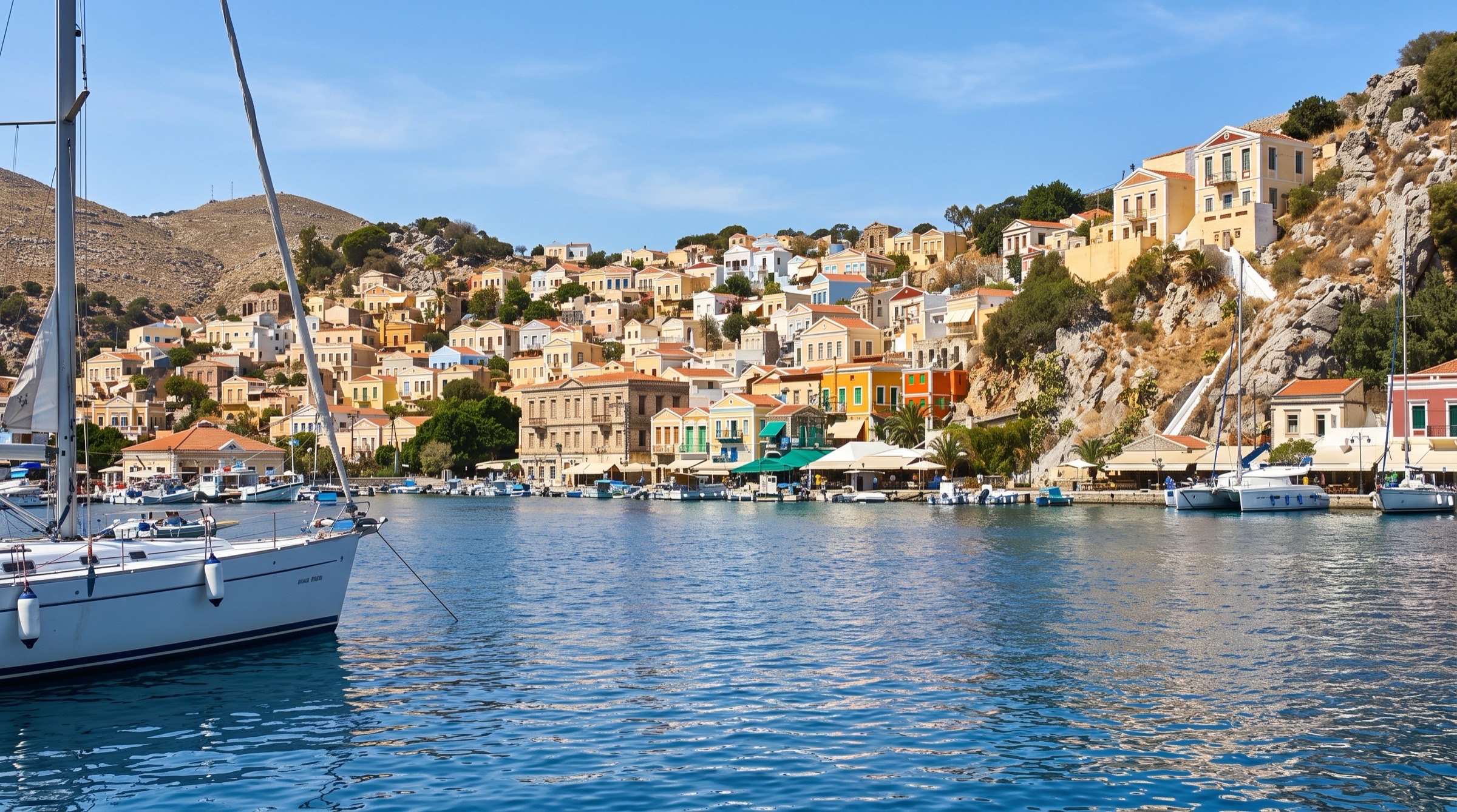
The Dodecanese lie off the Turkish coast, from Rhodes' medieval old town to Symi's painted harbor, with Kos, Kalymnos, Patmos and quiet Lipsi in between. Distances are longer than in the Ionian and the northern islands feel the meltemi. The islands mix history, diving and remote beaches.
Best months
Difficulty
ModerateLonger passages and stronger meltemi in the northern Dodecanese.
Conditions
The meltemi blows north to northwest, Force 4-5 in June, 5-7 in July and August, with gusts off high ground. May, June, September and October are gentler. Harbors at Rhodes, Symi and Patmos fill early in summer.
Area guide
Greece — Dodecanese, Sporades & North Aegean
Greece
The eastern and northern Aegean is Greece's longest cruising frontier: the Dodecanese chain strung along the Turkish coast from Kastellorizo and Rhodes north through Symi, Tilos, Nisyros, Kos, Kalymnos, Leros, Lipsi, Arki and Patmos; the big, green North Aegean islands of Samos, Ikaria, Fourni, Chios, Lesvos and Lemnos; and, across the sea to the west, the pine-covered Northern Sporades (Skiathos, Skopelos, Alonissos and the National Marine Park of Alonissos and Northern Sporades) plus Skyros and the sheltered Pagasetic Gulf below Mount Pelion. Charter fleets work out of Kos, Rhodes, Samos, Skiathos and Volos. The Dodecanese give short, varied hops between Knights-era towns, volcanic Nisyros and tiny taverna islets like Marathi and Arki; the North Aegean is quieter, bigger-scale and less chartered; the Sporades offer green, more gently-winded cruising and one of the Mediterranean's best marine parks, home to the Mediterranean monk seal. The northern Dodecanese (Patmos, Leros, Kalymnos and the north coast of Kos) are among the most meltemi-exposed waters in Greece in July and August, while the southern Dodecanese, Sporades and Pagasetic Gulf are more moderate.
Top of the list
- 1Planitis (Kyra Panagia)Near-landlocked natural harbour inside Zone A of the Alonissos marine park — one of only two places in the park's core where you may anchor overnight.
- 2Gialos Harbour (Symi)Arguably the most beautiful harbour in Greece: a bowl of pastel neoclassical mansions climbing from the quay to Chorio via the Kali Strata steps.
- 3Rhodes Medieval Old TownUNESCO-listed walled city of the Knights of St John, a short walk from Mandraki Harbour and Rhodes Marina.
- 4Kokkinokastro Bay (Alonissos)Red-cliffed bay with clear water and the remains of ancient Ikos; a sailing guide calls it a must-see and worth an overnight in settled weather.
- 5Panormitis Bay (Symi)Almost-enclosed bay below the 18th-century Panormitis monastery — a calm overnight stop on Symi's south coast.
- 6Monastery of St John the Theologian (Patmos)Fortress-monastery crowning Chora; with the Cave of the Apocalypse it forms a UNESCO site and the pilgrimage heart of the Dodecanese.
- 7Stefanos Crater (Nisyros)Walk down into a steaming, sulphur-crusted volcanic crater — the signature day ashore on any Dodecanese charter.
- 8Marathi AnchorageIslet with a sandy bay, moorings and family tavernas — the classic lazy stop between Patmos, Lipsi and Arki.
- 9Port Augusta (Arki)Narrow, sheltered inlet with a tiny village quay on one of the least-developed inhabited islands in the chain.
- 10Vathi Fjord (Kalymnos)Spectacular steep-sided inlet cutting into Kalymnos' east coast, ending at the hamlet of Rina — tricky but unforgettable.
- 11Lindos BayAnchor beneath the Acropolis of Lindos, with the tiny, near-enclosed St Paul's Bay next door.
- 12Megisti Harbour (Kastellorizo)Greece's easternmost island: a horseshoe of painted houses facing Kaş in Turkey, and a port for crossing to or from the Turkish coast.
- 13Blue Cave (Kastellorizo)Low-entranced sea cave on Kastellorizo whose interior glows electric blue.
- 14Xerokampos Bay (Leros)South-Leros bay that a cruiser describes as very sheltered in northerlies, with taverna moorings — a meltemi bolt-hole.
- 15Livadia Harbour (Tilos)Yacht-friendly harbour on a quiet, walkers' island, base for the abandoned village of Mikro Chorio.
- 16Peristera Ancient ShipwreckA 5th-century BCE wreck of thousands of amphorae off Peristera — part of the Alonissos Underwater Museum.
- 17Skopelos Town HarbourAmphitheatre town of whitewashed houses and Byzantine churches; the busiest yacht harbour in the Sporades after Skiathos.
- 18Steni Vala Harbour (Alonissos)Small fishing-village harbour and the last provisioning stop before the marine park core.
- 19Fourni Harbour (Fournoi Korseon)Fishermen's archipelago between Samos and Ikaria, famous for lobster tavernas and dozens of ancient shipwrecks.
- 20Sigri Bay (Lesvos)West-coast bay sheltered from the meltemi, next to the Petrified Forest of Lesvos and its natural history museum.
- 21Molyvos (Mithymna) HarbourCastle-topped stone village with a small harbour on Lesvos' north coast; base for the Eftalou hot springs.
- 22Mesta Village (Chios)Labyrinthine fortified mastic village in southern Chios, reachable from the harbour at Limenas Meston.
- 23Palaio Trikeri HarbourCar-free islet in the Pagasetic Gulf with a tiny harbour and fish tavernas — the calm-water heart of a Volos charter.
- 24Tristomo Bay (Karpathos)Remote three-mouthed inlet on north Karpathos, noted for good protection from the meltemi.
- 25Eupalinos Tunnel (Samos)Sixth-century BCE aqueduct tunnel dug from both ends above Pythagorio, a UNESCO site walkable from Samos Marina.
When to go
Charter brokers work the Dodecanese from March to November, with July and August the peak (Plain Sailing, Rhodes). Late May, June and September are the sweet spot: the meltemi is gentler and more predictable, the sea is warm and harbours less crowded (Yachtwarriors). By month (Filovent): the meltemi is occasional in May (Force 3–4), moderate in June (F4–5), strong in July (F5–6, gusts 7), peaks in August (F5–7, gusts 8), eases in September (F4–5) and is rare in October. July–August brings packed quays — Rhodes, Symi and Patmos fill early in the afternoon. The Northern Sporades are greener and less windy than the Cyclades, so the summer breeze is usually cooling rather than punishing (anchor.yt), and the Pagasetic Gulf inside the Pelion peninsula is sheltered from the meltemi. Spring (May–June) and autumn (September–October) are the recommended months for the Samos Sea, with fewer meltemi gales and emptier anchorages.
Weather and hazards
The meltemi (etesian) is the dominant summer wind: northerly in the northern Aegean, turning north-westerly towards the Dodecanese. It typically fills in by early afternoon at 15–20 kn, sometimes over 30 kn, usually easing in the evening, but strong spells last several days (anchor.yt). Exposure (Filovent): high in the northern Dodecanese — Patmos, Leros, Kalymnos and the north coast of Kos; moderate in the southern Dodecanese (south Kos, Symi, Rhodes) and in the Sporades. Off Rhodes, summer winds are typically Force 4–5 from the north-west and have reached Force 8; they usually drop at night but can return in the early hours (Plain Sailing). Leeward fall-winds (katabatic gusts) are violent off high islands — Kos is a known example, and Samos' south (leeward) coast can see violent gusts; an orographic cloud over the mountain is a warning sign. Expect steep, short seas in the open channels between Symi, Tilos and Nisyros in a strong meltemi. The Samos (Mycale) Strait between Samos and Turkey, just over 1 nm wide, carries an east-setting current usually of 1–2 kn but at times 3–4 kn, raising overfalls in gusty conditions. Livadia (Tilos) can get meltemi downbursts and is uncomfortable in south-easterlies; Patitiri (Alonissos) suffers swell in the meltemi. Skiathos' runway sits next to the harbour approach and landing aircraft pass close to masts. The Greek–Turkish sea border is close and disputed in places (Samos, Leros, Kalymnos, Kos, Kastellorizo): stay in Greek waters unless properly cleared. Noonsite reports (2016) that Mytilene's east quay may be closed to visitors because of commercial and migrant traffic. Submarine power cables are charted/signed in some anchorages (e.g. Megalos Mourtias, Alonissos) — read the chart before you drop the hook. Winter brings gales from both north and south.
Hurricane season
No tropical cyclone season. The Mediterranean does produce occasional storm-strength cyclones, most often in autumn. Storm Daniel (4–8 September 2023) caused catastrophic flooding in Thessaly, including Volos and the Pelion villages (the Krafsidonas river overflowed in Volos on 6 September), and travel to Skiathos was banned during the storm; the system became a Mediterranean tropical-like cyclone ('Medicane Daniel') after leaving Greece. Watch forecasts closely from September to November.
Entry and clearance
Greece is in the EU and Schengen; non-EU crew must clear immigration at a port of entry and observe the 90/180-day Schengen limit. Ports of entry in this area (Noonsite): Dodecanese — Rhodes (Mandraki), Symi, Kos, Kalymnos, Leros, Patmos and Kastellorizo; North Aegean — Lesvos (Mytilene; a 2018 report also cites Petra, with port police at Molyvos), Chios, Samos (Vathy and Pythagorio) and Lemnos (Myrina); Volos. Kastellorizo's status is contested: Noonsite and CruisersWiki list it as a port of entry, while a recent German yachting article says it is not and that EU owners arriving from Turkey can check in through an agent for a fee — confirm before relying on it. Foreign private yachts need a Transit Log; it is now issued online (e-TL), and one yacht was fined €300 (reported on Noonsite) for failing to apply before arrival. Port police may still ask for a printed copy, plus registration, insurance, crew list, passports and TEPAI proof; some ask for a T2L/MRN document to prove EU VAT status. Crossing to or from Turkey: clear out with Greek customs, passport control and port police at a designated port, hoist the Turkish courtesy flag and report immediately at a Turkish port of entry (e.g. Ayvalık/Dikili, Çeşme, Kuşadası, Didim, Bodrum, Datça, Bozburun, Marmaris, Kaş); on return, clear back in at a Greek port of entry. Mid-passage flag swapping is illegal even though it was once tolerated, and Greece bans firearms and some medicines (e.g. codeine). On arrival from Turkey at Samos (Vathy or Pythagorio), hail the coast guard (Limenarchio) on VHF 12. Charter yachts carry their own papers; Turkish visits need advance permission from the charter company and usually an agent.
Permits and fees
TEPAI (Greek cruising tax) applies to pleasure craft over 7 m: per month, 7–8 m €16, 8–10 m €25, 10–12 m €33, over 12 m €8 per metre; charged by calendar month, minimum one month (AADE e-TEPAI brochure). Pay online before entering Greek waters and keep proof aboard. National Marine Park of Alonissos and Northern Sporades: since 2022 an online ticket (alonissos-tickets.necca.gov.gr) is compulsory to enter Zone A waters (Kyra Panagia/Pelagos, Gioura, Piperi, Psathoura, Skantzoura and nearby islets); Sailing Issues quotes €33.50 per vessel per day/night plus €5.50 per guest per day/night (verify on the portal). Zone A rules: Piperi is a strict reserve; at Kyra Panagia you may anchor only at Planitis, Monastery cove and Agios Petros, overnight only at Planitis and Agios Petros, and land only at the Monastery; at Psathoura anchor and land only in the south bay (Mandraki); at Skantzoura only in Limani bay; keep 1 nm from the Gioura reef; on Alonissos (Zone B) do not approach within 200 m of the coast between Capes Kalamos and Ammoni. Mooring buoys at Spartines (Alonissos) are free and anchoring there is forbidden (since 2024). Harbour dues on municipal quays are modest — e.g. about €0.75 per metre at Myrina, Lemnos, cash, with €5 water/power cards (Sailing Issues) — while Patitiri sells €10/€20 water-and-power cards (2024). Verify locally. Greece's DEKPA document (€30, stamped on each entry and exit) was reported by Sailing Issues.
Tides and currents
Tides are negligible for navigation (a few tens of centimetres); wind and pressure move sea level more than the tide. Currents matter in narrow straits: the Samos (Mycale) Strait sets east-south-east at 1–3 kn and up to 3–4 kn, with overfalls. Official tide tables: Hellenic Navy Hydrographic Service (hnhs.gr). Harmonic prediction stations on tidesatlas.com include Ialysos (Rhodes), Kalymnos, Kasos and Chios (predictions typically within 10–15 cm).
Money
Euro (EUR). Cards are accepted in towns and marinas; carry cash for small-island tavernas, harbour dues (e.g. Myrina is cash only) and water/power cards.
Radio and phones
VHF 16 for distress (Hellenic Coast Guard/JRCC Piraeus). Port authorities commonly work VHF 12 (e.g. Patitiri harbour office in season; Samos coast guard for arrivals from Turkey); Myrina (Lemnos) harbour uses VHF 9 per one guide, 12 per another. Olympia Radio weather broadcasts (Sailing Issues): Rhodes ch 63, Astypalaia ch 23, Chios ch 85, Mytilene ch 01 (bulletins at 6:00 am, 10:00 am, 4:00 pm and 8:00 pm UTC), Lemnos ch 82, Pilio (Volos/Skiathos) ch 60, Sfendami (Thessaloniki) ch 23; gale warnings and forecasts on ch 16 on request. NAVTEX 518 kHz: Limnos (L) covers the Samos Sea, NE and NW Aegean and Central Aegean (about 5:50 am, 9:50 am, 5:50 pm and 9:50 pm UTC); Iraklio (I) covers the Rodos Sea, Karpathio, SE Aegean and Kastellorizo Sea (5:10 am, 9:10 am, 1:10 pm, 5:10 pm, 9:10 pm UTC). Online: HNMS (emy.gr), Poseidon (HCMR) and meteo.gr. Mobile data is good near populated islands; EU roaming applies.
Charter bases
- Kos MarinaKos town, about 1 nm south-east of the old harbour; about 25–30 minutes by taxi from Kos airportKavas Yachting (9 own yachts, 30–54 ft), Greeka, most Kos bareboat, gulet and crewed charters start here (Sailing Issues)
- Rhodes Marina and Mandraki MarinaRhodes town; Rhodes Marina (opened 2016, about 600 berths) and historic Mandraki by the Old Town, both with fuel berths; about 20 minutes from Rhodes airportbrokers such as Plain Sailing place bareboats and catamarans here
- Samos Marina (Pythagorio)South-east Samos near the airport; 280 berths up to 25 mSailing Issues names Samos (Pythagorion Marina) as a main charter base — verify current operators
- Skiathos Marina / Skiathos PortSkiathos town; Sailing Issues calls it the ultimate Sporades charter baseGreeka, brokers such as Helm (sample itinerary from Skiathos Marina)
- Volos MarinaVolos, at the head of the Pagasetic Gulf; better-equipped than Skiathos but farther from the islandsKavas Yachting
Getting there
- Rhodes Diagoras International — RHOMain gateway for Rhodes, Symi and the southern Dodecanese; about 20 minutes by taxi to Mandraki or Rhodes Marina (four-person taxi about €50–60 per Plain Sailing — verify locally).
- Kos Hippocrates International — KGSGateway for the Kos charter fleet; about 25–30 minutes by taxi to Kos Marina.
- Samos Aristarchos — SMINext to Pythagorio and Samos Marina; gateway for Samos, Fourni and Ikaria.
- Skiathos Alexandros Papadiamantis — JSIRunway at the edge of Skiathos town, a short taxi to the marina; seasonal international flights.
- Volos / Nea Anchialos (Central Greece) — VOLSeasonal flights for Volos-based charters and the Pagasetic Gulf.
- Mytilene Odysseas Elytis (Lesvos) — MJTSouth of Mytilene town and its marina.
- Chios Island National — JKHJust south of Chios town.
- Lemnos Hephaestus — LXSDomestic and seasonal flights for Myrina and Moudros.
- Leros — LRSShort strip at Partheni, next to the boatyards; small domestic aircraft from Athens.
- Kalymnos — JKLSmall domestic airport.
- Karpathos — AOKSouth of Pigadia; domestic and seasonal flights.
- Ikaria — JIKDomestic flights from Athens.
- Skyros — SKUDomestic flights; Linaria is the island's port.
- Astypalaia — JTYSmall domestic airport.
- Kastellorizo — KZSSmall strip with links to Rhodes.
- Kasos — KSJSmall strip with island-hopper links.
Charts and guides
- Rod Heikell, Greek Waters Pilot (Imray)
- Imray G32 (Northern Dodecanese and Turkish Ionian coast), G35 (Central Dodecanese, Rhodes, Symi and Carian coast), G25 (Northern Sporades, Pagasetic Gulf/Volos)
- Eagle Ray Greece Sea Guide Vol. IV — East Aegean and Dodecanese (charts included); Eagle Ray also recommended over Heikell for Skopelos' Panormos bay
- Hellenic Navy Hydrographic Service official charts (Greek sheets 31 and 74 for the Pagasetic Gulf); Admiralty 1556 (Volos approaches)
- Sailing Issues island pages and logbooks (Alonissos/Peristera anchorage-by-anchorage, 2024)
- Navily, Noforeignland and Noonsite community harbour reviews
Sample routes
- 7-day Dodecanese loop from Kos (143 nm, Helm sample)Day 1 · Kos airport (KGS) → Kos Marina · 0 nmKos old town, Eleftherias Square, the AsklepionDay 2 · Kos Marina → Pothia Harbour (Kalymnos) · 16 nmSponge shops, climb to Agios Savvas monastery; upwind into the prevailing breezeDay 3 · Pothia Harbour (Kalymnos) → Pali Marina (Nisyros) · 29 nmWind behind you; volcano crater and thermal bathsDay 4 · Pali Marina (Nisyros) → Gialos Harbour (Symi) · 32 nmKali Strata steps to Chorio, neoclassical waterfrontDay 5 · Gialos Harbour (Symi) → Panormitis Bay (Symi) · 12 nmLunch in west-coast inlets, sheltered bay below the monasteryDay 6 · Panormitis Bay (Symi) → Livadia Harbour (Tilos) · 24 nmBeach by the harbour, scooter to Mikro ChorioDay 7 · Livadia Harbour (Tilos) → Kos Marina · 30 nmKos Castle, return the boat
- 7-day Northern Sporades from Skiathos (69 nm, Helm sample)Day 1 · Skiathos airport (JSI) → Skiathos Marina · 0 nmProvisioning and dinner in Skiathos townDay 2 · Skiathos Marina → Panormos Bay (Skopelos) · 10 nmTwo-hour sail; pine-backed beaches; nearby Blo BayDay 3 · Panormos Bay (Skopelos) → Skopelos Town Harbour · 13 nmHilltop kastro, Byzantine churches, Folklore MuseumDay 4 · Skopelos Town Harbour → Peristeri Anchorage (Peristera) · 14 nmUninhabited island off Alonissos; quiet night at anchorDay 5 · Peristeri Anchorage (Peristera) → Steni Vala Harbour (Alonissos) · 5 nmFishing village tavernas; dive trips to the isletsDay 6 · Steni Vala Harbour (Alonissos) → Loutraki Harbour (Skopelos) · 21 nmGlossa village above; Agios Ioannis Kastri chapelDay 7 · Loutraki Harbour (Skopelos) → Skiathos Marina · 6 nmLunch stop at Koukounaries Beach and dinghy into the Strofilia lagoon
- 14-day one-way Kos to Rhodes through the whole Dodecanese chain (nm approximate; legs from Yachtwarriors, Helm and Plain Sailing where marked, others estimated)Day 1 · Kos airport (KGS) → Kos Marina · 0 nmProvision, Kos old townDay 2 · Kos Marina → Pserimos Bay (Avlakia) · 10 nmShort shakedown; sandy bay goes quiet after the day boats leave (Yachtwarriors ~10 nm)Day 3 · Pserimos Bay (Avlakia) → Skala Harbour (Patmos) · 37 nmLeave early before the meltemi fills in; evening walk up to Chora (Yachtwarriors ~30 nm)Day 4 · Skala Harbour (Patmos) → Grikos Bay (Patmos) · 3 nmMonastery of St John and Cave of the Apocalypse in the morning; swim and anchor at Grikos (nm estimated)Day 5 · Grikos Bay (Patmos) → Lipsi Harbour · 10 nmLunch swim at Platis Gialos; village tavernas (Yachtwarriors ~10 nm)Day 6 · Lipsi Harbour → Port Augusta (Arki) · 8 nmSwim stop at Tiganakia's turquoise shallows (nm estimated)Day 7 · Port Augusta (Arki) → Marathi Anchorage · 2 nmLazy beach day, taverna moorings (nm estimated)Day 8 · Marathi Anchorage → Lakki Harbour (Leros) · 15 nm1930s Italian rationalist Lakki; Leros War Museum (nm estimated)Day 9 · Lakki Harbour (Leros) → Pothia Harbour (Kalymnos) · 15 nmSponge-diving heritage, limestone climbing cliffs (Yachtwarriors ~15 nm)Day 10 · Pothia Harbour (Kalymnos) → Pali Marina (Nisyros) · 29 nmDownwind run; evening thermal baths (Helm 29 nm)Day 11 · Pali Marina (Nisyros) → Livadia Harbour (Tilos) · 17 nmMorning in the Stefanos Crater, afternoon sail to Tilos (nm estimated)Day 12 · Livadia Harbour (Tilos) → Panormitis Bay (Symi) · 24 nmMonastery bay (Helm 24 nm, reverse direction)Day 13 · Panormitis Bay (Symi) → Gialos Harbour (Symi) · 12 nmWest-coast coves en route; Kali Strata at sunset (Helm 12 nm)Day 14 · Gialos Harbour (Symi) → Mandraki Harbour (Rhodes) · 25 nmApproach the Old Town walls; refuel and return the boat (Plain Sailing/Yachtwarriors ~25 nm)
Places in Greece — Dodecanese, Sporades & North Aegean
- AB supermarket (Pothia)Stores · Kalymnos
- Achata Arch & Pigadia Bay Dive Sites (Karpathos)Dive · Karpathos
- Achata Beach (Karpathos)Beach · Karpathos
- Acherounes Bay — Linaria Cove (Skyros)Anchorage · Skyros
- Achilli Port (Skyros)Marina · Skyros
- Acropolis of LindosLandmark · Rhodes
- Acropolis of Rhodes (Monte Smith)View · Rhodes
- Adelfi Islets anchorageAnchorage · Adelfi
- Aegean Film Festival (Patmos)Event · Patmos
- Afiartis Windsurf & Kite Beaches (Karpathos)Watersport · Karpathos
- Afissos (Pelion)Anchorage · Pelion peninsula (mainland)
- Agathi Beach Anchorage (Rhodes)Anchorage · Rhodes
- Agathonisi Fuel, Water & Shore PowerService · Agathonisi
- Agathonisi Harbour Mini MarketStores · Agathonisi
- Agathonisi Health Clinic (Megalo Chorio)Service · Agathonisi
- Agathonisi Port Police & CoastguardService · Agathonisi
- Agathonisi South-Coast BaysAnchorage · Agathonisi
- Agia Anna cliff & cavern (Skopelos)Dive · Skopelos
- Agia Dynami Beach (Chios)Beach · Chios
- Agia Eleni Beach (Skiathos)Beach · Skiathos
- Agia Ermioni Harbour (Chios)Anchorage · Chios
- Agia Fotini Beach (Chios)Beach · Chios
- Agia Irini Beach (Chios)Beach · Chios
- Agia Kioura Chapel (Partheni)Landmark · Leros
- Agia Kyriaki (Trikeri)Anchorage · Pelion peninsula (mainland)
- Agia Kyriaki FestivalEvent · Pelion peninsula (mainland)
- Agia Kyriaki Karnagio (Traditional Boatyard)Service · Pelion peninsula (mainland)
- Agia Marina (Symi)Anchorage · Symi
- Agia Marina Harbour (Leros)Anchorage · Leros
- Agia Markella Monastery & Anchorage (Chios)Landmark · Chios
- Agia Thekla Feast (Agriolivado)Event · Patmos
- Agioi Anargyroi (Alonissos)Anchorage · Alonissos
- Agios Andreas Port (Astypalaia)Service · Astypalaia
- Agios Antonios Harbour (Tilos)Anchorage · Tilos
- Agios Antonios Islet Anchorage (Giali)Anchorage · Agios Antonios (Giali)
- Agios Antonios Islet Rocks Snorkel (Giali)Snorkel · Agios Antonios (Giali)
- Agios Dimitrios (Alonissos)Anchorage · Alonissos
- Agios Elias sea-jump (Kastellorizo, July)Event · Kastellorizo (Megisti)
- Agios Emilianos (Symi)Anchorage · Symi
- Agios Ermogenis Bay (Lesvos)Anchorage · Lesvos
- Agios Fokas (Astypalaia)Anchorage · Astypalaia
- Agios Fokas Anchorage (Kos)Anchorage · Kos
- Agios Fokas Anchorage (Lesvos)Anchorage · Lesvos
- Agios Fokas Beach (Skyros)Beach · Skyros
- Agios Georgios Dysalona (Symi)Anchorage · Symi
- Agios Georgios Harbour (Agathonisi)Anchorage · Agathonisi
- Agios Georgios Tavernas (Agathonisi)Eat · Agathonisi
- Agios Ioannis Cove (Oinousses)Anchorage · Oinousses
- Agios Ioannis Harbour & Anchorage (East Pelion)Anchorage · Pelion peninsula (mainland)
- Agios Ioannis Kaspakas Anchorage (Lemnos)Anchorage · Lemnos
- Agios Ioannis Kastri Chapel (Skopelos)Landmark · Skopelos
- Agios Ioannis Thermastis Cove (Fourni)Anchorage · Fournoi Korseon
- Agios Ioannis–Kissos Kalderimi (East Pelion)Hike · Pelion peninsula (mainland)
- Agios Isidoros Bay & Traditional Shipyard (Samos)Landmark · Samos
- Agios Isidoros Chapel (Gourna)Landmark · Leros
- Agios Kirykos Fuel & Water (Ikaria)Service · Ikaria
- Agios Kirykos Harbour & Marina (Ikaria)Marina · Ikaria
- Agios Kirykos Town Provisions (Ikaria)Stores · Ikaria
- Agios Konstantinos Beach (Astypalaia)Beach · Astypalaia
- Agios Konstantinos Byzantine settlement (Telendos)Hike · Telendos
- Agios Konstantinos Harbour (Samos)Anchorage · Samos
- Agios Minas CoveAnchorage · Agios Minas
- Agios Nikitas Festival (Mandraki, Nisyros)Event · Nisyros
- Agios Nikolaos Anchorage (Spoa, Karpathos)Anchorage · Karpathos
- Agios Nikolaos Bay (Patmos)Anchorage · Patmos
- Agios Nikolaos Beach (Symi)Beach · Symi
- Agios Nikolaos Islet Anchorage (Psara)Anchorage · Psara
- Agios Panteleimon Feast (Chiliomodi islet)Event · Patmos
- Agios Panteleimon Festival (Tilos, July 27)Event · Tilos
- Agios Panteleimon Monastery (Tilos)Landmark · Tilos
- Agios Petros Bay (Alonissos)Anchorage · Alonissos
- Agios Petros Bay (Kyra Panagia)Anchorage · Kyra Panagia (Pelagos)
- Agios Petros Beach (Skyros)Beach · Skyros
- Agios Petros submerged Neolithic settlement (Kyra Panagia)Landmark · Kyra Panagia (Pelagos)
- Agios Savvas Monastery (Kalymnos)View · Kalymnos
- Agios Sergios Bay (Tilos)Anchorage · Tilos
- Agios Sostis Islet Anchorage (Chios)Anchorage · Chios
- Agios Spyridon Anchorage (Saria)Anchorage · Saria
- Agios Stefanos Basilica & Kastri Islet (Kos)Landmark · Kos
- Agios Stefanos Beach (Livadia, Tilos)Beach · Tilos
- Agios Stefanos Islet Anchorage (Chios)Anchorage · Chios
- Agios Vasilios (Symi)Beach · Symi
- Agios Zacharias & Despoti Nero (Tilos)Anchorage · Tilos
- Agios Zacharias Rock Formations Snorkel (Tilos)Snorkel · Tilos
- Agmar Marina (Lakki)Marina · Leros
- Agmar Partheni boatyardService · Leros
- Agnanti Restaurant (Glossa, Skopelos)Eat · Skopelos
- Agnontas Harbour (Skopelos)Marina · Skopelos
- Agria AnchorageAnchorage · Pelion peninsula (mainland)
- Agrilidi Bay (Astypalaia)Anchorage · Astypalaia
- Agriolivado Bay (Patmos)Anchorage · Patmos
- Aiolos Taverna (Mikro Beach, South Pelion)Eat · Pelion peninsula (mainland)
- Akamatra Restaurant (Karlovasi)Eat · Samos
- Akra Drapano (Atsipades Cove, Ikaria)Anchorage · Ikaria
- Akrogiali Fish Taverna (Skiathos)Eat · Skiathos
- Aktaion Taverna (Skopelos Town)Eat · Skopelos
- Alatas North AnchorageAnchorage · Alatas
- Alatas Reef DiveDive · Pelion peninsula (mainland)
- Alatas South AnchorageAnchorage · Alatas
- Alexandra's Restaurant (Kastellorizo)Eat · Kastellorizo (Megisti)
- Alimia Bay (Agios Georgios), AlimiaAnchorage · Alimia
- Alimia Castle hikeHike · Alimia
- Alinda Bay (Leros)Anchorage · Leros
- Alinda Beach (Leros)Beach · Leros
- Aloni Taverna (Xirokampos)Eat · Leros
- Alonissos Chora (Old Village) hikeHike · Alonissos
- Alonissos Marine Park Zone A ticketPermit · Kyra Panagia (Pelagos)
- Alonissos Seacolours Dive Center (Patitiri)Dive · Alonissos
- Alonissos Underwater Museum Information Centre (Chora)Landmark · Alonissos
- Alykes Salt Lake (Tigaki)Wildlife · Kos
- Amaliapoli (Pagasetic Gulf)Anchorage · Pelion peninsula (mainland)
- Amarandos Bay (Skopelos)Anchorage · Skopelos
- Amarantos Gulf dive site (Skopelos)Dive · Skopelos
- Amarantos Wall (Skopelos)Dive · Skopelos
- Amaso Dive Center (Agios Kirykos)Dive · Ikaria
- Ammoua Beach (Kasos)Beach · Kasos
- Ammoudeli Beach (Plomari)Beach · Lesvos
- Amoopi (Karpathos)Anchorage · Karpathos
- Amoopi Tavernas & Minimarkets (Karpathos)Eat · Karpathos
- AMoS Film Festival (Alonissos)Event · Alonissos
- Analipsi North Cove (Astypalaia)Anchorage · Astypalaia
- Anasis Bakery (Pothia)Stores · Kalymnos
- Anatoli Ouzeri (Skopelos Kastro)Eat · Skopelos
- Anavatos Abandoned Village (Chios)Landmark · Chios
- Anavros Beach (Volos)Beach · Pelion peninsula (mainland)
- Ancient KamirosLandmark · Rhodes
- Ancient Theatre of MytileneLandmark · Lesvos
- Andromachi Beach (Lesvos)Anchorage · Lesvos
- Anemomylos Windmill Café (Molos)Bar · Skyros
- Ano Vathy Tavernas (Samos Town)Eat · Samos
- Anthony Quinn Bay (Ladiko)Anchorage · Rhodes
- Anti-submarine net control ship wreck (Partheni)Dive · Leros
- Antimachia Castle (Kos)Hike · Kos
- Antiperatos Beach & Holocaust Memorial (Kasos)Beach · Kasos
- Antipsara — Psili Ammos & Agios IoannisBeach · Antipsara
- Antipsara Agios Ioannis AnchorageAnchorage · Antipsara
- Antipsara South & SE AnchoragesAnchorage · Antipsara
- ANZAC Commemoration, Moudros & Portianou (late April)Event · Lemnos
- Apella Beach (Karpathos)Beach · Karpathos
- Aphrodite Taverna (Pali, Nisyros)Eat · Nisyros
- Apiganos Beach (Oinousses)Beach · Oinousses
- Aplotaria Market Street Bakeries & Greengrocers (Chios Town)Stores · Chios
- Apollon Restaurant (Kokkari)Eat · Samos
- Apothikes Bay (Gulf of Kalloni entrance)Anchorage · Lesvos
- Apothyka Beach (Chios)Anchorage · Chios
- Aquacore Divers (Agia Kyriaki)Dive · Pelion peninsula (mainland)
- Arado Ar 196 seaplane wreck (Agia Kyriaki)Dive · Leros
- Aramis Taverna (Loutraki, Skopelos)Eat · Skopelos
- Archaeological Museum of ChiosLandmark · Chios
- Archaeological Museum of MytileneLandmark · Lesvos
- Archaeological Museum of PythagoreioLandmark · Samos
- Archaeological Museum of Rhodes (Knights' Hospital)Landmark · Rhodes
- Archaeological Museum of Samos (Vathy)Landmark · Samos
- Archangelos Islet (Leros)Anchorage · Archangelos (Leros)
- Areta Bay (Halki)Anchorage · Halki
- Arginonta Bay (Kalymnos)Anchorage · Kalymnos
- Argo Replica & Volos WaterfrontLandmark · Pelion peninsula (mainland)
- Arkasa (Karpathos)Beach · Karpathos
- Arki Panagia Feast (August 23)Event · Arki
- Arki Provisions & ShowersStores · Arki
- Arki Village TavernasEat · Arki
- Arkos Islet anchorage (off Skiathos)Anchorage · Arkos (off Skiathos)
- Armathia Islet Beaches (Kasos)Beach · Armathia
- Artemis Leros Boatyard (Partheni)Service · Leros
- Asklepion of KosLandmark · Kos
- Aspa Cove (Fourni)Anchorage · Fournoi Korseon
- Aspri Beach (Patmos)Beach · Patmos
- Aspronisi Anchorage (Lipsi)Anchorage · Lipsi
- Asproniso Bay (Lesvos)Anchorage · Lesvos
- Assumption Festival (Palia Chora, Alonissos)Event · Alonissos
- Astypalaia Chora & Querini CastleLandmark · Astypalaia
- Astypalaia Health Centre (Chora)Service · Astypalaia
- Astypalaia MeltemiSeasonal · Astypalaia
- Astypalaia Port Authority & Entry Status (Skala)Permit · Astypalaia
- Astypalaia Provisions (Skala & Chora)Stores · Astypalaia
- Astypalaia Windmills ViewpointView · Astypalaia
- Atheras Ridge Hike (Arethousa to Dokimi)Hike · Ikaria
- Atsitsa Bay (Skyros)Anchorage · Skyros
- Autumn southerlies & thunderstorms (Dodecanese)Seasonal · Leros
- Avaptisto SE Anchorage (Arki)Anchorage · Arki
- Avaptisto West Anchorage (Arki)Anchorage · Arki
- Avgonyma Village (Chios)Landmark · Chios
- Avlakia Beach (Pserimos)Beach · Pserimos
- Avlona–Tristomo Trail (Karpathos)Hike · Karpathos
- Avlonia Beach (SW Chios)Anchorage · Chios
- Avlonia Cove (south Chios)Anchorage · Chios
- Avlonia Cove Snorkel (south Chios)Snorkel · Chios
- Balkoni Taverna (Emporeios, Nisyros)Eat · Nisyros
- Banana Beach (Skiathos)Beach · Skiathos
- Battle of Leros & Vasilissa Olga commemorations (Lakki)Event · Leros
- Bellenis Tower Museum (Alinda)Landmark · Leros
- Bilali Beach (Oinousses)Beach · Oinousses
- Billy's Restaurant (Kastellorizo)Eat · Kastellorizo (Megisti)
- Black Rock Dive Centre (Skala Eresou)Dive · Lesvos
- Blefouti Bay (Leros)Anchorage · Leros
- Blo Bay (Panormos, Skopelos)Anchorage · Skopelos
- Blue Cave (Kastellorizo)Snorkel · Kastellorizo (Megisti)
- Blue Harbour Beach (Mple Limanaki, Astypalaia)Snorkel · Astypalaia
- Bouka Old Harbour (Kasos)Anchorage · Kasos
- Bouka Waterfront Tavernas (Kasos)Eat · Kasos
- Bourtzi (Skiathos)Landmark · Skiathos
- Bourtzi Restaurant (Skiathos)Eat · Skiathos
- Capes Kalamos–Ammoni zone (Alonissos, park zone B1)Permit · Alonissos
- Captain's & Salonikios Tavernas (Pali, Nisyros)Eat · Nisyros
- Casa di Vino (Lipsi)Bar · Lipsi
- Castle of Lykourgos Logothetis (Pythagorio)Landmark · Samos
- Castle of Neratzia (Kos Castle)Landmark · Kos
- Castle of the Knights / Kastellorizo museumLandmark · Kastellorizo (Megisti)
- Cave of the Apocalypse (Patmos)Landmark · Patmos
- Centaurs' Path (Chania–Portaria)Hike · Pelion peninsula (mainland)
- Chalares Gorge Trail (Christos Raches to Nas)Hike · Ikaria
- Chalavra Lagoon (Makronisi, Lipsi)Snorkel · Lipsi
- Charamida Bay (Lesvos)Anchorage · Lesvos
- Charani Bay Anchorage (Symi)Anchorage · Symi
- Charkadio Cave & Dwarf Elephant Museum (Tilos)Landmark · Tilos
- Chavouli Beach (Moudros Bay)Anchorage · Lemnos
- Chios Coast Guard & Weather on VHFService · Chios
- Chios Cooking Gas StoreService · Chios
- Chios Fuel, Chandlery & RepairsService · Chios
- Chios Island National Airport (JKH)Service · Chios
- Chios Kastro (Genoese Castle)Landmark · Chios
- Chios Marina (Tefas concession)Marina · Chios
- Chios Maritime MuseumLandmark · Chios
- Chios Mastic MuseumLandmark · Chios
- Chios Port of Entry — Port Police & CustomsPermit · Chios
- Chios Scuba Diving Adventure Center (Chios Town)Dive · Chios
- Chios Seafront OuzeriesEat · Chios
- Chios Strait Dive Sites & Scuba CentresDive · Chios
- Chios Strait Monk Seal Waters (Chios & Turkish Coast IMMA)Wildlife · Chios
- Chios Town HarbourMarina · Chios
- Chios Town Provisions & MarketStores · Chios
- Chios–Çeşme Ferry & Turkish HopService · Chios
- Chochlakas Beach (Telendos)Beach · Telendos
- Chochlakoura Bay (Kouloura, Lipsi)Anchorage · Lipsi
- Chora Restaurants & Bars (Astypalaia)Eat · Astypalaia
- Chora Tavernas (Patmos)Eat · Patmos
- Chora Walk & Viewpoint (Patmos)Hike · Patmos
- Chora Windmills (Patmos)Landmark · Patmos
- Chorio & Knights' Castle (Halki)Hike · Halki
- Chorio shops (Symi)Stores · Symi
- Chorio tavernas at the top of the Kali Strata (Symi)Eat · Symi
- Chrisi Milia Beach (Alonissos)Beach · Alonissos
- Christoforos Wreck (Panormos Bay, Skopelos)Dive · Skopelos
- Christos Bay (Lipsi)Anchorage · Lipsi
- Chrousos Bay (Lesvos)Anchorage · Lesvos
- Chrysi Milia (Alonissos)Anchorage · Alonissos
- Chrysomilia (Fourni)Anchorage · Fournoi Korseon
- Church of St John the Theologian (Lipsi)Landmark · Lipsi
- Citimarine Chandlery (Volos)Service · Pelion peninsula (mainland)
- Congas Beach Anchorage (Molyvos)Anchorage · Lesvos
- Cory's Shearwaters (Sesklia–Symi IBA)Wildlife · Seskli
- Damatria Beach (Karpathos)Beach · Karpathos
- Damouchari (East Pelion)Anchorage · Pelion peninsula (mainland)
- Danos Bakery (Skiathos Town)Stores · Skiathos
- Dasia Canyon (Skopelos)Dive · Skopelos
- Dasia Gallery (Skopelos)Dive · Skopelos
- Dasia Lift (Skopelos)Dive · Skopelos
- Daskalio Cave (Vathi)Landmark · Kalymnos
- Delfini Taverna (Agios Antonios, Tilos)Eat · Tilos
- Dendrolimano (Votsi)Eat · Alonissos
- Diafani Harbour (Karpathos)Anchorage · Karpathos
- Diafani Water, Fuel & Supplies (Karpathos)Service · Karpathos
- Diafani Waterfront Tavernas (Karpathos)Eat · Karpathos
- Diakofti Bay (Patmos)Anchorage · Patmos
- Diakofti Boatyard & Marine Services (Patmos)Service · Patmos
- Diakoftis Beach (Karpathos)Beach · Karpathos
- Didima Beach Anchorage (Chios)Anchorage · Chios
- Dilaila Restaurant (Katsadia)Bar · Lipsi
- Dimitri's Bakery & Emborio mini-markets (Halki)Stores · Halki
- Dio Liskaria Beach (Leros)Beach · Leros
- Divers Island Kalymnos (Kantouni)Dive · Kalymnos
- Dolphin Diving Center (Kolios, Skiathos)Dive · Skiathos
- Dormition Feast at Panagia Geranou (Patmos)Event · Patmos
- Drakospilia (Dragon's Cave), AstypalaiaLandmark · Astypalaia
- Dyo Gialoi Bay (Halki)Anchorage · Halki
- East Cove (Oinousses)Anchorage · Oinousses
- East of Gria Cove (Fourni)Anchorage · Fournoi Korseon
- East Pelion Mini Boat Tour (Agios Ioannis)Tour · Pelion peninsula (mainland)
- Efanos Peak Climb from Karavostamo (Ikaria)Hike · Ikaria
- Eftalou Beach (Lesvos)Beach · Lesvos
- Eftalou Hot Springs (Lesvos)Landmark · Lesvos
- Elaionas & Dolopes (Leftos Gialos)Eat · Alonissos
- Eleni Beach (Lipsi)Anchorage · Lipsi
- Eleonora's falcon season (Piperi & Skantzoura)Seasonal · Piperi
- Elinda Bay (Chios)Anchorage · Chios
- Elinda Bay Dive Site (Chios)Dive · Chios
- Elinda Beach (Chios)Beach · Chios
- Ellinokamara Cave (Kasos)Landmark · Kasos
- Emborio Harbour (Halki)Marina · Halki
- Emborio waterfront tavernas (Halki)Eat · Halki
- Emborios (Kasos)Anchorage · Kasos
- Emborios / Nimborio Bay (Symi)Anchorage · Symi
- Emborios Tavernas (Kasos)Eat · Kasos
- Embros Therma Hot Springs (Kos)Beach · Kos
- Emporeios Village (Nisyros)View · Nisyros
- Emporio Archaeological Site (Chios)Landmark · Chios
- Emporios Bay (Kalymnos)Anchorage · Kalymnos
- Emporios Bay & Mavra Volia Snorkel (Chios)Snorkel · Chios
- Emporios Cove & Mavra Volia (Chios)Anchorage · Chios
- Emporios tavernas (Kalymnos)Eat · Kalymnos
- Emporios Waterfront TavernasEat · Chios
- En Plo Taverna (Eristos, Tilos)Eat · Tilos
- Eristos Bay (Tilos)Anchorage · Tilos
- Ermis Ouzeri (Mytilene)Eat · Lesvos
- Eupalinos Tunnel (Samos)Landmark · Samos
- Evaggelistria–Emporeios Trail (Nisyros)Hike · Nisyros
- Evangelismos Monastery (Oinousses)Landmark · Oinousses
- Evangelistria Monastery ruins (Skantzoura)Hike · Skantzoura
- Evdilos Harbour (Ikaria)Anchorage · Ikaria
- Evdilos Village Provisions (Ikaria)Stores · Ikaria
- Evdilos Water & Power (Ikaria)Service · Ikaria
- Evros Leros Marina (Lakki)Marina · Leros
- Express Laundry (Rhodes, Mandraki)Service · Rhodes
- Fakistra Beach (East Pelion)Beach · Pelion peninsula (mainland)
- Fakistra Sea Cave & Agios Athanasios Springs Snorkel (East Pelion)Snorkel · Pelion peninsula (mainland)
- Fakos Peninsula Anchorage (Lemnos)Anchorage · Lemnos
- Faliraki BeachBeach · Rhodes
- Faltaits Folklore Museum (Skyros)Landmark · Skyros
- Fanes Harbour (Rhodes)Anchorage · Rhodes
- Fara Beach (Lesvos)Anchorage · Lesvos
- Farmakonisi Military ZonePermit · Farmakonisi
- Faros (Ikaria)Anchorage · Ikaria
- Faros cafe-bar (Kastellorizo)Bar · Kastellorizo (Megisti)
- Fasoli Beach (Oinousses)Beach · Oinousses
- Fast Laundry Self-Service (Volos)Service · Pelion peninsula (mainland)
- Favios Fish Taverna (Milina)Eat · Pelion peninsula (mainland)
- Feast of Agia Marina (Vourliotes, Samos)Event · Samos
- Feast of Agia Markella (July 22)Event · Chios
- Feast of Agios Riginos (Skopelos)Event · Skopelos
- Feast of Panagia Vrontiani (Samos)Event · Samos
- Feast of St John the Theologian (Patmos)Event · Patmos
- Feast of the Dormition (Psara, August 15)Event · Psara
- Feast of the Dormition (Vathy, Samos)Event · Samos
- Feraklos Castle (Haraki)Landmark · Rhodes
- Filerimos MonasteryView · Rhodes
- Finiki Fish Tavernas (Karpathos)Eat · Karpathos
- Finiki Harbour (Karpathos)Anchorage · Karpathos
- Fish Hunter Tackle Shop (Fry, Kasos)Fishing · Kasos
- Fishermen's Night (Votsi, Alonissos)Event · Alonissos
- Floisvos Taverna (Katigiorgis)Eat · Pelion peninsula (mainland)
- Flomari Seafood Taverna (Gomati, Lemnos)Eat · Lemnos
- Fokia Beach (Oinousses)Beach · Oinousses
- Fokiotrypa (Fokiada) Cove (Skyros)Anchorage · Skyros
- Forno Del Pane bakery (Alinda)Stores · Leros
- Fourni Ancient ShipwrecksDive · Fournoi Korseon
- Fourni Fish & Lobster TavernasEat · Fournoi Korseon
- Fourni Fuel & WaterService · Fournoi Korseon
- Fourni Harbour (Fournoi Korseon)Marina · Fournoi Korseon
- Fourni Health Station & PharmacyService · Fournoi Korseon
- Fourni Main Street ProvisionsStores · Fournoi Korseon
- French Bakery (Skiathos airport road)Stores · Skiathos
- Fry East Anchorage (Kasos)Anchorage · Kasos
- Fry Fuel & Water (Kasos)Service · Kasos
- Fry Harbour (Kasos)Anchorage · Kasos
- Fry Supermarkets, Bakery & Greengrocer (Kasos)Stores · Kasos
- Ftelio Beach Snorkelling (Psara)Snorkel · Psara
- Ftenagia Bay (Halki)Anchorage · Halki
- Gaidaros Islet Anchorage (North Tilos)Anchorage · Gaidaros (Tilos)
- Gaidouravlakos (Agathonisi)Anchorage · Agathonisi
- Gatos Restaurant (Molyvos old market)Eat · Lesvos
- Gavathas – Lapsarna PathHike · Lesvos
- Gavathas Harbour (Lesvos)Anchorage · Lesvos
- General Hospital of Chios (Skylitsio)Service · Chios
- General Hospital of Lemnos (Myrina)Service · Lemnos
- Gerakas (Alonissos)Anchorage · Alonissos
- German landing craft wreck (Strongyli islet)Dive · Leros
- Giala (Windmill Bay, Alonissos)Anchorage · Alonissos
- Giali Beach (Halki)Beach · Halki
- Giali Obsidian & Pumice IslandLandmark · Giali (Gyali)
- Gialo Gialo (Petra seafront)Eat · Lesvos
- Gialos Harbour (Symi)Marina · Symi
- Gialos harbour-front tavernas & ouzeri (Symi)Eat · Symi
- Gialos laundry (Symi)Service · Symi
- Gialos Restaurant (Ormos Marathokampou)Eat · Samos
- Gialos supermarkets & market lane (Symi)Stores · Symi
- Giannoula K Wreck (Plimmyri)Dive · Rhodes
- Gioura — Cyclops Cave & wild goatsWildlife · Gioura
- Gioura Reef (Pagos) fishing exclusion (park zone A8)Permit · Gioura
- Glipapa Bay (Porto Grosso, Arki)Anchorage · Arki
- Glossa Village (Skopelos)Hike · Skopelos
- Glyfa (Alonissos)Anchorage · Alonissos
- Glyfada Bay (Sarakino Islet)Anchorage · Sarakino
- Glyfoneri Beach dive site (Skopelos)Dive · Skopelos
- Glysteri Bay (Skopelos)Anchorage · Skopelos
- Glysteri Beach dive site (Skopelos)Dive · Skopelos
- Gomati Bay (Lemnos)Anchorage · Lemnos
- Gomati Beach (Lemnos)Beach · Lemnos
- Gomati Sand Dunes (Ammothines, Lemnos)Hike · Lemnos
- Gourna Bay (Leros)Anchorage · Leros
- Grana Bay & Avlaki (Nisyros)Anchorage · Nisyros
- Gria Cove (Fourni)Anchorage · Fournoi Korseon
- Grikos Bay (Patmos)Anchorage · Patmos
- Gryllokambos Bay (Patmos)Anchorage · Patmos
- Gulf of Gera — Perama & Skala Loutron (Lesvos)Anchorage · Lesvos
- Gulf of Kalloni — Skala Kallonis (Lesvos)Anchorage · Lesvos
- Gyali Bay Anchorage (Isthmus, Giali)Anchorage · Giali (Gyali)
- Halki clinic (Emborio)Service · Halki
- Halki water & fuel (Emborio)Service · Halki
- Haraki Bay (Rhodes)Anchorage · Rhodes
- Heinkel He 111 bomber wreck (Blefouti)Dive · Leros
- Helatros Bay (Kasos)Anchorage · Kasos
- Hephaistia (Lemnos)Landmark · Lemnos
- Heraion of SamosLandmark · Samos
- Herea-Pythagoreia Festival (Samos)Event · Samos
- Hidden (Armenistis Beach)Eat · Ikaria
- Hippocrates Plane TreeLandmark · Kos
- Hippocratia Festival & Hippocratic Oath Re-enactment (Kos)Event · Kos
- Hohlaki Black Pebble Beach (Nisyros)Beach · Nisyros
- Horto (Chorto) Harbour & AnchorageAnchorage · Pelion peninsula (mainland)
- Hydrovius Diving Center (Krithoni)Dive · Leros
- I Mouria tou Myrivili (Skala Sykamineas)Eat · Lesvos
- I Stamatia Taverna (Pefkos road)Eat · Skyros
- I Zoi ton Angelon (The Life of Angels), PigadiaEat · Karpathos
- Ikaria Sea MeltemiSeasonal · Ikaria
- Ikarian Independence Day (Agios Kirykos)Event · Ikaria
- Ikarian Panigiria (Summer Village Festivals)Event · Ikaria
- Ilias supermarket (Agia Marina)Stores · Leros
- Iliovasilema Taverna-Ouzeri (Psara)Eat · Psara
- Imporeios Bay (Alimia)Anchorage · Alimia
- Ireon Harbour (Samos)Anchorage · Samos
- Ireon Music Festival (Samos)Event · Samos
- Isalos Taverna (Palaio Trikeri)Eat · Palaio Trikeri
- Istories tou Barba (Magazia)Eat · Skyros
- Italian accommodation barge wreck (Lakki Bay)Dive · Leros
- Jellyfish season (Alonissos east coast)Seasonal · Alonissos
- Junkers Ju 52 aircraft wreck (Leros)Dive · Leros
- Kabeirion Sanctuary (Lemnos)Landmark · Lemnos
- Kairis Traditional Bakery (Lipsi)Stores · Lipsi
- Kala Nera (Pelion)Anchorage · Pelion peninsula (mainland)
- Kaladakia Beach (Samos)Beach · Samos
- Kalamakia (Alonissos)Anchorage · Alonissos
- Kalamies Taverna (Kokkari)Eat · Samos
- Kalamitsa Bay (Skyros)Anchorage · Skyros
- Kali Strata to Chorio (Symi)Hike · Symi
- Kali Tychi Wreck (Agia Kyriaki)Dive · Pelion peninsula (mainland)
- Kalikatsou Rock (Petra, Patmos)Landmark · Patmos
- Kalithea Dive Site (Waterhoppers platform)Dive · Rhodes
- Kalithea SpringsSnorkel · Rhodes
- Kalloni Health CentreService · Lesvos
- Kalloni Salt Pans Birdwatching (spring migration)Wildlife · Lesvos
- Kalymnos Airport (JKL)Service · Kalymnos
- Kalymnos Archaeological Museum (Pothia)Landmark · Kalymnos
- Kalymnos Climbing FestivalEvent · Kalymnos
- Kalymnos Diving (Vlychadia)Dive · Kalymnos
- Kalymnos Diving Center (Panormos)Dive · Kalymnos
- Kalymnos Health Center 'Vouvaleio' (Pothia)Service · Kalymnos
- Kalymnos Nautical & Folklore Museum / sponge workshopsLandmark · Kalymnos
- Kalymnos Port of Entry — Port PolicePermit · Kalymnos
- Kalymnos Sponge Factory (Pothia)Landmark · Kalymnos
- Kalymnos Sponge Week (after Easter)Event · Kalymnos
- Kalymnos Trail & the Italian PathHike · Kalymnos
- Kamari Bay (Fourni)Snorkel · Fournoi Korseon
- Kamari Bay Anchorage (Kefalos, Kos)Anchorage · Kos
- Kamari Beach Tavernas (Kefalos)Eat · Kos
- Kamari Blue Ride (Agia Fotini)Dive · Chios
- Kamari Port (Kefalos, Kos)Marina · Kos
- Kambos Bay (Lipsi)Anchorage · Lipsi
- Kambos Bay (Patmos)Anchorage · Patmos
- Kaminakia Beach (Astypalaia)Beach · Astypalaia
- Kamiros Skala HarbourAnchorage · Rhodes
- Kampi Bay (Fourni)Anchorage · Fournoi Korseon
- Kampos Beach (Lesvos)Anchorage · Lesvos
- Kampos Beach & Ancient Oinoe (Ikaria)Beach · Ikaria
- Kampos Marathokampou (Votsalakia) Beach (Samos)Beach · Samos
- Kamposos family taverna (Levitha)Eat · Levitha
- Kanapitsa Bay dive site (Skopelos)Dive · Skopelos
- Kania Beach (Halki)Beach · Halki
- Kantouni Beach (Kalymnos)Beach · Kalymnos
- Kardamena Harbour (Kos)Anchorage · Kos
- Kardamena ProvisionsStores · Kos
- Kardamyla / Marmaro Harbour (Chios)Anchorage · Chios
- Kardamyla / Marmaro ProvisionsStores · Chios
- Kardamyla Fuel Stations (Elinoil & Revoil)Service · Chios
- Karfas Bay (Chios)Anchorage · Chios
- Karfas Beach (Chios)Beach · Chios
- Karkinagri Harbour (Ikaria)Marina · Ikaria
- Karlovasi Fuel, Water & Power (Samos)Service · Samos
- Karlovasi Harbour (Samos)Marina · Samos
- Karlovasi Provisions (Samos)Stores · Samos
- Karpathos Airport (AOK)Service · Karpathos
- Karpathos Diving Center (Pigadia)Dive · Karpathos
- Karpathos General Hospital (Pigadia)Service · Karpathos
- Karpathos Port Authority & Entry Status (Pigadia)Permit · Karpathos
- Karpathos Strait Winds & GustsSeasonal · Karpathos
- Karvoinolakas Beach (Lemnos)Anchorage · Lemnos
- Kasidi Cove (Fourni)Anchorage · Fournoi Korseon
- Kasos Airport (KSJ)Service · Kasos
- Kasos Health Centre & Emergency Contacts (Fry)Service · Kasos
- Kasos Holocaust Commemoration (7 June)Event · Kasos
- Kasos Summer Festivals (Panigyria)Event · Kasos
- Kasos Taxi, Car & Bike Hire (Fry)Service · Kasos
- Kasos Walking TrailsHike · Kasos
- Kastani Beach (Skopelos)Beach · Skopelos
- Kastelia Beach & Reef (Amoopi, Karpathos)Snorkel · Karpathos
- Kastelli Fortress (Kalymnos)Landmark · Kalymnos
- Kastellorizo BakeryStores · Kastellorizo (Megisti)
- Kastellorizo fuel & water (EKO station, Mandraki road)Service · Kastellorizo (Megisti)
- Kastellorizo harbourfront tavernasEat · Kastellorizo (Megisti)
- Kastellorizo Port of Entry statusPermit · Kastellorizo (Megisti)
- Kastellorizo summer windsSeasonal · Kastellorizo (Megisti)
- Kastri cavern dive ('Mamma Mia' church, Skopelos)Dive · Skopelos
- Kastri Islet Anchorage (Agios Stefanos, Kefalos Bay)Anchorage · Kos
- Kastro (Skiathos)Hike · Skiathos
- Kastro Avgoustinis (Arki)Landmark · Arki
- Katarraktis Anchorage (Chios)Anchorage · Chios
- Kato Fana Bay (Chios)Anchorage · Chios
- Kato Gatzea Shore ReefDive · Pelion peninsula (mainland)
- Kato Gatzea Waterfront (Kamares Taverna)Eat · Pelion peninsula (mainland)
- Kato Gialos Beach (Psara)Beach · Psara
- Kato Lakkos Beach (Karpathos)Beach · Karpathos
- Katsadia Bay West (Lipsi)Anchorage · Lipsi
- Katsadia East & Limni (Lipsi)Anchorage · Lipsi
- Katsakas Cove (Samiopoula)Anchorage · Samiopoula
- Kavidas & Tiramolas supermarkets (Kastellorizo)Stores · Kastellorizo (Megisti)
- Kechria Bay (Skiathos)Anchorage · Skiathos
- Kefalas Cave (Kalymnos)Landmark · Kalymnos
- Kefalos Bay Dive Sites: Kastri, Three Rocks, Skala & KrikelosDive · Kos
- Kefalos Village Provisions (Kos)Stores · Kos
- Keros Beach (Lemnos)Beach · Lemnos
- Keros Beach Kitesurf (Lemnos)Watersport · Lemnos
- Kerveli Bay (Samos)Anchorage · Samos
- Kerveli Dive Center (Samos)Dive · Samos
- Khokhlakoi Fish Taverna (Mandraki, Nisyros)Eat · Nisyros
- Kimissi Path & Fountani Springs (Lipsi)Hike · Lipsi
- Klidonas — St John's Eve (Lipsi)Event · Lipsi
- Klima Bay (Peristera)Anchorage · Peristera
- Klima Cove (Samos)Anchorage · Samos
- Kobe Lighthouse Anchorage (Lemnos)Anchorage · Lemnos
- Kokkalias Bay (Peristera)Anchorage · Peristera
- Kokkari (Samos)Anchorage · Samos
- Kokkini Bay (Tilos)Anchorage · Tilos
- Kokkinokastro Bay (Alonissos)Anchorage · Alonissos
- Kokkinopoulo Lighthouse (Psara)Landmark · Psara
- Kolona Cove (Samos)Anchorage · Samos
- Kolona Harbour (Rhodes)Anchorage · Rhodes
- Kolymbia Bay (Rhodes)Anchorage · Rhodes
- Kolympada Bay (Skyros)Anchorage · Skyros
- Komi Beach (Chios)Beach · Chios
- Kontias Bay — Diapori (Lemnos)Anchorage · Lemnos
- Kontos bakery (Agia Marina)Stores · Leros
- Kos Archaeological MuseumLandmark · Kos
- Kos Divers (Psalidi, Kos)Dive · Kos
- Kos Hydrofoil Pier (Kos Town)Marina · Kos
- Kos Kite & Windsurf Beaches (Mastichari, Kohilari & Kefalos Bay)Watersport · Kos
- Kos MarinaMarina · Kos
- Kos Marina Boatyard & Travel LiftService · Kos
- Kos Marina Chandlery & Marine ElectronicsService · Kos
- Kos Marina Fuel DockService · Kos
- Kos Marina Laundry, Showers & Gas RefillService · Kos
- Kos Meltemi Fall Winds (Cape Agios Fokas & Kos Bay)Seasonal · Kos
- Kos Old Harbour (Mandraki, Kos)Marina · Kos
- Kos Old Town TavernasEat · Kos
- Kos Port of Entry — Port Police, Immigration & CustomsPermit · Kos
- Kos Town HospitalService · Kos
- Kos Town LaundriesService · Kos
- Kos Town Municipal Market & SupermarketsStores · Kos
- Kos Town PharmaciesService · Kos
- Kotsinas (Lemnos)Anchorage · Lemnos
- Kottes Bay (Trikeri peninsula)Anchorage · Pelion peninsula (mainland)
- Koukounaries Beach (Skiathos)Beach · Skiathos
- Koukounaries Lagoon & stone-pine reserve (Strofilia, Skiathos)Wildlife · Skiathos
- Koukounaries small harbour (Skiathos)Marina · Skiathos
- Koumparos supermarket (Alinda)Stores · Leros
- Kounoupa Islet Beach (Astypalaia)Beach · Kounoupa
- Koutsomitis & Kounoupa Islets (Astypalaia)Snorkel · Koutsomitis
- Kozi Blu (Evdilos)Eat · Ikaria
- Krifi Ammos (Skiathos)Anchorage · Skiathos
- Kritikos (Therma, Agios Kirykos)Eat · Ikaria
- Kritsa Restaurant (Portaria)Eat · Pelion peninsula (mainland)
- Ktima Petra (Patmos)Eat · Patmos
- Kymi Port (Paralia Kymis, Evia)Marina · Evia
- Kyra Panagia Beach (Karpathos)Beach · Karpathos
- Kyra Panagia MonasteryLandmark · Kyra Panagia (Pelagos)
- Ladiko Bay (Rhodes)Anchorage · Rhodes
- Ladiko Wall DiveDive · Rhodes
- Lagkada Fish TavernasEat · Chios
- Lagkada Harbour (Chios)Anchorage · Chios
- Lagkada Saturday Night Music (Jul–Aug)Event · Chios
- Lakka Beach (Psara)Beach · Psara
- Lakki anti-submarine nets (harbour entrance)Dive · Leros
- Lakki chandlery & provisionsStores · Leros
- Lakki floating metal buoy (WWII mooring buoy)Dive · Leros
- Lakki Harbour (Leros)Anchorage · Leros
- Lakki Italian rationalist architectureLandmark · Leros
- Lakki landing craft wreck (Lakki Bay)Dive · Leros
- Lakki laundry (Leros)Service · Leros
- Lalaria anchorage (Skiathos north coast)Anchorage · Skiathos
- Lalaria Beach (Skiathos)Snorkel · Skiathos
- Lambi Bay (Patmos)Beach · Patmos
- Lazareta & Katsouni Beaches (Psara)Beach · Psara
- Lefkathia Beach (Volissos, Chios)Beach · Chios
- Lefkes Bay (Patmos)Anchorage · Patmos
- Lefkos (Karpathos)Anchorage · Karpathos
- Lefkos Tavernas & Minimarkets (Karpathos)Eat · Karpathos
- Leftos Gialos (Alonissos)Anchorage · Alonissos
- Leftos Gialos Beach (Alonissos)Beach · Alonissos
- Lekatis Restaurant (Ormos Marathokampou)Eat · Samos
- Lemnos Diving — Myrina, Platy & DiaporiDive · Lemnos
- Lemnos Flamingo Lakes (Alyki & Chortarolimni)Wildlife · Lemnos
- Lemnos Strong Winds (meltemi & winter gales)Seasonal · Lemnos
- Lemonakia Beach (Samos)Beach · Samos
- Leros Airport (LRS)Service · Leros
- Leros Health Center & Hospital (Lakki)Service · Leros
- Leros Marina (Evros) boatyard & haul-outService · Leros
- Leros NW CoveAnchorage · Leros
- Leros Port of Entry — Lakki Port PolicePermit · Leros
- Leros reef and wall dive (Dio Liskaria)Dive · Leros
- Leros sea cave diveDive · Leros
- Leros War Cemetery (Alinda)Landmark · Leros
- Leros War Museum (Merikia tunnel)Landmark · Leros
- Lesvos Diving Center (Charamida)Dive · Lesvos
- Lesvos North-Coast Meltemi ExposureSeasonal · Lesvos
- Lesvos Scuba Oceanic Centre (Petra)Dive · Lesvos
- Lesvos SW Bay (Eressos peninsula)Anchorage · Lesvos
- Lethra Beach Walk (Tilos)Hike · Tilos
- Levitha Islet mooringsAnchorage · Levitha
- Levitha North CoveAnchorage · Levitha
- Levitha West CoveAnchorage · Levitha
- Levitha WWII Italian outpost walkHike · Levitha
- Liamis Dive Centre (Kos Town Harbour)Dive · Kos
- Lidl & My Market (Karfas–Lefkonia, Chios)Stores · Chios
- Lidl SkiathosStores · Skiathos
- Lientou Beach (Lipsi)Beach · Lipsi
- Lies Beach (Nisyros)Beach · Nisyros
- Ligonari Beach (Lesvos)Anchorage · Lesvos
- Limena South Bay (Lesvos)Anchorage · Lesvos
- Limenari Bay (Tilos)Anchorage · Tilos
- Limenas Meston (Mesta Harbour)Anchorage · Chios
- Limnia Harbour (Volissos, Chios)Marina · Chios
- Limnionas Bay (Samos)Anchorage · Samos
- Limnionas Beach (East Pelion)Beach · Pelion peninsula (mainland)
- Limnionas Harbour (Kos)Anchorage · Kos
- Limnonari Beach (Skopelos)Anchorage · Skopelos
- Limnonari Beach dive site (Skopelos)Dive · Skopelos
- Limnos Beach Anchorage (Volissos, Chios)Anchorage · Chios
- Linaria Harbour (Skyros)Marina · Skyros
- Linaria Quay Water & Fuel Delivery (Skyros)Service · Skyros
- Linda's Taverna (Kaminakia, Astypalaia)Eat · Astypalaia
- Lindos BayAnchorage · Rhodes
- Lindos Dive SitesDive · Rhodes
- Lindos village supermarkets & mini-marketsStores · Rhodes
- Lindos village tavernasEat · Rhodes
- Lipsi Fuel (ARGO station)Service · Lipsi
- Lipsi HarbourMarina · Lipsi
- Lipsi Port PoliceService · Lipsi
- Lipsi Provisions (Vavoulas & Calypso)Stores · Lipsi
- Lipsi Village TavernasEat · Lipsi
- Lipsi Wine Festival (August)Event · Lipsi
- Lithi Beach (Chios)Beach · Chios
- Lithi Harbour (Chios)Anchorage · Chios
- Little Paris taverna (Kastellorizo)Eat · Kastellorizo (Megisti)
- Livadakia Bay (Peristera)Anchorage · Peristera
- Livadi (Astypalaia)Anchorage · Astypalaia
- Livadi Beach (Armenistis, Ikaria)Beach · Ikaria
- Livadi Beach Tavernas (Astypalaia)Eat · Astypalaia
- Livadi Geranou (Patmos)Anchorage · Patmos
- Livadi Kaloyiron (Patmos)Anchorage · Patmos
- Livadia Harbour (Tilos)Marina · Tilos
- Livadia Provisions & Bakery (Tilos)Stores · Tilos
- Livadia Quay Services: Water, Power, Fuel & Shore Help (Tilos)Service · Tilos
- Loutra & Pali Thermal Baths (Nisyros)Landmark · Nisyros
- Loutraki fuel & water (Skopelos)Service · Skopelos
- Loutraki Harbour (Skopelos)Marina · Skopelos
- Lycian Tomb (Kastellorizo)Landmark · Kastellorizo (Megisti)
- Lyra & Papandria (Lipsi)Anchorage · Lipsi
- Lyxnari Taverna (Lakki)Eat · Leros
- Magali Grill (Skopelos Town)Eat · Skopelos
- Maistros Bay & Kastraki (Agathonisi)Anchorage · Agathonisi
- Makrinitsa (Pelion)View · Pelion peninsula (mainland)
- Makronisi Anchorage (Arki)Anchorage · Arki
- Makrys Gialos (Karpathos)Anchorage · Karpathos
- Maltezana (Analipsi) Bay & Quay (Astypalaia)Anchorage · Astypalaia
- Maltezana Tavernas & Bakery (Astypalaia)Eat · Astypalaia
- Managros Beach (Volissos, Chios)Beach · Chios
- Mandomata Beach (Rhodes)Anchorage · Rhodes
- Mandraki (Kastellorizo)Anchorage · Kastellorizo (Megisti)
- Mandraki Beach (Kastellorizo)Beach · Kastellorizo (Megisti)
- Mandraki EKO filling station (Rhodes)Service · Rhodes
- Mandraki Harbour (Nisyros)Anchorage · Nisyros
- Mandraki Harbour (Rhodes)Marina · Rhodes
- Mandraki Tavernas & Provisions (Nisyros)Stores · Nisyros
- Mandraki Village Tavernas: Irini, Vegos & Panorama (Nisyros)Eat · Nisyros
- Mandraki yacht mini-markets (Rhodes)Stores · Rhodes
- Maneta Cove (Fourni)Anchorage · Fournoi Korseon
- Manganitis (Ikaria)Anchorage · Ikaria
- Manolates Village (Samos)Landmark · Samos
- Manolis Kalomiris Festival (Vathy, Samos)Event · Samos
- Marathi AnchorageAnchorage · Marathi
- Marathi Birdlife & SnorkellingWildlife · Marathi
- Marathi TavernasEat · Marathi
- Marathounda Bay (Symi)Anchorage · Symi
- Marathounta Beach (Pserimos)Beach · Pserimos
- Margaritis Reef (Strogilo, Skopelos)Dive · Skopelos
- Margetis Taverna (Skyros Chora)Eat · Skyros
- Maria's Market (Panteli)Stores · Leros
- Marina Yacht Club Café-Restaurant (Mytilene Marina)Eat · Lesvos
- Marmari Beach (Kos)Beach · Kos
- Marmita (Skiathos)Eat · Skiathos
- Maroni Cove (Symi)Anchorage · Symi
- Mary Mary (Armenistis)Eat · Ikaria
- Masouri sport climbingHike · Kalymnos
- Masoutis Supermarket (Chios Town, Kastro)Stores · Chios
- Mastichari Harbour (Kos)Anchorage · Kos
- Mavra Volia Black Pebble Beach (Chios)Beach · Chios
- Mavri Rachi & Palaiokastro (Psara)Landmark · Psara
- Me Zen (Volos)Eat · Pelion peninsula (mainland)
- Medicane & autumn storm risk (Sporades)Seasonal · Skiathos
- Medieval Rose Festival (Rhodes Old Town)Event · Rhodes
- Mediterranean Frogs Dive Centre (Astypalaia)Dive · Astypalaia
- Mediterranean monk sealWildlife · Alonissos
- Mediterranean Monk Seal Information Centre (Patitiri)Wildlife · Alonissos
- Megali Ammos & Siferi Bay (Skiathos)Anchorage · Skiathos
- Megali Lakka (Samos)Anchorage · Samos
- Megalo Chorio & Knights' Castle (Tilos)Hike · Tilos
- Megalo Chorio Mini Market & Bakery (Agathonisi)Stores · Agathonisi
- Megalo Chorio Walk (Agathonisi)Hike · Agathonisi
- Megalo Pefko (Skopelos)Snorkel · Skopelos
- Megalo Seitani (Samos)Anchorage · Samos
- Megalos Aselinos (Skiathos)Anchorage · Skiathos
- Megalos Mourtias (Alonissos)Anchorage · Alonissos
- Megalos Mourtias Beach (Alonissos)Beach · Alonissos
- Megas Limnionas Anchorage (Chios)Anchorage · Chios
- Megisti Harbour (Kastellorizo)Marina · Kastellorizo (Megisti)
- Megisti Medical Center (Kastellorizo health centre)Service · Kastellorizo (Megisti)
- Meloi Bay (Patmos)Anchorage · Patmos
- Meltemi Gusts at SkyrosSeasonal · Skyros
- Meltemi in the Chios ChannelSeasonal · Chios
- Meltemi Season (Patmos–Lipsi–Arki)Seasonal · Patmos
- Merikas Bay (Patmos)Anchorage · Patmos
- Mesaionas Taverna (Mesta)Eat · Chios
- Mesta Village (Chios)Landmark · Chios
- Mikes bakery (Alinda/Krithoni)Stores · Leros
- Mikri Lakka (Samos)Anchorage · Samos
- Mikri Psili Ammos (Patmos)Anchorage · Patmos
- Mikro Chorio Ghost Village (Tilos)Hike · Tilos
- Mikro Seitani (Samos)Anchorage · Samos
- Mikros Aselinos (Skiathos)Anchorage · Skiathos
- Mikros Mourtias (Alonissos)Anchorage · Alonissos
- Milia Bay moorings (Alonissos)Anchorage · Alonissos
- Milia Beach (Alonissos)Beach · Alonissos
- Milia Beach (Skopelos)Beach · Skopelos
- Milies–Kala Nera Railway & Kalderimi Loop (Pelion)Hike · Pelion peninsula (mainland)
- Milina (Pelion)Anchorage · Pelion peninsula (mainland)
- Milina Bakery & Mini-marketsStores · Pelion peninsula (mainland)
- Mistegna Bay (Lesvos)Anchorage · Lesvos
- Molos Fishing Harbour (Skyros)Marina · Skyros
- Molos Supermarkets & Bakery (Skyros)Stores · Skyros
- Molyvos (Mithymna) HarbourAnchorage · Lesvos
- Molyvos CastleView · Lesvos
- Molyvos First-Aid Station & FuelService · Lesvos
- Molyvos Harbour TavernasEat · Lesvos
- Molyvos Supermarket & BakeryStores · Lesvos
- Monastery Cove (Monastiri, Kyra Panagia)Anchorage · Kyra Panagia (Pelagos)
- Monastery of St John the Theologian (Patmos)Landmark · Patmos
- Monastery of the Dormition (Psara)Landmark · Psara
- Monolithos CastleView · Rhodes
- Morasites Beach (Lemnos)Anchorage · Lemnos
- Moschato Bay (Lipsi)Anchorage · Lipsi
- Moudros Allied War Cemetery (Lemnos)Landmark · Lemnos
- Moudros Bay (Lemnos)Anchorage · Lemnos
- Moudros Clinic (Lemnos)Service · Lemnos
- Moudros Harbour (Lemnos)Marina · Lemnos
- Moudros Provisions & Water TapStores · Lemnos
- Moudros Waterfront Tavernas (To Kyma & Galazio Limani)Eat · Lemnos
- Mount Dikeos Hike (Kos)Hike · Kos
- Mount Kerkis Hike (Samos)Hike · Samos
- Mourtia (Samos)Anchorage · Samos
- Mourtzeflos Beach (Lemnos)Anchorage · Lemnos
- Mycale Bay (Samos)Anchorage · Samos
- Mylopotamos Beach (East Pelion)Beach · Pelion peninsula (mainland)
- Mylos Fish Restaurant (Agia Marina)Eat · Leros
- Myrina Castle (Lemnos)View · Lemnos
- Myrina Fishing-Harbour Tavernas (O Glaros & To Limanaki)Eat · Lemnos
- Myrina Harbour (Lemnos)Marina · Lemnos
- Myrina Port of Entry — Port Police & Customs (Lemnos)Permit · Lemnos
- Myrina Provisions, Laundry & Hospital (Lemnos)Stores · Lemnos
- Myrina Water, Electricity & FuelService · Lemnos
- Myrties–Telendos AnchorageAnchorage · Kalymnos
- Mytilene CastleLandmark · Lesvos
- Mytilene Chandlery, Boatyard & Marine ServicesService · Lesvos
- Mytilene Fuel — Tanker Delivery & Shell StationService · Lesvos
- Mytilene Haul-Out & Lift-and-Launch (Setur Marina)Service · Lesvos
- Mytilene Marina (Setur Marina Mytilini)Marina · Lesvos
- Mytilene Port of Entry — Port Police & CustomsPermit · Lesvos
- Mytilene Provisions — Supermarkets & Ermou Street MarketStores · Lesvos
- Mytilene Town Harbour QuayAnchorage · Lesvos
- Nagos Beach (Chios)Beach · Chios
- Nanou Bay (Symi)Anchorage · Symi
- Nas Beach (Ikaria)Beach · Ikaria
- Natural History Museum of the Aegean (Mytilinii)Landmark · Samos
- Navagio Shipwreck Bay (Peristera)Snorkel · Peristera
- Nea Agora / New Market (Rhodes)Stores · Rhodes
- Nea Agora & Mandraki restaurants (Rhodes)Eat · Rhodes
- Nea Koutali Harbour (Lemnos)Anchorage · Lemnos
- Nea Moni Monastery (Chios)Landmark · Chios
- Neo Klima (Elios) Harbour (Skopelos)Marina · Skopelos
- Nereus Boatyard (Rhodes)Service · Rhodes
- Net-laying barge wreck (Partheni entrance)Dive · Leros
- Netia Restaurant (Patmos Marina)Eat · Patmos
- Nies Beach (Pagasetic Gulf)Beach · Pelion peninsula (mainland)
- Nikia Village & Volcano Viewpoint (Nisyros)View · Nisyros
- Nisi Anchorage (Samos)Anchorage · Samos
- Nisi Restaurant (Molyvos)Eat · Lesvos
- Nisiopi (Megalonisi) Petrified Forest Marine ParkTour · Lesvos
- North Myrina Anchorage (Romeikos Gialos side)Anchorage · Lemnos
- North-East Anchorage (near Strovili, Chios)Anchorage · Chios
- Northern Dodecanese meltemi (high exposure)Seasonal · Kalymnos
- O Angelos Taverna (Kottes)Eat · Pelion peninsula (mainland)
- O Lambros Taverna (Aspous)Eat · Skyros
- O Makis Fish Taverna (Mastichari, Kos)Eat · Kos
- O Manolas Taverna (Agia Kyriaki)Eat · Pelion peninsula (mainland)
- O Pappous ki Ego (Skyros Chora)Eat · Skyros
- Ocean Blue Diving School (Siferi & Agios Antonios, Skiathos)Dive · Skiathos
- Octopus Scuba Diving (Skiathos new port)Dive · Skiathos
- Oi Nostimies tis Ouranias (Ano Vathy)Eat · Samos
- Oinousses August GatheringSeasonal · Oinousses
- Oinousses Coastal WalkHike · Oinousses
- Oinousses Harbour (Mandraki)Marina · Oinousses
- Oinousses Harbour Services (Water, Power, Pharmacy)Service · Oinousses
- Oinousses Maritime MuseumLandmark · Oinousses
- Oinousses Mermaid StatueLandmark · Oinousses
- Oinousses Outer Islets Snorkel (Pasas & islets)Snorkel · Oinousses
- Oinousses Town Provisions & TavernasStores · Oinousses
- Olympi Village & Cave (Chios)Landmark · Chios
- Olympos Feast of the Panagia, 15 AugustEvent · Karpathos
- Olympos Health Centre (Karpathos)Service · Karpathos
- Olympos Village (Karpathos)Hike · Karpathos
- Omonia Cafe (Livadia, Tilos)Eat · Tilos
- Ormos Lo (Vrontados)Anchorage · Chios
- Ormos Marathokampos (Samos)Anchorage · Samos
- Ormos Steno (Arki)Anchorage · Arki
- Ouzeri Kambourelias (Skiathos Old Port)Eat · Skiathos
- Ouzo Kalo Pigadi (Skiathos)Eat · Skiathos
- Pachia Ammos Beach (Nisyros)Beach · Nisyros
- Pagasetic Gulf WindsSeasonal · Pelion peninsula (mainland)
- Palace of the Grand Master (Rhodes)Landmark · Rhodes
- Palaio Trikeri HarbourAnchorage · Palaio Trikeri
- Palaiokastro Anchorage (SW Lesvos)Anchorage · Lesvos
- Palamari Archaeological Site (Skyros)Landmark · Skyros
- Palatia Anchorage (Saria)Anchorage · Saria
- Paleokastro & Panagia Kavouradena (Xerokampos)Hike · Leros
- Paleokastro Walls (Nisyros)Landmark · Nisyros
- Pali Marina (Nisyros)Marina · Nisyros
- Pali Quay Services: Water, Power, Fuel, Showers & Laundry (Nisyros)Service · Nisyros
- Palio Pyli Castle Village (Kos)Hike · Kos
- Palionisos Bay (Kalymnos)Anchorage · Kalymnos
- Palos Bay (Agathonisi)Anchorage · Agathonisi
- Pamfila Bay (Lesvos)Anchorage · Lesvos
- Panagia Evangelistria Monastery (Palaio Trikeri)Landmark · Palaio Trikeri
- Panagia Geranou Anchorage (Patmos)Anchorage · Patmos
- Panagia Glykofilousa Festival, Petra (15 August)Event · Lesvos
- Panagia Grafiotissa Beach & chapel (Pserimos)Beach · Pserimos
- Panagia Grafiotissa festival (Pserimos, 15 August)Event · Pserimos
- Panagia Kakaviotissa Hike (Lemnos)Hike · Lemnos
- Panagia Kounistra (Iconistra) celebrations (Skiathos)Event · Skiathos
- Panagia Spiliani Festival (Nisyros, August 15)Event · Nisyros
- Panagia Spiliani Monastery (Nisyros)Landmark · Nisyros
- Panagia tou Charou Church (Lipsi)Landmark · Lipsi
- Panagia tou Charou Feast (Lipsi)Event · Lipsi
- Panagiouda Harbour (Lesvos)Anchorage · Lesvos
- Pandeli Castle & windmills (Leros)View · Leros
- Panormitis Bay (Symi)Anchorage · Symi
- Panormitis feast (Archangel Michael, November)Event · Symi
- Panormitis MonasteryLandmark · Symi
- Panormitis passenger-ship wreck (Telendos)Dive · Telendos
- Panormos Bay (Astypalaia)Anchorage · Astypalaia
- Panormos Bay (Skopelos)Anchorage · Skopelos
- Panoulis Taverna (Votsi)Eat · Alonissos
- Panteli Bay (Leros)Anchorage · Leros
- Panteli Beach (Leros)Beach · Leros
- Papa Minas Beach (Karpathos)Beach · Karpathos
- Papa Nero Beach (Agios Ioannis)Beach · Pelion peninsula (mainland)
- Paradise Beach (Kos)Beach · Kos
- Paradise Beach (Telendos)Beach · Telendos
- Paradise Beach Anchorage (Kefalos Bay, Kos)Anchorage · Kos
- Paradisio Taverna (Vlychadia)Eat · Kalymnos
- Paralia Achillio Anchorage (west Skyros)Anchorage · Skyros
- Paralia Aspropotamos (Lesvos)Anchorage · Lesvos
- Paralia Kardamyla AnchorageAnchorage · Chios
- Partheni Bay (Leros)Anchorage · Leros
- Partheni North Cove (Leros)Anchorage · Leros
- Parthenomytos Beach (Moudros Bay)Anchorage · Lemnos
- Pasas Island Coves (Oinousses)Anchorage · Oinousses
- Patitiri clinic & medical centre (Alonissos)Service · Alonissos
- Patitiri fuel stationsService · Alonissos
- Patitiri Harbour (Alonissos)Marina · Alonissos
- Patitiri provisions & water/power cardsStores · Alonissos
- Patmos Health CenterService · Patmos
- Patmos Port of Entry — Port PolicePermit · Patmos
- Patmos Religious Music FestivalEvent · Patmos
- Patmos Yacht Marina (Skala)Marina · Patmos
- Pedi Bay (Symi)Anchorage · Symi
- Pedi fuel station (Symi)Service · Symi
- Pedi supermarkets (Symi)Stores · Symi
- Pedi tavernas (Symi)Eat · Symi
- Pefki (Pefkos) supermarkets, bakery & pharmacyStores · Rhodes
- Pefki Coves (Rhodes)Anchorage · Rhodes
- Pefkos Bay (Skyros)Anchorage · Skyros
- Pelegrinas Bay (Alimia)Anchorage · Alimia
- Pelekania & Elidaki (Fourni)Anchorage · Fournoi Korseon
- Pelion Train (Ano Lechonia–Milies)Tour · Pelion peninsula (mainland)
- Pera Kastro / Chora (Kalymnos)Hike · Kalymnos
- Pergousa Islet Anchorage (Nisyros)Anchorage · Pergousa (Nisyros)
- Peristera Ancient ShipwreckDive · Peristera
- Peristeri Anchorage (Peristera)Anchorage · Peristera
- Petra & Kalikatsou Anchorage (Patmos)Anchorage · Patmos
- Petra Bakeries & GrocerStores · Lesvos
- Petra Harbour & Bay (Lesvos)Anchorage · Lesvos
- Petra Medical ClinicService · Lesvos
- Petrified Forest of Lesvos (Sigri)Landmark · Lesvos
- Petrified Forest Park Walk (Bali Alonia)Hike · Lesvos
- Petrino (Loutraki, Skopelos)Eat · Skopelos
- Petritsa Beach Anchorage (Skyros)Anchorage · Skyros
- Petrokopio (Marmaro) Anchorage (Fourni)Anchorage · Fournoi Korseon
- Petrokopio Ancient Marble Quarry (Fourni)Landmark · Fournoi Korseon
- Piato Islet (Lipsi)Anchorage · Lipsi
- Pigadia Bay Anchorage (Karpathos)Anchorage · Karpathos
- Pigadia Fuel Stations (Karpathos)Service · Karpathos
- Pigadia Harbour (Karpathos)Marina · Karpathos
- Pigadia Provisions (Karpathos)Stores · Karpathos
- Pigadia Quay Water & Fuel (Karpathos)Service · Karpathos
- Pigadia Waterfront Tavernas (Karpathos)Eat · Karpathos
- Pigadia West Front Restaurants (Karpathos)Eat · Karpathos
- Pikoulas Bakery (Kos Town)Stores · Kos
- Piperi strict reservePermit · Piperi
- Pirofani Taverna (Panteli)Eat · Leros
- Pithos Bay (Palaio Trikeri)Anchorage · Palaio Trikeri
- Plaka Bay Anchorage (Tilos)Anchorage · Tilos
- Plaka Beach (Agios Ioannis)Beach · Pelion peninsula (mainland)
- Plaka Beach (Tilos)Beach · Tilos
- Plakes Beach (Astypalaia)Snorkel · Astypalaia
- Planitis (Kyra Panagia)Anchorage · Kyra Panagia (Pelagos)
- Platania Bay & Kolios (Skiathos)Anchorage · Skiathos
- Platanos Restaurant (Myrina market)Eat · Lemnos
- Platanos supermarket & Mikes bakery (Platanos)Stores · Leros
- Plati Beach (Lemnos)Beach · Lemnos
- Plati Gialos (Kalymnos)Beach · Kalymnos
- Platia Islet Lunch Stop (Skyros)Anchorage · Skyros
- Platis Gialos (Lipsi)Beach · Lipsi
- Plimmyri Bay (Rhodes)Anchorage · Rhodes
- Plomari Harbour (Lesvos)Anchorage · Lesvos
- Plomari Harbour Tavernas (Mythos & Achivada)Eat · Lesvos
- Plomari Health CentreService · Lesvos
- Plomari Ouzo Museum (Varvagiannis)Landmark · Lesvos
- Plomari Provisions — Masoutis & Market StreetStores · Lesvos
- Pnigmenos Beach (Telendos)Beach · Telendos
- Poliochni Prehistoric Site (Lemnos)Landmark · Lemnos
- Pondamos Beach (Halki)Beach · Halki
- Poros Bay (Agathonisi)Anchorage · Agathonisi
- Port Akti (Kalymnos)Anchorage · Kalymnos
- Port Augusta (Arki)Anchorage · Arki
- Portianou War Cemetery (Lemnos)Landmark · Lemnos
- Posidonio Cove (Samos)Anchorage · Samos
- Potami Beach (Samos)Beach · Samos
- Potami Beach Anchorage (Chios)Anchorage · Chios
- Potami Waterfalls (Samos)Hike · Samos
- Potha Bay (Telendos)Anchorage · Telendos
- Potha Beach (Telendos)Beach · Telendos
- Pothia caique boatyard (Kalymnos)Service · Kalymnos
- Pothia fuel, water & provisionsStores · Kalymnos
- Pothia Harbour (Kalymnos)Marina · Kalymnos
- Pothia marine stores & chandleryService · Kalymnos
- Prasonisi (kite/windsurf)Watersport · Rhodes
- Prasouda Islet Reef & Monastery (Pagasetic Gulf)Dive · Pelion peninsula (mainland)
- Prasso Islet anchorage (Skantzoura)Anchorage · Skantzoura
- Praxis Market (Alinda)Stores · Leros
- Proton Supermarket (Skala)Stores · Patmos
- Psara & Antipsara Seabird and Falcon ColoniesWildlife · Psara
- Psara Cafés & Bars (Cavos, Petrino, Sirokos)Bar · Psara
- Psara Cove North of the BreakwaterAnchorage · Psara
- Psara East Cove (Limnos Beach)Anchorage · Psara
- Psara EKO Fuel StationService · Psara
- Psara HarbourAnchorage · Psara
- Psara Harbourfront Tavernas (Aldebaran, Flaros, Ta Delfinia)Eat · Psara
- Psara Holocaust CommemorationEvent · Psara
- Psara NE Bay Anchorage (Monastery)Anchorage · Psara
- Psara North-Side HikingHike · Psara
- Psara Northern Bay AnchorageAnchorage · Psara
- Psara NW Bay AnchorageAnchorage · Psara
- Psara Provisions & TavernasStores · Psara
- Psara Rural Health ClinicService · Psara
- Psariotis Restaurant (Linaria)Eat · Skyros
- Psaropoula Taverna (Panteli)Eat · Leros
- Psathoura Mandraki & lighthouseAnchorage · Psathoura
- Pserimos Bay (Avlakia)Anchorage · Pserimos
- Pserimos East Cove (Vathi)Anchorage · Pserimos
- Pserimos supplies (Avlakia) — bring cash and storesStores · Pserimos
- Pserimos tavernasEat · Pserimos
- Psili Ammos (Patmos)Beach · Patmos
- Psili Ammos Anchorage (Patmos)Anchorage · Patmos
- Psili Ammos Anchorage (Samos)Anchorage · Samos
- Psili Ammos Beach (Astypalaia)Beach · Astypalaia
- Psili Ammos Beach (Marathokampos)Beach · Samos
- Psili Ammos Beach (Samos)Beach · Samos
- Psoradia South Anchorage (Kastellorizo)Anchorage · Kastellorizo (Megisti)
- Pyrgi Village (Chios)Landmark · Chios
- Pythagoras Cave (Sarantaskaliotissa, Samos)Hike · Samos
- Pythagorio Fishermen's Festival (Samos)Event · Samos
- Pythagorio Harbour (Samos)Anchorage · Samos
- Pythagorio Port of Entry - Port Police (Samos)Permit · Samos
- Pythagorio Provisions & Chandlery (Samos)Stores · Samos
- Pythagorio Waterfront TavernasEat · Samos
- Pythos (Pythou) Islet Dives — WWII Aircraft Tail (Trikeri)Dive · Pelion peninsula (mainland)
- Rakostroto (Evdilos)Eat · Ikaria
- Red Rock Cove (Astypalaia)Snorkel · Astypalaia
- Renes Bays (Skyros)Anchorage · Skyros
- Rhodes chandleriesService · Rhodes
- Rhodes fuel (Mandraki tanker & Rhodes Marina fuel berth)Service · Rhodes
- Rhodes General HospitalService · Rhodes
- Rhodes laundry and gas refillService · Rhodes
- Rhodes MarinaMarina · Rhodes
- Rhodes Medieval Old TownLandmark · Rhodes
- Rhodes Old Town tavernas sailors useEat · Rhodes
- Rhodes Old Town walls walkHike · Rhodes
- Rhodes Port of Entry — Port Police & Customs, MandrakiPermit · Rhodes
- Rhodes west-coast meltemiSeasonal · Rhodes
- Rina tavernas (Vathi)Eat · Kalymnos
- Rita's Taverna (Telendos)Eat · Telendos
- Ro IsletLandmark · Ro
- Rouketopolemos Rocket War (Vrontados, Easter)Event · Chios
- Round of Raches On Foot (Ikaria)Hike · Ikaria
- Rousoumi Gialos (Alonissos)Anchorage · Alonissos
- Rupert Brooke's GraveLandmark · Skyros
- Sail Aegean Services — Volos Boatyard & ChandleryService · Pelion peninsula (mainland)
- Saint Barbara Beach (Lemnos)Anchorage · Lemnos
- Saint Theodoros Southern Bay (Lemnos)Anchorage · Lemnos
- Salagona Bay (Chios)Anchorage · Chios
- Salagona–Olympi–Mesta Walk (Chios)Hike · Chios
- Samiopoula Islet (Psalida Cove)Anchorage · Samiopoula
- Samos Dive Center (Pythagorio)Dive · Samos
- Samos Marina (Pythagorio)Marina · Samos
- Samos Marina Boatyard (Pythagorio)Service · Samos
- Samos Marina Fuel Station (Pythagorio)Service · Samos
- Samos Marina Nautical Equipment Store (Pythagorio)Service · Samos
- Samos South-Coast Fall WindsSeasonal · Samos
- Samos Windsurfing (Kokkari)Watersport · Samos
- Samos Wine FestivalEvent · Samos
- Samos Wine Museum (Vathy)Landmark · Samos
- Samos Young Artists Festival (Pythagorio)Event · Samos
- Saravari Bay (Lemnos)Anchorage · Lemnos
- Saria Wildlife: Monk Seals & Eleonora's FalconsWildlife · Saria
- Scuba Fun Pelion (Chorto & Agios Ioannis)Dive · Pelion peninsula (mainland)
- Sea Adventure / Island Divers Dive Centre (Karfas)Dive · Chios
- Sea daffodil bloom (Psathoura dunes)Seasonal · Psathoura
- Sea of Samos Cruising SeasonsSeasonal · Samos
- Sea World Scuba Diving Center (Agios Stefanos, Kefalos)Dive · Kos
- Seitani Monk Seal Coast (Samos)Wildlife · Samos
- Seskli IsletAnchorage · Seskli
- Seven Springs (Epta Piges)Hike · Rhodes
- Seychelles Beach (Ikaria)Beach · Ikaria
- Seychelles Beach Trail (Ikaria)Hike · Ikaria
- Sigri – Plaka Park – Eresos Lava PathHike · Lesvos
- Sigri Bay (Lesvos)Anchorage · Lesvos
- Sigri Fuel & Water by ArrangementService · Lesvos
- Sigri Waterfront Tavernas (Cavo Doro & Plaza)Eat · Lesvos
- Simantiris Mansion Folklore Museum (Chora)Landmark · Patmos
- Skafi Bay (Tilos) — avoidAnchorage · Tilos
- Skala Bakeries & Daphne's Pastry ShopStores · Patmos
- Skala Eco-Laundry (Patmos)Service · Patmos
- Skala Eresou ClinicService · Lesvos
- Skala Eressou (Lesvos)Anchorage · Lesvos
- Skala Fuel & Water (Astypalaia)Service · Astypalaia
- Skala Fuel & Water (Patmos)Service · Patmos
- Skala Harbour (Astypalaia)Marina · Astypalaia
- Skala Harbour (Patmos)Marina · Patmos
- Skala Loutron Quay (Gulf of Gera)Anchorage · Lesvos
- Skala Sykamineas (Lesvos)Anchorage · Lesvos
- Skala Sykamineas Bakery & Mini-MarketStores · Lesvos
- Skala Waterfront Tavernas (Astypalaia)Eat · Astypalaia
- Skantzoura LimaniAnchorage · Skantzoura
- Skiathos Airport approach (runway by the harbour)Landmark · Skiathos
- Skiathos Diving Centre (Koukounaries)Dive · Skiathos
- Skiathos Health CentreService · Skiathos
- Skiathos MarinaMarina · Skiathos
- Skiathos Marina fuel truck, water & powerService · Skiathos
- Skiathos Old Port (Bourtzi / Belvedere quay)Marina · Skiathos
- Skiathos Palace Cup (Koukounaries)Event · Skiathos
- Skiathos town tavernasEat · Skiathos
- Sklavenitis Supermarket (Skala)Stores · Patmos
- Skopelos Dive Center (Sporades Diving, Panormos)Dive · Skopelos
- Skopelos harbour fuel pointService · Skopelos
- Skopelos Health CentreService · Skopelos
- Skopelos Kastro & churches walkHike · Skopelos
- Skopelos Town HarbourMarina · Skopelos
- Skopelos Town provisions & fuelStores · Skopelos
- Skyros Carnival (Apokries)Event · Skyros
- Skyros Chora & CastleHike · Skyros
- Skyros Diving (Gorgonia Diving)Dive · Skyros
- Skyros Health Centre & Pharmacies (Chora)Service · Skyros
- Skyros PoniesWildlife · Skyros
- Skyros Port Authority (Linaria)Permit · Skyros
- Skyros Sea Caves & Snorkel Boat TripsTour · Skyros
- Sokastro Islet (Karpathos)Landmark · Karpathos
- Sossinola Taverna (Steni Vala)Eat · Alonissos
- Southern Anchorage (Tris Boukes approaches, Skyros)Anchorage · Skyros
- Spar Supermarket (Skiathos ring road)Stores · Skiathos
- Spartines Bay moorings (Alonissos)Anchorage · Alonissos
- Speedwash laundry (Masouri)Service · Kalymnos
- Spilias Bay (Agathonisi)Anchorage · Agathonisi
- Spitalia Restaurant (Psara)Eat · Psara
- Sporades Marine Service & Boat Land (Skopelos repairs and storage)Service · Skopelos
- Sporades meltemi (moderate)Seasonal · Skiathos
- St George Islet Anchorage (Agios Georgios, Kastellorizo)Anchorage · Kastellorizo (Megisti)
- St Nicholas Fortress (Mandraki)Landmark · Rhodes
- St Paul's Bay (Lindos)Anchorage · Rhodes
- Stafylos (Volos)Eat · Pelion peninsula (mainland)
- Stafylos Bay (Skopelos)Anchorage · Skopelos
- Stamatis Restaurant (Grikos)Eat · Patmos
- Stathmos Restaurant (Milies)Eat · Pelion peninsula (mainland)
- Statue of Liberty (Mytilene Harbour)Landmark · Lesvos
- Stavros & Kouvari Bay (Patmos)Anchorage · Patmos
- Stefanos Crater (Nisyros)Hike · Nisyros
- Stegna Beach Anchorage (Rhodes)Anchorage · Rhodes
- Stella's Bakery (Platanos)Stores · Leros
- Steni Vala fuel delivery, water & powerService · Alonissos
- Steni Vala Harbour (Alonissos)Marina · Alonissos
- Steno Bay (Astypalaia)Anchorage · Astypalaia
- Sto Gialo (Manganitis)Eat · Ikaria
- Storm Daniel Flooding Legacy (Volos/Pelion, Sept 2023)Seasonal · Pelion peninsula (mainland)
- Street of the Knights (Rhodes)Landmark · Rhodes
- Strogilo Wall (Skopelos)Dive · Skopelos
- Strongyli Islet (Nisyros)Landmark · Strongyli (Nisyros)
- Strongyli Megistis (lighthouse islet)Landmark · Strongyli
- Sunken Pothaia ruins (Telendos channel)Snorkel · Telendos
- Sunset Café (Pserimos)Bar · Pserimos
- Supermarkets near Rhodes Marina and Mandraki (AB Vassilopoulos, Tanagra)Stores · Rhodes
- Sykiada Bay (Chios)Anchorage · Chios
- Symi bakeries & provisionsStores · Symi
- Symi Festival (summer)Event · Symi
- Symi fuel station (Gialos)Service · Symi
- Symi Kastro & windmills viewpointView · Symi
- Symi Marina (Pedi)Marina · Symi
- Symi pharmacies & doctors (Gialos and Chorio)Service · Symi
- Symi Port of Entry — Port PolicePermit · Symi
- Symi shrimp tavernas on the Gialos quayEat · Symi
- Syrmatexniki Rigging & Marine Hardware (Volos)Service · Pelion peninsula (mainland)
- Ta Limnia Taverna (Limnia)Eat · Chios
- Ta Meltemaki (Katarraktis)Eat · Chios
- Tampakika Windmills & Ouzeri e Miloi (Chios)Eat · Chios
- Tarti Bay (Lesvos)Anchorage · Lesvos
- Taverna Anna (Pserimos)Eat · Pserimos
- Taverna Ftenagia (Halki)Eat · Halki
- Taverna Lampi (Patmos)Eat · Patmos
- Taverna Michalis (Livadia, Tilos)Eat · Tilos
- Taverna Paradisos (Vromolithos)Eat · Leros
- Taverna Peparithos (Skopelos Town)Eat · Skopelos
- Taverna Platanos (Linaria)Eat · Skyros
- Taverna Pontamos (Halki)Eat · Halki
- Taverna To Steki (Alinda)Eat · Leros
- Taviri Cove (Nimos)Anchorage · Nimos
- Taxiarchi Babaka Beach Anchorage (N Chios)Anchorage · Chios
- Teichos Bay (Alimia)Anchorage · Alimia
- Telegrafos Beach (Lesvos)Anchorage · Lesvos
- Telendos Village Anchorage (Telendos)Anchorage · Telendos
- Telendos village quay & tavernasEat · Telendos
- Telendos–Masouri Sea Crossing RaceEvent · Kalymnos
- Temple of Artemis Tauropolos (Nas, Ikaria)Landmark · Ikaria
- Thanos & Evgatis Bays (SW Lemnos)Anchorage · Lemnos
- The Captain's Table (Molyvos Harbour)Eat · Lesvos
- The Octopus Restaurant (Molyvos Harbour)Eat · Lesvos
- Therma Bay (Ikaria)Anchorage · Ikaria
- Therma Hot Springs (Ikaria)Landmark · Ikaria
- Tholos (Theologos) Bay (Tilos)Anchorage · Tilos
- Tholos Bay Reefs Snorkel (Tilos)Snorkel · Tilos
- Tholos Boatyard (Chios)Service · Chios
- Thymaina (Keramidou Bay)Anchorage · Thymaina
- Tigaki Beach (Kos)Beach · Kos
- Tiganakia (Arki)Snorkel · Arki
- Tigani & Makria Ammos Beaches (Chios)Beach · Chios
- Tilos Birdlife: Eleonora's Falcon & the Tilos ParkWildlife · Tilos
- Tilos Port Police & FuelService · Tilos
- To Kamaki Ouzeri (Patitiri)Eat · Alonissos
- To Kampi Taverna (Fourni)Eat · Fournoi Korseon
- To Kastro Taverna & Megalo Chorio Village Cafes (Tilos)Eat · Tilos
- To Kyma Bay (Patmos)Anchorage · Patmos
- To Tsipouradiko mas (Skala)Eat · Patmos
- Tokmakia Isles (Lesvos)Anchorage · Lesvos
- Tokmakia Isles SnorkelSnorkel · Lesvos
- Toli Bay (Symi)Anchorage · Symi
- Tourkikos Gialos Anchorage (Myrina)Anchorage · Lemnos
- Trachia Bay (Halki)Anchorage · Halki
- Trachili Bay Dive Site (Chios)Dive · Chios
- Trachili Beach (Chios)Anchorage · Chios
- Trachili Beach (Skopelos)Anchorage · Skopelos
- Trachili Cape dive site (Skopelos)Dive · Skopelos
- Trachilia Inlet (Chios)Anchorage · Chios
- Traganou Cave Anchorage (Rhodes)Anchorage · Rhodes
- Tragonisi South Anchorage (Patmos)Anchorage · Patmos
- Trail of the Elves (Christos Raches to Kampos)Hike · Ikaria
- Trehantiri Taverna (Skala)Eat · Patmos
- Trianta (Ialysos) BayAnchorage · Rhodes
- Trikeri Village HikeHike · Pelion peninsula (mainland)
- Tris Boukes Bay (Skyros)Anchorage · Skyros
- Tristomo Bay (Karpathos)Anchorage · Karpathos
- Tsagarada–Fakistra–Damouchari Coastal Path (East Pelion)Hike · Pelion peninsula (mainland)
- Tsamadou Beach (Samos)Beach · Samos
- Tsambika BayAnchorage · Rhodes
- Tsambika Monastery viewpointView · Rhodes
- Tsankari Bay (Agathonisi)Anchorage · Agathonisi
- Tsilia Cove (Lesvos)Anchorage · Lesvos
- Tsonia Beach (Lesvos)Anchorage · Lesvos
- Tsonia Red-Sand Beach (Lesvos)Beach · Lesvos
- Tsopela (Samos)Anchorage · Samos
- Tsougria NW Bay (Tsougria)Anchorage · Tsougria
- Tsougriaki Islet anchorage (Tsougria)Anchorage · Tsougria
- Tsougriaki reef dive site (Skiathos)Dive · Tsougria
- Tsoukalia Bay (Alonissos)Anchorage · Alonissos
- Turkogiali Bay (Symi)Anchorage · Symi
- Tzasteni Bay (Pagasetic Gulf)Anchorage · Pelion peninsula (mainland)
- Tzivaeri Taverna (Skala)Eat · Patmos
- Tzortzi Bay (Alonissos)Anchorage · Alonissos
- Vagia Cove (Patmos)Anchorage · Patmos
- Vai Beach (Analipsi, Astypalaia)Beach · Astypalaia
- Valaxa Islet & Light (Skyros)Landmark · Valaxa
- Valley of the Butterflies (Petaloudes)Wildlife · Rhodes
- Vananda Beach (Karpathos)Beach · Karpathos
- Varsamo Beach (Samos)Beach · Samos
- Vasiliko Bay (Peristera)Anchorage · Peristera
- Vasilissa Olga crew memorial (Lakki waterfront)Landmark · Leros
- Vasilissa Olga destroyer wreck (Lakki Bay)Dive · Leros
- Vatera Beach (Lesvos)Beach · Lesvos
- Vathi Fjord (Kalymnos)Anchorage · Kalymnos
- Vathia Spilia Beach (Horto–Milina)Beach · Pelion peninsula (mainland)
- Vathy (Astypalaia)Anchorage · Astypalaia
- Vathy (Samos Town) HarbourMarina · Samos
- Vathy Beach (Pserimos)Beach · Pserimos
- Vathy East Anchorage (Astypalaia)Anchorage · Astypalaia
- Vathy Gialo & Faneromenis Coves (Symi)Anchorage · Symi
- Vathy Pigadi (Agathonisi)Anchorage · Agathonisi
- Vathy Port of Entry (Samos)Permit · Samos
- Vathy Provisions & Chandlery (Samos)Stores · Samos
- Vatses Beach (Astypalaia)Beach · Astypalaia
- Venetiko Islet Dive Sites (S Chios)Dive · Venetiko
- Venetiko Islet Eleonora's Falcon Colony (S Chios)Wildlife · Venetiko
- Vidalis supermarket (Pothia)Stores · Kalymnos
- Vigli / St George Anchorage (Rhodes)Anchorage · Rhodes
- Vitsilia Cove (Fourni)Anchorage · Fournoi Korseon
- Vlichadia Bay (Kalymnos)Anchorage · Kalymnos
- Vlichadia dive sites & Sea MuseumDive · Kalymnos
- Vlycha Bay (Lindos)Anchorage · Rhodes
- Vlychada Cove (Fourni)Anchorage · Fournoi Korseon
- Volissos Village (Chios)Landmark · Chios
- Volos Eastern Anchorage (Nea Ionia–Agria)Anchorage · Pelion peninsula (mainland)
- Volos Fuel (Shell, Polymeri St, by the Marina)Service · Pelion peninsula (mainland)
- Volos General Hospital (Achillopouleio)Service · Pelion peninsula (mainland)
- Volos MarinaMarina · Pelion peninsula (mainland)
- Volos Port / Town QuayMarina · Pelion peninsula (mainland)
- Volos Port of Entry — Central Port AuthorityPermit · Pelion peninsula (mainland)
- Volos Supermarkets & ProvisioningStores · Pelion peninsula (mainland)
- Volos Tsipouradika (Argonafton Waterfront)Eat · Pelion peninsula (mainland)
- Volos Western Anchorage (Alykes)Anchorage · Pelion peninsula (mainland)
- Vostanio General Hospital (Mytilene)Service · Lesvos
- Votsi Harbour (Alonissos)Anchorage · Alonissos
- Vromolithos Bay (Leros)Anchorage · Leros
- Vromolithos Beach (Leros)Beach · Leros
- Vrontados & Daskalopetra (Homer's Stone)Landmark · Chios
- Vrontados Harbour (Chios)Anchorage · Chios
- Vrontados Supermarket (Chara)Stores · Chios
- Vroukounda Ancient Site (Karpathos)Landmark · Karpathos
- Vroulidia Bay (Chios)Anchorage · Chios
- Wash n' Dry self-service laundry (Skopelos)Service · Skopelos
- West Cove (Oinousses)Anchorage · Oinousses
- Wildfire Season (Chios)Seasonal · Chios
- Windmills Anchorage outside Mandraki (Rhodes)Anchorage · Rhodes
- Winter south-easterlies (Rhodes & Symi)Seasonal · Rhodes
- Women's Cooperative Restaurant (Petra)Eat · Lesvos
- Xampelia Beach (Lesvos)Anchorage · Lesvos
- Xero Bay (Peristera)Anchorage · Peristera
- Xerokampos Bay (Leros)Anchorage · Leros
- Zefyros Beach Anchorage (Rhodes)Anchorage · Rhodes
- Zia Village (Kos)View · Kos
- Zoodochos Pigi Convent (Chora)Landmark · Patmos
- Zoodochos Pigi Cove (Samos)Anchorage · Samos
- Zoodochos Pigi Monastery (Samos)Landmark · Samos
- Zorbas Taverna (Panteli)Eat · Leros
- Zoumbosub Diving Center (Afissos)Dive · Pelion peninsula (mainland)