 AI image
Pacific
Phuket & Phang Nga Bay
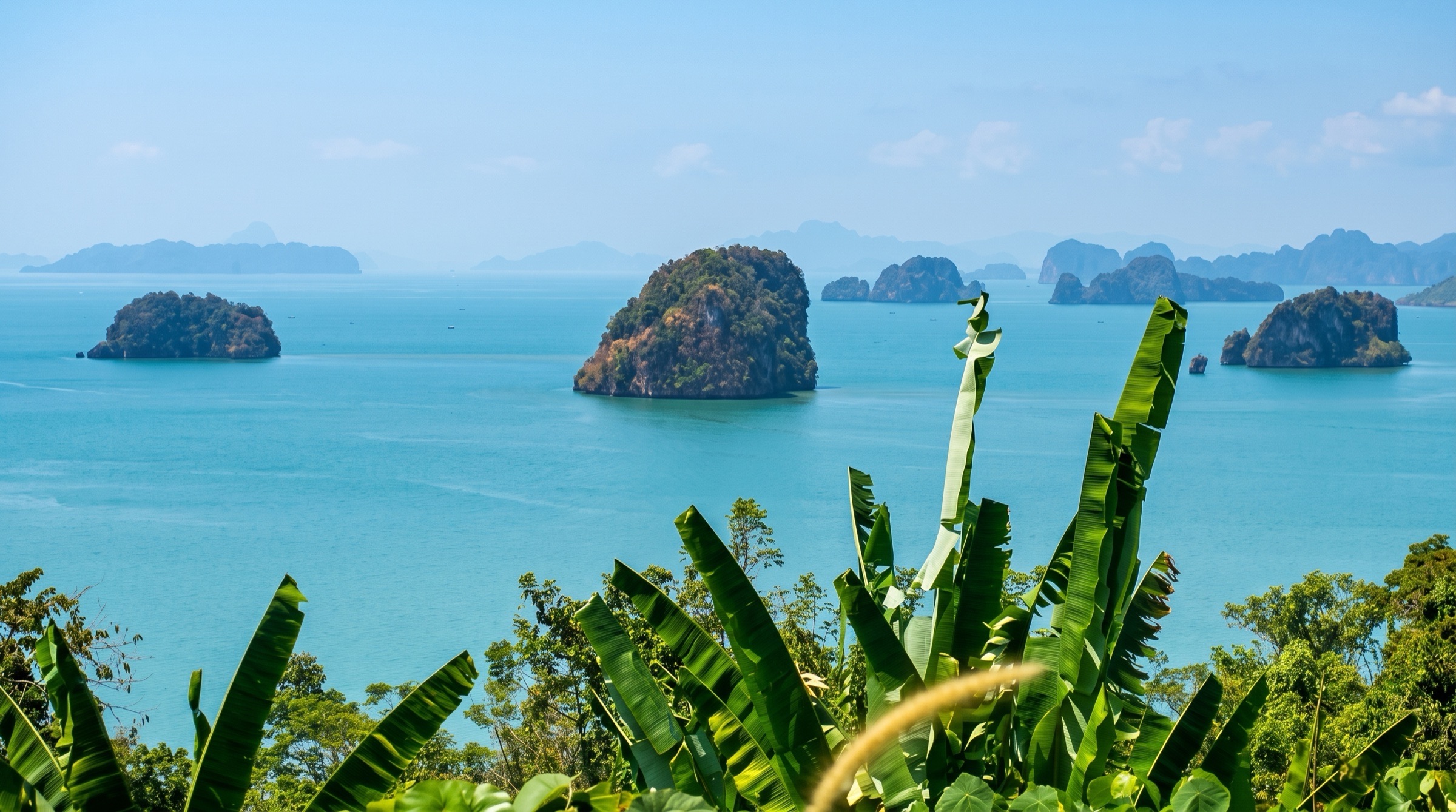
Phang Nga Bay has limestone towers rising from green water, sea caves called hongs that you explore by kayak or dinghy, and the stunning Phi Phi islands. Phuket is the base, with marinas, services and excellent Thai food ashore. Water is sheltered and distances are short.
Best months
Difficulty
EasySheltered bay, short hops and light monsoon winds.
Conditions
The northeast monsoon from November to April brings dry weather, light to moderate winds and calm water. May to October has southwest monsoon squalls, rain and swells outside the bay, though the bay itself stays sheltered. Watch for fishing nets and longtail boats.
Itineraries here
Area guide
Thailand
Thailand
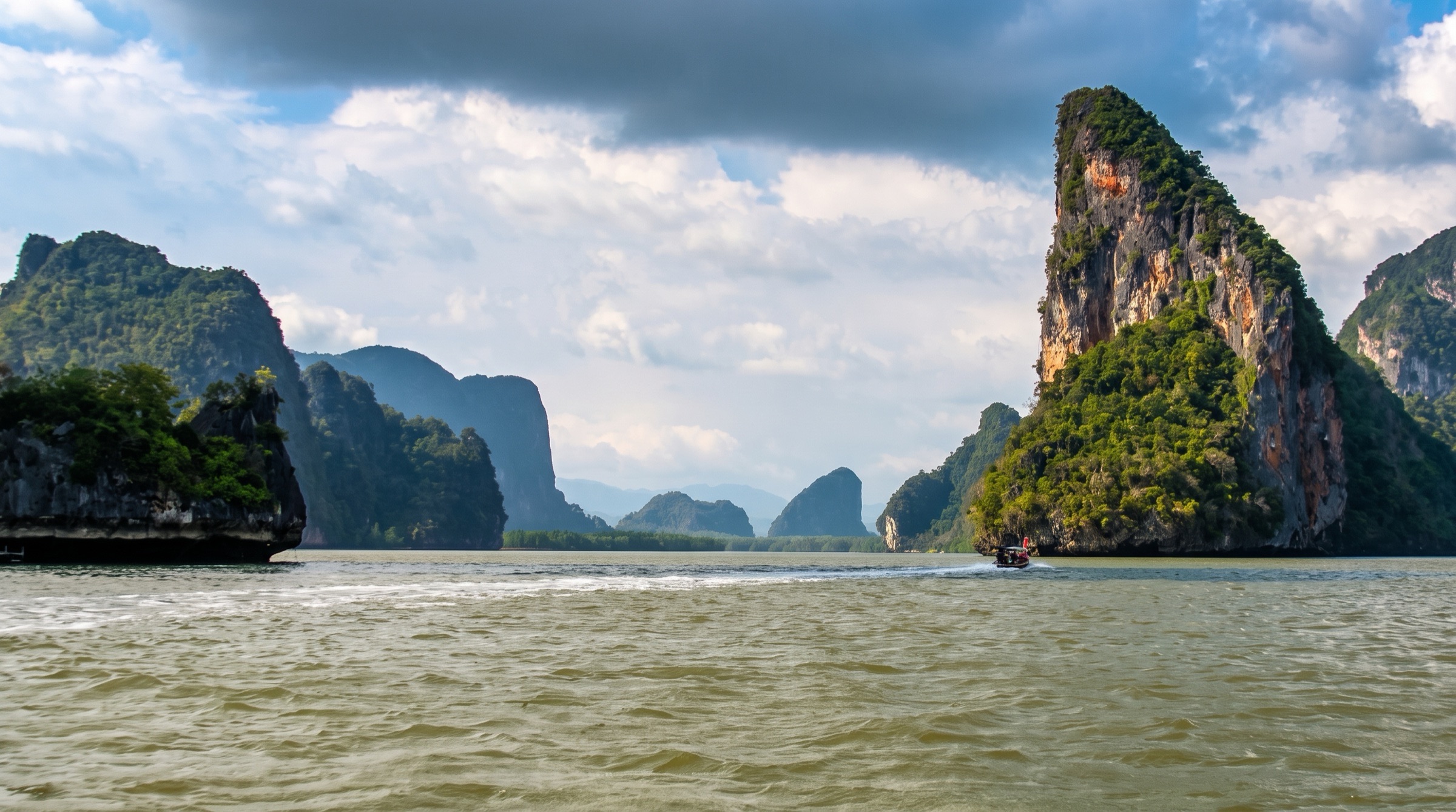
Thailand gives cruisers two seas on opposite monsoon clocks. On the Andaman side, Phuket is the yachting hub of Southeast Asia, with five marinas, the region's best haul-out yards and a one-stop clearance office at Ao Chalong. From there the cruising runs north to the granite boulders of the Similan and Surin parks, east into the limestone towers and hidden hongs (sea-cave lagoons) of Phang Nga Bay, and south past Krabi, Phi Phi, Lanta and the Trang islands to Koh Lipe and the Butang group on the Malaysian border, a classic route that ends at Langkawi. On the Gulf side, Koh Samui, Koh Phangan, Koh Tao and the 42-island Ang Thong Marine Park make a compact island group about 20 nm apart, and Koh Chang, Koh Mak and Koh Kut in Trat province offer quiet, sheltered water near Cambodia. Most of the best spots are national marine parks with per-person fees, mandatory moorings and seasonal closures, so check the rules before each stop.
Top of the list
- 1Koh Hong Lagoon (Phang Nga)The signature Phang Nga Bay experience: you paddle a dinghy or kayak through a cave into a hong, a lagoon open to the sky and ringed by sheer limestone. Anchor nearby, in mud, in either monsoon.
- 2Maya Bay (Phi Phi Le)The cliff-ringed bay from The Beach. Five park moorings allow an overnight stay after the day boats leave. The beach is closed to yachts, and the bay closes every August and September.
- 3Rai Lei West Beach Anchorage (Railay)A sand anchorage under towering limestone, with Phra Nang Beach, the Princess Cave, world-class sport climbing and beach restaurants a short dinghy ride away. There is no road access.
- 4Koh Rok Anchorage B (South Channel)Two uninhabited park islands with white sand, clear water and reef. Arrive late in the afternoon to have the moorings and beaches to yourself. Hin Daeng and Hin Muang are 12 nm away.
- 5Emerald Cave (Tham Morakot), Koh MukYou swim through an 80 m pitch-dark tunnel to a hidden beach inside the island. Bring a torch, and go early before the day boats arrive.
- 6Koh Similan Anchorage (Donald Duck Bay, #8)The best-protected overnight stop in the Similans, with granite boulders above and below the water and some of Thailand's best diving. The park is open mid-October to mid-May only.
- 7Koh Bon West Ridge (mantas)The Similans' manta cleaning station, where mantas are almost guaranteed in high season. Anchoring is impossible because of the depth, so use the orange park moorings on the southwest side.
- 8Richelieu RockA horseshoe pinnacle rising from 40 m, famous for whale sharks in March and April. It is Thailand's most celebrated dive site, about 10 nm east of Surin.
- 9Koh Surin Nua Park HQ Anchorage (Chong Khad Bay)A remote park anchorage 108 nm from Patong, with Moken sea-nomad villages, fringing reefs and almost no development.
- 10Koh Phing Kan (James Bond Island)The Koh Tapu spire from The Man with the Golden Gun. Visit at dawn or late afternoon to beat the tour boats, and combine it with Koh Panyi.
- 11Koh Panyi Sea Gypsy VillageA Muslim fishing village on stilts, built out from under a limestone cliff, with a floating football pitch and seafood restaurants over the water.
- 12Ao Muang Anchorage (Paradise Koh Yao)A calm, muddy-bottom anchorage off a boutique resort on Koh Yao Noi, with a view of Phang Nga Bay's karsts and a quiet rural island to cycle ashore.
- 13Koh Lipe North Anchorage (Sunset Beach)Thailand's southern gateway, with customs and immigration on the island, a lively walking street and clear water. It is the jumping-off point for the Butangs and Langkawi.
- 14Chado Cliff Viewpoint, Koh AdangA steep jungle climb from the park HQ to one of the great views in the Andaman, looking over Koh Lipe and the Butang islands.
- 15Koh Rawi Southwest AnchoragePark moorings on a sandy shelf beside reef snorkelling, with a ranger station, a freshwater tap and a jungle trail to a waterfall.
- 16Ao Batok (Racha Yai Main Bay)The easiest blue-water escape from Phuket, at 14 nm. Sand, clear water and wreck dives in nearby Ter Bay.
- 17Ao Chalong AnchorageThe Andaman port of entry, with good mud holding, the one-stop clearance office, fuel, water and the Phuket Cruising Yacht Club.
- 18Koh Wua Ta Lap ViewpointA 345-step climb from the Ang Thong park HQ to a panorama over the 42-island marine park.
- 19Emerald Lake (Thale Nai), Koh Mae KoA saltwater lake inside a limestone island, reached by a short stair climb from the Koh Mae Ko beach. It is the photo stop of Ang Thong.
- 20Koh Nang Yuan Anchorage and MooringsThree islets joined by coral-sand bars off Koh Tao, with free orange public moorings, a viewpoint, and snorkelling at the Japanese Gardens.
- 21Ao Hin Wong MooringsKoh Tao's best southwest-monsoon shelter, a rocky cove with excellent snorkelling and diving. Anchoring is banned, so pick up a mooring.
- 22Sail Rock (Hin Bai)The Gulf's best dive site, a lone pinnacle between Phangan and Tao, with a vertical chimney swim-through and frequent whale sharks.
- 23Koh Kradan Southeast Bay AnchorageTrang's prettiest island, with exceptional snorkelling off the park HQ and a palm-backed sunset beach on the west side.
- 24Koh Wai Northeast Anchorage (Paradise Resort)A gem of the Koh Chang group, with reef snorkelling off the anchorage, a jungle path across the island and almost no roads.
- 25Hin DaengThailand's most dramatic deep wall, a red soft-coral pinnacle rising from 70 m, where mantas and whale sharks come through in season. Combine it with Hin Muang.
When to go
Andaman coast (Phuket, Phang Nga, Krabi, Phi Phi, Lanta, Trang, Satun, Similan and Surin): the northeast monsoon from November to April is the main season, with dry weather, moderate NE breezes, flat water on west-facing shores and the best visibility. The Similan and Surin parks open only in this window, roughly 15 October to 15 May. The southwest monsoon from May to October brings 10 to 30 kn SW winds, swell on the west-facing coasts, squalls and afternoon rain. Sheltered sailing continues year-round inside Phang Nga Bay and along Phuket's east coast, and experienced crews enjoy the stronger winds. The 2025 closures ran 16 May to 14 October 2025 for the Similan and Surin parks and the Adang–Rawi group, and 1 August to 30 September for Maya Bay. Gulf of Thailand (Samui, Phangan, Tao, Ang Thong, Koh Chang): the Gulf runs largely opposite to the Andaman, so it is the natural choice when the Andaman is rough. Samui operators give January to April, with steady easterlies, as the most reliable window, and May to October as fair sailing with heat and squalls. The northeast-monsoon surges from about November to January can blow hard for days. In the eastern Gulf (Koh Chang), the charter companies run only from October to May.
Weather and hazards
Southwest-monsoon squalls with sudden 30 kn gusts and heavy rain, most common May to October. Northeast-monsoon surges in the Gulf blow 20 to 25 kn for days, usually strongest at night and in the morning, with roll from NW or SW swell in many anchorages. Fishing hazards are everywhere: unlit fishing boats, squid boats with bright lights at night, fish and pearl farms, and gill nets strung across channels and hong entrances. Many reefs and rocks are not accurately charted on digital charts. Hin Bida, Hin Klai and Hin Klang off Phi Phi, Hin Klang off Ao Po and the Koh Tien spire at Koh Rang in Trat are all named in the Southeast Asia Pilot, so keep a lookout and avoid night entries. Longtails and speedboats are fast and heavy throughout the day, from about 10am to 5pm. Ferry wakes at Koh Muk and elsewhere can flip dinghies. Seasonal jellyfish in Phang Nga Bay and the mangrove creeks are mostly mild, though there are occasional reports of more dangerous species, so wear rash guards. In 2026, Noonsite warned that the container ship SEALLOYD ARC sank southwest of Ko Kaew Noi, Phuket, on 7 February 2026 with 297 containers. Stay 100 m from any floating container and report sightings to the Maritime Security Command Centre on 1465 or the Pollution Control Department on 1196. Anchoring on coral is illegal in the national parks and is fined. Do not run dinghy engines inside caves or hongs.
Hurricane season
Tropical cyclones are rare at this latitude, but they do happen. The Andaman side is rarely hit directly. The Gulf of Thailand can be affected by typhoons and their remnants crossing from the South China Sea, mainly June to January, with the late-season storms (October to January) the most dangerous for southern Thailand. Tropical Storm Pabuk made landfall at Pak Phanang, Nakhon Si Thammarat, on 4 January 2019. It was the first tropical storm to make landfall over southern Thailand since Linda in 1997, and it killed eight people in Thailand. Watch the Thai Meteorological Department and the JTWC, and plan a bolt-hole when you are in the Gulf in the late season.
Entry and clearance
Ports of entry listed by Noonsite: Phuket (Ao Chalong), Krabi, Koh Lanta, Koh Lipe, Satun, Ranong, Koh Samui, Chumphon, Pranburi, Pattaya, Bangkok and Koh Chang. Phuket (Ao Chalong): a one-stop office on the Chalong pier houses Immigration, Customs and the Harbour Master, and you must check in within 24 hours of arrival. Register online for a first entry, either in advance or on arrival at the Yacht Control Center. Noonsite gives check-in hours of 9am to 2:45pm and check-out hours of 9am to 2:10pm, with lunch from 12pm to 1pm. The Harbour Master is officially closed on Sundays, and weekend or holiday clearance costs extra. All crew must attend for photos and fingerprints. AIS has been mandatory for foreign yachts entering, leaving and moving within Thai waters since 1 January 2016, and a substantial fine applies if you have no transponder. Noonsite reports that Chalong's system is separate from the Marine Department single window (md.go.th), so you must register on both. Moving between provinces (Phuket, Phang Nga, Krabi, Trang, Satun) requires a harbour-master check-out and check-in, and cruisers have reported fines of 500 to 5,000 THB, with one 5,000 THB fine for arriving in Krabi without confirming with the Phuket Harbour Master in 2022. Koh Lipe: Immigration and Customs are on the island, with fees paid at the ferry office. There is no Harbour Department on Koh Lipe. A 2024 report gave check-in as Immigration 500 THB per person, Customs 400 and Marine 200, and check-out as Immigration 500 THB per person, Customs 600 and Marine 800, with weekday hours only. Koh Samui: Customs and Immigration are at Ao Nathon. Koh Chang group: Immigration and the port office are at the Laem Ngop pier, and Customs is about an hour away by road. Krabi: Customs and the Harbour Department are near the Klong Ji Lard pier, and Immigration is beside the Marine Police office. Visas: from 15 September 2026, Thailand cut the visa-free stay from 60 to 30 days, tourism only, for 60 countries, including the US, the UK, Canada, Australia and the EU. The 60-day scheme stays valid for entries up to 14 September 2026. Check your own nationality before arrival. Verify every fee and procedure locally, because they change often and differ by office.
Permits and fees
No general cruising permit is needed for a foreign yacht on a temporary visit, but customs entry, harbour-master clearance and inter-provincial movement reports are required, as described under entry and clearance. National marine park fees are charged per foreign person, usually collected by ranger speedboat at the anchorage or through the DNP e-ticket system. Published figures include: Similan 500 THB per person per day plus 400 THB per vessel and 400 THB per scuba diver per day (Southeast Asia Pilot), with a daily quota and QueQ/e-ticket booking reported in 2024; Phi Phi, Koh Rok, Koh Hong (Phang Nga) and Emerald Cave 400 THB per person; Ang Thong 500 THB per person; Tarutao (Ao Pante) 500 THB per person; Koh Hong (Krabi) 300 THB per adult; Koh Rang in Trat 400 THB. Koh Khai has local council charges of 200 THB per boat plus 40 THB per foreign visitor. Mu Ko Chang was reported at 200 THB per person per day plus 50 THB per boat. All of these come from guides of various years, so verify locally. Rules: anchoring on coral is banned; use park moorings where they are laid. Fishing, spearfishing and feeding fish are prohibited in the parks, and arrests have been reported at Koh Khai for feeding fish. Barbecues are banned on park beaches, for example at Koh Rok. Waters near the Myanmar border, north of Surin, need prior permission. Leaving a yacht in Thailand without its captain aboard has involved a 2,000 THB fee or a 20,000 THB refundable bond at Phuket Immigration, a figure reported in 2017, so verify it.
Tides and currents
The Andaman coast has mainly semidiurnal tides, two highs and two lows a day. Phuket's spring range reaches about 2.5 to 2.6 m, referenced to the Ko Taphao Noi station of the Hydrographic Department, Royal Thai Navy. Tide height decides a lot here: hong and cave entries in Phang Nga Bay and at Koh Hong (Krabi), which needs more than 2 m to clear the reef; the Boat Lagoon channel, where deep drafts should enter in the last hour of the flood; Chong Koh Yao, where high tide should exceed draft by at least 0.5 m; the Krabi rivers; dinghy landings on drying mud at Chalong and Bang Bao; and the Koh Lipe walking-street jetty, which has no access at low tide. Wind against tide kicks up confused seas between south Phuket and Racha Yai. Currents of about 2 kn run in the Koh Panan / Koh Belitung Besa passage off Tarutao at mid-tide, and strong currents run in the Koh Rawi passage and the Koh Miang east channel in the Similans. Gulf of Thailand tides are smaller and largely diurnal. Official sources: the Hydrographic Department, Royal Thai Navy, National Tide Tables (hydro.navy.mi.th), from a network of 29 permanent gauges with near-real-time data.
Money
Thai baht (THB). ATMs are common on every inhabited island, often beside 7-Eleven stores. Koh Lipe has ATMs but no bank branch. Foreign-card ATM withdrawals carry a fixed fee. Park fees, longtail rides and most beach restaurants take cash only. Noonsite has warned of counting tricks at money-changer booths in Phuket, so count your notes.
Radio and phones
VHF 16 for calling and distress. Marinas reported by the Southeast Asia Pilot and Noonsite: Royal Phuket Marina on Ch 79, Phuket Boat Lagoon Harbour Master on Ch 71 during office hours, Ao Po Grand Marina on Ch 69 before arrival, and Ch 19 or 69 for a local guide into Khlong Son, Koh Chang. Thailand's Maritime Security Command Centre emergency hotline is 1465. Mobile data from AIS, True and DTAC is cheap and covers most anchorages, though coverage varies by island; Koh Adang west has none. Many cruisers carry two SIMs. AIS transmission is mandatory under way in Thai waters.
Charter bases
- Phuket Yacht Haven MarinaMai Khao / Thalang, north-east PhuketDream Yacht Charter
- Ao Po Grand MarinaNorth-east Phuket, at the entrance to Phang Nga BayThe Moorings, Sunsail, Simpson Yacht Charter
- Phuket Boat Lagoon / Royal Phuket MarinaEast coast Phuket (Koh Kaew)various skippered and bareboat operators (verify)
- Petcharat MarinaBophut/Bangrak, Koh SamuiDream Yacht Charter (cabin charter)
- Salak Phet / Bang Rong Than PierSouth-east Koh Chang, TratGulf Charters Thailand, Sailing Koh Chang (Aqua Charters), Island Spirit Yacht Charter
Getting there
- Phuket International Airport — HKTThe main Andaman gateway, with international flights. It is close to Yacht Haven and about 35 to 50 minutes from Ao Po Grand Marina, Boat Lagoon or Chalong by road.
- Krabi International Airport — KBVBest for joining a boat at Ao Nang, Railay or the Krabi River marinas.
- Trang Airport — TSTDomestic flights. About 30 km from Pak Meng for the Trang islands (Koh Ngai, Muk, Kradan).
- Hat Yai International Airport — HDYThe nearest major airport for Satun and the Pak Bara piers, the ferry ports for Koh Lipe and Tarutao.
- Samui International Airport — USMA small airport mostly served by Bangkok Airways, about 15 minutes from Bophut and Bangrak. Bangrak anchorage lies under the approach path.
- Surat Thani International Airport — URTLower-cost alternative for the Gulf islands, with bus and ferry connections via Donsak to Samui and Phangan.
- Trat Airport — TDXBangkok Airways service to Trat, for the Laem Ngop and Ao Thammachat ferries to Koh Chang.
- Suvarnabhumi International Airport (Bangkok) — BKKLong-haul hub with connections to all of the above. Koh Chang is about 5 hours by road.
Charts and guides
- Southeast Asia Pilot, 7th edition (Bill O'Leary & Grenville Fordham), formerly the Andaman Sea Pilot, covering 600+ anchorages from the Andaman Sea to the Spice Islands; southeastasiapilot.com has the anchorage index and the Phuket–Langkawi cruising map
- Hydrographic Department, Royal Thai Navy: official charts, National Tide Tables, Sailing Directions, and the List of Lights and Buoys in Thai Waters
- Noonsite Thailand country and port pages (formalities, recent cruiser reports)
- Gulf Charters Thailand free sailing guide to the Koh Chang archipelago
- Navionics / C-MAP electronic charts (reef positions around Phi Phi and elsewhere are not accurately charted, per the Southeast Asia Pilot)
Sample routes
- 7-day Phuket & Phang Nga classic loop (NE season, The Helm route, 136 nm)Day 1 · Phuket marina → Koh Phanak – Koh Hong (Phang Nga) · 24 nmPhang Nga Bay limestone islands; dinghy through the Koh Phanak cave into a hong; Koh Hong's largest hongDay 2 · Koh Hong (Phang Nga) → Koh Panyi – Ao Muang (Paradise Koh Yao) · 19 nmKoh Panyi stilt fishing village; resort on a half-moon bay; cycling and cooking classes ashoreDay 3 · Koh Yao Noi → Koh Dam Hok (Chicken Island) · 17 nmSand beaches and fringing reef; the chicken-head rock; snorkellingDay 4 · Koh Dam Hok → Phi Phi Don (north) · 12 nmPowder-sand beaches; reef snorkelling; beachfront dining; dive tripsDay 5 · Phi Phi Don (north) → Ton Sai Bay (Phi Phi Don) · 11 nmSheltered bay under limestone cliffs; village nightlife; Maya Bay by longtailDay 6 · Ton Sai Bay → Ao Batok (Racha Yai Main Bay) · 25 nmUp to 30 m visibility for diving; two white-sand beachesDay 7 · Koh Racha Yai → Phuket marina (via Koh Rang Yai) · 28 nmSwim stop at Koh Rang Yai's 1 km beach; seafood; return to the marina
- 7-day SW-season sheltered loop from Ao Po Grand Marina (The Moorings route)Day 1 · Ao Po Grand Marina → Koh Naka Yai (east) · 2 nmSheltered east coast in SW winds; beachfront resort for sunsetDay 2 · Koh Naka Yai → Ao Muang (Paradise Koh Yao) · 15 nmPhang Nga Bay karsts; mangrove kayaking; resort mooringsDay 3 · Koh Yao Noi → Ao Nam Mao Anchorage · 20 nmQuiet bay under cliffs near Railay; access to Krabi and Ao NangDay 4 · Ao Nam Mao → Phi Phi Don (east coast) · 20 nmEast coast shelter in the SW season; Ton Sai village by short boat rideDay 5 · Phi Phi Don → Racha Yai East (Ter Bay) Anchorage · 27 nmUnderwater sculptures and wrecks; Ter Bay is sheltered in the SW monsoonDay 6 · Koh Racha Yai → Koh Rang Yai Anchorage and Moorings · 22 nmLong sand beach; pearl farm; mooring buoysDay 7 · Koh Rang Yai → Ao Po Grand Marina · 7 nmCall the marina on VHF for a berth; return the boat
- 14-day one-way Phuket to Koh Lipe (Phang Nga, Krabi, Phi Phi, Lanta, Trang, Butang; NE season). Distances are straight-line between Southeast Asia Pilot waypoints, so add 10–20% for routingDay 1 · Ao Po Grand Marina → Koh Hong Anchorage A (Phang Nga) · 10 nmDinghy into Koh Hong lagoon at mid to high tide; dawn visit to James Bond Island the next morningDay 2 · Koh Hong (Phang Nga) → Ao Muang Anchorage (Paradise Koh Yao) · 9 nmKoh Panyi stilt village en route; rural Koh Yao Noi by bicycleDay 3 · Koh Yao Noi → Koh Hong South Anchorage (Krabi) · 6 nmKoh Hong (Krabi) lagoon on tides above 2 m; bat cave; beach restaurantDay 4 · Koh Hong (Krabi) → Rai Lei West Beach Anchorage (Railay) · 10 nmPhra Nang Beach and Princess Cave; climbing; sunset at RailayDay 5 · Railay → Maya Bay National Park Moorings · 20 nmPick up a park mooring in the evening as the day boats leave; Loh Samah and Pileh Lagoon by dinghyDay 6 · Phi Phi Le → Ton Sai Bay Anchorage (Phi Phi Don) · 4 nmPhi Phi viewpoint hike; provisioning in Ton Sai village; Bida Nok dive. Distance approximateDay 7 · Phi Phi Don → Hat Kan Tiang Anchorage · 22 nmKoh Lanta's prettiest bay; Lanta Old Town by road. Clear with the Krabi harbour master for the province change. Distance approximateDay 8 · Koh Lanta → Koh Rok Anchorage B (South Channel) · 17 nmArrive late afternoon; reef snorkelling; dive Hin Daeng and Hin Muang the next morningDay 9 · Koh Rok → Koh Kradan West Bay (Sunset Beach) Anchorage · 13 nmExceptional snorkelling off the east coast; palm-fringed beachDay 10 · Koh Kradan → Koh Muk West (Sabay Bay) Anchorage · 4 nmSwim the Emerald Cave tunnel early, before the tour boats; Charlie BeachDay 11 · Koh Muk → Koh Bulon Le East Anchorage · 35 nmLongest leg; quiet island with trails to hidden coves. Little shelter in a strong NE surgeDay 12 · Koh Bulon Le → Koh Rawi Southwest Anchorage · 27 nmButang group park moorings; Koh Hin Ngam's stone beach; Rawi waterfall trailDay 13 · Koh Rawi → Koh Adang West Moorings · 5 nmChado Cliff Viewpoint hike; Koh Yang and Koh Kra snorkellingDay 14 · Koh Adang → Koh Lipe North Anchorage (Sunset Beach) · 3 nmClear out at Koh Lipe immigration and customs (weekdays) before Langkawi, 23 nm to Telaga; walking-street dinner
- 7-day Koh Samui, Ang Thong, Koh Tao & Koh Phangan loop (about 115 nm, adapted from a World Yacht Charter route, World Yacht Charter route)Day 1 · Thong Krut Pier (longtails to Koh Taen) → Koh Taen (Koh Tan) Anchorage · 3 nmMangrove walk; reef snorkelling; quiet once the day visitors leave; 3 nm is from the Thong Krut roadstead on Samui's south coast, add about 20 nm if starting from the Bangrak/Bophut charter basesDay 2 · Koh Taen → Koh Wua Ta Lap Anchorage (Ang Thong Park HQ) · 20 nmKayaking among limestone; 345-step viewpoint climbDay 3 · Koh Wua Ta Lap Anchorage (Ang Thong Park HQ) → Koh Phaluai Anchorage · 10 nmDinghy under the Koh Sam Sao arch; Emerald Lake on Koh Mae Ko (about 2 nm north to Koh Sam Sao, then about 8 nm south to Koh Phaluai; straight-line distances)Day 4 · Koh Phaluai → Ao Mamuang (Mango Bay) Moorings · 36 nmCoral snorkelling; calm early and late in the dayDay 5 · Koh Tao (north) → Shark Island (Koh Tao) · 6 nmSnorkelling and paddleboarding after the dive boats leaveDay 6 · Koh Tao → Bottle Beach (Haad Khuat) Anchorage · 23 nmRemote north-coast bay of Phangan, reached mainly by boatDay 7 · Koh Phangan → Ao Chaweng Anchorage · 17 nmLunch near Haad Rin; Chaweng evening; short hop back to base
- 7-day Koh Chang, Koh Mak & Koh Kut loop from Salak Phet (NE season, Nov–Apr; about 52 nm). Distances are straight-line between Southeast Asia Pilot waypoints, so add 10–20% for routingDay 1 · Koh Chang Marina (Salak Phet) → Koh Mak Southwest Bay (Ao Suan Yai/Ao Kao) Anchorage · 12 nmLunch and reef snorkelling at Koh Wai Northeast Anchorage (Paradise Resort) (5 nm), then on to the NE-season overnight off the Koh Mak ferry jettyDay 2 · Koh Mak Southwest Bay (Ao Suan Yai/Ao Kao) Anchorage → Koh Mak Southwest Bay (Ao Suan Yai/Ao Kao) Anchorage · 8 nmDay trip to Koh Rang National Park HQ Anchorage for the Koh Rang Reefs (4 nm each way); afternoon at Ao Kao Beach (Koh Mak) or the Elephants Underwater SculpturesDay 3 · Koh Mak Southwest Bay (Ao Suan Yai/Ao Kao) Anchorage → Ao Khlong Chao Anchorage · 12 nmCross to Koh Kut; dinghy up the khlong and walk to Khlong Chao Waterfall (NE season only at this anchorage)Day 4 · Ao Khlong Chao Anchorage → Koh Kut Maisi Lek Anchorage (Soneva Kiri bay) · 5 nmStop at Koh Raet Anchorage (Koh Kut) for the Temple Statues Dive and Koh Raet Firefly Creek; overnight in the year-round shelter of Soneva Kiri bayDay 5 · Koh Kut Maisi Lek Anchorage (Soneva Kiri bay) → Koh Mak Southeast (Ao Tar Nid) Anchorage · 6 nmDinghy-only look at Koh Kradat Deer Island (2 nm on; keelboats cannot approach); Baan Ao Nid village ashoreDay 6 · Koh Mak Southeast (Ao Tar Nid) Anchorage → Ao Bang Bao Anchorage · 17 nmDay stop at Koh Ngam Day Anchorage (9 nm; watch the rock south of the bay), then Bang Bao Pier Village seafoodDay 7 · Ao Bang Bao Anchorage → Koh Chang Marina (Salak Phet) · 5 nmRound the south coast to Salak Phet; Salak Phet Seafood Pontoons for the last dinner
Places in Thailand
- 100 Degrees East Dive Center (Bangrak)Service · Koh Samui
- 12 Bars Japanese (Koh Mak)Eat · Koh Mak
- 15 Palms Beach Bar (White Sands)Bar · Koh Chang
- Abdul's Pancakes, SaladanEat · Koh Lanta Yai
- Adang–Rawi Seasonal Closure (mid-May to mid-Oct)Seasonal · Koh Adang
- Ae Fish BBQ (Ton Sai)Eat · Koh Phi Phi Don
- Alaturka Turkish Restaurant (White Sands)Eat · Koh Chang
- Alin Kitchen & Cafe (Koh Muk Village)Eat · Koh Muk
- Amanpuri Bay AnchorageAnchorage · Phuket
- AME Marine Chandlery, Boat LagoonService · Phuket
- Amsterdam Bar (West Coast Sunset)Bar · Koh Phangan
- Andaman Clinic (Koh Yao Yai)Service · Koh Yao Yai
- Andaman Sea Southwest Monsoon (May–Oct)Seasonal · Krabi mainland coast
- Ang Thong Monkeys and WildlifeWildlife · Koh Wua Ta Lap
- Ang Thong National Marine Park HQPermit · Koh Wua Ta Lap
- Ang Thong National Park FeePermit · Koh Wua Ta Lap
- Ang Thong Northern Islands Dive SitesDive · Koh Lim
- Ang Thong Park HQ Restaurant and BungalowsEat · Koh Wua Ta Lap
- Ang Thong Sea KayakingWatersport · Koh Wua Ta Lap
- Ang Thong Seasonal Closure (Nov–Dec, NE monsoon)Seasonal · Koh Wua Ta Lap
- Angela's Bakery and Diner (Maenam)Stores · Koh Samui
- Anita's ReefDive · Koh Ha (#5)
- Antica Locanda (Bangrak)Eat · Koh Samui
- Ao A Yi Ang Beach, Koh AdangBeach · Koh Adang
- Ao Bang Bao AnchorageAnchorage · Koh Chang
- Ao Bang Bao Anchorage (Koh Kut)Anchorage · Koh Kut
- Ao Bang Kao AnchorageAnchorage · Koh Samui
- Ao Batok (Racha Yai Main Bay)Anchorage · Koh Racha Yai
- Ao Chalok Baan Kao AnchorageAnchorage · Koh Tao
- Ao Chaloklum AnchorageAnchorage · Koh Phangan
- Ao Chalong AnchorageAnchorage · Phuket
- Ao Chaweng AnchorageAnchorage · Koh Samui
- Ao Chong Khad Beach and Park HQ (Surin)Permit · Koh Surin Nua
- Ao Hin Wong MooringsAnchorage · Koh Tao
- Ao Kao Beach (Koh Mak)Beach · Koh Mak
- Ao Khao Kwai Anchorage (Buffalo Bay, Koh Phayam)Anchorage · Koh Phayam
- Ao Khao Kwai Restaurants (Buffalo Bay, Koh Phayam)Eat · Koh Phayam
- Ao Khlong Chao AnchorageAnchorage · Koh Kut
- Ao Khlong Phrao AnchorageAnchorage · Koh Chang
- Ao Khlong Son AnchorageAnchorage · Koh Chang
- Ao Labu North AnchorageAnchorage · Koh Yao Yai
- Ao Labu South AnchorageAnchorage · Koh Yao Yai
- Ao Lamai AnchorageAnchorage · Koh Samui
- Ao Lanah Anchorage (Phi Phi Don)Anchorage · Koh Phi Phi Don
- Ao Lang Ya Bays Anchorage (Koh Adang North)Anchorage · Koh Adang
- Ao Leuk MooringsAnchorage · Koh Tao
- Ao Leuk Restaurants (Chabalay, Baan Talay)Eat · Koh Tao
- Ao Mae Haad AnchorageAnchorage · Koh Phangan
- Ao Mae Haad Anchorage (Koh Tao)Anchorage · Koh Tao
- Ao Mae Yai, Koh Surin NuaSnorkel · Koh Surin Nua
- Ao Mai Pai Beach (Bamboo Bay)Beach · Koh Lanta Yai
- Ao Makham Anchorage (Tarutao)Anchorage · Koh Tarutao
- Ao Makham Deep Sea PortLandmark · Phuket
- Ao Mamuang (Mango Bay) MooringsAnchorage · Koh Tao
- Ao Molae Beach, TarutaoBeach · Koh Tarutao
- Ao Molae Park Restaurant (Tarutao)Eat · Koh Tarutao
- Ao Muang Anchorage (Paradise Koh Yao)Anchorage · Koh Yao Noi
- Ao Nam Mao AnchorageAnchorage · Krabi mainland coast
- Ao Nang AnchorageAnchorage · Krabi mainland coast
- Ao Nang Beach and TownStores · Krabi mainland coast
- Ao Nang Grand LaundryService · Krabi mainland coast
- Ao Nang Landmark Night MarketEat · Krabi mainland coast
- Ao Nang Roadside Fuel (no fuel dock)Service · Krabi mainland coast
- Ao Nasai (Lipa Noi) Car Ferry AnchorageAnchorage · Koh Samui
- Ao Nathon AnchorageAnchorage · Koh Samui
- Ao Nguang Chang (Koh Similan)Beach · Koh Similan (#8)
- Ao Niang Beach Restaurant (Koh Kradan)Eat · Koh Kradan
- Ao Nid Pier (Koh Mak public pier)Service · Koh Mak
- Ao Nui BeachBeach · Koh Lanta Yai
- Ao Pante Anchorage (Tarutao)Anchorage · Koh Tarutao
- Ao Pante Mangrove Longtail and Kayak Trip (Khlong Pante)Tour · Koh Tarutao
- Ao Pante Park Restaurant (Tarutao HQ)Eat · Koh Tarutao
- Ao Phang Nga National Park Entry FeePermit · Phang Nga Bay (bay-wide)
- Ao Phang Nga National Park HQPermit · Phang Nga mainland (Tha Dan)
- Ao Phangka AnchorageAnchorage · Koh Samui
- Ao Phra-Ae (Long Beach) Mooring, Layana ResortAnchorage · Koh Lanta Yai
- Ao Po Grand MarinaMarina · Phuket
- Ao Po Village Jetty AnchorageAnchorage · Phuket
- Ao Sai Beach (Koh Yao Yai)Beach · Koh Yao Yai
- Ao Sai Khao, Koh Rawi (East)Snorkel · Koh Rawi
- Ao Sai Nuan AnchorageAnchorage · Koh Tao
- Ao Salak Phet AnchorageAnchorage · Koh Chang
- Ao Salat (Koh Kut)Landmark · Koh Kut
- Ao Salat Ferry Pier (Koh Kut)Service · Koh Kut
- Ao Sapparot Ferry PierService · Koh Chang
- Ao Si Beach (Koh Jum)Beach · Koh Jum (Koh Pu)
- Ao Son AnchorageAnchorage · Koh Tarutao
- Ao Son Ranger Station Restaurant and WaterEat · Koh Tarutao
- Ao Sri Thanu / Zen BeachBeach · Koh Phangan
- Ao Suan Yai Pier (Koh Mak Resort Pier)Service · Koh Mak
- Ao Suthep Snorkel Trail (Surin Tai)Snorkel · Koh Surin Tai
- Ao Ta Lo Lang Cha Anchorage (Koh Adang North-East)Anchorage · Koh Adang
- Ao Talen Anchorage (Tha Len)Anchorage · Krabi mainland coast
- Ao Talo Lae Lae Anchorage (Koh Adang East)Anchorage · Koh Adang
- Ao Talo Pa Tai Pa Yang Beach, Koh RawiBeach · Koh Rawi
- Ao Talo Palien West Bay Anchorage, Koh RawiAnchorage · Koh Rawi
- Ao Talo Puya Sea Gypsy Village, Koh AdangLandmark · Koh Adang
- Ao Talo Udang AnchorageAnchorage · Koh Tarutao
- Ao Talo Udang Prison SiteLandmark · Koh Tarutao
- Ao Talo Wao AnchorageAnchorage · Koh Tarutao
- Ao Talo Wao Historic Prison CampLandmark · Koh Tarutao
- Ao Tao (Turtle Bay)Snorkel · Koh Surin Tai
- Ao Tapao Beach (Koh Kut)Beach · Koh Kut
- Ao Tha Rua Channel Entrance (Boat Lagoon waiting area)Anchorage · Phuket
- Ao Thammachat Ferry PierService · Trat mainland (Laem Ngop)
- Ao Thian Og (Shark Bay)Anchorage · Koh Tao
- Ao Thong Lang and Koh Tae Nok ReefsSnorkel · Koh Phangan
- Ao Thong Takien AnchorageAnchorage · Koh Samui
- Ao Ting Rai Anchorage (Koh Jum)Anchorage · Koh Jum (Koh Pu)
- Ao Wok Tum AnchorageAnchorage · Koh Phangan
- Ao Yai Fishing Village (Koh Kut)Eat · Koh Kut
- Ao Yai Restaurants and Bars (Long Beach, Koh Phayam)Eat · Koh Phayam
- Ao Yon Anchorage (Cape Panwa)Anchorage · Phuket
- Aonang Medical ClinicService · Krabi mainland coast
- Api Restaurant & Bar (SAii Phi Phi Island Village, Loh Bagao)Eat · Koh Phi Phi Don
- Ark Bar Beach Club (Chaweng)Bar · Koh Samui
- Asian Phuket Marine & Dockyard (Khlong Tha Chin)Service · Phuket
- Baan Rim Nam Seafood (Klong Hia)Eat · Koh Yao Yai
- Baan Sai Palee Laundry, KantiangService · Koh Lanta Yai
- Ban Koh Jum Village and PierStores · Koh Jum (Koh Pu)
- Ban Koh Muk Village (Hua Laem)Stores · Koh Muk
- Ban Koh Pu Village and PierLandmark · Koh Jum (Koh Pu)
- Ban Koh Siboya Village and PierLandmark · Koh Siboya
- Ban Lang Khao Beach Landing (Koh Libong)Service · Koh Libong
- Ban Lang Khao Beach Restaurants (Koh Libong)Eat · Koh Libong
- Ban Pak Chok Anchorage (Koh Ra / Koh Phra Thong)Anchorage · Koh Phra Thong
- Ban Phrao (Ban Maphrao) Pier, Koh LibongService · Koh Libong
- Banana Beach (north-west Phuket)Beach · Phuket
- Banana Tree Restaurant, Koh LipeEat · Koh Lipe
- Bandon International HospitalService · Koh Samui
- Bang Bao Home (Koh Kut)Eat · Koh Kut
- Bang Bao Pier VillageEat · Koh Chang
- Bang Niang and Khuk Khak Laundries (Khao Lak)Service · Khao Lak coast (mainland)
- Bang Niang MarketStores · Khao Lak coast (mainland)
- Bang Pae Waterfall TrailHike · Phuket
- Bang Po AnchorageAnchorage · Koh Samui
- Bang Tao Bay Anchorage (Laguna)Anchorage · Phuket
- Bang Tao South Anchorage (Amancruises base)Anchorage · Phuket
- Bangkok Hospital Phuket / Vachira Phuket HospitalService · Phuket
- Bangkok Hospital SamuiService · Koh Samui
- Bangkok Hospital TratService · Trat mainland (Trat town)
- Bangrak Anchorage (Big Buddha Bay)Anchorage · Koh Samui
- Bangrak Ferry PierService · Koh Samui
- Bangrak Fresh Market (east of Seatran pier)Stores · Koh Samui
- Bangrak Tour-Boat Jetties (fuel and water by arrangement)Service · Koh Samui
- Barracuda Restaurant at The Wharf (Bophut)Eat · Koh Samui
- Bay Regatta (Phang Nga Bay to Krabi)Event · Krabi mainland coast
- Beacon ReefDive · Koh Similan (#8)
- Bear Bar (Koh Yao Yai)Bar · Koh Yao Yai
- Benny's On The Beach, Sunrise BeachEat · Koh Lipe
- Bentley's Sports Bar (White Sands)Bar · Koh Chang
- Bida Nok and Bida NaiDive · Koh Bida Nok
- Big Buddha (Phra Phutta Ming Mongkol)Landmark · Phuket
- Big Buddha Beach (Bang Rak)Beach · Koh Samui
- Big Buddha Temple (Wat Phra Yai)Landmark · Koh Samui
- Big C and Lotus's (Pearl Beach)Stores · Koh Chang
- Big C BophutStores · Koh Samui
- Big C Supercenter KrabiStores · Krabi mainland coast
- Black Bananas (Ao Ngamkho)Eat · Koh Kut
- Blue Pearl Bar (Cococape, Koh Mak)Bar · Koh Mak
- Blues Blues Restaurant (Khlong Son)Eat · Koh Chang
- BLUU Asian Kitchen & Bar, Royal Phuket MarinaBar · Phuket
- Boat Lagoon Boatyard and ChandleriesService · Phuket
- Boonsung Wreck (Khao Lak)Dive · Khao Lak coast (mainland)
- Bophut AnchorageAnchorage · Koh Samui
- Bophut Laundry (Fisherman's Village)Service · Koh Samui
- Bophut PTT Fuel and Jerry-can FuelService · Koh Samui
- Bottle Beach (Haad Khuat) AnchorageAnchorage · Koh Phangan
- Bottle Beach Restaurants (Bottle Beach 1, Bungabow, Smile)Eat · Koh Phangan
- Bottle Beach Trail (Haad Khom to Haad Khuat)Hike · Koh Phangan
- Boulder City and Sharkfin Reef (Koh Payan, #3)Dive · Koh Payan (#3)
- Bread O'Clock Bakery, ChalongStores · Phuket
- Breakfast BendDive · Koh Ba Ngu (#9)
- Bua Bok Cave, Koh Wua Ta LapHike · Koh Wua Ta Lap
- Bubble Bar (Ao Yai, Koh Phayam)Bar · Koh Phayam
- Bulon Le BarsBar · Koh Bulon Le
- Bulon Le Village EateriesEat · Koh Bulon Le
- Bulone Minimart, Koh Bulon LeStores · Koh Bulon Le
- Bulone Resort Restaurant, Koh Bulon LeEat · Koh Bulon Le
- Buoyancy WorldDive · Koh Tao
- Cafe Tropical, Koh LipeEat · Koh Lipe
- Capt Ed's Spot (Laem Hua Larn)Anchorage · Koh Yao Yai
- Captain Nhong Seafood (Ao Salat)Eat · Koh Kut
- Carlitos Bar (Ton Sai Beach)Bar · Koh Phi Phi Don
- Carnivore Steakhouse (Ao Nang)Eat · Krabi mainland coast
- Central Phuket Mall (Festival and Floresta), Phuket TownStores · Phuket
- Chado Cliff Viewpoint, Koh AdangView · Koh Adang
- Chai Chet Fuel PumpService · Koh Chang
- Chalok Baan Kao and Shark Bay Restaurants (Taa Toh, The Cape)Eat · Koh Tao
- Chalok Baan Kao Shops (7-Eleven and Orchid Minimart)Stores · Koh Tao
- Chaloklum Fishing VillageEat · Koh Phangan
- Chaloklum Fuel and Water (jerry can)Service · Koh Phangan
- Chaloklum Seafood Restaurants (Phorn Seafood)Eat · Koh Phangan
- Chalong Laundries (Clean Machine, Otteri, Oscar)Service · Phuket
- Chalong Lighthouse & LightweedEat · Phuket
- Chalong Pier Fuel and Water BargeService · Phuket
- Chalong Pier One-Stop Clearance Center (Customs, Immigration, Harbour Master)Permit · Phuket
- Chalong Supermarkets (Lotus's, Makro, Super Cheap)Stores · Phuket
- Chao Mae Kuan Im Shrine ViewpointView · Koh Phangan
- Charlee Barleys, Klong NinBar · Koh Lanta Yai
- Chaweng BeachBeach · Koh Samui
- Chaweng Noi BeachBeach · Koh Samui
- Chi Samui Beach Club (Bangrak)Bar · Koh Samui
- Chicken Island Anchorage (Koh Kai / North Koh Dam Khwan)Anchorage · Koh Dam Hok (Chicken Island)
- Chicken Island Southeast Anchorage (SW Monsoon)Anchorage · Koh Dam Hok (Chicken Island)
- Chill Chill @ PaiEat · Koh Yao Yai
- Chillout Cafe and Tum Korat (Khlong Chao)Eat · Koh Kut
- Choeng Mon Beach SlipwayService · Koh Samui
- Chom View Restaurant (Koh Ngai)Eat · Koh Ngai (Koh Hai)
- Chong Koh Yao AnchorageAnchorage · Koh Yao Noi
- Chong Koh Yao Sand SpitBeach · Koh Yao Yai
- Chong Lad Pier (Koh Yao Yai)Service · Koh Yao Yai
- Chowlay and Ruan Thai Seafood (Bang Bao Pier)Eat · Koh Chang
- Christmas PointDive · Koh Ba Ngu (#9)
- Chumphon PinnacleDive · Chumphon Pinnacle
- Chumphon Port of Entry (Pak Nam Chumphon)Permit · Chumphon (mainland)
- Citrus Restaurant & Bar, Klong DaoEat · Koh Lanta Yai
- CJ Supermarket (Kai Bae)Stores · Koh Chang
- Coco Bar (Golden Pearl Beach)Bar · Koh Jum (Koh Pu)
- Coco Tam's Beach Bar (Bophut)Bar · Koh Samui
- Coconut Bay Snorkel (Koh Pu)Snorkel · Koh Jum (Koh Pu)
- Cook Kai Restaurant, Klong NinEat · Koh Lanta Yai
- Coral Grand Dive Center (Bangrak)Service · Koh Samui
- Crocodile Cave (Tham Jarakhe) by dinghyWatersport · Koh Tarutao
- Crust Bakery (Khlong Prao)Stores · Koh Chang
- Day Beds Restaurant (Seavana, Ao Suan Yai)Eat · Koh Mak
- Deep SixDive · Koh Payu (#7)
- Diamond Cave (Phra Nang Nai), RailayLandmark · Krabi mainland coast
- Dive Point Dive Center (Choeng Mon)Service · Koh Samui
- Domesila / Phaeng Waterfall ViewpointView · Koh Phangan
- Donald Duck Bay (Ao Kuerk)Beach · Koh Similan (#8)
- Dragon Spine Sandbar (Koh Yao Noi west coast)Beach · Koh Yao Noi
- Drunken Sailors, KantiangEat · Koh Lanta Yai
- Dusit Thani Krabi Beach Anchorage (Khlong Muang)Anchorage · Krabi mainland coast
- East Marine Asia Chandlery, Boat LagoonService · Phuket
- East of EdenDive · Koh Payu (#7)
- Eastern Gulf Northeast Monsoon Surges (Dec–Jan)Seasonal · Koh Chang
- Eight Mile RockDive · Open water (south of Koh Lipe)
- El Barrio (Kai Bae)Eat · Koh Chang
- Elephant American Coffee House, Koh LipeEat · Koh Lipe
- Elephant Head RockDive · Koh Hin Pousar (#6)
- Elixir Divers (Koh Yao Yai)Service · Koh Yao Yai
- Emerald Cave (Tham Morakot), Koh MukSnorkel · Koh Muk
- Emerald Lake (Thale Nai), Koh Mae KoView · Koh Mae Ko
- Emergency Doctor Clinic (Prunai area, Koh Yao Yai)Service · Koh Yao Yai
- Esan Family (Hin Dam)Eat · Koh Kut
- Escape Beach Bar, Hat Sai Yao (Koh Muk)Bar · Koh Muk
- Esso Fuel Station (Koh Yao Yai)Service · Koh Yao Yai
- Filou Cocktail Lounge (Kai Bae)Bar · Koh Chang
- First Standard Clinic (Lam Sai, Koh Yao Noi)Service · Koh Yao Noi
- Fisherman's Restaurant (Ban Tai)Eat · Koh Phangan
- Fisherman's Village Bophut (Walking Street)Eat · Koh Samui
- Five Bird's Nest Islands Day Anchorage (Koh Mae Tap)Anchorage · Five Islands (Koh Si Koh Ha / Bird's Nest Islands)
- Flame Tree Restaurant, Railay WestEat · Krabi mainland coast
- Flour Power Bakery, Sunset BeachEat · Koh Lipe
- Food Garden and Food Art Hut (Ao Kao)Eat · Koh Mak
- Fraggle Rock ViewpointView · Koh Tao
- Freedom Beach AnchorageAnchorage · Phuket
- Friend Seafood (Kai Bae)Eat · Koh Chang
- Full Moon Party, Haad RinEvent · Koh Phangan
- Gas Shop LPG Refill (opposite Krabi Airport)Service · Krabi mainland coast
- Gibbon Rehabilitation ProjectWildlife · Phuket
- Golden Buddha Beach (Koh Phra Thong)Beach · Koh Phra Thong
- Golden Pearl and Andaman Beach Anchorage (Koh Jum)Anchorage · Koh Jum (Koh Pu)
- Golden Pearl Beach and Andaman Beach (Long Beach), Koh JumBeach · Koh Jum (Koh Pu)
- Goodsmarket (Ao Tapao, Koh Kut)Stores · Koh Kut
- Grand Mar Hut Seafood (Koh Wai)Eat · Koh Wai
- Green Mango Club (Chaweng)Bar · Koh Samui
- Green RockDive · Koh Nang Yuan
- Gulf Charters Thailand Base (Salak Phet)Service · Koh Chang
- Gulf Northeast Monsoon Surges (Nov–Jan)Seasonal · Koh Samui
- Gulf Typhoon / Tropical Storm Risk (Jun–Jan)Seasonal · Koh Samui
- Haad Chao Phao AnchorageAnchorage · Koh Phangan
- Haad Chao Phao Restaurants and Bars (Phangan Cabana, Heaven Beach Bar)Eat · Koh Phangan
- Haad Choeng Mon Day AnchorageAnchorage · Koh Samui
- Haad Kai Bae AnchorageAnchorage · Koh Chang
- Haad Khom (Coconut Beach)Snorkel · Koh Phangan
- Haad Nam Tok (Than Sadet) AnchorageAnchorage · Koh Phangan
- Haad Rin ATMs, Laundry and FuelService · Koh Phangan
- Haad Rin Clinics and PharmaciesService · Koh Phangan
- Haad Rin Nai AnchorageAnchorage · Koh Phangan
- Haad Rin Nok AnchorageAnchorage · Koh Phangan
- Haad Rin Restaurants and Bars (Drop In, Little Home, Mellow Mountain)Bar · Koh Phangan
- Haad Salad AnchorageAnchorage · Koh Phangan
- Haad Son (Secret Beach)Beach · Koh Phangan
- Haad Thien and Haad YuanBeach · Koh Phangan
- Haad Yao (Phangan) AnchorageAnchorage · Koh Phangan
- Haad Yao Bars (Eagle Bar, Jungle Roots, Rasta Home)Bar · Koh Phangan
- Haad Yao Restaurants (Absolute Island, Haad Yao Villa, Pura Vida)Eat · Koh Phangan
- Had Khlong Dao AnchorageAnchorage · Koh Lanta Yai
- Half Moon Festival (Ban Tai)Event · Koh Phangan
- Happy Elephant Restaurant (Bophut)Eat · Koh Samui
- Hari Raya (Eid al-Fitr) on Koh YaoEvent · Koh Yao Noi and Koh Yao Yai
- Haris Kitchen (Loh Pared)Eat · Koh Yao Yai
- Hat Chao Mai National Park Fee (Trang Islands)Permit · Koh Kradan
- Hat Chao Mai National Park HQ and Campground (Hat Chang Lang)Permit · Mainland (Trang)
- Hat Kan Tiang AnchorageAnchorage · Koh Lanta Yai
- Hat Khlong Chak Anchorage (Waterfall Bay)Anchorage · Koh Lanta Yai
- Hat Sai Kaew (Koh Yao Noi)Beach · Koh Yao Noi
- Hat Sai Yao & East Coast Anchorage, Koh MukAnchorage · Koh Muk
- Hat Yao (Ban Chao Mai) PierService · Mainland (Trang)
- Heaven Sense (Bang Bao, Koh Kut)Eat · Koh Kut
- Hells Bells Bar (Koh Phayam village)Bar · Koh Phayam
- Hin Bida (Phi Phi Shark Point)Dive · Koh Bida Nok
- Hin DaengDive · Hin Daeng
- Hin Dot (Chimney Rock)Dive · Koh Phi Phi Don
- Hin Klang Reef (Phi Phi Don)Dive · Koh Phi Phi Don
- Hin Kong (Surin)Dive · Koh Surin Tai
- Hin Kong Pier (Koh Yao Yai east coast)Service · Koh Yao Yai
- Hin Lat WaterfallHike · Koh Samui
- Hin Luang (Koh Bon Pinnacle)Dive · Koh Bon
- Hin Luk BatDive · Koh Chang
- Hin MuangDive · Hin Muang
- Hin RapDive · Koh Chang
- Hin Ta & Hin Yai RocksLandmark · Koh Samui
- Hin Takon Dukang Dive SiteDive · Koh Lipe
- Hin Wong PinnacleDive · Koh Tao
- Hippies Bar (Ton Sai Bay)Bar · Koh Phi Phi Don
- Hippy Bar (Ao Khao Kwai, Koh Phayam)Bar · Koh Phayam
- Home Reggae Bar, Koh LipeBar · Koh Lipe
- Honeymoon Bay (Koh Miang)Snorkel · Koh Miang (#4)
- Hong by Starlight Evening Sea-Canoe TripTour · Koh Hong (Phang Nga)
- Hornbill Viewpoint (Koh Yao Noi)View · Koh Yao Noi
- Hornbills of Koh Yao NoiWildlife · Koh Yao Noi
- HTMS Chang WreckDive · Koh Chang
- HTMS Kled Kaew WreckDive · Koh Phi Phi Le
- HTMS Pangan Museum Ship (Thong Sala)Landmark · Koh Phangan
- HTMS Sattakut WreckDive · Koh Tao
- Hua Hin Pier Car Ferry (Koh Klang to Lanta Noi)Service · Koh Klang (Lanta)
- Huang Nam Keaw WaterfallHike · Koh Kut
- Hula Hula Bar and La Casetta (Laem Tong)Bar · Koh Phi Phi Don
- I-Talay Beach Bar (Ao Suan Yai)Bar · Koh Mak
- Indie Beach and Ginger Home (Bang Bao Beach)Bar · Koh Chang
- Inthanin Fuel Station (Choeng Mon road)Service · Koh Samui
- Invito Al Cibo (White Sands)Eat · Koh Chang
- Irie Bar, Phra AeBar · Koh Lanta Yai
- Italiano (Koh Kradan)Eat · Koh Kradan
- Iyara and Phu Talay Seafood (Khlong Prao estuary)Eat · Koh Chang
- Jab Jab Seafood and Aoy's Bakery (Salak Phet)Eat · Koh Chang
- James Bond Island Anchorage (Koh Daeng Yai channel)Anchorage · Koh Phing Kan (James Bond Island)
- Jansom Bay and Freedom BeachBeach · Koh Tao
- Japanese Gardens (Nang Yuan)Snorkel · Koh Nang Yuan
- Jerpordee Pier Restaurant (Bang Bao)Eat · Koh Chang
- John-Suwan ViewpointView · Koh Tao
- June Juea Bay AnchorageAnchorage · Koh Tao
- Jungle Beach (Ao Sane) AnchorageAnchorage · Phuket
- Jungle Experience Party (Ban Tai)Event · Koh Phangan
- Kai Bae ViewpointView · Koh Chang
- Kai Bae Walking Street BarsBar · Koh Chang
- Kamala Bay AnchorageAnchorage · Phuket
- Kan Eang 2 Seafood, Chalong BeachfrontEat · Phuket
- Kan Eang@Pier, ChalongEat · Phuket
- Kantang and Trang River ApproachesAnchorage · Mainland (Trang)
- Kantang ShipyardService · Mainland (Trang)
- Kantiang Beach (Ao Kantiang)Beach · Koh Lanta Yai
- Karon Beach AnchorageAnchorage · Phuket
- Kata Beach AnchorageAnchorage · Phuket
- Kata Noi AnchorageAnchorage · Phuket
- Kata Rocks Floating JettyService · Phuket
- Kata Rocks Superyacht Rendezvous and Poker Run (December)Event · Phuket
- KaTi Culinary (Khlong Prao)Eat · Koh Chang
- Kaw Kwang Beach (Laem Kaw Kwang)Beach · Koh Lanta Yai
- Kawthaung Border Crossing (Myanmar)Permit · Ranong (mainland)
- Khao Koh Pu (Mount Pu) HikeHike · Koh Jum (Koh Pu)
- Khao Lak Anchorage (Bang Niang)Anchorage · Khao Lak coast (mainland)
- Khao Lak Clinics and HospitalService · Khao Lak coast (mainland)
- Khao Lak Dive Centres (tank fills and gear)Service · Khao Lak coast (mainland)
- Khao Mai Kaew CaveHike · Koh Lanta Yai
- Khao Phra Thaeo Rainforest (No-Hunting Area)Hike · Phuket
- Khao Ra Summit HikeHike · Koh Phangan
- Khao Rang Viewpoint (Rang Hill)View · Phuket
- Khao Salak Phet Peak TrailHike · Koh Chang
- Khiri Phet WaterfallHike · Koh Chang
- Khlong Chak Waterfall TrailHike · Koh Lanta Yai
- Khlong Chao Lueam WaterfallHike · Koh Chang
- Khlong Chao Minimarts (Koh Kut)Stores · Koh Kut
- Khlong Chao Night Market (Koh Kut)Eat · Koh Kut
- Khlong Chao WaterfallHike · Koh Kut
- Khlong Nonsi WaterfallHike · Koh Chang
- Khlong Nueng WaterfallHike · Koh Chang
- Khlong Phlu WaterfallHike · Koh Chang
- Khlong Phrao SupermarketStores · Koh Chang
- Khlong Prao Coin LaundryService · Koh Chang
- Khlong Yai Ki WaterfallHike · Koh Kut
- Khuk Khak Fresh MarketStores · Khao Lak coast (mainland)
- Khuk Khak PTT Station and Cooking Gas (Khao Lak)Service · Khao Lak coast (mainland)
- Khun Niyom Stalls, Phi Phi MarketEat · Koh Phi Phi Don
- King Cruiser Wreck (Anemone Reef)Dive · Anemone Reef (Phang Nga Bay)
- Klong Chao Laundry (Koh Kut)Service · Koh Kut
- Klong Dao BeachBeach · Koh Lanta Yai
- Klong Hia Pier (Koh Yao Yai)Service · Koh Yao Yai
- Klong Jark Beach (Koh Yao Noi)Beach · Koh Yao Noi
- Klong Khong BeachBeach · Koh Lanta Yai
- Klong Kloi Laundry (Bang Bao Beach)Service · Koh Chang
- Klong Nin AnchorageAnchorage · Koh Lanta Yai
- Klong Nin BeachBeach · Koh Lanta Yai
- Klong Nin Friday MarketStores · Koh Lanta Yai
- Klong Prao Night MarketStores · Koh Chang
- Ko Belitung Besa North Anchorage (Tarutao South-East)Anchorage · Koh Belitung Besa (Ko Lae Tong)
- Ko Hin Khao & Ko Ayam Snorkel (Bulon)Snorkel · Koh Bulon Le
- Ko Laen Anchorage (Tarutao North-East)Anchorage · Ko Laen
- Ko Taphao Noi LighthouseLandmark · Koh Taphao Noi
- Koh Adang National Park HQ (Laem Son)Permit · Koh Adang
- Koh Adang North PointDive · Koh Adang
- Koh Adang Pirate WaterfallHike · Koh Adang
- Koh Adang West MooringsAnchorage · Koh Adang
- Koh Bai DangSnorkel · Koh Bai Dang
- Koh Bida Nai Dive Site (Fantasy Reef)Dive · Koh Bida Nai
- Koh Bitsi AnchorageAnchorage · Koh Bitsi
- Koh Bon (Rawai)Beach · Koh Bon (Rawai)
- Koh Bon and Koh Tachai Day-Use Mooring RulesPermit · Koh Bon
- Koh Bon MooringsAnchorage · Koh Bon
- Koh Bon Swim Spot (Five Islands)Snorkel · Five Islands (Koh Si Koh Ha / Bird's Nest Islands)
- Koh Bon West Ridge (mantas)Dive · Koh Bon
- Koh BubuBeach · Koh Bubu
- Koh Bulao Bot & Hin Bae Wa SnorkelSnorkel · Koh Liang
- Koh Bulon Don AnchorageAnchorage · Koh Bulon Don
- Koh Bulon Le East AnchorageAnchorage · Koh Bulon Le
- Koh Bulon Le Main Beach (Pansand)Beach · Koh Bulon Le
- Koh Bulon Mai Phai Day AnchorageAnchorage · Koh Bulon Mai Phai
- Koh Butang East Anchorage (Ao Talo Lo Ko)Anchorage · Koh Butang
- Koh Butang North AnchorageAnchorage · Koh Butang
- Koh Butang South-East Islets Anchorage (Ao Talo Lo Kuai)Anchorage · Koh Butang
- Koh Butang South-West Anchorage (Ao Ta Lo La Yo)Anchorage · Koh Butang
- Koh Chang Marina (Salak Phet)Marina · Koh Chang
- Koh Chang National Park HQ (Than Mayom)Permit · Koh Chang
- Koh Chang Naval Battle Memorial (1941)Landmark · Trat mainland (Laem Ngop)
- Koh Chang Naval Battle Wreck (Salak Phet)Landmark · Koh Chang
- Koh Chang Southwest Monsoon and Rainy Season (May–Oct)Seasonal · Koh Chang
- Koh Chang Wine Gallery (Kai Bae)Bar · Koh Chang
- Koh Chi (Koh Stork / Ko Ree)Snorkel · Koh Chi
- Koh Chong Lat Channel AnchorageAnchorage · Koh Chong Lat
- Koh Chong Lat Middle Passage AnchorageAnchorage · Koh Chong Lat
- Koh Chuak & Koh WaenSnorkel · Koh Chuak
- Koh Chuku (Koh Khai) Day AnchorageAnchorage · Koh Chuku
- Koh Doc Mai WallDive · Koh Dok Mai (Phang Nga Bay)
- Koh Fan Yai and Koh Fan NoiLandmark · Koh Fan
- Koh Ha Lagoon and ChimneyDive · Koh Ha Yai
- Koh Ha Yai MooringsAnchorage · Koh Ha Yai
- Koh Haa CathedralDive · Koh Ha Yai
- Koh Hae North Anchorage (Coral Island)Anchorage · Koh Hae (Coral Island)
- Koh Hae South Cove (Coral Island)Anchorage · Koh Hae (Coral Island)
- Koh Hin Ngam (Stone Island)Beach · Koh Hin Ngam
- Koh Hong Anchorage A (Phang Nga)Anchorage · Koh Hong (Phang Nga)
- Koh Hong Anchorage B (Phang Nga, lagoon cave)Anchorage · Koh Hong (Phang Nga)
- Koh Hong Bat Cave and Beach (Krabi)Landmark · Koh Hong (Krabi)
- Koh Hong Lagoon (Krabi)Snorkel · Koh Hong (Krabi)
- Koh Hong Lagoon (Phang Nga)Watersport · Koh Hong (Phang Nga)
- Koh Hong North Anchorage (Krabi)Anchorage · Koh Hong (Krabi)
- Koh Hong South Anchorage (Krabi)Anchorage · Koh Hong (Krabi)
- Koh Huyong Turtle Beach (#1)Wildlife · Koh Huyong (#1)
- Koh JabangSnorkel · Koh Jabang
- Koh Jum Barrel Fuel (Ban Koh Jum and Ting Rai)Service · Koh Jum (Koh Pu)
- Koh Jum Health Promotion HospitalService · Koh Jum (Koh Pu)
- Koh Jum Seafood RestaurantEat · Koh Jum (Koh Pu)
- Koh Kam NoiLandmark · Koh Kam Noi
- Koh Kam Yai AnchorageAnchorage · Koh Kam Yai
- Koh Khai Nai AnchorageAnchorage · Koh Khai Nai
- Koh Khai Nok Day MooringsSnorkel · Koh Khai Nok
- Koh Khai Nui Day MooringsSnorkel · Koh Khai Nui
- Koh Khai Rock Arch (Satun)Landmark · Koh Khai (Satun)
- Koh KhamBeach · Koh Kham
- Koh Khao Yai Anchorage (Bulan Channel)Anchorage · Koh Khao Yai (Satun)
- Koh Khao Yai Prasat Hin Phan Yot Rock CastleLandmark · Koh Khao Yai (Satun)
- Koh Khlui East AnchorageAnchorage · Koh Khlui
- Koh Kho KhaoLandmark · Koh Kho Khao
- Koh Klang Community (Krabi River)Landmark · Koh Klang (Krabi)
- Koh KlumSnorkel · Koh Klum
- Koh Koi Yai & Koh Koi Noi Day AnchorageAnchorage · Koh Koi Yai
- Koh Kood HospitalService · Koh Kut
- Koh Kra ReefSnorkel · Koh Kra
- Koh Kradan East Coast ReefSnorkel · Koh Kradan
- Koh Kradan Japanese WreckDive · Koh Kradan
- Koh Kradan Southeast Bay AnchorageAnchorage · Koh Kradan
- Koh Kradan Underwater Wedding (Valentine's Day)Event · Koh Kradan
- Koh Kradan West Bay (Sunset Beach) AnchorageAnchorage · Koh Kradan
- Koh Kradat Deer IslandWildlife · Koh Kradat
- Koh Kudu Yai AnchorageAnchorage · Koh Kudu Yai
- Koh Kudu Yai LagoonWatersport · Koh Kudu Yai
- Koh Kut Fuel and Water (Ao Tapao)Service · Koh Kut
- Koh Kut Maisi Lek Anchorage (Soneva Kiri bay)Anchorage · Koh Maisi Lek (Kut)
- Koh Kut Makka TreeLandmark · Koh Kut
- Koh Lading (Koh Lao Lading) Paradise BeachBeach · Koh Lading
- Koh Lanja Coral GardenSnorkel · Koh Lanja
- Koh Lanta Fuel (road stations; no confirmed fuel dock)Service · Koh Lanta Yai
- Koh Lanta HospitalService · Koh Lanta Yai
- Koh Lanta Port of Entry (Saladan)Permit · Koh Lanta Yai
- Koh Lao Liang Climbing and BeachesHike · Koh Lao Liang
- Koh Lao YaBeach · Koh Lao Ya
- Koh Lawa Yai BeachBeach · Koh Lawa Yai (Koh Wa Yai)
- Koh Lawa Yai Day AnchorageAnchorage · Koh Lawa Yai (Koh Wa Yai)
- Koh Lawa Yai Ranger Station (Or Por 1)Permit · Koh Lawa Yai (Koh Wa Yai)
- Koh Lawa Yai Seagrass and Shallow Coral FlatsSnorkel · Koh Lawa Yai (Koh Wa Yai)
- Koh Liang Group AnchorageAnchorage · Koh Liang
- Koh Libong Dugong WatchingWildlife · Koh Libong
- Koh Libong North Passage AnchorageAnchorage · Koh Libong
- Koh Libong West Coast AnchorageAnchorage · Koh Libong
- Koh Lim Day AnchorageAnchorage · Koh Lim
- Koh Lipe Anchorage D (Hin Takon Dukang)Anchorage · Koh Lipe
- Koh Lipe ATMs and Money ExchangeService · Koh Lipe
- Koh Lipe Clinics and HospitalService · Koh Lipe
- Koh Lipe Dive CentresService · Koh Lipe
- Koh Lipe Drinking Water Refill and Jerry-Can FuelService · Koh Lipe
- Koh Lipe Immigration and Customs (Pattaya Beach)Permit · Koh Lipe
- Koh Lipe Immigration Season and Hours (Langkawi Run)Seasonal · Koh Lipe
- Koh Lipe LaundriesService · Koh Lipe
- Koh Lipe Mini-marts and 7-ElevenStores · Koh Lipe
- Koh Lipe North Anchorage (Sunset Beach)Anchorage · Koh Lipe
- Koh Lipe South Anchorage (Pattaya Beach)Anchorage · Koh Lipe
- Koh Lipe Walking StreetEat · Koh Lipe
- Koh LokoiDive · Koh Lokoi
- Koh Lon (Lone Island)Beach · Koh Lon
- Koh Lon North Shore Anchorage (Lo Ne Beach)Anchorage · Koh Lon
- Koh Ma (Horse Island), Koh NgaiDive · Koh Ma
- Koh Ma Reef Dive (northwest Phangan)Dive · Koh Ma
- Koh Ma Sandbar (Mae Haad)Snorkel · Koh Ma
- Koh Mae Ko AnchorageAnchorage · Koh Mae Ko
- Koh Mai Phai (Bamboo Island) AnchorageAnchorage · Koh Mai Phai (Bamboo Island)
- Koh Maisi Lek Anchorage (Chang group)Anchorage · Koh Maisi Lek (Chang)
- Koh Maisi Yai East AnchorageAnchorage · Koh Maisi Yai
- Koh Maithon East AnchorageAnchorage · Koh Maithon
- Koh Maithon West AnchorageAnchorage · Koh Maithon
- Koh Mak Dive Centres (Koh Mak Divers / BB Divers)Service · Koh Mak
- Koh Mak Health Center and ClinicsService · Koh Mak
- Koh Mak Northwest Bay AnchorageAnchorage · Koh Mak
- Koh Mak Roadside Fuel (Ao Kao)Service · Koh Mak
- Koh Mak Seafood (Ao Nid)Eat · Koh Mak
- Koh Mak Southeast (Ao Tar Nid) AnchorageAnchorage · Koh Mak
- Koh Mak Southwest Bay (Ao Suan Yai/Ao Kao) AnchorageAnchorage · Koh Mak
- Koh Mak Village Pier and ShopsStores · Koh Mak
- Koh Man Nai and Koh Man NokSnorkel · Koh Man Nai
- Koh Mat Sum (Pig Island) BeachBeach · Koh Mat Sum
- Koh Miang Beaches (Hat Na and Hat Lek)Beach · Koh Miang (#4)
- Koh Miang East AnchorageAnchorage · Koh Miang (#4)
- Koh Miang Park HQ Anchorage (#4)Anchorage · Koh Miang (#4)
- Koh Miang Park HQ and Ranger StationPermit · Koh Miang (#4)
- Koh Muk Health CenterService · Koh Muk
- Koh Muk South Anchorage (Hat Farang / Charlie Beach)Anchorage · Koh Muk
- Koh Muk Water and Fuel (Village)Service · Koh Muk
- Koh Muk West (Sabay Bay) AnchorageAnchorage · Koh Muk
- Koh Na Khae (Koh Hong group)Landmark · Koh Na Khae
- Koh Naka Noi Anchorage (Nina Beach Camp)Anchorage · Koh Naka Noi
- Koh Naka Yai AnchorageAnchorage · Koh Naka Yai
- Koh Nang Reef Snorkel (Phra Nang)Snorkel · Koh Nang
- Koh Nang Yuan Anchorage and MooringsAnchorage · Koh Nang Yuan
- Koh Nang Yuan ViewpointView · Koh Nang Yuan
- Koh Ngai East AnchorageAnchorage · Koh Ngai (Koh Hai)
- Koh Ngai Resort RestaurantEat · Koh Ngai (Koh Hai)
- Koh Ngai South Double Bay MooringsAnchorage · Koh Ngai (Koh Hai)
- Koh Ngai Water (Koh Ngai Resort Pier)Service · Koh Ngai (Koh Hai)
- Koh Ngai West AnchorageAnchorage · Koh Ngai (Koh Hai)
- Koh Ngam Day AnchorageAnchorage · Koh Ngam
- Koh Nok Clifftop ViewpointHike · Koh Nok
- Koh Nok Kayak Paddle from Pasai BeachWatersport · Koh Nok
- Koh Nok Stop-over AnchorageAnchorage · Koh Nok
- Koh Nui & Koh Sup Twin StacksSnorkel · Koh Sup
- Koh Pak Bia AnchorageAnchorage · Koh Pak Bia
- Koh Palai (Ko Bulo) LightLandmark · Koh Palai
- Koh Panan (Ko Pa Nan), Tarutao South TipLandmark · Koh Panan
- Koh Panyi AnchorageAnchorage · Koh Panyi
- Koh Panyi Floating Football PitchLandmark · Koh Panyi
- Koh Panyi Sea Gypsy VillageLandmark · Koh Panyi
- Koh Phaluai AnchorageAnchorage · Koh Phaluai
- Koh Phaluai VillageLandmark · Koh Phaluai
- Koh Phanak AnchorageAnchorage · Koh Phanak
- Koh Phanak East Bay AnchorageAnchorage · Koh Phanak
- Koh Phanak Hongs and CavesWatersport · Koh Phanak
- Koh Phanak Northwest Bay AnchorageAnchorage · Koh Phanak
- Koh Phangan HospitalService · Koh Phangan
- Koh Phangan Rainy Season (Oct–Dec)Seasonal · Koh Phangan
- Koh Phayam AnchorageAnchorage · Koh Phayam
- Koh Phayam Clinic and HospitalService · Koh Phayam
- Koh Phayam Petrol (outboard fuel)Service · Koh Phayam
- Koh Phayam Village and Main PierStores · Koh Phayam
- Koh Phetra East AnchorageAnchorage · Koh Phetra
- Koh Phetra West AnchorageAnchorage · Koh Phetra
- Koh Phi (Ang Thong HQ reef hazard)Landmark · Koh Phi
- Koh Phing Kan (James Bond Island)Landmark · Koh Phing Kan (James Bond Island)
- Koh Phra Thong Savanna and HornbillsWildlife · Koh Phra Thong
- Koh Po & Talat Lanta AnchorageAnchorage · Koh Lanta Yai
- Koh Po Village LandingLandmark · Koh Po
- Koh Poda Anchorage (North Koh Dam Hok)Anchorage · Koh Poda
- Koh Poda East Lunch Stop (East Koh Dam Hok)Anchorage · Koh Poda
- Koh Pu (Crab Island) Snorkel, KataSnorkel · Koh Pu (Kata)
- Koh Pu Valley Bar (Sunset Beach)Bar · Koh Jum (Koh Pu)
- Koh Pung Drift DiveDive · Koh Pung
- Koh Raet (Ao Po)Landmark · Koh Raet
- Koh Raet Anchorage (Koh Kut)Anchorage · Koh Raet (Kut)
- Koh Raet Firefly Creek (Baan Manok)Wildlife · Koh Kut
- Koh Rang – Koh Tun AnchorageAnchorage · Koh Tun (Koh Rang Lek)
- Koh Rang National Park HQ AnchorageAnchorage · Koh Rang (Trat)
- Koh Rang NoiLandmark · Koh Rang Noi
- Koh Rang Nok Bird-Nest CaveWildlife · Koh Rang Nok
- Koh Rang North AnchorageAnchorage · Koh Rang (Trat)
- Koh Rang Northern Islets Snorkel AnchorageAnchorage · Koh Rang (Trat)
- Koh Rang ReefsDive · Koh Rang (Trat)
- Koh Rang West AnchorageAnchorage · Koh Rang (Trat)
- Koh Rang Yai Anchorage and MooringsAnchorage · Koh Rang Yai
- Koh Rawi North Coast Bays (Ao Ta Lo La Ka, Ao Ta Lo Ku Yot)Anchorage · Koh Rawi
- Koh Rawi Park Ranger Station and Waterfall TrailHike · Koh Rawi
- Koh Rawi Southwest AnchorageAnchorage · Koh Rawi
- Koh Rawi West Beaches Anchorage (Moorings guide)Anchorage · Koh Rawi
- Koh Rayang Nok and Koh PhiSnorkel · Koh Rayang Nok
- Koh Roi & Koh Kudu AnchorageAnchorage · Koh Roi
- Koh Roi HongWatersport · Koh Roi
- Koh Rok Anchorage A (East Channel)Anchorage · Koh Rok Nok
- Koh Rok Anchorage B (South Channel)Anchorage · Koh Rok Nai
- Koh Rok Nai National Park Ranger StationPermit · Koh Rok Nai
- Koh Rok Nok East Wall (Sea Fans)Dive · Koh Rok Nok
- Koh Rok Nok North BeachBeach · Koh Rok Nok
- Koh Rok Snorkel ReefSnorkel · Koh Rok Nok
- Koh Sam Anchorage (Khlong Muang)Anchorage · Krabi mainland coast
- Koh Sam Sao Rock ArchSnorkel · Koh Sam Sao
- Koh Sam Sao Stone Bridge AnchorageAnchorage · Koh Sam Sao
- Koh Samui Hospital (Nathon)Service · Koh Samui
- Koh Samui Immigration Office (Maenam)Permit · Koh Samui
- Koh Sawang & Koh Palai MooringsDive · Koh Sawang
- Koh Siboya LighthouseLandmark · Koh Siboya
- Koh Siboya West Anchorage (off SiBoya Bungalows)Anchorage · Koh Siboya
- Koh Similan Anchorage (Donald Duck Bay, #8)Anchorage · Koh Similan (#8)
- Koh Similan LighthouseLandmark · Koh Similan (#8)
- Koh Similan Park Restaurant and ShopEat · Koh Similan (#8)
- Koh Siray Shipyards and Phuket RiverService · Koh Siray
- Koh Som (Bangrak islet)Landmark · Koh Som
- Koh Sukorn (Ko Mu) Pier and VillagesLandmark · Koh Sukorn
- Koh Surin Nua Anchorage A (east coast)Anchorage · Koh Surin Nua
- Koh Surin Nua Park HQ Anchorage (Chong Khad Bay)Anchorage · Koh Surin Nua
- Koh Surin Nua West Bay (Ao Mai Ngam)Anchorage · Koh Surin Nua
- Koh Surin Tai South AnchorageAnchorage · Koh Surin Tai
- Koh Tachai AnchorageAnchorage · Koh Tachai
- Koh Tachai BeachBeach · Koh Tachai
- Koh Tachai Closure (since 2016) and Reopening StatusSeasonal · Koh Tachai
- Koh Tachai PinnacleDive · Koh Tachai
- Koh Tae Nai and Ao Nai WokWatersport · Koh Phangan
- Koh Taen (Koh Tan) AnchorageAnchorage · Koh Taen (Koh Tan)
- Koh Taen Mangrove WalkHike · Koh Taen (Koh Tan)
- Koh Taen Reef SnorkellingSnorkel · Koh Taen (Koh Tan)
- Koh Talabeng & Lanta Noi Cliffs AnchorageAnchorage · Koh Talabeng
- Koh Tanga AnchorageAnchorage · Koh Tanga
- Koh Tao Clinics (Mae Haad)Service · Koh Tao
- Koh Tao Dive Shops and Tank Fills (Mae Haad)Service · Koh Tao
- Koh Tao Fuel and Water (Mae Haad, by jerry can)Service · Koh Tao
- Koh Tao Hospital and Ocean Medical Hyperbaric ChamberService · Koh Tao
- Koh Tao Northeast Monsoon Isolation (Nov–Feb)Seasonal · Koh Tao
- Koh Tao Orange Public Moorings (no anchoring on artificial reef)Permit · Koh Tao
- Koh Tao Whale Shark SightingsSeasonal · Koh Tao
- Koh Taphao Yai AnchorageAnchorage · Koh Taphao Yai
- Koh Tapu Limestone SpireLandmark · Koh Tapu
- Koh Thai Phlao and Koh Nai Phut AnchorageAnchorage · Koh Nai Phut
- Koh Thai Phlao Sea Caves and KayakingWatersport · Koh Thai Phlao
- Koh Thalu (Koh Talu) Pierced IsletsLandmark · Koh Thalu
- Koh TorinlaSnorkel · Koh Torinla
- Koh Tup Sandbar (Thale Waek)Beach · Koh Tup
- Koh UsenSnorkel · Koh Usen
- Koh Waen Train WreckDive · Koh Waen
- Koh Wai Northeast Anchorage (Paradise Resort)Anchorage · Koh Wai
- Koh Wai Paradise and Good Feeling RestaurantsEat · Koh Wai
- Koh Wai ReefSnorkel · Koh Wai
- Koh Wai South AnchorageAnchorage · Koh Wai
- Koh Wua Ta Lap Anchorage (Ang Thong Park HQ)Anchorage · Koh Wua Ta Lap
- Koh Wua Ta Lap ViewpointView · Koh Wua Ta Lap
- Koh Wua Ta Lap White Beach SnorkelSnorkel · Koh Wua Ta Lap
- Koh Yai Ranger Station (Koh Hong group)Permit · Koh Yai (Koh Hong group)
- Koh Yang (Koh Kata)Snorkel · Koh Yang
- Koh Yang Anchorage (James Bond B)Anchorage · Koh Phing Kan (James Bond Island)
- Koh Yao International Diving School (Lam Sai)Service · Koh Yao Noi
- Koh Yao Island Resort AnchorageAnchorage · Koh Yao Noi
- Koh Yao Noi Cycling LoopHike · Koh Yao Noi
- Koh Yao Noi Northwest Bay AnchorageAnchorage · Koh Yao Noi
- Koh Yao Noi Town Centre (7-Eleven, Bakery and Shops)Stores · Koh Yao Noi
- Koh Yao Noi Village Market and Mini-martsStores · Koh Yao Noi
- Koh Yao Noi West-Coast MangrovesWildlife · Koh Yao Noi
- Koh Yao Viewpoint Restaurant, Charlie Beach (Koh Muk)Eat · Koh Muk
- Koh Yao Yai 7-Eleven and Loh Pared ShopsStores · Koh Yao Yai
- Koh Yao Yai Southern End AnchorageAnchorage · Koh Yao Yai
- Koh Yawasam AnchorageAnchorage · Koh Yawasam
- Koh Yippon Swim-through (Ang Thong)Dive · Koh Yippon
- Koh YuakSnorkel · Koh Yuak
- Koh Yung (Mosquito Island)Snorkel · Koh Yung (Mosquito Island)
- Kon Gin Sen (Ao Kao)Eat · Koh Mak
- Korner Bar, Long BeachBar · Koh Lanta Yai
- Krabi Boat Lagoon MarinaMarina · Krabi mainland coast
- Krabi Boek Fa Andaman FestivalEvent · Krabi mainland coast
- Krabi Customs, Harbour and Immigration (Klong Ji Lard)Permit · Krabi mainland coast
- Krabi HospitalService · Krabi mainland coast
- Krabi Maharaj Morning MarketStores · Krabi mainland coast
- Krabi Marina (Krabi Town)Marina · Krabi mainland coast
- Krabi Nakharin International HospitalService · Krabi mainland coast
- Krabi River Entrance and AnchorageAnchorage · Krabi mainland coast
- Krabi River Estuary Mangroves (Ramsar Site)Wildlife · Krabi mainland coast
- Krabi Town Night Market (Walking Street)Stores · Krabi mainland coast
- Kradan Beach Resort Restaurant (Koh Kradan)Eat · Koh Kradan
- Krajat Supermarket (Koh Phayam)Stores · Koh Phayam
- Kuraburi Pier (Surin ferries)Service · Khao Lak coast (mainland)
- La Baguette Magique Bakery, RawaiStores · Phuket
- La Luna Italian Restaurant, Koh LipeEat · Koh Lipe
- La-ngu Lotus's SupermarketStores · Mainland (La-ngu)
- Laanta Lanta FestivalEvent · Koh Lanta Yai
- Lae Lay Grill (Ao Nang)Eat · Krabi mainland coast
- Lae Lay Seafood and Bar (Koh Muk)Eat · Koh Muk
- Laem Haad Beach and Sandbar (Koh Yao Yai)Beach · Koh Yao Yai
- Laem Hin PierService · Phuket
- Laem Khlong Prom AnchorageAnchorage · Koh Kut
- Laem Kruat PierService · Krabi mainland coast
- Laem Ngop Pier (Immigration and Port)Permit · Trat mainland (Laem Ngop)
- Laem Sak Seafood RestaurantEat · Laem Sak (Krabi mainland)
- Laem Set AnchorageAnchorage · Koh Samui
- Laem Sing and Surin Beach AnchorageAnchorage · Phuket
- Laem Son Beach, Koh AdangBeach · Koh Adang
- Laem Sor PagodaLandmark · Koh Samui
- Laem Thai Pao AnchorageAnchorage · Phuket
- Laem ThianSnorkel · Koh Tao
- Laem Tong Anchorage (North Phi Phi Don)Anchorage · Koh Phi Phi Don
- Laem Tong Beach Restaurants (Phi Phi Don)Eat · Koh Phi Phi Don
- Laem Tong Sea Gypsy Village (Phi Phi Don)Landmark · Koh Phi Phi Don
- Laem Tukkae Chao Lay Village (Koh Siray)Landmark · Koh Siray
- Laem Yai Pier (Ao Labu South, Koh Yao Yai)Service · Koh Yao Yai
- Lalizas Thailand, Boat LagoonService · Phuket
- Lam Kaen Fuel Station (Thap Lamu)Service · Khao Lak coast (mainland)
- Lam Sai Lobster SeafoodEat · Koh Yao Noi
- Lamai BeachBeach · Koh Samui
- Lamai Fresh Food MarketStores · Koh Samui
- Lamai Night Market and Food StallsEat · Koh Samui
- Lang Ya Yai Beach, Koh AdangBeach · Koh Adang
- Lanta Laundry Lounge and Otteri Wash & Dry, SaladanService · Koh Lanta Yai
- Lanta Mangrove Kayaking (Koh Talabeng and Lanta Noi)Watersport · Koh Talabeng
- Lanta Marine Services MooringsService · Koh Lanta Yai
- Lanta Noi Car Ferry LandingService · Koh Lanta Noi
- Lanta Old Town (Talat Lanta)Landmark · Koh Lanta Yai
- Lanta Yai East-Coast Mangrove BoardwalkHike · Koh Lanta Yai
- Laundry Service (Ton Sai, East Village)Service · Koh Phi Phi Don
- Layana Resort Tides Restaurant, Phra AeEat · Koh Lanta Yai
- Light My Fire Restaurant (Koh Ngai)Eat · Koh Ngai (Koh Hai)
- Little Red Oven (Koh Mak)Eat · Koh Mak
- Local Thai Food (Railay)Eat · Krabi mainland coast
- Loh Bagao Bay AnchorageAnchorage · Koh Phi Phi Don
- Loh Bagao Village Restaurants (Phi Phi Don)Eat · Koh Phi Phi Don
- Loh Dalum Bay AnchorageAnchorage · Koh Phi Phi Don
- Loh Jark Bay AnchorageAnchorage · Koh Yao Yai
- Loh Jark Pier (Koh Yao Yai)Service · Koh Yao Yai
- Loh Moo Dee Beach AnchorageAnchorage · Koh Phi Phi Don
- Loh Pared Beach (Koh Yao Yai)Beach · Koh Yao Yai
- Loh Paret Bay Anchorage (Santithiya)Anchorage · Koh Yao Yai
- Loh Samah BaySnorkel · Koh Phi Phi Le
- Loi Reua Moken Ancestor Festival (Surin)Event · Koh Surin Tai
- Loi Ruea Chao Le FestivalEvent · Koh Lanta Yai
- Lonely Beach (Haad Tha Nam) AnchorageAnchorage · Koh Chang
- Long Beach & Sabai Corner Anchorage (Koh Yao Noi)Anchorage · Koh Yao Noi
- Lotus's Chaweng–BophutStores · Koh Samui
- Lotus's go fresh, Klong NinStores · Koh Lanta Yai
- Lotus's MaenamStores · Koh Samui
- Lotus's NathonStores · Koh Samui
- Love Koh Tao ViewpointView · Koh Tao
- Loy Krathong (Koh Chang)Event · Koh Chang
- Loy Krathong (Phang Nga)Event · Phang Nga mainland
- Loy Krathong at Saphan Hin, Phuket TownEvent · Phuket
- Loy Krathong in SatunEvent · Mainland (Satun)
- Loy Krathong on SamuiEvent · Koh Samui
- Loy Krathong on the Krabi RiverEvent · Krabi mainland coast
- Loy Rua Boat Festival (Urak Lawoi)Event · Koh Lipe
- LPG Cooking Gas Refill (near Boat Lagoon)Service · Phuket
- Lu Du Waterfall (Ao Son Trail)Hike · Koh Tarutao
- Luboa Café (Koh Jum)Eat · Koh Jum (Koh Pu)
- Mae Haad Pier-Front Restaurants (Cafe del Sol, Zest, Safety Stop)Eat · Koh Tao
- Mae Haad Pier, Koh TaoService · Koh Tao
- Mae Haad Provisioning (7-Eleven, supermarkets and market)Stores · Koh Tao
- Mae Haad to Chalok Baan Kao Coastal Trail (Sai Nuan and June Juea)Hike · Koh Tao
- Mae Haad, Haad Salad and Haad Yao ReefsDive · Koh Phangan
- Maenam AnchorageAnchorage · Koh Samui
- Maenam BeachBeach · Koh Samui
- Maenam Walking Street (Thursday)Event · Koh Samui
- Mai Khao Beach AnchorageAnchorage · Phuket
- Mai Ngam Nature Trail (Surin Nua)Hike · Koh Surin Nua
- Makathanee Pier (Ao Kao)Service · Koh Mak
- Makro Food Service (White Sands)Stores · Koh Chang
- Makro Phuket Wholesale (Vichit Songkram Road)Stores · Phuket
- Makro Samui (Lamai)Stores · Koh Samui
- Malong and Turtle Rock (Phi Phi Le)Dive · Koh Phi Phi Le
- Mama Halal Food (Koh Jum)Eat · Koh Jum (Koh Pu)
- Mango Bay (Ao Muang), Koh Bulon LeBeach · Koh Bulon Le
- Mango ViewpointView · Koh Tao
- Mango Wash and Dry (Mae Haad Laundry)Service · Koh Tao
- Mangrove Sea-Canoe Routes (John Gray's Sea Canoe)Tour · Koh Hong (Phang Nga)
- Manoh Pier (Koh Yao Noi ferry to Bang Rong)Service · Koh Yao Noi
- Manta Season at Koh Bon (Feb–Apr)Seasonal · Koh Bon
- Maya Bay (Phi Phi Le)Beach · Koh Phi Phi Le
- Maya Bay Annual Closure (Aug–Sep)Seasonal · Koh Phi Phi Le
- Maya Bay National Park MooringsAnchorage · Koh Phi Phi Le
- Member Diving (Bophut)Service · Koh Samui
- Meridien Bay Anchorage (Relax Bay)Anchorage · Phuket
- Merlin Beach Reef SnorkelSnorkel · Phuket
- Moken Village (Ao Bon)Landmark · Koh Surin Tai
- Mong Bar, Charlie Beach (Koh Muk)Bar · Koh Muk
- Monkey Bar (Ao Kao)Bar · Koh Mak
- Monkey Beach (Ton Sai West Tip)Beach · Koh Phi Phi Don
- Monkey Hill (Khao Toh Sae), Phuket TownWildlife · Phuket
- Mookdara Restaurant (Koh Muk Village)Eat · Koh Muk
- Morgan Restaurant and Bar (Kai Bae)Bar · Koh Chang
- Mr. Boy Cafe (Ban Koh Jum)Eat · Koh Jum (Koh Pu)
- Mr. Chuoi's Bar and Restaurant (Koh Phra Thong)Eat · Koh Phra Thong
- Mu Ko Chang National Park FeePermit · Koh Chang
- Mu Ko Lanta National Park HQ and LighthouseHike · Koh Lanta Yai
- Mu Ko Lanta Park Island ClosuresSeasonal · Koh Rok Nai
- Mu Ko Phetra National ParkPermit · Koh Phetra
- Mu Ko Phi Phi National Park FeePermit · Koh Phi Phi Don
- Mu Ko Tarutao National Park FeePermit · Koh Tarutao
- MuTu Pier (Koh Jum)Service · Koh Jum (Koh Pu)
- Na Muang WaterfallsHike · Koh Samui
- Nai Harn Bay AnchorageAnchorage · Phuket
- Nai Thon Beach AnchorageAnchorage · Phuket
- Nai Yang Bay AnchorageAnchorage · Phuket
- Naka Lay Bay Anchorage (Patong north)Anchorage · Phuket
- Nang Thong Supermarket and Khaolak Super MartStores · Khao Lak coast (mainland)
- Nathon Customs and Immigration (Samui port of entry)Permit · Koh Samui
- Nathon MarketStores · Koh Samui
- Nathon Pier Fuel and WaterService · Koh Samui
- Nathon Walking Street (Saturday)Event · Koh Samui
- Nathon Workshops and Hardware (Samui repairs)Service · Koh Samui
- Navy Wives Club Restaurant (Thap Lamu)Eat · Khao Lak coast (mainland)
- Ngamkho Speedboat Pier (S Beach, Koh Kut)Service · Koh Kut
- Nikita's Beach Restaurant, RawaiEat · Phuket
- Noochy Seafood (Ao Yai)Eat · Koh Kut
- Noppharat Thara Beach / Hat Noppharat Thara–Mu Ko Phi Phi National Park HQPermit · Krabi mainland coast
- North Point (Koh Ba Ngu)Dive · Koh Ba Ngu (#9)
- Northeast Monsoon High Season (Nov-Apr)Seasonal · Phuket
- Nuch Leuang Seafood (Khlong Chao)Eat · Koh Kut
- Old Phuket Town (Thalang Road)Landmark · Phuket
- OMG! Sports Bar & Restaurant, Koh LipeBar · Koh Lipe
- On The Rocks, Serendipity Beach ResortEat · Koh Lipe
- Otteri Wash & Dry (Krabi Town)Service · Krabi mainland coast
- Pak Bara 7-Eleven and Mini-martsStores · Mainland (La-ngu)
- Pak Bara PierService · Mainland (La-ngu)
- Pak Bara PTT Fuel Station (Road 4052)Service · Mainland (La-ngu)
- Pak Bara Restaurants (Pier and Pak Bara Beach)Eat · Mainland (La-ngu)
- Pak Meng PierService · Mainland (Trang)
- Palm Beach Restaurant (Khlong Prao)Eat · Koh Chang
- Palong Wall (Phi Phi Le)Dive · Koh Phi Phi Le
- Panorama Restaurant, Sangka UEat · Koh Lanta Yai
- Pansand Resort Restaurant, Koh Bulon LeEat · Koh Bulon Le
- Panwa Bali AnchorageAnchorage · Phuket
- Panyee Darussalam MosqueLandmark · Koh Panyi
- Papaya Mom Restaurant, Koh LipeEat · Koh Lipe
- Papaya Restaurant (Ton Sai)Eat · Koh Phi Phi Don
- Paradise Beach Snorkel (Patong south)Snorkel · Phuket
- Paradise Koh Yao ResortEat · Koh Yao Noi
- Paradise Lost (Koh Kradan)Eat · Koh Kradan
- Paradise Restaurant & Bar, Ao Kaun Tong (Koh Ngai)Eat · Koh Ngai (Koh Hai)
- Pasai Beach / Long Beach, Koh Yao NoiBeach · Koh Yao Noi
- Pasai Laundry Service (Koh Yao Noi)Service · Koh Yao Noi
- Pasai Roadside Fuel Pump (Koh Yao Noi)Service · Koh Yao Noi
- Patong Bay AnchorageAnchorage · Phuket
- Patong South Point Beaches Anchorage (Tri Trang)Anchorage · Phuket
- Pattaya Beach Bars, Koh LipeBar · Koh Lipe
- Pattaya Beach Seafood Grills, Koh LipeEat · Koh Lipe
- Pattaya Beach, Koh LipeBeach · Koh Lipe
- Ped Num Bay AnchorageAnchorage · Koh Yao Yai
- Petcharat Marina (Bophut/Bangrak)Marina · Koh Samui
- Phaknam Bay Moorings (Phi Phi Don)Anchorage · Koh Phi Phi Don
- Phalauy Seafood Restaurant (Koh Phaluai)Eat · Koh Phaluai
- Phang Nga Bay Box Jellyfish / Stinger WarningSeasonal · Phang Nga Bay (bay-wide)
- Phangan Dive Centres (Haad Yao Divers, Lotus, Chaloklum Diving)Service · Koh Phangan
- Phi Phi Island HospitalService · Koh Phi Phi Don
- Phi Phi Relax Beach Resort Restaurant (Phaknam Bay)Eat · Koh Phi Phi Don
- Phi Phi Viewpoint HikeView · Koh Phi Phi Don
- Phithak Shipyard and Service (PSS), SatunService · Mainland (Satun)
- Phra Ae Beach (Long Beach)Beach · Koh Lanta Yai
- Phra Ae Monday MarketStores · Koh Lanta Yai
- Phra Nang Beach Anchorage (Tham Phra Nang)Anchorage · Krabi mainland coast
- Phra Nang Princess CaveLandmark · Krabi mainland coast
- Phuket AquariumLandmark · Phuket
- Phuket Boat Lagoon MarinaMarina · Phuket
- Phuket Cruising Yacht Club (PCYC), ChalongBar · Phuket
- Phuket King's Cup Regatta (Kata Beach, early December)Event · Phuket
- Phuket Provincial Immigration Office (Phuket Town)Service · Phuket
- Phuket Raceweek (July)Event · Phuket
- Phuket Town Central Market (Ranong Road Fresh Market)Stores · Phuket
- Phuket Vegetarian Festival (Jui Tui Shrine, Phuket Town)Event · Phuket
- Phuket Weekend Night Market (Naka Market)Stores · Phuket
- Phuket Yacht Club, ChalongBar · Phuket
- Phuket Yacht Haven MarinaMarina · Phuket
- Phulay Bay AnchorageAnchorage · Krabi mainland coast
- Pier Village Restaurants (Koh Phayam)Eat · Koh Phayam
- Pileh LagoonWatersport · Koh Phi Phi Le
- Pilot Bar Restaurant (Khlong Prao)Eat · Koh Chang
- Pimalai Resort and Spa, Kan TiangEat · Koh Lanta Yai
- Pinnacle Beach Anchorage, Koh PhaluaiAnchorage · Koh Phaluai
- Pooh's Bar, Koh LipeBar · Koh Lipe
- Port Takola Boatyard, Chandlery and EngineersService · Krabi mainland coast
- Port Takola Fuel, Water and Gas RefillService · Krabi mainland coast
- Port Takola MarinaMarina · Krabi mainland coast
- Promthep Cape ViewpointView · Phuket
- PTT Blue Innovation (Bophut ring road)Service · Koh Samui
- Pulau Dapor Restaurant, Koh PoEat · Koh Po
- Racha Noi East Day AnchorageAnchorage · Koh Racha Noi
- Racha Noi South Tip (manta dive)Dive · Koh Racha Noi
- Racha Noi West Day AnchorageAnchorage · Koh Racha Noi
- Racha Yai East (Ter Bay) AnchorageAnchorage · Koh Racha Yai
- Racha Yai Ter Bay Wrecks (Harruby, Sinaran Andaman)Dive · Koh Racha Yai
- Rai Lei West Beach Anchorage (Railay)Anchorage · Krabi mainland coast
- Railay and Tonsai LaundryService · Krabi mainland coast
- Railay Bay Resort Restaurant and Bar (Railay West)Eat · Krabi mainland coast
- Railay ClinicService · Krabi mainland coast
- Railay East AnchorageAnchorage · Krabi mainland coast
- Railay Rock ClimbingWatersport · Krabi mainland coast
- Railay Viewpoint and Lagoon Climb (Pool Cave)Hike · Krabi mainland coast
- Raksawarin Hot Springs (Ranong)Landmark · Ranong (mainland)
- Ramadan on the Koh Yao IslandsSeasonal · Koh Yao Noi and Koh Yao Yai
- Ranong Anchorage and ApproachAnchorage · Ranong (mainland)
- Ranong Coin LaundriesService · Ranong (mainland)
- Ranong Customs, Immigration and Harbour (Andaman north port of entry)Permit · Ranong (mainland)
- Ranong Fish Market (Saphan Pla)Stores · Ranong (mainland)
- Ranong Fishery Port Fuel (PTT, Saphan Pla)Service · Ranong (mainland)
- Ranong HospitalService · Ranong (mainland)
- Ranong Municipal Fresh Market (Ruangrat Road)Stores · Ranong (mainland)
- Rassada PierService · Phuket
- Rasta View (Bang Bao)Bar · Koh Chang
- Ratanachai Slipway (Tha Chin River)Service · Phuket
- Rawai Pier and Sea Gypsy (Chao Lay) VillageLandmark · Phuket
- Rawai Seafood MarketEat · Phuket
- Red Rock (Nang Yuan Pinnacle)Dive · Koh Nang Yuan
- Reggae Bar Muay Thai Ring (Ton Sai)Bar · Koh Phi Phi Don
- Ri Pa Beach, Koh Adang WestBeach · Koh Adang
- Richelieu RockDive · Richelieu Rock
- Rimtang Restaurant (Ban Koh Jum)Eat · Koh Jum (Koh Pu)
- Rock Bar (Hin Ta, Lamai)Bar · Koh Samui
- Rock Point (Chaloklum Bay east tip)Dive · Koh Phangan
- Rock View Terrace (Coconut Bay, Koh Pu)Eat · Koh Jum (Koh Pu)
- Rolling Stoned Bar (Ton Sai)Bar · Koh Phi Phi Don
- Rolly Tasker Sails LoftService · Phuket
- Royal Phuket MarinaMarina · Phuket
- Royal Phuket Marina Fuel Dock and Boatyard ServicesService · Phuket
- Ruan Thai Restaurant (Loh Bagao)Eat · Koh Phi Phi Don
- Ruang Thong Bakery (Nathon)Stores · Koh Samui
- Sabay Bar (White Sands)Bar · Koh Chang
- Sail Rock (Hin Bai)Dive · Sail Rock (Hin Bai)
- Sail Rock Viewpoint (Koh Similan)View · Koh Similan (#8)
- Sail Rock, Koh Dong (Butang)Dive · Koh Butang
- Sailing Koh Chang Base (Bang Rong Than Pier)Service · Koh Chang
- Sairee Beach AnchorageAnchorage · Koh Tao
- Sairee Beach Bars (Fishbowl, Lotus Bar, Fizz)Bar · Koh Tao
- Sairee Village ProvisioningStores · Koh Tao
- Sairee Village Restaurants (995 Roasted Duck, Sairee Cottage)Eat · Koh Tao
- Saladan Health Centre and Koh Lanta Police StationService · Koh Lanta Yai
- Saladan Pier and VillageStores · Koh Lanta Yai
- Saladan Walking Street Food MarketStores · Koh Lanta Yai
- Salak Phet Fuel, Water and ProvisionsService · Koh Chang
- Salak Phet Mangrove BoardwalkHike · Koh Chang
- Salak Phet Seafood PontoonsEat · Koh Chang
- Salaloy Seafood, RawaiEat · Phuket
- Samet Nangshe ViewpointView · Phang Nga mainland (Takua Thung)
- Samui Airport (USM)Service · Koh Samui
- Samui Buffalo Fighting FestivalEvent · Koh Samui
- Samui Diving Resort (Bophut)Service · Koh Samui
- Samui Haul-out, Slipway and Chandlery (no yacht yard on the island)Service · Koh Samui
- Samui International Hospital (Chaweng)Service · Koh Samui
- Samui Regatta (Chaweng)Event · Koh Samui
- Sangka U Sea Gypsy VillageLandmark · Koh Lanta Yai
- Santhiya Pier (Loh Pared, Koh Yao Yai)Service · Koh Yao Yai
- Sarasin Bridge (Phuket road link)Landmark · Phuket
- Satun Customs, Immigration and Harbour DepartmentPermit · Mainland (Satun)
- Satun River Anchorage and Government JettyAnchorage · Mainland (Satun)
- Satun Town MarketsStores · Mainland (Satun)
- Satun Traditional and International Kite FestivalEvent · Mainland (Satun)
- Sawasdee Restaurant (Erawan Palms, Laem Tong)Eat · Koh Phi Phi Don
- Scuba Birds Dive Center (Chaweng)Service · Koh Samui
- Sea Taste Bar (Koh Ngai)Bar · Koh Ngai (Koh Hai)
- Sealavie Beach Bar, Sunrise BeachBar · Koh Lipe
- SEALLOYD ARC Wreck and Container HazardLandmark · Off south-west Phuket
- Seaside Restaurant and Serve Chilled (Mae Haad sunset)Eat · Koh Tao
- Secret Buddha GardenHike · Koh Samui
- Seven Seas Resort Restaurant (Koh Kradan)Eat · Koh Kradan
- Shambhala Beach Bar (Blue Haven Bay)Bar · Koh Chang
- Shark Island (Koh Tao)Snorkel · Koh Tao
- Shark Point (Hin Musang)Dive · Hin Musang (Phang Nga Bay)
- Shark Point Snorkel (Hin Phae), Long BeachSnorkel · Koh Phi Phi Don
- Siam Bay (Bay 1) Dive and Snorkel, Racha YaiDive · Koh Racha Yai
- Siam Royal View MarinaMarina · Koh Chang
- SiBoya Bungalows RestaurantEat · Koh Siboya
- Similan and Surin Park Opening Day (15 October)Event · Koh Similan (#8)
- Similan Island Birds and WildlifeWildlife · Koh Similan (#8)
- Similan National Park Fee and QuotaPermit · Koh Miang (#4)
- Similan Seasonal Closure (mid-May to mid-Oct)Seasonal · Koh Similan (#8)
- Siri Lanta Bridge (Lanta Noi - Lanta Yai)Landmark · Koh Lanta Noi
- Slinky Beach Bar (Loh Dalum)Bar · Koh Phi Phi Don
- Soi RCA and Center Point Nightlife (Ao Nang)Bar · Krabi mainland coast
- Solavita Cafe, Royal Phuket MarinaEat · Phuket
- Son Bay Beach (Crab Beach, Koh Yao Yai)Beach · Koh Yao Yai
- Songkran (Thai New Year) in Phang NgaEvent · Phang Nga mainland
- Songkran (Thai New Year) on SamuiEvent · Koh Samui
- Songkran and Wan Lai (Koh Chang)Event · Koh Chang
- Songkran Water Festival (Thai New Year), PhuketEvent · Phuket
- Southwest Monsoon Exposure, West Coast (May-Oct)Seasonal · Phuket
- Southwest Monsoon Sailing Season (May–Oct)Seasonal · Koh Samui
- Southwest Monsoon Squalls in Phang Nga BaySeasonal · Phang Nga Bay (bay-wide)
- Southwest Monsoon: No West-Coast Anchorages (Lanta)Seasonal · Koh Lanta Yai
- Southwest PinnacleDive · Southwest Pinnacle
- Spices and Herbs, KantiangEat · Koh Lanta Yai
- Sri Lipe Restaurant, Koh LipeEat · Koh Lipe
- Sri Thanu and Secret Beach Cafés (Orion Cafe, Secret Beach)Eat · Koh Phangan
- Sri Thanu Beach Bars (Grasshopper, The Monkey, Honey Pot)Bar · Koh Phangan
- Sri Thanu Village Restaurants (Sri Thanu Kitchen, Mama Market)Eat · Koh Phangan
- Stonehenge Dive Site (Butang)Dive · Koh Butang
- Su San Hoi Fossil Shell BeachLandmark · Krabi mainland coast
- Summer SUP Beach Bar (Khlong Prao)Bar · Koh Chang
- Sun and Soul (Cookies Resort, White Sands)Eat · Koh Chang
- Sunrise Beach Anchorage, Koh LipeAnchorage · Koh Lipe
- Sunrise Beach, Koh LipeBeach · Koh Lipe
- Sunset Bar (Khlong Chao)Bar · Koh Kut
- Sunset Beach and Luboa Bay (Koh Pu)Beach · Koh Jum (Koh Pu)
- Sunset Beach Bars, Koh LipeBar · Koh Lipe
- Sunset Beach, Koh LipeBeach · Koh Lipe
- Sunset Restaurant (Nathon)Eat · Koh Samui
- Super Cheap Koh Kaew (near Boat Lagoon and Royal Phuket Marina)Stores · Phuket
- Surin Islands Wildlife (turtles, macaques, gecko)Wildlife · Koh Surin Nua
- Surin National Park Fee and Burmese Border PermissionPermit · Koh Surin Nua
- SW Monsoon on the Similan–Surin Coast (May–Oct)Seasonal · Koh Similan (#8)
- Sweetcake by Moo (Ao Nid)Eat · Koh Mak
- Ta-Lay Time Restaurant (Koh Mak)Eat · Koh Mak
- Taling Ngam BeachBeach · Koh Samui
- Tammalang Pier (Satun ferries)Service · Mainland (Satun)
- Tanote Bay MooringsAnchorage · Koh Tao
- TAOFESTIVAL (Koh Tao Music and Underwater Festival)Event · Koh Tao
- Tarutao National Park HQ, Ao PantePermit · Koh Tarutao
- Tarutao National Park Tourism Opening FestivalEvent · Mainland (La-ngu)
- Taste of India (White Sands)Eat · Koh Chang
- Temple Statues Dive (Koh Raet)Dive · Koh Raet (Kut)
- Tesco Lotus RanongStores · Ranong (mainland)
- Tha Ao Po Pier (Koh Yao Noi west coast)Service · Koh Yao Noi
- Tha Khao Beach and Koh Nui Sandbar (Koh Yao Noi)Beach · Koh Yao Noi
- Tha Khao Night Market (Koh Yao Noi)Stores · Koh Yao Noi
- Tha Khao Pier (Koh Yao Noi)Service · Koh Yao Noi
- Tha Pae Yoi Village and Pier (Koh Phra Thong)Service · Koh Phra Thong
- Thai Lady Pancake Shop, Koh LipeEat · Koh Lipe
- Thai Navy Memorial Day (17 January)Event · Trat mainland (Laem Ngop)
- Thai Scuba Dive (Lamai)Service · Koh Samui
- Thailand International Boat Show (January, Yacht Haven)Event · Phuket
- Tham Lod Sea Cave (Koh Thalu)Watersport · Koh Thalu
- Than Mayom WaterfallHike · Koh Chang
- Than Prawet WaterfallHike · Koh Phangan
- Than Sadet Royal WaterfallHike · Koh Phangan
- Thap Lamu Anchorage (Ban Thap Lamu)Anchorage · Khao Lak coast (mainland)
- Thap Lamu and Lam Kaen LaundriesService · Khao Lak coast (mainland)
- Thap Lamu Pier (park ferries)Service · Khao Lak coast (mainland)
- The Beach Club (Blue Haven Bay)Eat · Koh Chang
- The Beach Seafood & Grill (Ao Nang)Eat · Krabi mainland coast
- The Boathouse, KataEat · Phuket
- The Cliff Restaurant (Thong Takien)Eat · Koh Samui
- The Corner Food & Drink, ChalongEat · Phuket
- The Deck Restaurant, Phuket Yacht HavenEat · Phuket
- The Elephants Underwater Sculptures (Koh Rayang Nai)Dive · Koh Rayang Nai
- The Fisherman Hut (Koh Kut)Eat · Koh Kut
- The Hardstand Cafe, Boat LagoonEat · Phuket
- The Hilltop Ao NangEat · Krabi mainland coast
- The Last Bar (Railay East)Bar · Krabi mainland coast
- The Last Fisherman Bar (Ao Nang)Bar · Krabi mainland coast
- The Only Bar (Loh Dalum)Bar · Koh Phi Phi Don
- The Pyramid Bar & RestaurantEat · Koh Yao Noi
- The Rock Bar (Koh Jum)Bar · Koh Jum (Koh Pu)
- The Rock Restaurant & Bar (Railay)Eat · Krabi mainland coast
- The Sunset Bar and Restaurant (Bangrak)Eat · Koh Samui
- The U-Turn (Chai Chet)Eat · Koh Chang
- Thong Krut Pier (longtails to Koh Taen)Service · Koh Samui
- Thong Nai Pan Bars (Flip Flop, Nu Bar, I Sea Bar)Bar · Koh Phangan
- Thong Nai Pan Noi AnchorageAnchorage · Koh Phangan
- Thong Nai Pan Noi Restaurants (Rasta Baby, Luna, That's Amore)Eat · Koh Phangan
- Thong Nai Pan Yai AnchorageAnchorage · Koh Phangan
- Thong Nai Pan Yai Restaurants (Chai Ya, Memory Bar, Fat Cat's)Eat · Koh Phangan
- Thong Sala Anchorage (east of Koh Tae Nai)Anchorage · Koh Phangan
- Thong Sala Fuel StationService · Koh Phangan
- Thong Sala Night MarketEat · Koh Phangan
- Thong Sala Pier and TownStores · Koh Phangan
- Thong Sala Supermarkets (Lotus's, Big C, Tops)Stores · Koh Phangan
- Tiger Cave Temple (Wat Tham Suea)Hike · Krabi mainland coast
- Time to Chill Bar, Koh LipeBar · Koh Lipe
- Ting Rai Beach (Koh Jum)Beach · Koh Jum (Koh Pu)
- Ting Tong Bar, Charlie Beach (Koh Muk)Bar · Koh Muk
- To-Boo Cliff ViewpointView · Koh Tarutao
- Together Restaurant (Loh Pared)Eat · Koh Yao Yai
- Ton Chong Fa WaterfallHike · Khao Lak coast (mainland)
- Ton Sai Bay Anchorage (Phi Phi Don)Anchorage · Koh Phi Phi Don
- Ton Sai Freshwater Pontoon (Phi Phi Don)Service · Koh Phi Phi Don
- Ton Sai Village and PierStores · Koh Phi Phi Don
- Tonsai BeachBeach · Krabi mainland coast
- Tops Supermarket, Mixxmall RawayanaStores · Phuket
- Trang Town MarketStores · Mainland (Trang)
- Trang Vegetarian Festival and Sea-borne Chak PhraEvent · Mainland (Trang)
- Trat Customs (Khlong Yai)Permit · Trat mainland (Laem Ngop)
- Tsunami Memorial Police Boat 813 (Bang Niang)Landmark · Khao Lak coast (mainland)
- Turtle Nesting Season, Ao SonSeasonal · Koh Tarutao
- Turtle Rock (Koh Similan)Dive · Koh Similan (#8)
- Twins (Nang Yuan)Dive · Koh Nang Yuan
- Ü Wash Laundry, Klong NinService · Koh Lanta Yai
- U-Khao U-Nam Restaurant (Bang Bao)Eat · Koh Chang
- Unni's (Ton Sai)Eat · Koh Phi Phi Don
- Vanilla Sky Beach Bar (Khlong Prao)Bar · Koh Chang
- Viewpoint Hill (Lanta Cross-Island Road)View · Koh Lanta Yai
- Viking CaveLandmark · Koh Phi Phi Le
- Villa Market / Central Phuket supermarketsStores · Phuket
- Wanna's Restaurant (Ao Nang)Eat · Krabi mainland coast
- Wat ChalongLandmark · Phuket
- Wat Khao ThamLandmark · Koh Phangan
- Wat Khunaram (Mummified Monk)Landmark · Koh Samui
- Wat Pho Herbal Sauna (Ban Tai)Landmark · Koh Phangan
- Wat Plai LaemLandmark · Koh Samui
- Wat Sila Ngu (Red Temple)Landmark · Koh Samui
- Wat Suwan Kuha (Monkey Cave Temple), Phang NgaLandmark · Phang Nga mainland
- Waterfall Bay AnchorageAnchorage · Phuket
- West Koh Ra Beaches AnchorageAnchorage · Koh Phra Thong
- West of EdenDive · Koh Payu (#7)
- Whale Shark Season (Feb–Apr, Richelieu)Seasonal · Richelieu Rock
- Whale Shark Season at HTMS ChangSeasonal · Koh Chang
- White RockDive · Koh Tao
- White Sands Beach (Haad Sai Khao) AnchorageAnchorage · Koh Chang
- White Sands Clinics (Bangkok Hospital Koh Chang / International Clinic)Service · Koh Chang
- White Sands Night MarketEat · Koh Chang
- Why Not Bar, Kan TiangBar · Koh Lanta Yai
- Windmill ViewpointView · Phuket
- World Med Centre (Phi Phi)Service · Koh Phi Phi Don
- X Minimart (Ao Kao)Stores · Koh Mak
- Ya Nui Bay Anchorage (Nai Harn north headland)Anchorage · Phuket
- Ya Nui Beach and Koh Man SnorkelSnorkel · Phuket
- Yacht Haven Fuel DockService · Phuket
- Yam-Yam Restaurant (Railay East)Eat · Krabi mainland coast
- Yongkasem Bay (Monkey Beach) AnchorageAnchorage · Koh Phi Phi Don