 CC BY-SA 4.0, Wikimedia Commons
Anchorage· Koh Phangan· Thailand
Thong Nai Pan Noi Anchorage
9° 46.6′ N · 100° 3.6′ E
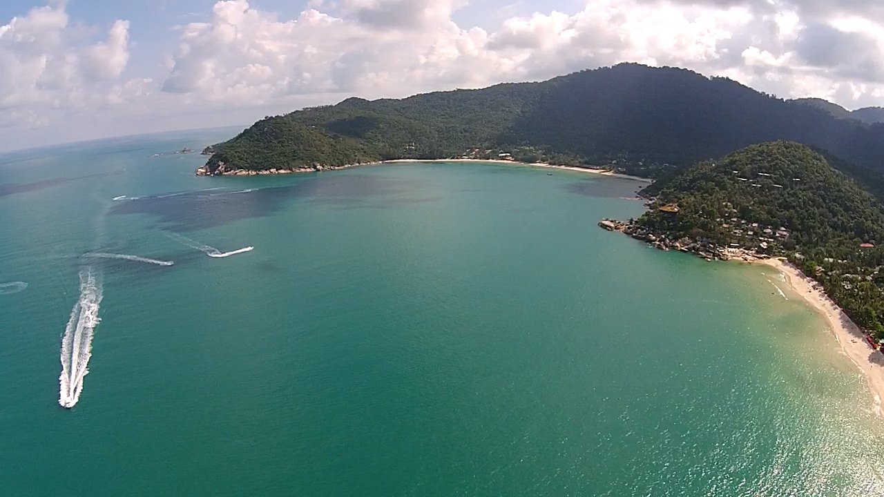
The northern of the twin Thong Nai Pan bays on Phangan's northeast corner: a crescent of white sand under jungle hills, with upmarket resorts at each end and a small village behind.
Practical
Southeast Asia Pilot waypoint 09°46.583N 100°03.597E (anchorage D), about 11 nm from Haad Rin Nai. The Pilot says the northern bay (Noi) can be subject to swell, with anchoring in 4 m on sand; the southern bay (Yai) is the more protected. Both bays face east, so they are SW-monsoon and settled-weather anchorages and should be left when the NE monsoon sets in (Wikivoyage: safe swimming year-round except the November monsoon, which normally ends around mid-December). Ashore in Noi: three ATMs, a pharmacy, minimarts and a 7-Eleven (Wikivoyage, OpenStreetMap), restaurants and bars, and scooter rentals on the paved road. Panviman Resort's infinity pool overlooks the bay. Than Prawet waterfall is a short trek away.
Best for
East-coast SW-monsoon anchorage with village services
Season
Mar–Oct and settled weather; exposed to NE monsoon
Nearby
- Thong Nai Pan Bars (Flip Flop, Nu Bar, I Sea Bar)0.4 NM away
- Thong Nai Pan Noi Restaurants (Rasta Baby, Luna, That's Amore)0.4 NM away
- Thong Nai Pan Yai Anchorage0.4 NM away
- Thong Nai Pan Yai Restaurants (Chai Ya, Memory Bar, Fat Cat's)0.5 NM away
- Than Prawet Waterfall0.6 NM away
- Than Sadet Royal Waterfall1.7 NM away
- Bottle Beach Restaurants (Bottle Beach 1, Bungabow, Smile)1.8 NM away
- Bottle Beach (Haad Khuat) Anchorage1.9 NM away