 AI image
Bahamas
Abacos
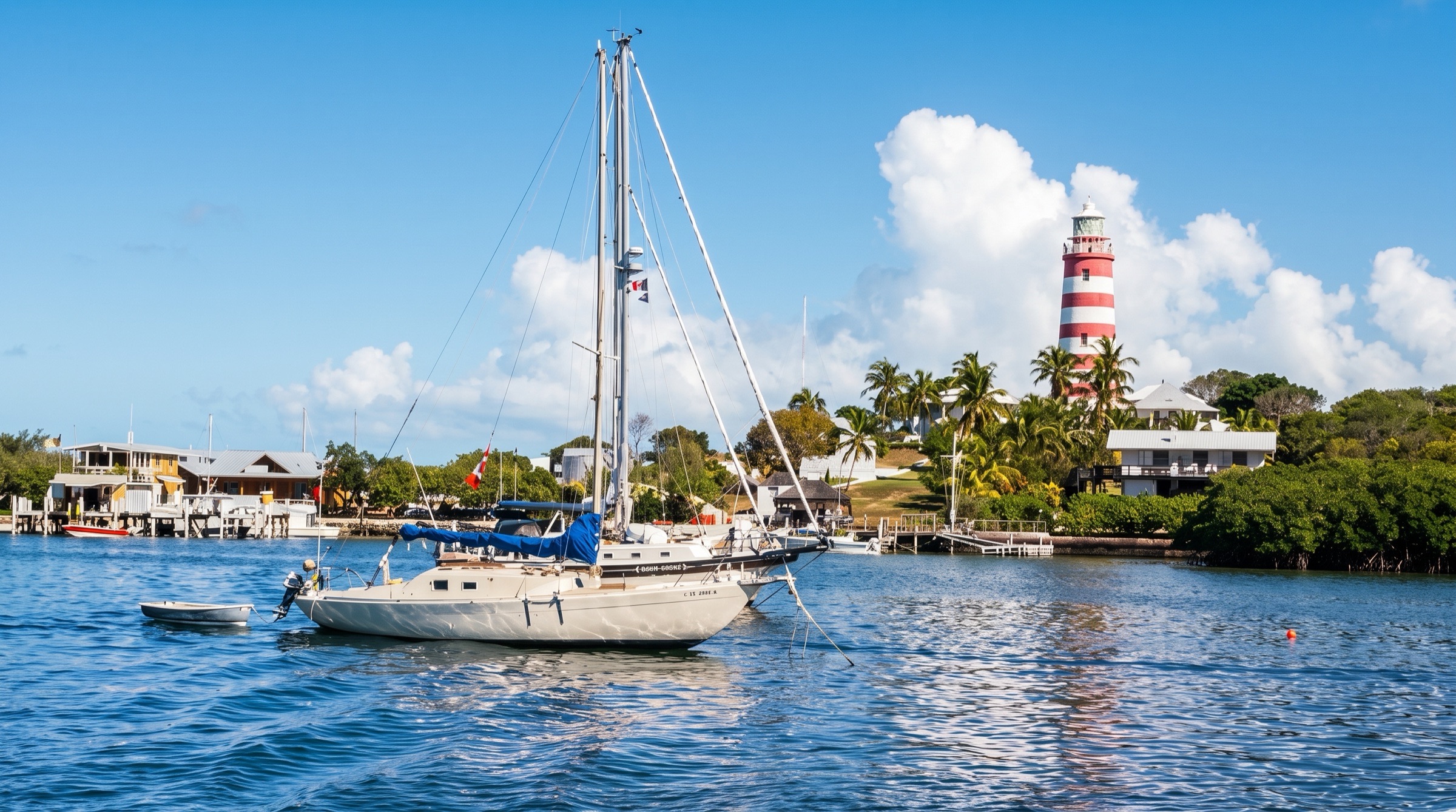
The Abacos wrap a long, sheltered sound called the Sea of Abaco, so most days are short hops between colorful Loyalist villages such as Hope Town and Man-O-War Cay. Beaches, snorkeling and lively harbors give a gentle introduction to the Bahamas, with plenty of marinas and provisions. The red-and-white striped lighthouse at Hope Town is the icon.
Best months
Difficulty
EasySheltered sound and short hops; ocean cuts can close in north swells.
Conditions
Easterly trades of 10-20 knots and warm, settled spring weather. Winter fronts bring west and north winds of 20-30 knots; the ocean cuts, notably Whale Cay Passage, can break dangerously in north swells. Hurricane season is June to November, so spring is the sweet spot.
Itineraries here
Area guide
Bahamas — North
Bahamas
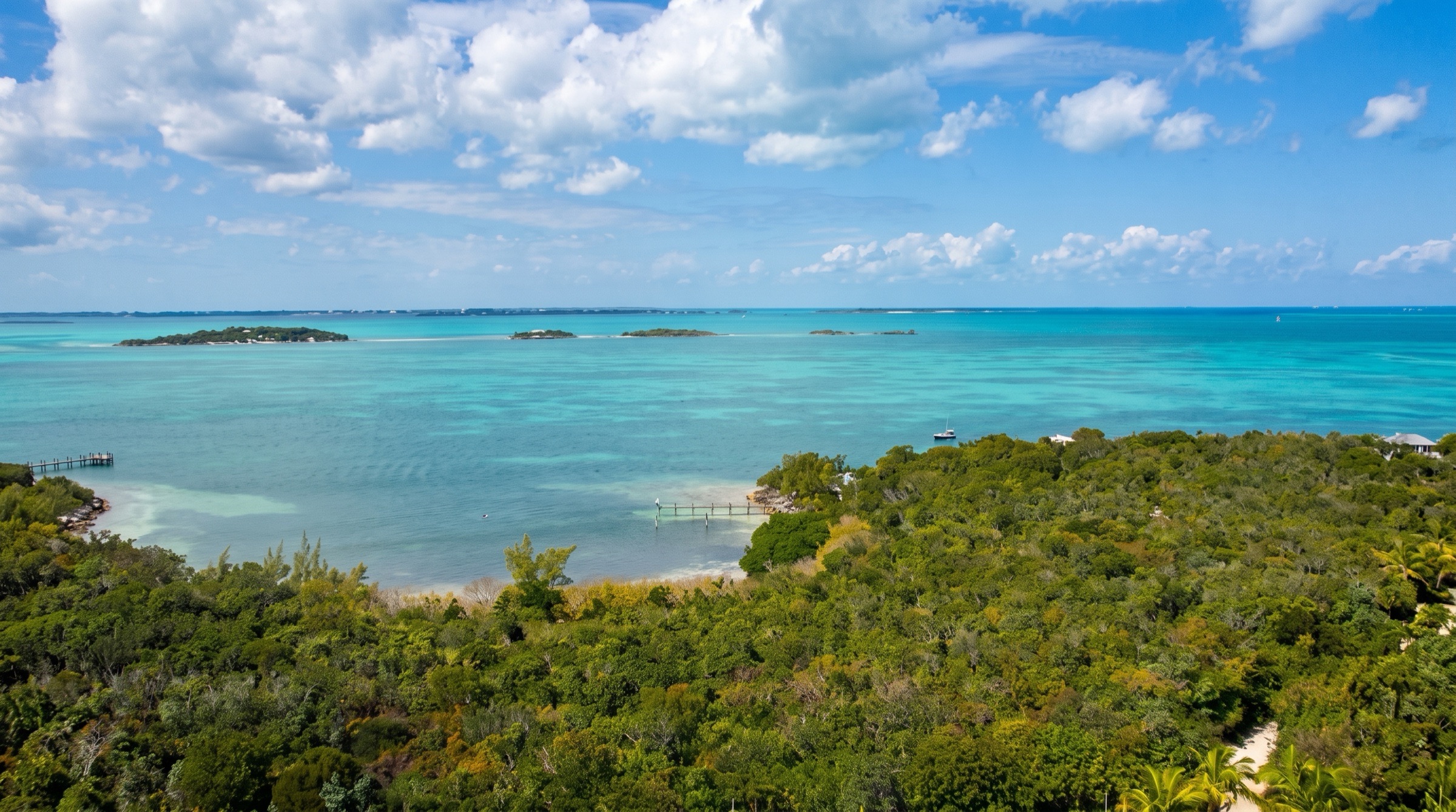
The northern Bahamas are the shortest hop from Florida and some of the most forgiving cruising water in the world. The Abacos are a 120-mile arc of barrier cays enclosing the Sea of Abaco: protected, shallow (mostly 8-20 ft) and mostly line-of-sight sailing between Loyalist villages like Hope Town, Man-O-War and New Plymouth, with Marsh Harbour as the hub for provisions, parts and the bareboat fleets. The Abacos were devastated by Hurricane Dorian in September 2019; most cruiser infrastructure has since been rebuilt, but always confirm a marina or restaurant is open. Grand Bahama (West End and Lucaya) and the Biminis are the classic Gulf Stream landfalls and ports of entry. The Berry Islands are a thin, quiet chain of about 30 cays with blue holes, empty beaches and a handful of marinas, and the jump to Nassau. Nassau and Paradise Island are the country's capital, its biggest provisioning and repair center and its busiest harbor, with Rose Island as the nearby escape. Rage at the ocean cuts, especially Whale Cay Passage, and winter cold fronts are the hazards that set every plan.
Top of the list
- 1Hope Town Harbour MooringsA storybook harbor of clapboard cottages under the candy-striped Elbow Reef Lighthouse; the defining Abaco stop.
- 2Elbow Reef LighthouseOne of the last kerosene-burning, hand-wound lighthouses in the world; climb it for the view over Hope Town and the reef.
- 3Tahiti BeachA curving sandbar at the south tip of Elbow Cay that dries at low tide; the classic Abaco beach anchorage.
- 4Nipper's Beach Bar & GrillGreat Guana Cay's double-decker beach bar on a 7-mile Atlantic beach, with reef snorkeling straight off the sand.
- 5New Plymouth (Green Turtle Cay)Loyalist village of narrow lanes, the Albert Lowe Museum and the Memorial Sculpture Garden.
- 6Manjack Cay AnchorageQuiet, privately owned cay with walking trails, mangrove creeks, rays and turtles; a cruiser favorite north of the Whale.
- 7Treasure Cay BeachA 3.5-mile crescent of powder sand often listed among the best beaches in the world.
- 8Pete's Pub & Gallery (Little Harbour)Bronze foundry, gallery and barefoot beach bar in the near-landlocked Little Harbour.
- 9Sandy Cay Reef (Pelican Cays Land and Sea Park)Some of the healthiest elkhorn coral in the Abacos inside a no-take national park.
- 10Lynyard Cay AnchorageEmpty beaches and easy sand holding at the south end of the Sea of Abaco, a dinghy ride from Little Harbour.
- 11Fowl Cay Reef PreserveProtected shallow reef north of Man-O-War Cay with moorings for day snorkeling.
- 12Man-O-War Cay HarbourBoatbuilding village of the Albury family, a dry island with two protected harbors and mooring fields.
- 13Great Sale Cay AnchorageThe classic overnight stop on the Little Bahama Bank crossing, a wide anchorage with strong holding.
- 14Grand Cay SettlementA lively fishing settlement and port of entry at the top of the Abacos, with the remote Double Breasted Cays nearby.
- 15Walker's Cay MarinaThe northernmost Bahamian island and a historic sportfishing outpost, rebuilt after Dorian.
- 16Hoffman's Cay Blue HoleA 600-foot-wide blue hole ringed by a 20-foot cliff, a short walk from the anchorage.
- 17Honeymoon Harbour (Gun Cay)A tiny reef-ringed anchorage at the north end of Gun Cay, famous for its friendly stingrays.
- 18SS Sapona WreckA concrete ship grounded south of Bimini in 1926; climb it, jump from it, snorkel it.
- 19Bimini RoadAn underwater line of limestone blocks off North Bimini, snorkeled by those chasing the Atlantis legend.
- 20Great Harbour Cay BeachAn 8-mile sweep of beach on the Berry Islands' quietest big island, with the Beach Club for lunch.
- 21Chub Cay WallThe Tongue of the Ocean edge drops away off Chub Cay, with caves, caverns and pelagics.
- 22Little Harbour Cay (Flo's Conch Bar)The hand-built conch bar in the middle of the Berry Islands, a cruiser institution.
- 23Lucayan National ParkMangroves, Gold Rock Beach and one of the longest underwater cave systems in the world on Grand Bahama.
- 24Peterson Cay National ParkA tiny protected cay and reef off south Grand Bahama, a classic day anchorage from Lucaya.
- 25Rose Island South (Sandy Toes) AnchorageNassau's backyard escape: turquoise sand anchorages, reefs and beaches 6 nm east of the harbor.
- 26Ocean Atlas (Clifton reef sculpture garden)The largest underwater sculpture in the world, a short dinghy ride from the Clifton anchorage.
- 27Shark Wall and Shark Arena (Stuart Cove's shark dives)Kneel on the sand as Caribbean reef sharks circle within arm's length, off the Tongue of the Ocean wall on New Providence's south-west coast.
When to go
December through April is the best season (The Moorings recommends December-April), with steady easterly trades. From December to February, winter cold fronts arrive every week or so with the wind clocking from SE through W to NW and N, often 20-30 kt; pick anchorages for the wind shift. May-June is lighter and hot. Late June to early July brings Regatta Time in Abaco. Summer (July-August) can be calm and glassy but is inside hurricane season.
Weather and hazards
Rage: when a northeast or north wind or a distant Atlantic swell opposes the ebb at the ocean cuts, the seas stand up and break, sometimes in calm local weather. Whale Cay Passage is the notorious one: the inside route west of Whale Cay is shallow, so boats over about 4 ft draft must go outside, and a NE wind above about 10 kt often closes it; ask for a report on VHF and listen to the Abaco Cruisers Net. Other cuts (North Man-O-War Channel, Tilloo Cut, North Bar Channel, Little Harbour Bar, Loggerhead Channel) rage in the same conditions. Banks navigation: much of the Little Bahama Bank and the Sea of Abaco is 6-15 ft with sand bores, grass and coral heads; read the water with the sun high and behind you. The Gulf Stream runs north at an average of about 2.5 kt; never cross with any north component in the wind. Nassau Harbour is a busy commercial port with cruise ships, mail boats and ferries; theft and crime warrant ordinary city care. Mosquitoes and no-see-ums in calm weather near mangroves.
Hurricane season
Atlantic hurricane season runs June 1-November 30, with the peak from mid-August to mid-October. Hurricane Dorian (Category 5, September 2019) stalled over the Abacos and Grand Bahama and destroyed much of Marsh Harbour, the Mudd and Treasure Cay; Hurricane Matthew (2016) damaged West End and Lucaya. Charter insurance and many marinas restrict summer and fall cruising; plan to be south of the box or hauled out by August, or monitor NHC daily and know your hurricane hole.
Entry and clearance
Complete the Click2Clear online application (customs and immigration) before arrival and keep the PCR number. Fly the yellow Q flag and go directly to a port of entry; only the captain goes ashore to clear. Northern ports of entry include Walker's Cay (by arrangement), Grand Cay, Spanish Cay, Cooper's Town, Green Turtle Cay (Green Turtle Club), Marsh Harbour, Treasure Cay, West End (Old Bahama Bay), Freeport/Lucaya (Grand Bahama Yacht Club, Port Lucaya), Bimini (Alice Town and Resorts World Bimini), Cat Cay (members only since 2020), Chub Cay, Great Harbour Cay, and Nassau (Prince George Dock and several marinas such as Palm Cay). Ports of entry and office hours change often, so call ahead. Arriving outside hours can incur overtime fees; marinas often charge non-guests a landing fee. Visitors normally receive a 90-day stamp, with extensions possible at immigration. Foreign vessels over 50 ft must run AIS at all times in Bahamian waters.
Permits and fees
Fees effective July 1, 2025 (US$; verify on Click2Clear before departure): 12-month temporary cruising permit $500 under 50 ft, $1,000 for 50-99 ft, $3,000 over 100 ft; $30 for each passenger beyond three who is 6 or older; tenders over 25 ft $500. Anchorage fee (12 months) $200 under 50 ft, $350 for 50-99 ft. 30-day fishing permit $100 under 50 ft, $300 for 50 ft and over, renewed online every 30 days. Frequent Digital Cruising Card (2 years, unlimited entries) $1,500 under 50 ft, $2,500 for 50-99 ft. Before July 2025 the cruising permit was $300 (over 35 ft) including fishing, so older guides understate costs. Bahamas National Trust parks (Pelican Cays Land and Sea Park, Fowl Cay Reef Preserve, Lucayan National Park, Peterson Cay) are no-take; mooring fees vary.
Tides and currents
Semi-diurnal tides with about 2.5-3.5 ft range (The Moorings gives 3-4 ft for the Abacos). Currents run strongly through the ocean cuts and in Bimini's harbor entrance. Reference station: NOAA Settlement Point, Grand Bahama (9710441), tidesandcurrents.noaa.gov; Nassau subordinate station TEC4623 is referenced to Settlement Point. Explorer Chartbooks Near Bahamas includes tide tables and time corrections for Abaco, Bimini and the Berry Islands. Many shallow entrances (Green Turtle's Black Sound and White Sound, Bimini Cove, the Berry Islands' Little Harbour) need half tide or better.
Money
Bahamian dollar (BSD), pegged 1:1 to the US dollar; US dollars are accepted everywhere. Cards are common in Nassau, Marsh Harbour and Freeport; carry cash for the outer cays, moorings and customs overtime. ATMs in Marsh Harbour, Hope Town, Green Turtle Cay, Freeport, Alice Town and Nassau.
Radio and phones
Abaco Cruisers Net: VHF 68 at 8:15 am Monday to Saturday from Marsh Harbour, opening with weather and reports on the cuts (weather repeated around 9:00 am); reception is weak at Green Turtle Cay. VHF 16 for calling and hailing, then switch; in the Abacos many businesses and boats monitor VHF 16 and 68. Nassau Harbour Control (VHF 16, 24 hours) must be called for permission to enter, leave or move within Nassau Harbour. Cell data from BTC and Aliv covers settlements; coverage is thin at Great Sale Cay, the Berry Islands' middle cays and the far north cays.
Charter bases
- Marsh Harbour, AbacoGreat Abaco, Sea of AbacoThe Moorings (Abaco Beach Resort, Bay St; sailing monohulls, sailing and power catamarans), Cruise Abaco (Abaco Beach Resort / Boat Harbour Marina; bareboat and captain-by-day charters, 39-52 ft), Navigare Yachting (Conch Inn Marina; Lagoon and Bali catamarans 39-52 ft; base opened 2021), MarineMax Vacations (power catamarans, Abaco Beach Resort)
- Nassau (Palm Cay Marina)Southeast New ProvidenceNavigare Yachting (Bali, Lagoon and Fountaine Pajot catamarans 40-54 ft), Dream Yacht Charter (Palm Cay Marina base, opened 2018 with partner Navtours), Several smaller bareboat and crewed operators via brokers; verify current operators
Getting there
- Leonard M. Thompson International Airport (Marsh Harbour) — MHHMain Abaco gateway; about an hour from several Florida airports. Closest to the charter bases.
- Treasure Cay Airport — TCBNorth-central Abaco; ferry or water taxi to Green Turtle Cay and Great Guana.
- Grand Bahama International Airport (Freeport) — FPOFreeport; taxis to Port Lucaya and West End.
- South Bimini Airport — BIMSouth Bimini; short water taxi to Alice Town.
- Great Harbour Cay Airport — GHCBerry Islands; small-plane service from Florida and Nassau.
- Chub Cay International Airport — CCZSouthern Berry Islands, beside Chub Cay Marina.
- Lynden Pindling International Airport (Nassau) — NASMain international gateway; connections to every Out Island.
Charts and guides
- Explorer Chartbook Near Bahamas, 12th edition (September 2025): Gulf Stream crossings, Grand Bahama, Abacos, Bimini, Berry Islands, Andros and New Providence; tide tables 2026-2027
- The Cruising Guide to Abaco, Bahamas (White Sound Press)
- Waterway Guide Bahamas (with online marina and anchorage listings at waterwayguide.com)
- Navionics and Garmin ActiveCaptain community data
- Bahamas National Trust park pages (bnt.bs) for park rules and moorings
Sample routes
- Abacos Highlights (7 days, from Marsh Harbour)Day 1 · Marsh Harbour → Great Guana Cay · 11 nmFisher's Bay anchorage; walk across to Nipper's Beach Bar and the reef off the Atlantic beach.Day 2 · Great Guana Cay → Manjack Cay · 17 nmThrough Whale Cay Passage in settled weather; trails, mangrove creek, rays and turtles.Day 3 · Manjack Cay → Green Turtle Cay · 5 nmWhite Sound moorings; New Plymouth, Albert Lowe Museum, Memorial Sculpture Garden.Day 4 · Green Turtle Cay → Hope Town (Elbow Cay) · 27 nmLong reach back south; climb the Elbow Reef Lighthouse, Wyannie Malone Museum.Day 5 · Hope Town (Elbow Cay) → Little Harbour · 13 nmPast Tilloo and the Pelican Cays; Pete's Pub & Gallery. Enter on a rising tide.Day 6 · Little Harbour → Lynyard Cay · 3 nmSnorkel Sandy Cay Reef in the Pelican Cays park; quiet west-side anchorage.Day 7 · Lynyard Cay → Man-O-War Cay · 14 nmBoatbuilding village and Atlantic beaches before returning to Marsh Harbour.
- Florida to Abaco and back via the Little Bahama Bank (12 days)Day 1 · Lake Worth Inlet, Florida → West End (Old Bahama Bay) · 55 nmGulf Stream crossing in a south or east wind; clear in at Old Bahama Bay (distance approx).Day 2 · West End (Old Bahama Bay) → Great Sale Cay · 60 nmOnto the Little Bahama Bank past Mangrove Cay; anchor in the wide west-side bight (distance approx).Day 3 · Great Sale Cay → Allans-Pensacola Cay · 25 nmRemote, landlocked anchorage; the old missile-tracking station ruins and the Signing Tree (distance approx).Day 4 · Allans-Pensacola Cay → Manjack Cay · 20 nmPast Spanish and Powell Cays; Manjack's trails and creek (distance approx).Day 5 · Manjack Cay → Green Turtle Cay · 5 nmNew Plymouth, Green Turtle Club, provisions at the village grocers.Day 6 · Green Turtle Cay → Great Guana Cay · 12 nmWhale Cay Passage on a calm morning; Nipper's and the reef (distance approx).Day 7 · Great Guana Cay → Man-O-War Cay · 6 nmFowl Cay Reef Preserve snorkel on the way; harbor moorings (distance approx).Day 8 · Man-O-War Cay → Hope Town (Elbow Cay) · 6 nmLighthouse climb, Tahiti Beach at low tide (distance approx).Day 9 · Hope Town (Elbow Cay) → Little Harbour · 13 nmSandy Cay Reef snorkel, Pete's Pub.Day 10 · Little Harbour → Marsh Harbour · 15 nmReprovision and fuel; clear out arrangements (distance approx).Day 11 · Marsh Harbour → Great Sale Cay · 70 nmLong day west across the bank (distance approx).Day 12 · Great Sale Cay → West End (Old Bahama Bay) · 60 nmStage for the Stream crossing home; wait for a window with no north in the wind (distance approx).
- Bimini, Berry Islands and Nassau (10 days)Day 1 · Fort Lauderdale or Miami → Alice Town (North Bimini) · 50 nmGulf Stream crossing; clear in, conch salad on the waterfront (distance approx).Day 2 · Alice Town (North Bimini) → Honeymoon Harbour (Gun Cay) · 10 nmSS Sapona wreck snorkel en route; stingrays at Honeymoon Harbour (distance approx).Day 3 · Honeymoon Harbour (Gun Cay) → Great Harbour Cay · 75 nmAcross the Great Bahama Bank past Russell Beacon and the Northwest Channel; long day (distance approx).Day 4 · Great Harbour Cay → Great Harbour Cay · 0 nmBike the island, Great Harbour Cay Beach, the Beach Club, Sugar Beach caves.Day 5 · Great Harbour Cay → Hoffman's Cay · 15 nmHoffman's Cay Blue Hole cliff jump; beach walks (distance approx).Day 6 · Hoffman's Cay → Little Harbour Cay · 6 nmFlo's Conch Bar (distance approx).Day 7 · Little Harbour Cay → Frazers Hog Cay · 12 nmSea turtle mangrove creeks; Berry Islands Club moorings (distance approx).Day 8 · Frazers Hog Cay → Chub Cay · 5 nmDive or snorkel Chub Cay Wall; fuel and clear customs at Chub Cay Marina (members-only club: no day passes or dining for transients, written permission on VHF 68) (distance approx).Day 9 · Chub Cay → Rose Island · 40 nmLeave Chub Point at first light for a daylight arrival; about 40 nm on 116° true across the Northeast Providence Channel to Chub Rock Channel and the Rose Island reefs and beaches.Day 10 · Rose Island → Nassau Harbour · 6 nmCall Nassau Harbour Control; provision, Fort Charlotte, Queen's Staircase (distance approx).
Places in Bahamas — North
- 40s Bar and RestaurantEat · South Bimini
- Abaco Beach Resort & Boat Harbour MarinaMarina · Great Abaco (Marsh Harbour)
- Abaco Cruisers Net (VHF 68)Service · Great Abaco (Marsh Harbour)
- Abaco GroceriesStores · Great Abaco (Marsh Harbour)
- Abaco Hurricane Season and the Dorian LegacySeasonal · Great Abaco (Marsh Harbour)
- Abaco InnEat · Elbow Cay
- Abaco Island PharmacyService · Great Abaco (Marsh Harbour)
- Abaco National ParkWildlife · Great Abaco (Hole-in-the-Wall)
- Abaco Parrot ViewingWildlife · Great Abaco (Hole-in-the-Wall)
- Abaco Suzuki (Union Jack Dock)Service · Great Abaco (Marsh Harbour)
- Abaco Whale and Dolphin Sightings (BMMRO)Wildlife · Great Abaco (Sandy Point)
- Abaco Winter Cold FrontsSeasonal · Great Abaco (Marsh Harbour)
- Abaco Yacht Services (Black Sound boatyard)Service · Green Turtle Cay
- Albany MarinaMarina · New Providence (Nassau)
- Albert Lowe MuseumLandmark · Green Turtle Cay
- Albury Boatbuilding Heritage (Man-O-War)Landmark · Man-O-War Cay
- Albury's Ferry Dock (The Crossing)Service · Great Abaco (Marsh Harbour)
- Albury's Sail Shop (Man-O-War)Landmark · Man-O-War Cay
- Alder Cay AnchorageAnchorage · Alder Cay
- Alice Town (North Bimini)Landmark · North Bimini
- Alice Town Anchorage (west side, off Radio Beach)Anchorage · North Bimini
- Alice Town Community Clinic (government)Service · North Bimini
- Allans-Pensacola Atlantic beachBeach · Allans-Pensacola Cay
- Allans-Pensacola Cay AnchorageAnchorage · Allans-Pensacola Cay
- Allans-Pensacola mangrove creeks (turtles, sharks and rays)Wildlife · Allans-Pensacola Cay
- Allans-Pensacola Signing Tree and Atlantic trailHike · Allans-Pensacola Cay
- Ambergris Cay Anchorage (Berry Islands)Anchorage · Ambergris Cay
- Angelfish Creek BridgeLandmark · Little Abaco / Great Abaco
- Arawak Cay Fish FryEat · New Providence (Nassau)
- Ardastra Gardens, Zoo and Conservation CentreWildlife · New Providence (Nassau)
- Athol Island Anchorage (West)Anchorage · Athol Island
- Athol Island East AnchorageAnchorage · Athol Island
- Athol Island South AnchorageAnchorage · Athol Island
- Atlantis MarinaMarina · Paradise Island
- Aunt Pat's Bay AnchorageAnchorage · Elbow Cay
- Bahama Divers / Better in Bahamas Tour Co. (Nassau Yacht Haven)Dive · New Providence (Nassau)
- Bahama Mama Billfish Classic (West End)Event · Grand Bahama
- Bahamas Ferries and mailboats (Potter's Cay)Service · New Providence (Nassau)
- Bailey Town Anchorage (harbour, north of the Big Game Club)Anchorage · North Bimini
- Baker's Bay (Great Guana) AnchorageAnchorage · Great Guana Cay
- Baker's Bay Golf & Ocean Club MarinaMarina · Great Guana Cay
- Bamboo Cay North Anchorage (Bight of Abaco)Anchorage · Bamboo Cay (Bight of Abaco)
- Banks and ATMs (East Bay Street)Service · New Providence (Nassau)
- Barbary BeachBeach · Grand Bahama
- Basin Harbour (Bight of Abaco)Anchorage · Bight of Abaco (south of Cooper's Town)
- BASRA (Bahamas Air-Sea Rescue Association) dinghy dockService · New Providence (Nassau)
- BattleGround Bahamas Yellowfin Tuna Tournament (Lucaya)Event · Grand Bahama
- Bay of Five PiratesAnchorage · Great Harbour Cay
- Bay Street MarinaMarina · New Providence (Nassau)
- Bayshore MarinaMarina · New Providence (Nassau)
- Beach Weekend Bahamas Marina (former Leeward Yacht Club)Marina · Green Turtle Cay
- Ben's Cave and Burial Mound CaveHike · Grand Bahama
- Berry Islands Bonefishing Flats (west of the Ambergris Cays)Fishing · Ambergris Cay
- Berry Islands Club (Frazers Hog Cay)Bar · Frazers Hog Cay
- Berry Islands Club Moorings (Frazers Hog Cay)Anchorage · Frazers Hog Cay
- Big John's Bar & GrillEat · North Bimini
- Big O's Swimming Pigs Bar (No Name Cay)Bar · No Name Cay
- Bight of Old Robinson Blue HolesSnorkel · Great Abaco
- Bimini Barge wreckDive · South Bimini
- Bimini Bay East Basin AnchorageAnchorage · North Bimini
- Bimini Bay Marina / Fisherman's Village (Resorts World Bimini)Marina · North Bimini
- Bimini Bay North Basin AnchorageAnchorage · North Bimini
- Bimini Beach Club and Marina (South Bimini)Marina · South Bimini
- Bimini Big Game Club Resort & MarinaMarina · North Bimini
- Bimini Blue Water fuel dockService · North Bimini
- Bimini Blue Water Resort & MarinaMarina · North Bimini
- Bimini Boating FlingEvent · North Bimini
- Bimini Coin LaundromatService · North Bimini
- Bimini Cove pool bar & restaurant (former Bimini Sands)Eat · South Bimini
- Bimini Cove Resort & Marina (South Bimini)Marina · South Bimini
- Bimini Customs & Immigration, Alice Town (Port of Entry)Permit · North Bimini
- Bimini fishing tournaments (Big Game Club)Event · North Bimini
- Bimini Nature TrailHike · South Bimini
- Bimini Northeast Anchorage (bank side)Anchorage · North Bimini
- Bimini propane (LPG) refillsService · North Bimini
- Bimini RoadSnorkel · North Bimini
- Bimini Seafood Company & Hemingway's Rum Club (Big Game Club)Eat · North Bimini
- Bimini Shark Lab (Bimini Biological Field Station)Wildlife · South Bimini
- Bimini sportfishing seasonsSeasonal · North Bimini
- Bimini Water Taxi (North–South Bimini ferry)Service · North Bimini
- Bimini wild dolphin encountersWildlife · North Bimini
- Bird Cay AnchorageAnchorage · Bird Cay
- Bird Cay Beach AnchorageAnchorage · Bird Cay
- Bishop's Beach Club (High Rock)Eat · Grand Bahama
- Bita Bay BeachBeach · Green Turtle Cay
- Black Point Anchorage (Pelican Harbour)Anchorage · Great Abaco
- Black Sound (Green Turtle) Anchorage and MooringsAnchorage · Green Turtle Cay
- Black Sound Cay National ReserveWildlife · Green Turtle Cay
- Black Sound fuel (Other Shore Club and Black Sound docks)Service · Green Turtle Cay
- Black Sound MarinaMarina · Green Turtle Cay
- Blue Marlin Cove Resort & Marina (Bootle Bay, West End)Marina · Grand Bahama
- Bluff House Beach Resort & MarinaMarina · Green Turtle Cay
- Bond's Cay AnchorageAnchorage · Bond's Cay
- Bond's Cay South AnchorageAnchorage · Bond's Cay
- Bonefish season on the East End flatsSeasonal · Grand Bahama
- Bonefishing the East Bimini flats (guided)Fishing · East Bimini
- Bones Bar (Port Lucaya)Bar · Grand Bahama
- Bradford Marine Bahamas (boatyard)Service · Grand Bahama
- Brendal's Dive CenterDive · Green Turtle Cay
- Brendal's outer-reef dive sites (Green Turtle Cay)Dive · Green Turtle Cay
- Bridges Cay AnchorageAnchorage · Bridges Cay
- Bridges Cay North AnchorageAnchorage · Bridges Cay
- Bridges Cay South AnchorageAnchorage · Bridges Cay
- Brown's Boat Basin (haul-out)Service · New Providence (Nassau)
- Brown's Hardware (Bailey Town)Service · North Bimini
- Browns Cay AnchorageAnchorage · Browns Cay (south of Ocean Cay)
- Browns MarinaMarina · North Bimini
- Bullock's Harbour Community Clinic (Great Harbour Cay)Service · Great Harbour Cay
- Bullocks Harbour Anchorage (Cistern Cay beach)Anchorage · Great Harbour Cay
- Bullocks Harbour North AnchorageAnchorage · Great Harbour Cay
- Bullocks Harbour SettlementLandmark · Great Harbour Cay
- Cabana Bar & Grill (Schooner Bay)Eat · Great Abaco (Schooner Bay)
- Cabbage Beach (Paradise Island)Beach · Paradise Island
- Cabbage Cay / Guano Cay AnchorageAnchorage · Cabbage Cay
- Cable BeachBeach · New Providence (Nassau)
- Cable Beach AnchorageAnchorage · New Providence (Nassau)
- Cable Beach East Anchorage (Saunders Beach)Anchorage · New Providence (Nassau)
- Cap'n Jack'sEat · Elbow Cay
- Cappuccino's (Port Lucaya)Eat · Grand Bahama
- Caribbean Scuba Club (Viva Wyndham Fortuna Beach)Dive · Grand Bahama
- Carters Cay Anchorage (inside, by the fishing camp)Anchorage · Carters Cays
- Carters Cays Anchorage (Old Yankee Cay)Anchorage · Carters Cays
- Castaway Cay (Gorda Cay)Landmark · Gorda Cay
- Cat Cay Anchorage (east side, off the airstrip)Anchorage · Cat Cay
- Cat Cay port of entry and fuel (members and guests)Permit · Cat Cay
- Cat Cay Yacht Club (members only)Marina · Cat Cay
- Cave and Cashs Cays Anchorage (Bight of Abaco)Anchorage · Cave Cay / Cashs Cay (Bight of Abaco)
- Cave Cay North AnchorageAnchorage · Cave Cay (Bight of Abaco)
- Cave Cay West AnchorageAnchorage · Cave Cay (Bight of Abaco)
- CBS Marine & Land CommunicationService · Great Abaco (Marsh Harbour)
- Cedar Harbour (Little Abaco)Landmark · Little Abaco (Cedar Harbour)
- Centre of the World RockLandmark · Crab Cay (Little Abaco)
- Channel Cay Bight Anchorage (Pelican Cays)Anchorage · Pelican Cays
- Cherokee and Little Harbour Bonefishing FlatsFishing · Great Abaco (Cherokee Sound)
- Cherokee Grocery and DeliStores · Great Abaco (Cherokee Sound)
- Cherokee Long DockLandmark · Great Abaco (Cherokee Sound)
- Cherokee SettlementLandmark · Great Abaco (Cherokee Sound)
- Cherokee Sound Anchorage (Cherokee Point)Anchorage · Great Abaco (Cherokee Sound)
- Chub Cay Billfish Tournaments (Chub Cay Classic and Chub Cay Open)Event · Chub Cay
- Chub Cay Customs & Immigration (Port of Entry)Permit · Chub Cay
- Chub Cay Fuel DockService · Chub Cay
- Chub Cay Fuel Dock WaterService · Chub Cay
- Chub Cay Laundry (members and owners only)Service · Chub Cay
- Chub Cay MarinaMarina · Chub Cay
- Chub Cay SandbarBeach · Chub Cay
- Chub Cay Ship Store (mini market)Stores · Chub Cay
- Chub Cay WallDive · Chub Cay
- Chub Cay West AnchorageAnchorage · Chub Cay
- Chub Point LightLandmark · Chub Cay
- Cistern Cay South AnchorageAnchorage · Cistern Cay (Great Harbour)
- Citrus Haven Anchorage (North Cat Cay)Anchorage · Cat Cay
- Classic Wash Laundromat (Marsh Harbour)Service · Great Abaco (Marsh Harbour)
- Clifton Bay / West Bay AnchorageAnchorage · New Providence (Nassau)
- Clifton Heritage National ParkLandmark · New Providence (Nassau)
- Clubhouse Restaurant & Bar (Chub Cay)Eat · Chub Cay
- Cockroach Cay AnchorageAnchorage · Cockroach Cay
- Coco (Cocoa) Bay Anchorage (Green Turtle Cay)Anchorage · Green Turtle Cay
- Coco Bay BeachBeach · Green Turtle Cay
- Coco Beach Bar / Treasure Cay restaurantsEat · Treasure Cay (Great Abaco)
- Colors by the Sea (Marsh Harbour)Eat · Great Abaco (Marsh Harbour)
- Compleat Angler site (Hemingway's Bimini)Landmark · North Bimini
- Conch Inn and MarinaMarina · Great Abaco (Marsh Harbour)
- Conch Inn Mooring BallsAnchorage · Great Abaco (Marsh Harbour)
- Coolie Mae's Sunset by the SeaEat · Great Harbour Cay
- Cooper's fuel station (Midshipman Road, Lucaya)Service · Grand Bahama
- Cooper's TownLandmark · Great Abaco (Cooper's Town)
- Cooper's Town AnchorageAnchorage · Great Abaco (Cooper's Town)
- Cooper's Town Community ClinicService · Great Abaco (Cooper's Town)
- Cooper's Town Customs & Immigration (Port of Entry)Permit · Great Abaco (Cooper's Town)
- Cooper's Town MarineService · Great Abaco (Cooper's Town)
- Coral Caverns (Coral Caves), Green Turtle CayDive · Green Turtle Cay
- Coral HarbourAnchorage · New Providence (Nassau)
- Coral Vita coral farmLandmark · Grand Bahama
- Cormorant Cay Anchorage (Snake Cay north)Anchorage · Snake Cay
- Count Basie SquareLandmark · Grand Bahama
- Crab Cay Anchorage (Angelfish Point)Anchorage · Crab Cay (Little Abaco)
- Crab Cay cut snorkel (Angelfish Point)Snorkel · Crab Cay (Little Abaco)
- Crab Cay West AnchorageAnchorage · Crab Cay (Little Abaco)
- Cracker P's Bar & Grill (Lubbers Quarters)Bar · Lubbers Quarters
- Crew House Bar & Lounge (Nassau Yacht Haven)Bar · New Providence (Nassau)
- Cross Harbour AnchorageAnchorage · Great Abaco
- Crossing RocksLandmark · Great Abaco
- Crown HavenLandmark · Little Abaco (Crown Haven)
- Crown Haven Anchorage (Fox Town access)Anchorage · Little Abaco (Crown Haven)
- Crystal Cay Marine Park AnchorageAnchorage · Long Cay / Silver Cay
- Curly Tails Restaurant & BarEat · Great Abaco (Marsh Harbour)
- Customs and Immigration at Lynden Pindling International Airport (NAS)Permit · New Providence (Nassau)
- D&S ConvenienceStores · South Bimini
- Da Bes Yet BakeryStores · Great Abaco (Marsh Harbour)
- Da Valley Restaurant (Fox Town)Eat · Little Abaco (Fox Town)
- Da Wharf Cafe (Great Harbour Cay Marina)Eat · Great Harbour Cay
- DC-3 Wreck (Cistern Cay)Snorkel · Cistern Cay (Great Harbour)
- Deep Water CayLandmark · Deep Water Cay
- Deep Water Cay Anchorage (East End, shoal draft)Anchorage · Deep Water Cay
- Delaporte Bay (Cable Beach) AnchorageAnchorage · New Providence (Nassau)
- Devil's Cay AnchorageAnchorage · Devil's Cay
- Devour! The Beach (Green Turtle Club)Event · Green Turtle Cay
- Diamond Cay Anchorage (Chub Cay south beach)Anchorage · Chub Cay
- Dive Abaco (Marsh Harbour) - Currently ClosedDive · Great Abaco (Marsh Harbour)
- Dive GuanaDive · Great Guana Cay
- Dock N' Dine (Man-O-War)Eat · Man-O-War Cay
- Doctors Hospital / Princess Margaret HospitalService · New Providence (Nassau)
- Dollar Harbour (South Cat Cay)Anchorage · Cat Cay
- Dolphin House MuseumLandmark · North Bimini
- Dorsett's Conch Experience Grill and Fish Fry (Taino Beach)Eat · Grand Bahama
- Double Breasted Cays AnchorageAnchorage · Double Breasted Cays
- Double Breasted Cays sand bores and snorkelingSnorkel · Double Breasted Cays
- Double Breasted Cays South AnchorageAnchorage · Double Breasted Cays
- Downtown Nassau (Bay Street, Straw Market, Pompey Museum)Landmark · New Providence (Nassau)
- Dream Yacht Charter base (Palm Cay)Service · New Providence (Nassau)
- East Abaco Creeks National ParkWildlife · Great Abaco
- East Villa Restaurant (East Bay Street)Eat · New Providence (Nassau)
- Edwin's Boat Yard (Man-O-War)Service · Man-O-War Cay
- Eight Mile RockLandmark · Grand Bahama
- El Capitan (dive site)Dive · Grand Bahama
- Elbow Reef LighthouseLandmark · Elbow Cay
- Elizabeth on Bay MarinaMarina · New Providence (Nassau)
- End of the World SaloonBar · North Bimini
- Fiddle CayLandmark · Fiddle Cay
- Firefly Sunset Resort (Firefly Bar & Grill)Eat · Elbow Cay
- Fisher's Bay Anchorage (Great Guana)Anchorage · Great Guana Cay
- Fisherman's Village Immigration & Customs (Resorts World seaplane base)Permit · North Bimini
- Flamingo Bay Marina (Taino Beach)Marina · Grand Bahama
- Flying Fish GastroBar (Port Lucaya)Eat · Grand Bahama
- Fort CharlotteLandmark · New Providence (Nassau)
- Fort MontaguLandmark · New Providence (Nassau)
- Fort Montague Bay AnchorageAnchorage · New Providence (Nassau)
- Fortune Beach & Banana BayBeach · Grand Bahama
- Fountain of Youth (South Bimini)Landmark · South Bimini
- Fowl Cay Anchorage (Abaco)Anchorage · Fowl Cay
- Fowl Cay Anchorage (Berry Islands)Anchorage · Fowl Cay (Berry Islands)
- Fowl Cay Reef PreserveSnorkel · Fowl Cay
- Fox Town Anchorage (near town)Anchorage · Little Abaco (Fox Town)
- Fox Town Community ClinicService · Little Abaco (Fox Town)
- Fox Town fuel, groceries and BTCService · Little Abaco (Fox Town)
- Fox Town Outer AnchorageAnchorage · Little Abaco (Fox Town)
- Frazers Hog Cay AnchorageAnchorage · Frazers Hog Cay
- Frazers Hog Cay North AnchorageAnchorage · Frazers Hog Cay
- Freeport chandlery and marine partsService · Grand Bahama
- Freeport Harbour (commercial port)Landmark · Grand Bahama
- Freeport laundromatsService · Grand Bahama
- Freeport propane refillsService · Grand Bahama
- Friday Night Sushi and Live Music (Pete's Pub)Event · Little Harbour (Great Abaco)
- Froggies Out Island Adventures (Hope Town)Dive · Elbow Cay
- Garbanzo BeachBeach · Elbow Cay
- Garden of the GrovesHike · Grand Bahama
- Gillam Bay BeachBeach · Green Turtle Cay
- Ginn Sur Mer Canal Anchorage (south of West End)Anchorage · Grand Bahama
- Goat Cay Anchorage (Great Harbour)Anchorage · Great Harbour Cay
- Gold Rock BeachBeach · Grand Bahama
- Gold Rock Creek mangrove boardwalkWildlife · Grand Bahama
- Goldie's Conch House (Arawak Cay)Eat · New Providence (Nassau)
- Goulding Cay ReefSnorkel · New Providence (Nassau)
- Government Docks Anchorage (Bullocks Harbour)Anchorage · Great Harbour Cay
- Grabbers Bed Bar & GrillBar · Great Guana Cay
- Grand Bahama International Airport (FPO)Service · Grand Bahama
- Grand Bahama Regatta and Heritage Festival (Taino Beach)Event · Grand Bahama
- Grand Bahama Scuba (Ocean Reef)Dive · Grand Bahama
- Grand Bahama ShipyardLandmark · Grand Bahama
- Grand Bahama Yacht Club (Lucayan Marina Village)Marina · Grand Bahama
- Grand Bahama Yacht Club Customs & Immigration OfficePermit · Grand Bahama
- Grand Bahama Yacht Club Fuel Dock (Lucaya)Service · Grand Bahama
- Grand Cay Community ClinicService · Grand Cay (Little Grand Cay)
- Grand Cay Customs & Immigration (Port of Entry)Permit · Grand Cay (Little Grand Cay)
- Grand Cay Easter fishing tournament and homecomingEvent · Grand Cay (Little Grand Cay)
- Grand Cay groceries, fuel and fresh seafoodStores · Grand Cay (Little Grand Cay)
- Grand Cay Harbour AnchorageAnchorage · Grand Cay (Little Grand Cay)
- Grand Cay restaurants and take-out (Rosie's and local stands)Eat · Grand Cay (Little Grand Cay)
- Grand Cay SettlementLandmark · Grand Cay (Little Grand Cay)
- Grand Cays sportfishing and bonefish flatsFishing · Grand Cay
- Great Abaco West Shore Anchorage (opposite Lynyard Cay)Anchorage · Great Abaco
- Great Guana Atlantic beachBeach · Great Guana Cay
- Great Guana Cay provisionsStores · Great Guana Cay
- Great Guana Cay Settlement HarbourAnchorage · Great Guana Cay
- Great Guana north-shore reefsSnorkel · Great Guana Cay
- Great hammerhead seasonSeasonal · North Bimini
- Great Harbour Cay BeachBeach · Great Harbour Cay
- Great Harbour Cay Beach Anchorage (Beach Club)Anchorage · Great Harbour Cay
- Great Harbour Cay Blue Hole (Rat Cay)Snorkel · Great Harbour Cay
- Great Harbour Cay Customs & Immigration (Port of Entry)Permit · Great Harbour Cay
- Great Harbour Cay Fishing Tournament (May)Event · Great Harbour Cay
- Great Harbour Cay Fuel DockService · Great Harbour Cay
- Great Harbour Cay Golf Cart and Car RentalService · Great Harbour Cay
- Great Harbour Cay Golf Course and Resort RuinsLandmark · Great Harbour Cay
- Great Harbour Cay Groceries (Bullocks Harbour)Stores · Great Harbour Cay
- Great Harbour Cay MarinaMarina · Great Harbour Cay
- Great Harbour Cay Marina LaundryService · Great Harbour Cay
- Great Harbour Entrance Anchorage (south of the cut)Anchorage · Great Harbour Cay
- Great Harbour South Anchorage (off the settlement)Anchorage · Great Harbour Cay
- Great Sale Cay (West Side) AnchorageAnchorage · Great Sale Cay
- Great Sale Cay AnchorageAnchorage · Great Sale Cay
- Great Sale Cay North-East Anchorage (open)Anchorage · Great Sale Cay
- Great Stirrup Cay (Norwegian Cruise Line private island)Landmark · Great Stirrup Cay
- Great Stirrup Cay LighthouseLandmark · Great Stirrup Cay
- Great Stirrup Cay South Anchorage (Great Harbour Cay - North)Anchorage · Great Stirrup Cay
- Green Cay South Anchorage (Rose Island)Anchorage · Green Cay (Rose Island)
- Green Parrot (East Bay Street, Bay Street Marina)Bar · New Providence (Nassau)
- Green Turtle Bluff anchorageAnchorage · Green Turtle Cay
- Green Turtle Cay Community ClinicService · Green Turtle Cay
- Green Turtle Cay Customs & Immigration (Port of Entry)Permit · Green Turtle Cay
- Green Turtle Cay golf-cart rentalsService · Green Turtle Cay
- Green Turtle Cay laundry (marina self-service)Service · Green Turtle Cay
- Green Turtle Club fuel dock (White Sound)Service · Green Turtle Cay
- Green Turtle Club Resort & MarinaMarina · Green Turtle Cay
- Gregory Boat Mechanic (Grand Cay)Service · Grand Cay (Little Grand Cay)
- Guana Hideaways MarinaMarina · Great Guana Cay
- Gun Cay Cut Northeast AnchorageAnchorage · Gun Cay
- Gun Cay East AnchorageAnchorage · Gun Cay
- Gun Cay LighthouseLandmark · Gun Cay
- Gun Cay West AnchorageAnchorage · Gun Cay
- Hammerhead's Restaurant & BarEat · Great Harbour Cay
- Harbour Central MarinaMarina · New Providence (Nassau)
- Harbour View Grocery (Hope Town)Stores · Elbow Cay
- Harbour View MarinaMarina · Great Abaco (Marsh Harbour)
- Harbour View Marina / Star Port Fuel DockMarina · New Providence (Nassau)
- Harbour's Edge (Hope Town)Eat · Elbow Cay
- Harbourside MarineService · New Providence (Nassau)
- Hawksbill Cays AnchorageAnchorage · Hawksbill Cays
- Hawksbill ReefDive · North Bimini
- Healing HoleSnorkel · East Bimini
- Hibiscus Cafe (Man-O-War)Eat · Man-O-War Cay
- Hoffman's Cay AnchorageAnchorage · Hoffman's Cay
- Hoffman's Cay Beach WalksBeach · Hoffman's Cay
- Hoffman's Cay Blue HoleHike · Hoffman's Cay
- Hoffman's Cay Mangrove AnchorageAnchorage · Hoffman's Cay
- Hoffman's Cay West Anchorage (shallow-draft)Anchorage · Hoffman's Cay
- Hogstyle Harbour (Carters Cays)Anchorage · Carters Cays
- Hole-in-the-Wall LighthouseLandmark · Great Abaco (Hole-in-the-Wall)
- Honeymoon Harbour (Gun Cay)Anchorage · Gun Cay
- Honeymoon Harbour Beach (Gun Cay)Beach · Gun Cay
- Hope Town Beach and ReefSnorkel · Elbow Cay
- Hope Town ClinicService · Elbow Cay
- Hope Town golf-cart rentals (Elbow Cay)Service · Elbow Cay
- Hope Town Harbour LodgeEat · Elbow Cay
- Hope Town Harbour MooringsAnchorage · Elbow Cay
- Hope Town Inn & MarinaMarina · Elbow Cay
- Hope Town Laundry (Marina Self-Service)Service · Elbow Cay
- Hope Town Public Docks and Cruiser Trash DropService · Elbow Cay
- Hope Town Songwriters FestivalEvent · Elbow Cay
- Hope Town to White Sound Walk (Queen's Highway)Hike · Elbow Cay
- Hurricane Hole Fuel DockService · Paradise Island
- Hurricane Hole Superyacht Marina (Paradise Island)Marina · Paradise Island
- Hurricane Season (Berry Islands)Seasonal · Berry Islands
- Hurricane season (Grand Bahama)Seasonal · Grand Bahama
- Hurricane season (New Providence)Seasonal · New Providence (Nassau)
- Hurricane season (North Abaco)Seasonal · Little Abaco / Great Abaco
- Hurricane Season (South Abaco)Seasonal · Great Abaco
- Indian Cay LighthouseLandmark · Indian Cay
- Indian Channel AnchorageAnchorage · Little Bahama Bank (off West End)
- Island Boy Tackle & MarineService · Great Abaco (Marsh Harbour)
- Island Roots Heritage Festival (Green Turtle Cay)Event · Green Turtle Cay
- James Bond Wrecks (Vulcan bomber and Tears of Allah)Dive · New Providence (Nassau)
- Jaws BeachBeach · New Providence (Nassau)
- Jib Room Restaurant & BarEat · Great Abaco (Marsh Harbour)
- Johnny's CayLandmark · Johnny's Cay
- Johnston Bronze Foundry and GalleryLandmark · Little Harbour (Great Abaco)
- Junkanoo (Boxing Day and New Year's Day)Event · New Providence (Nassau)
- Junkanoo BeachBeach · New Providence (Nassau)
- Junkanoo Beach AnchorageAnchorage · New Providence (Nassau)
- Junkanoo on Grand Bahama (Boxing Day, New Year's and Summer Festival)Event · Grand Bahama
- Kemtec Marine ElectronicsService · New Providence (Nassau)
- Knowles Marine (Freeport)Marina · Grand Bahama
- Laundry near the East Bay Street marinasService · New Providence (Nassau)
- Legendary Marina (Blue Water Cay)Marina · New Providence (Nassau)
- Leisure LeeAnchorage · Leisure Lee
- Leonard M. Thompson International Airport (MHH)Service · Great Abaco (Marsh Harbour)
- Lightbourn's Cay Anchorage (west side, East Grand Bahama Protected Area)Anchorage · Lightbourn's Cay
- Lightbourne MarineService · New Providence (Nassau)
- Lightbourne Marine (Sandy Point)Marina · Great Abaco (Sandy Point)
- Lighthouse Marina (Hope Town)Marina · Elbow Cay
- Little Abaco South Shore Anchorage (shoal draft)Anchorage · Little Abaco
- Little Gaulding Cay AnchorageAnchorage · Little Gaulding Cay
- Little Grand Cay AnchorageAnchorage · Grand Cay (Little Grand Cay)
- Little Grand Cay South AnchorageAnchorage · Grand Cay (Little Grand Cay)
- Little Harbour Atlantic Beach (North Beach)Beach · Little Harbour (Great Abaco)
- Little Harbour Blue HoleSnorkel · Little Harbour Cay
- Little Harbour CaveHike · Little Harbour (Great Abaco)
- Little Harbour Cay (Flo's Conch Bar)Bar · Little Harbour Cay
- Little Harbour Cay AnchorageAnchorage · Little Harbour Cay
- Little Harbour MooringsAnchorage · Little Harbour (Great Abaco)
- Little Harbour Old Lighthouse WalkHike · Little Harbour (Great Abaco)
- Little Harbour Reef SnorkelSnorkel · Little Harbour (Great Abaco)
- Little Harbour TurtlesWildlife · Little Harbour (Great Abaco)
- Little Sale CayLandmark · Little Sale Cay
- Little Stirrup Cay (Royal Caribbean's Perfect Day at CocoCay)Landmark · Little Stirrup Cay
- Little Whale CayLandmark · Little Whale Cay
- Little Whale Cay AnchorageAnchorage · Little Whale Cay
- Lodge Ferry Dock (Hope Town)Service · Elbow Cay
- Long Cay AnchorageAnchorage · Long Cay / Silver Cay
- Lost Blue HoleDive · Yellow Bank (east of New Providence)
- Love BeachBeach · New Providence (Nassau)
- Lubbers Quarters AnchorageAnchorage · Lubbers Quarters
- Lucaya BeachBeach · Grand Bahama
- Lucayan Medical CentreService · Grand Bahama
- Lucayan National ParkHike · Grand Bahama
- Luciano's of Chicago (East Bay Street)Eat · New Providence (Nassau)
- Lukka Kairi (Woodes Rogers Walk)Eat · New Providence (Nassau)
- Lyford Cay Club MarinaMarina · New Providence (Nassau)
- Lynyard Cay AnchorageAnchorage · Lynyard Cay
- Lynyard Cay Beach Picnic AreaBeach · Lynyard Cay
- M&M's (Cooper's Town lunch stop)Eat · Great Abaco (Cooper's Town)
- Mamma Rhoda Rock Reef (Chub Cay)Snorkel · Mamma Rhoda Rock
- Man-O-War Atlantic BeachesBeach · Man-O-War Cay
- Man-O-War Cay HarbourAnchorage · Man-O-War Cay
- Man-O-War Eastern Harbor Mooring FieldAnchorage · Man-O-War Cay
- Man-O-War Ferry Dock (Albury's)Service · Man-O-War Cay
- Man-O-War GroceryStores · Man-O-War Cay
- Man-O-War HardwareService · Man-O-War Cay
- Man-O-War Heritage MuseumLandmark · Man-O-War Cay
- Man-O-War MarinaMarina · Man-O-War Cay
- Man-O-War Public DockService · Man-O-War Cay
- Man-O-War Scopley Rock AnchorageAnchorage · Man-O-War Cay
- Mangoes MarinaMarina · Great Abaco (Marsh Harbour)
- Mangrove Cay (Little Bahama Bank)Anchorage · Mangrove Cay
- Mangrove Cay Anchorage (East)Anchorage · Mangrove Cay
- Mangrove Pass Around Cistern CayWatersport · Cistern Cay (Great Harbour)
- Manjack Cay AnchorageAnchorage · Manjack (Nunjack) Cay
- Manjack Cay mangrove creek (rays and turtles)Wildlife · Manjack (Nunjack) Cay
- Manjack Cay trailsHike · Manjack (Nunjack) Cay
- Manjack Central anchorageAnchorage · Manjack (Nunjack) Cay
- Marina View (Old Bahama Bay shop and coffee bar)Stores · Grand Bahama
- Market Fish Cay AnchorageAnchorage · Market Fish Cay
- Marlin MarineService · New Providence (Nassau)
- Marsh Harbour AnchorageAnchorage · Great Abaco (Marsh Harbour)
- Marsh Harbour Banks and ATMsService · Great Abaco (Marsh Harbour)
- Marsh Harbour Boat YardsService · Great Abaco (Marsh Harbour)
- Marsh Harbour car rentalsService · Great Abaco (Marsh Harbour)
- Marsh Harbour Clinic (Government Complex)Service · Great Abaco (Marsh Harbour)
- Marsh Harbour Customs & Immigration (Port of Entry)Permit · Great Abaco (Marsh Harbour)
- Marsh Harbour Fuel DocksService · Great Abaco (Marsh Harbour)
- Marsh Harbour Marina (Jib Room)Marina · Great Abaco (Marsh Harbour)
- Marsh Harbour propane refill (Abaco Gas)Service · Great Abaco (Marsh Harbour)
- Marsh Harbour Public Dock (Government Dock)Service · Great Abaco (Marsh Harbour)
- Mather Town Beach (Cleveland's & Margarita Villa)Bar · Grand Bahama
- Maxwell's SupermarketStores · Great Abaco (Marsh Harbour)
- McIntosh Restaurant & BakeryEat · Green Turtle Cay
- McLean's TownLandmark · Grand Bahama
- Memorial Sculpture GardenLandmark · Green Turtle Cay
- Memory RockLandmark · Memory Rock
- Mermaid Reef (Marsh Harbour)Snorkel · Great Abaco (Marsh Harbour)
- Middle Salt Cay AnchorageAnchorage · Salt Cay
- Miss Emily's Blue Bee BarBar · Green Turtle Cay
- Montage Cay Marina (Matt Lowe's Cay)Marina · Matt Lowe's Cay
- Montagu BeachBeach · New Providence (Nassau)
- Moraine Cay AnchorageAnchorage · Moraine Cay
- Moraine Cay beach and reefSnorkel · Moraine Cay
- Moraine Cay ocean reef (coral canyons)Snorkel · Moraine Cay
- Moraine Cay West AnchorageAnchorage · Moraine Cay
- Murray's Service Station (Cooper's Town fuel dock)Stores · Great Abaco (Cooper's Town)
- Nancy's Seaside (Sandy Point)Eat · Great Abaco (Sandy Point)
- Nassau Cruisers Net (VHF)Service · New Providence (Nassau)
- Nassau Customs, Prince George Dock (Port of Entry)Permit · New Providence (Nassau)
- Nassau Harbour Club MarinaMarina · New Providence (Nassau)
- Nassau Harbour Control (VHF 16)Service · New Providence (Nassau)
- Nassau Harbour Eastern AnchorageAnchorage · New Providence (Nassau)
- Nassau Harbour Western AnchorageAnchorage · New Providence (Nassau)
- Nassau propane refillService · New Providence (Nassau)
- Nassau supermarkets (Solomon's, Super Value, Fresh Market)Stores · New Providence (Nassau)
- Nassau Yacht ClubMarina · New Providence (Nassau)
- Nassau Yacht Club regatta (early February)Event · New Providence (Nassau)
- Nassau Yacht HavenMarina · New Providence (Nassau)
- Nate's Bakery (Bimini bread)Stores · North Bimini
- National Marine (Marsh Harbour)Service · Great Abaco (Marsh Harbour)
- Neal Watson's Bimini Scuba CenterDive · North Bimini
- New Plymouth (Green Turtle Cay)Landmark · Green Turtle Cay
- New Plymouth grocersStores · Green Turtle Cay
- Nipper's Beach Bar & GrillBar · Great Guana Cay
- Nipper's Reef snorkel (Great Guana Atlantic reef)Snorkel · Great Guana Cay
- No Name Cay anchorageAnchorage · No Name Cay
- No Name Cay pigsWildlife · No Name Cay
- North Bar Channel Barge WreckLandmark · Pelican Cays
- North Bimini Anchorage (Paradise Point)Anchorage · North Bimini
- North Cat Cay South AnchorageAnchorage · Cat Cay
- North Lynyard Cay AnchorageAnchorage · Lynyard Cay
- North Riding Point Club (bonefishing lodge)Fishing · Grand Bahama
- Nunjack Cay North Bay anchorageAnchorage · Manjack (Nunjack) Cay
- Ocean Atlas (Clifton reef sculpture garden)Snorkel · New Providence (Nassau)
- Ocean Beach (Green Turtle)Beach · Green Turtle Cay
- Ocean Beach and Bita Bay reefs (Green Turtle snorkel)Snorkel · Green Turtle Cay
- Ocean Cay (MSC Marine Reserve)Anchorage · Ocean Cay
- Ocean Reef Yacht Club & ResortMarina · Grand Bahama
- Ocean Swell in the Cuts (Rage Season)Seasonal · Lynyard Cay
- Oceans Blue Restaurant (Ocean Reef Yacht Club)Eat · Grand Bahama
- Old Bahama Bay Customs & Immigration (West End Port of Entry)Permit · Grand Bahama
- Old Bahama Bay Fuel Dock (West End)Service · Grand Bahama
- Old Bahama Bay Resort & Yacht Harbour (West End)Marina · Grand Bahama
- Old Bahama Bay Wahoo Charity Cup (West End)Event · Grand Bahama
- Old Fort Bay AnchorageAnchorage · New Providence (Nassau)
- On Da BeachBar · Elbow Cay
- Onego Traveller Wreck (off Hole-in-the-Wall)Landmark · Great Abaco (Hole-in-the-Wall)
- Orchid Bay MarinaMarina · Great Guana Cay
- Orchid Bay Restaurant & Bar (Great Guana)Eat · Great Guana Cay
- Outer Little Harbour AnchorageAnchorage · Little Harbour (Great Abaco)
- Palm Cay Marina & Beach ClubMarina · New Providence (Nassau)
- Paradise Cove & Deadman's ReefSnorkel · Grand Bahama
- Paradise Island Anchorage (The Cloister)Anchorage · Paradise Island
- Paradise Island LighthouseLandmark · Paradise Island
- Paradise Yacht Club MarinaMarina · Paradise Island
- Parrot Cays Anchorage (off Hope Town)Anchorage · Parrot Cays
- Pelican Cays Anchorage (behind Sandy Cay)Anchorage · Sandy Cay
- Pelican Cays Land and Sea ParkSnorkel · Pelican Cays
- Pelican Harbour Anchorage (Pelican Point)Anchorage · Great Abaco
- Pensacola Cay South AnchorageAnchorage · Allans-Pensacola Cay
- Pensacola North AnchorageAnchorage · Allans-Pensacola Cay
- Pete's Pub & Gallery (Little Harbour)Bar · Little Harbour (Great Abaco)
- Peterson Cay Anchorage (day stop)Anchorage · Peterson Cay
- Peterson Cay National ParkSnorkel · Peterson Cay
- Petit Cay AnchorageAnchorage · Great Harbour Cay
- Petro Express East fuel station (McLean's Town)Service · Grand Bahama
- Pharmacies (Lowe's and Paradise Pharmacy, East Bay Street)Service · New Providence (Nassau)
- Phillips SailmakersService · New Providence (Nassau)
- Picasso Gallery (dive site)Dive · Grand Bahama
- Pier One Restaurant (Freeport Harbour)Eat · Grand Bahama
- Pineapples Bar & GrillBar · Green Turtle Cay
- Pisces Restaurant & Bar (Midshipman Road, by GBYC)Eat · Grand Bahama
- Point House Restaurant (Spanish Cay)Eat · Spanish Cay
- Point Set RockLandmark · Point Set Rock
- Poop Deck Restaurant (Nassau Yacht Haven)Eat · New Providence (Nassau)
- Port Lucaya Marina (closed for redevelopment)Marina · Grand Bahama
- Port Lucaya MarketplaceEat · Grand Bahama
- Potter's Cay Dock (conch stands and mailboats)Eat · New Providence (Nassau)
- Powell Cay AnchorageAnchorage · Powell Cay
- Powell Cay trail and beachHike · Powell Cay
- Price Right SupermarketStores · Great Abaco (Marsh Harbour)
- Primeval Forest National ParkHike · New Providence (Nassau)
- Propane (LPG) Refills via Nassau Mailboat (Great Harbour Cay)Service · Great Harbour Cay
- Pygmy Caves (Tunnels)Dive · Grand Bahama
- Queen's Staircase and Fort FincastleLandmark · New Providence (Nassau)
- Radio BeachBeach · North Bimini
- Rage at the Whale (seasonal north swell)Seasonal · Whale Cay
- Rainbow ReefSnorkel · North Bimini
- Rand Memorial Hospital (Freeport)Service · Grand Bahama
- Rand Nature CentreWildlife · Grand Bahama
- Randalls Cay AnchorageAnchorage · Randalls Cay (off Great Abaco)
- Ray of Hope and Bahama Mama WrecksDive · New Providence (Nassau)
- Reef Shark Safari + Sapona (Neal Watson's)Tour · South Bimini
- Regatta Time in AbacoEvent · Green Turtle Cay
- Regattas in the Abacos (RITA)Event · Great Abaco (Marsh Harbour)
- Resorts World Bimini Mega MarinaMarina · North Bimini
- Roberts GroceriesStores · North Bimini
- Rock Awash Snorkel (south of Cabbage Cay)Snorkel · Cabbage Cay
- Rose Island Basin (hurricane hole)Anchorage · Rose Island
- Rose Island Beach Reef (north shore snorkel)Snorkel · Rose Island
- Rose Island North AnchorageAnchorage · Rose Island
- Rose Island North-East AnchorageAnchorage · Rose Island
- Rose Island South (Sandy Toes) AnchorageAnchorage · Rose Island
- Rosie's Place (Grand Cay)Marina · Grand Cay (Little Grand Cay)
- Royal Marsh Harbour Yacht ClubService · Great Abaco (Marsh Harbour)
- Royal Nassau Sailing ClubService · New Providence (Nassau)
- Sabor Restaurant & Bar (Pelican Bay marina, Lucaya)Eat · Grand Bahama
- Saddleback CayBeach · Saddleback Cay
- Salt Bay Anchorage (Athol Island NW)Anchorage · Athol Island
- Salt Cay (Blue Lagoon Island)Landmark · Salt Cay
- Salt Cay Southwest AnchorageAnchorage · Salt Cay
- Sandpiper Inn Restaurant (Schooner Bay)Eat · Great Abaco (Schooner Bay)
- Sandy Cay (Rose Island)Beach · Rose Island
- Sandy Cay Anchorage (north of West End)Anchorage · Sandy Cay (Grand Bahama)
- Sandy Cay Bank Anchorage (West End staging)Anchorage · Little Bahama Bank (north of West End)
- Sandy Cay Reef (Pelican Cays Land and Sea Park)Snorkel · Sandy Cay
- Sandy Point AnchorageAnchorage · Great Abaco (Sandy Point)
- Sandy Point Community ClinicService · Great Abaco (Sandy Point)
- Sandy Point Creek AnchorageAnchorage · Great Abaco (Sandy Point)
- Sandy Point Grocery and HardwareStores · Great Abaco (Sandy Point)
- Sandy Point Homecoming and Conch FestEvent · Great Abaco (Sandy Point)
- Sandy Point Settlement and Port of EntryPermit · Great Abaco (Sandy Point)
- Sandy Toes Beach Club (Rose Island)Bar · Rose Island
- Sandyport MarinaMarina · New Providence (Nassau)
- Sans Souci AnchorageAnchorage · New Providence (Nassau)
- Saunders BeachBeach · New Providence (Nassau)
- Schooner Bay General Store and FarmStores · Great Abaco (Schooner Bay)
- Schooner Bay HarbourMarina · Great Abaco (Schooner Bay)
- Scotland CayLandmark · Scotland Cay
- Sea Crest Hotel & MarinaMarina · North Bimini
- Sea Spray Resort & MarinaMarina · Elbow Cay
- Sea Spray Restaurant & Bar (White Sound)Eat · Elbow Cay
- Sea Turtle Haven (Frazers Hog Cay mangroves)Wildlife · Frazers Hog Cay
- Settlement Harbour (New Plymouth) anchorageAnchorage · Green Turtle Cay
- Shark Creek Mangrove Dinghy RouteWatersport · Great Harbour Cay
- Shark JunctionDive · Grand Bahama
- Shark Wall and Shark Arena (Stuart Cove's shark dives)Dive · New Providence (Nassau)
- Shelling Beach and Shark Creek (Great Harbour Cay south tip)Beach · Great Harbour Cay
- Silver Point Reef (shallow barrier reef)Snorkel · Grand Bahama
- Sir Charles Hayward Yacht Club (Lucayan Waterway south entrance)Marina · Grand Bahama
- Slaughter Harbour Anchorage (Great Stirrup / Little Stirrup)Anchorage · Great Stirrup Cay
- Smith's Point Fish FryEat · Grand Bahama
- Smitties RestaurantEat · North Bimini
- Snake Cay Anchorage (Great Stirrup)Anchorage · Great Stirrup Cay
- Snake Cay Anchorage (Sand Cay)Anchorage · Snake Cay
- Snake Cay Creek Dinghy Trail (East Abaco Creeks National Park)Watersport · Snake Cay
- Snake Cay South AnchorageAnchorage · Snake Cay
- Snappas Bar & GrillBar · Great Abaco (Marsh Harbour)
- Soldier Cay AnchorageAnchorage · Soldier Cay
- Soldier Cay Beach (beside Market Fish Cay)Beach · Soldier Cay
- Solomon's Downtown and Cost Right (Freeport provisioning)Stores · Grand Bahama
- Solomon's Lucaya (supermarket)Stores · Grand Bahama
- South Abaco Blue Holes Conservation AreaWildlife · Great Abaco
- South Bimini Airport (BIM)Service · South Bimini
- South Bimini Anchorage (Nixon Harbour)Anchorage · South Bimini
- South Bimini West Anchorage (old range channel)Anchorage · South Bimini
- South Bimini West Beach (Shell Beach)Beach · South Bimini
- South Cat Cay Anchorage (Rabbit Rocks)Anchorage · Cat Cay
- South Mackie Shoal Anchorage (Great Bahama Bank)Anchorage · Great Bahama Bank (east of Bimini)
- Southwest Bay Anchorage (Albany)Anchorage · New Providence (Nassau)
- Southwest Grand Cay AnchorageAnchorage · Grand Cay
- Spanish Cay AirportService · Spanish Cay
- Spanish Cay AnchorageAnchorage · Spanish Cay
- Spanish Cay Customs & Immigration (Port of Entry)Permit · Spanish Cay
- Spanish Cay Fuel DockService · Spanish Cay
- Spanish Cay MarinaMarina · Spanish Cay
- Spanish Cay Marina LaundryService · Spanish Cay
- SPID City (dive site)Dive · Grand Bahama
- Spiny lobster (crawfish) and stone-crab seasonsSeasonal · Far North Abaco
- Spoil Bank CayBeach · Spoil Bank Cay
- SS Sapona WreckSnorkel · Bimini bank (south of South Bimini)
- Stingray Safari + Honeymoon Harbour (Neal Watson's)Tour · Gun Cay
- Strangers Cay AnchorageAnchorage · Strangers Cay
- Strangers Cay South AnchorageAnchorage · Strangers Cay
- Stuart Cove's Dive BahamasDive · New Providence (Nassau)
- Stuart's Conch StandEat · North Bimini
- Sugar Beach Anchorage (Beach Access)Anchorage · Great Harbour Cay
- Sugar Beach Caves (Great Harbour Cay)Hike · Great Harbour Cay
- Sundowners (Green Turtle)Bar · Green Turtle Cay
- Sunken Barge (Great Harbour Cay approach)Landmark · Great Harbour Cay
- Sweetings CayLandmark · Sweetings Cay
- Sweetings Cay Anchorage (channel north of the settlement, shoal draft)Anchorage · Sweetings Cay
- Tahiti BeachBeach · Elbow Cay
- Tahiti Beach AnchorageAnchorage · Elbow Cay
- Taino Basin Anchorage (inside Bell Channel, Lucaya)Anchorage · Grand Bahama
- Taino BeachBeach · Grand Bahama
- Tasha's Place (take-out kiosk by Old Bahama Bay)Eat · Grand Bahama
- Tavern Cay South Anchorage (Tilloo Cay)Anchorage · Tilloo Cay
- Teaser's Tiki Bar (Old Bahama Bay, West End)Bar · Grand Bahama
- Terry's Conch Stand (Smith's Point)Eat · Grand Bahama
- Texaco Cove AnchorageAnchorage · Frazers Hog Cay
- The Beach Club (Great Harbour Cay)Eat · Great Harbour Cay
- The Boathouse Restaurant (Bluff House)Eat · Green Turtle Cay
- The FoodStore (Elbow Cay)Stores · Elbow Cay
- The Galley Bar & Restaurant (Xquisite Catamaran Center)Eat · Grand Bahama
- The Marina at Nassau Cruise PortMarina · New Providence (Nassau)
- The Moorings Abacos Base (Marsh Harbour)Service · Great Abaco (Marsh Harbour)
- The Nauti Rooster Bar & Grill (Chub Cay)Bar · Chub Cay
- The Other Shore Club MarinaMarina · Green Turtle Cay
- The Pocket (Chub Cay billfish grounds)Fishing · Chub Cay
- The Pointe MarinaMarina · New Providence (Nassau)
- The Retreat (Bahamas National Trust garden)Hike · New Providence (Nassau)
- The Strip (North Bimini)Dive · North Bimini
- The Victories (Victory Cays reef)Snorkel · Cat Cay
- Theo's WreckDive · Grand Bahama
- Thirsty Cuda Floating BarBar · Elbow Cay
- Thirsty TurtleBar · South Bimini
- Tilloo BankLandmark · Tilloo Cay
- Tilloo Cay Anchorage (Tilloo Pond)Anchorage · Tilloo Cay
- Tilloo Cay Atlantic BeachBeach · Tilloo Cay
- Tilloo Cut South Anchorage (Tavern Cay north)Anchorage · Tilloo Cay
- Tilloo Public DockLandmark · Tilloo Cay
- Tiloo Cut snorkel (south end of Elbow Cay)Snorkel · Elbow Cay
- Tom Curry Point Anchorage (outside Little Harbour)Anchorage · Little Harbour (Great Abaco)
- Tom Johnson Harbour (Great Sale Cay East)Anchorage · Great Sale Cay
- Tongue of the Ocean Wall (south-west New Providence)Dive · New Providence (Nassau)
- Tony Macaroni's Conch Experience (Taino Beach)Bar · Grand Bahama
- Top Gallant Basin Anchorage (Grand Lucayan Waterway)Anchorage · Grand Bahama
- TPA MarinaMarina · New Providence (Nassau)
- Tranquil Turtle Beach Bar (Bluff House)Bar · Green Turtle Cay
- Treasure Cay AnchorageAnchorage · Treasure Cay (Great Abaco)
- Treasure Cay BeachBeach · Treasure Cay (Great Abaco)
- Treasure Cay coin laundryService · Treasure Cay (Great Abaco)
- Treasure Cay Customs (Port of Entry)Permit · Treasure Cay (Great Abaco)
- Treasure Cay ferry to Green TurtleService · Treasure Cay (Great Abaco)
- Treasure Cay fuel dockService · Treasure Cay (Great Abaco)
- Treasure Cay golf-cart and car rentalsService · Treasure Cay (Great Abaco)
- Treasure Cay groceryStores · Treasure Cay (Great Abaco)
- Treasure Cay MarinaMarina · Treasure Cay (Great Abaco)
- Treasure Cay medical care (nearest clinics)Service · Treasure Cay (Great Abaco)
- Treasure Cay Outside anchorageAnchorage · Treasure Cay (Great Abaco)
- Tuna Alley (Cat Cay)Dive · Cat Cay
- Turtle Rocks and Triangle RocksSnorkel · Turtle Rocks
- Twin Brothers (Arawak Cay)Eat · New Providence (Nassau)
- UNEXSO (Underwater Explorers Society)Dive · Grand Bahama
- USS Adirondack Wreck (Man-O-War Reef)Dive · Man-O-War Cay
- USS San Jacinto wreck (1865)Dive · No Name Cay
- Valhalla Fuel Dock (Sandy Point)Marina · Great Abaco (Sandy Point)
- Vernon's Grocery and BakeryStores · Elbow Cay
- Walker's Cay AirportService · Walker's Cay
- Walker's Cay Customs & Immigration (Port of Entry)Permit · Walker's Cay
- Walker's Cay Fuel DockService · Walker's Cay
- Walker's Cay MarinaMarina · Walker's Cay
- Walker's Cay National Park reefs and shark divesDive · Walker's Cay
- Walker's Cay Sportfishing TournamentsEvent · Walker's Cay
- Wally's Fine Dining (Marsh Harbour)Eat · Great Abaco (Marsh Harbour)
- Water Cay Anchorage (Grand Bahama north shore, shoal draft)Anchorage · Water Cay (Grand Bahama)
- Wells Bay (Grand Cay)Anchorage · Grand Cay
- West End Anchorage (north of the Old Bahama Bay breakwater)Anchorage · Grand Bahama
- West End Community ClinicService · Grand Bahama
- West End Junior Sailing Regatta & FestivalEvent · Grand Bahama
- West End SettlementLandmark · Grand Bahama
- West End settlement conch stands, take-outs and barsEat · Grand Bahama
- West Side Grille (Old Bahama Bay, West End)Eat · Grand Bahama
- Whale - Little Whale Cay AnchorageAnchorage · Whale Cay
- Whale Cay Anchorage (Berry Islands)Anchorage · Whale Cay
- Whale Cay Southwest anchorageAnchorage · Whale Cay
- White Cay Anchorage (Berry Islands)Anchorage · White Cay
- White Cay Reef and Sunken KetchSnorkel · White Cay
- White Sound (Green Turtle) MooringsAnchorage · Green Turtle Cay
- White Sound Anchorage (Elbow Cay)Anchorage · Elbow Cay
- White Sound East anchorageAnchorage · Green Turtle Cay
- White Water Bar & Restaurant (Bullocks Harbour)Bar · Great Harbour Cay
- William's Town BeachBeach · Grand Bahama
- Winter Cold Fronts (Berry Islands)Seasonal · Berry Islands
- Winter cold fronts and harbour surge (Nassau)Seasonal · New Providence (Nassau)
- Winter cold fronts: choosing a far-north anchorageSeasonal · Little Bahama Bank / Far North Abaco
- Wyannie Malone Historical MuseumLandmark · Elbow Cay
- Xanadu BeachBeach · Grand Bahama
- Xquisite Catamaran Center (marina, Freeport)Marina · Grand Bahama
- Zorba's (Port Lucaya Marketplace)Eat · Grand Bahama