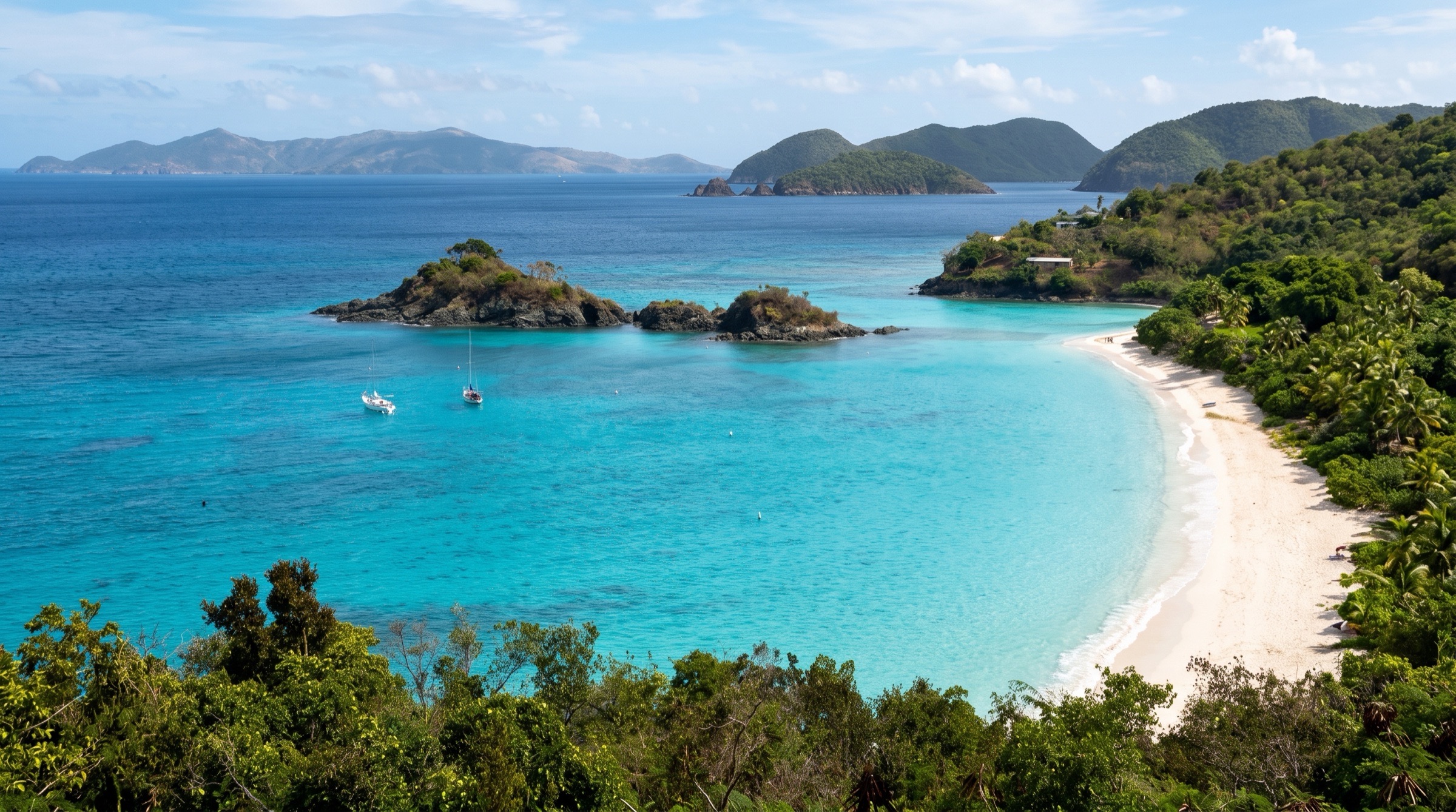
 AI image
Caribbean
US Virgin Islands
The US Virgin Islands pair St Thomas, where most charter bases sit, with St John, about 60 percent national park, with tidy mooring balls in clear turquoise bays. Snorkeling from the boat is the draw, and Americans need no passport. St Croix lies 35-40 miles south across open water and suits experienced crews only.
Best months
Difficulty
EasyShort hops and park moorings; only the St Croix leg is open water.
Conditions
Easterly trades of 15-20 knots, stronger around Christmas. Water is protected behind St John, but Pillsbury Sound and Current Cut can be gusty. Winter north swells make Magens and Brewers bays untenable. Peak hurricane risk is August to October.
Itineraries here
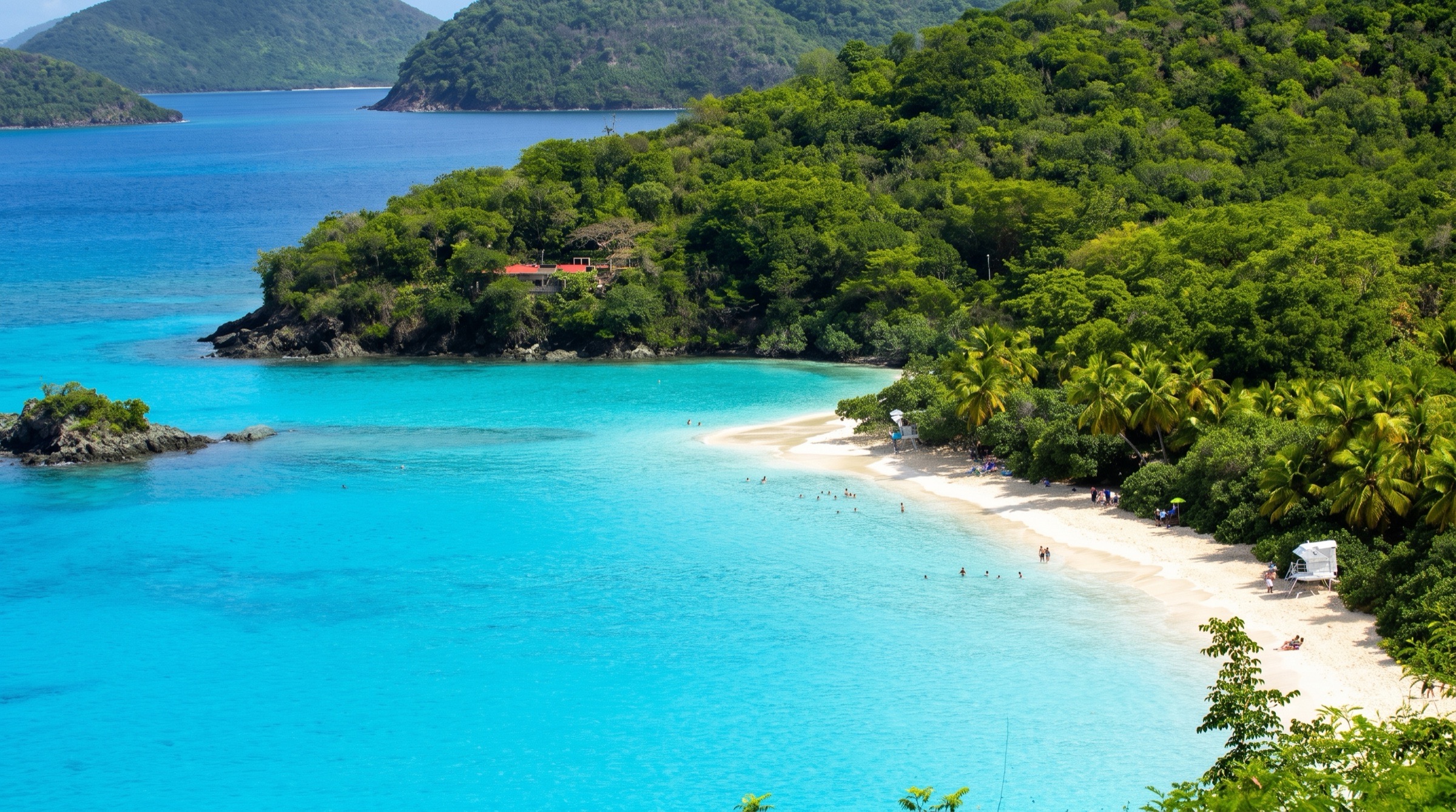
Area guide
Virgin Islands (BVI, USVI and Spanish Virgins)
British Virgin Islands · United States Virgin Islands · Puerto Rico
The Virgin Islands are the most popular bareboat charter ground in the world: dozens of steep green islands and cays wrapped around the Sir Francis Drake Channel, with short line-of-sight hops, steady easterly trades and protected water inside a ring of islands. Three political jurisdictions share the archipelago. The British Virgin Islands (Tortola, Virgin Gorda, Jost Van Dyke, Anegada and some 50 smaller islands) pack the famous stops into a day-sail radius: The Baths, the Norman Island caves, the RMS Rhone wreck, White Bay's Soggy Dollar Bar, Cooper Island, North Sound and the low coral atoll of Anegada behind its 18-mile Horseshoe Reef. The US Virgin Islands add St Thomas (the main airport and USVI charter bases), St John (about 60 percent national park, with an orderly National Park Service mooring system), and St Croix, 35 to 40 miles south across open water, with Buck Island Reef National Monument. West of St Thomas, the Spanish (Puerto Rican) Virgins, Culebra, Culebrita and Vieques, are a quieter world of former Navy islands, wildlife refuges, Flamenco Beach and the brightest bioluminescent bay on record, backed by the large marinas and charter fleets of Fajardo on Puerto Rico's east coast. Most anchorages in the BVI and St John are now mooring fields; moorings fill early in high season. Hurricanes Irma and Maria (September 2017) devastated both the BVI and the USVI; nearly everything has been rebuilt, but check that a business is open before planning around it.
Top of the list
- 1The Baths National ParkVirgin Gorda's granite boulder grottoes, tidal pools and the scramble trail to Devil's Bay; a BVI National Park since 1990 and the single most-visited stop in the islands. Go early on the day moorings.
- 2The Caves (Norman Island)Three water-level sea caves west of the Bight, a classic snorkel that gets darker the deeper you go; the Treasure Island legend lives here.
- 3RMS Rhone WreckRoyal Mail steamer wrecked off Salt Island in the 1867 hurricane; bow at about 80 ft and stern at about 30 ft, so it works for both divers and snorkelers. A national park since 1980.
- 4The IndiansFour pinnacles between Norman and Pelican islands with reef from the surface down; one of the best day-mooring snorkels in the BVI.
- 5Soggy Dollar BarWhite Bay, Jost Van Dyke: swim ashore, pay with a wet dollar and order the bar's famous Painkiller.
- 6Sandy SpitThe postcard sandbar islet off Green Cay and Little Jost Van Dyke, a lunch-stop swim in clear turquoise water.
- 7Loblolly BayAnegada's north-shore reef snorkel with coral heads close to the beach, on the inside of Horseshoe Reef.
- 8Setting Point Mooring Field & AnchorageThe only practical anchorage on Anegada, the low coral island 13 miles north of Virgin Gorda, reached by a buoyed channel; lobster dinners ashore.
- 9Flamingo Pond (Anegada Salt Ponds)Reestablished Caribbean flamingos (about 200 by 2016) in a Ramsar-listed salt pond system, plus the endangered Anegada rock iguana.
- 10Bitter End Yacht ClubThe heart of North Sound, Virgin Gorda's big protected sound; base for Saba Rock, Prickly Pear and Eustatia Sound.
- 11Cane Garden Bay Mooring FieldTortola's most beautiful north-shore bay, with beach bars and the Callwood Rum Distillery a short walk inland.
- 12Trellis Bay Full Moon Party (Fireball Sculptures)Beef Island's monthly full-moon gathering, with Aragorn's fire sculptures burning on the water.
- 13Cooper Island Beach ClubEco-minded beach bar and restaurant in Manchioneel Bay, a favorite overnight on the mooring field between Salt and Virgin Gorda.
- 14Foxy's Tamarind BarGreat Harbour, Jost Van Dyke's legendary beach bar and the island's port of entry anchorage; famous for its Old Year's Night party.
- 15Bubbly PoolA natural rock pool near Diamond Cay on Jost Van Dyke where swells crash through a gap and turn the water to champagne.
- 16Waterlemon CayLeinster Bay, St John: a cay ringed by reef with turtles, rays and starfish, a short swim from National Park moorings beside the Annaberg ruins.
- 17Francis Bay Moorings & AnchorageSt John's quietest north-shore mooring field, one of only two places anchoring is allowed in Virgin Islands National Park.
- 18Trunk Bay Underwater Snorkel TrailSt John's famous beach with an underwater trail of interpretive plaques inside Virgin Islands National Park.
- 19Hurricane Hole (Virgin Islands Coral Reef National Monument)Mangrove-lined bays off Coral Bay where USGS found corals growing on mangrove roots; the only coastal part of the national monument.
- 20Christmas Cove (Great St James)St Thomas' east-end mooring and anchoring cove, known for its floating pizza boat and good snorkeling.
- 21Buck Island Underwater TrailSt Croix's marked snorkel trail in Buck Island Reef National Monument, protected since 1948 as one of the finest marine gardens in the Caribbean.
- 22Flamenco BeachCulebra's mile of white coral sand, with old Navy Sherman tanks rusting on the beach.
- 23Tortuga Bay (Culebrita)A crescent anchorage on Culebrita inside the Culebra National Wildlife Refuge, with a hike to the 1886 lighthouse and the natural rock jacuzzis.
- 24Mosquito Bay Bioluminescent BayVieques' bio bay, named the brightest in the world by Guinness World Records in 2006; visit by licensed kayak tour.
- 25Cayo IcacosThe best of the La Cordillera cays off Fajardo, a white-sand cay with reef snorkeling, a short hop from the Puerto Rico charter bases.
When to go
Sailable year round. High season is December through April, with sunny weather and steady easterly trades; the 'Christmas winds' of midwinter can reinforce the trades and build bigger seas in the channels. May through July is quieter and often lighter, with good value. August through October is the heart of hurricane season; many charter companies and businesses close or slow down in September and October. Winter cold fronts send north swells (typically November to April) that make north-facing anchorages such as Cane Garden Bay, White Bay and Great Harbour on Jost Van Dyke, Brewers Bay, Magens Bay and Flamenco Bay rolly or untenable.
Weather and hazards
Easterly trade winds dominate, so the classic route works upwind (east) early in the week and runs downwind later. The Sir Francis Drake Channel is well protected, but the wind accelerates around headlands and through cuts (Thatch Island Cut, Soper's Hole, the Narrows, Pillsbury Sound, Current Cut) and the gaps between islands can be gusty. Open-water legs are the exception: Virgin Gorda to Anegada (about 13 nm, landfall on a low island only about 28 ft high, with Horseshoe Reef's hundreds of wrecks to the east and north; many charter companies restrict or forbid sailing there, and you should arrive in good light), St Thomas to St Croix (about 35 to 40 nm of open Caribbean), and St Thomas or Fajardo to Culebra. Reef hazards: Horseshoe Reef (Anegada), Colquhoun Reef and the reefs at the North Sound entrances, Johnson's Reef off St John's north shore (stay outside its markers), the reef approaches to Culebra's Ensenada Honda and the La Cordillera cays off Fajardo. Do not anchor on coral: anchoring is restricted or banned in many marine parks. Saharan dust episodes can bring haze and reduced visibility, and the BVI Department of Disaster Management has advised keeping hatches closed during heavy events. On Vieques, the former Navy bombing range at the east end is severely contaminated with unexploded ordnance and closed; obey all restricted-area signs and charted danger zones.
Hurricane season
Atlantic hurricane season runs June 1 to November 30, with activity peaking around September 10 and most storms falling between mid-August and mid-October (NOAA National Hurricane Center climatology). The region has been hit directly: Hurricane Irma (Category 5) struck the BVI on September 6, 2017 and devastated St John and St Thomas, and Hurricane Maria followed two weeks later across all three USVI islands and Puerto Rico. Culebra's Ensenada Honda is widely described as one of the most hurricane-secure harbors in the Caribbean, and Hurricane Hole on St John is a traditional storm refuge (now within the Virgin Islands Coral Reef National Monument; National Park Service moorings must be vacated when tropical storm warnings are forecast). Most charter insurance and many charter contracts restrict August to October cruising; have a haul-out or storm plan and watch nhc.noaa.gov.
Entry and clearance
British Virgin Islands: clear in at a port of entry before anchoring, mooring or landing anywhere else; Noonsite commenters reported fines of US$2,500 to US$10,000 for stopping before clearance (2022). Ports of entry for yachts: Road Town and West End (Soper's Hole) on Tortola, Great Harbour on Jost Van Dyke, and Spanish Town on Virgin Gorda (Gun Creek reported still closed). BVI Customs told callers in April 2026 that it operates 8:30 am to 4:30 pm every day, including weekends and holidays, with revenue collection ending at 4 pm; Immigration charged a US$40 overtime fee for a Sunday check-in (2026 report). All passport holders should attend in person. The BVI is listed among the territories using SailClear, the regional online pre-arrival notification system (sailclear.com): skippers can register the boat and file arrival and departure details before reaching port, but must still clear in person at the Customs and Immigration office. Confirm on arrival that the office accepts it. Charter guests normally have clearance and cruising permits handled by their charter company. US Virgin Islands and Puerto Rico: US jurisdiction. Yachts arriving from the BVI or any foreign port must report to US Customs and Border Protection (CBP) on arrival; non-US crew need a US visa or ESTA-eligible status as appropriate. St John's port of entry is Cruz Bay; St Thomas and St Croix have CBP offices in Charlotte Amalie and Christiansted, and Culebra and Fajardo are used for Puerto Rico arrivals. Confirm the current reporting method (CBP ROAM app or in person), office locations and hours with CBP before you sail, because they change. The USVI sits outside the US customs territory, so check with CBP whether a passage from the USVI to Puerto Rico needs reporting. Bareboat charters crossing between the BVI and USVI must clear out and in each way; some charter companies offer clearance services.
Permits and fees
BVI: the Cruising and Home Permit Act 2021 (in force October 12, 2021) sets cruising permit fees for charter boats per person per day: US$4 for home-based (BVI-based) charter boats and US$16 for foreign-based charter boats (for example a USVI-based charter coming over), with a 14-day advance notification required for foreign-based charter boats; amendments to the Act's fee schedule took effect June 1, 2025, so verify current rates. A 2026 Noonsite report for a private 42 ft yacht with two people listed US$38 Customs plus US$41 Port Authority on entry. BVI National Parks Trust: a Marine Conservation Permit is required to use the National Parks Trust day moorings (The Baths, the Indians, the Caves, the Rhone, Dogs and others); buy it online at bvinpt.org (processed within 5 business days), at the Trust office at 57 Main Street, Road Town, or at The Baths office; charter companies usually include it. Park moorings are for day use only; older figures (US$25 per week for 4 guests to US$55 for 10) are dated, verify locally. Private overnight moorings at resorts and bars typically ran US$30 to US$45 per night in 2019 to 2022 reports (verify locally). An Environmental and Tourism Levy (US$10 per visitor since 2017; vessel crew exempt) also applies. USVI: Virgin Islands National Park overnight moorings or anchoring cost US$26 per night between 5 pm and 7 am (US$13 with an Interagency Senior or Access pass), paid before you spend the night through the Recreation.gov app (scan the QR code at the floating pay stations in Leinster, Francis and Caneel bays, or land stations at the Cruz Bay Visitor Center, Salt Pond Beach and the VIERS dock in Lameshur Bay). Limit: 7 consecutive nights per bay and 30 nights per calendar year. Anchoring in the park is allowed only offshore Francis Bay and Lind Point (sand only, never on coral). Mooring colors: white with blue stripe for boats up to 60 ft, larger white-blue 'big boat' balls for 61 to 100 ft, orange-blue for snorkel and dive use. Trunk Bay charges a US$5 per person amenity fee (card or mobile only). Buck Island Reef National Monument (St Croix) is open 7 am to 5 pm, anchoring only in the West Beach area, and the park asks private vessels using the lagoon moorings to get an annual permit (email CHRI_Permits@nps.gov; allow five business days).
Tides and currents
Tidal range is small, so depth is rarely the issue; currents matter more, especially through Current Cut (St Thomas/Great St James), Pillsbury Sound, the Narrows and Thatch Island Cut, where wind against current builds a short steep chop. NOAA CO-OPS tide stations: Charlotte Amalie, St Thomas (9751639); Lameshur Bay, St John (9751381); Christiansted Harbor, St Croix (9751364); Limetree Bay, St Croix (9751401); Culebra (9752235); Isabel Segunda, Vieques (9752619); Fajardo (9753216). Use tidesandcurrents.noaa.gov predictions; for the BVI use the nearest USVI station (Lameshur Bay or Charlotte Amalie) as a guide.
Money
US dollar (USD) throughout: the BVI has used the US dollar since 1959, and the USVI and Puerto Rico are US territories. Cards are widely accepted in Road Town, Charlotte Amalie, Cruz Bay and Fajardo; carry cash for small beach bars, moorings collected by boat and Anegada. Provisioning is best in Road Town, St Thomas (large supermarkets and warehouse stores) and Fajardo; outer islands have small shops only. Note: driving is on the left in both the BVI and the USVI, on the right in Puerto Rico.
Radio and phones
VHF 16 for hailing and distress; marinas and businesses often use their own working channels (for example Safe Harbor Puerto del Rey on VHF 71); confirm each marina's channel in its entry. US carriers work in the USVI and Puerto Rico; the BVI is a separate country, so check your plan's roaming terms before crossing. Recreation.gov notes that some remote park areas have little or no cell service: download the app before arriving at St John moorings.
Charter bases
- The Moorings Yacht Club (Wickhams Cay II, Road Town)Road Town, Tortola, BVIThe Moorings (flagship base at The Moorings Yacht Club), Sunsail (re-verified Oct 2026 on sunsail.com: its BVI base is The Moorings Yacht Club in Road Town; on-site pool, Moorings Market & Deli, provisioning, laundry, showers, Charlie's Bar & Restaurant and Island Roots Coffee Shop)
- Ritter House Marina (Wickhams Cay II, Road Town)Road Town, Tortola, BVIBVI Yacht Charters (bareboat monohulls and catamarans of about 30 to 54 ft, plus crewed all-inclusive yachts; the company site gives its base as Ritter House Marina, Wickhams Cay 2, not Inner Harbour Marina)
- Fort Burt Marina (Road Town)Road Town, Tortola, BVIConch Charters (BVI bareboat monohulls and catamarans since 1987; charters under 7 nights by request)
- Nanny Cay Resort & MarinaTortola south coast, BVIHorizon Yacht Charters (home base since 1998), Waypoints Yacht Charters BVI (office 8:30 am to 5 pm; RiteWay Nanny Cay supermarket open daily 7 am to 7 pm; fuel dock, pump-out and ice on site), MarineMax Vacations (luxury power catamarans, 423 to 545 models; guest reviews on its site refer to its Nanny Cay base), 302-berth marina with full-service boatyard, fuel and water
- Hodges Creek Marina (Maya Cove, East End)East End, Tortola, BVI (about 15 minutes from Beef Island airport)The Catamaran Company / Catamaran Charters (Lagoon, Gemini and Aquila catamarans; base renovated in 2023), Dream Yacht Charter (its 2026 and 2027 'Tortola Dream Premium' cabin-charter itineraries board at Hodges Creek Marina on Saturday evening and spend the first night in the marina; its site blocks automated reading, so confirm bareboat base details with the company), Few transient slips because of the resident charter fleets; approach via the Maya Cove channel
- Soper's Hole (West End)West End, Tortola, BVISeveral yacht charter companies start and end trips here (Yacht Warriors); BVI customs office, fuel and water on site. Voyage Charters' website did not state its base marina when checked in October 2026, so confirm current West End operators directly
- Frenchtown Marina (Charlotte Amalie west)Frenchtown, St Thomas, USVI (about 10 minutes from Cyril E. King airport)Waypoints USVI (formerly CYOA Yacht Charters, acquired by Waypoints effective January 25, 2022): sailing and motor catamarans and 38 to 50 ft monohulls; bareboat, skippered and learn-to-sail charters; 3562 Honduras #4, Frenchtown Marina
- Red Hook (American Yacht Harbor) and Benner Bay (Compass Point Marina)East End, St Thomas, USVIAmerican Yacht Harbor (IGY): 123 berths including 4 megayacht berths, VHF 11 and 16, office +1 340-775-6454, Compass Point Marina, Benner Bay (sister to Independent Boat Yard; office 340-775-6144), Neither marina's own website names resident bareboat fleets (checked October 2026); several crewed and day-charter operators run from both, so confirm operators with the marina office, USVI-based boats pay the BVI foreign charter cruising-permit fees when entering the BVI
- Safe Harbor Puerto del ReyFajardo, Puerto RicoSail Caribe, Caribe Bliss, East Island Excursions, Marina has 900+ wet slips, fuel dock 8 am to 5 pm and a 150-ton travel lift; VHF 71
Getting there
- Cyril E. King Airport — STTSt Thomas, about 2 miles west of Charlotte Amalie. Main jet gateway for the whole region: nonstops from Miami, Charlotte, Atlanta, New York JFK, Newark, Philadelphia, Dallas, Houston, Washington Dulles and more. Ferries run from Charlotte Amalie and Red Hook to St John and to Tortola and Jost Van Dyke.
- Terrance B. Lettsome International Airport — EISBeef Island, linked to Tortola by bridge, next to Trellis Bay. American Eagle from Miami; InterCaribbean, Winair and seasonal Tradewind service via San Juan, Antigua, St Maarten and other islands.
- Henry E. Rohlsen Airport — STXSt Croix, about 6 miles southwest of Christiansted.
- Luis Muñoz Marín International Airport — SJUSan Juan, Puerto Rico. Largest airport in the region and the main gateway for Fajardo charter bases (about an hour by road); commuter flights to EIS, STT, Culebra and Vieques.
- Benjamín Rivera Noriega Airport (Culebra) and Antonio Rivera Rodríguez Airport (Vieques) — CPX / VQSSmall-aircraft service to San Juan and Ceiba; ferries also run from Ceiba to both islands.
Charts and guides
- The Cruising Guide to the Virgin Islands (Cruising Guide Publications; 2026 edition), the standard BVI/USVI charter guide with anchorage sketch charts
- The Complete Diving Guide: The Virgin Islands (Cruising Guide Publications)
- A Waterproof Planning Chart of the Virgin Islands (Cruising Guide Publications)
- NOAA electronic navigational charts (ENC) for the US Virgin Islands and Puerto Rico (verify current cells at charts.noaa.gov); UKHO Admiralty charts cover the BVI
- Virgin Islands National Park marine rules and interactive mooring map (nps.gov/viis)
- US Coast Pilot 5 (Gulf of Mexico, Puerto Rico and Virgin Islands)
- Noonsite British Virgin Islands, US Virgin Islands and Puerto Rico pages for clearance reports
Sample routes
- Classic BVI loop from Road Town (7 days; distances approximate)Day 1 · The Moorings Base (Wickhams Cay II) → The Bight Mooring Field (Norman Island) · 6 nmShort shakedown across the Drake Channel; afternoon snorkel at The Caves, sundowner at the Willy T or Pirates Bight.Day 2 · The Bight Mooring Field (Norman Island) → Manchioneel Bay Mooring Field (Cooper Island) · 9 nmEarly snorkel at The Indians, then the RMS Rhone on a day mooring off Salt Island; dinner at Cooper Island Beach Club.Day 3 · Manchioneel Bay Mooring Field (Cooper Island) → Saba Rock Mooring Field · 14 nmArrive at The Baths early for a day mooring, scramble to Devil's Bay, then up the coast through the North Sound entrance to Saba Rock or the Bitter End.Day 4 · Saba Rock Mooring Field → Setting Point Mooring Field & Anchorage · 13 nmOpen-water reach to Anegada in good light; taxi to Loblolly Bay or Cow Wreck Beach, the flamingo pond, and a lobster dinner.Day 5 · Setting Point Mooring Field & Anchorage → Marina Cay Mooring Field · 17 nmBroad reach back south and west; Monkey Point snorkel, Trellis Bay (full-moon party if the dates line up).Day 6 · Marina Cay Mooring Field → Great Harbour Mooring Field (Jost Van Dyke) · 18 nmDownwind along Tortola's north shore with a lunch stop at Cane Garden Bay; Foxy's in the evening.Day 7 · Great Harbour Mooring Field (Jost Van Dyke) → The Moorings Base (Wickhams Cay II) · 14 nmMorning at White Bay and the Soggy Dollar, lunch swim at Sandy Spit, then back through Thatch Island Cut and up the channel to Road Town.
- USVI and BVI from St Thomas (12 days; distances approximate)Day 1 · American Yacht Harbor (Red Hook) → Christmas Cove (Great St James) · 3 nmProvision in St Thomas, short hop through Current Cut, snorkel and pizza boat.Day 2 · Christmas Cove (Great St James) → Francis Bay Moorings & Anchorage · 9 nmThrough Pillsbury Sound to Cruz Bay for the National Park visitor center; north shore to Francis Bay; Maho Bay turtles.Day 3 · Francis Bay Moorings & Anchorage → Leinster Bay Moorings · 2 nmWaterlemon Cay snorkel and the walk to the Annaberg ruins.Day 4 · Leinster Bay Moorings → Great Harbour Mooring Field (Jost Van Dyke) · 6 nmClear out of the USVI at Cruz Bay first if required; clear into the BVI at Great Harbour.Day 5 · Great Harbour Mooring Field (Jost Van Dyke) → Cane Garden Bay Mooring Field · 7 nmSandy Spit and Green Cay in the morning; Callwood Rum Distillery.Day 6 · Cane Garden Bay Mooring Field → Marina Cay Mooring Field · 12 nmAlong the north shore, Monkey Point snorkel.Day 7 · Marina Cay Mooring Field → Saba Rock Mooring Field · 10 nmBeat or motor-sail to North Sound; Prickly Pear and Eustatia Sound.Day 8 · Saba Rock Mooring Field → Setting Point Mooring Field & Anchorage · 13 nmAnegada: beaches, flamingos, lobster.Day 9 · Setting Point Mooring Field & Anchorage → Virgin Gorda Yacht Harbour (Spanish Town) · 15 nmProvisions at Spanish Town; The Baths early the next morning.Day 10 · Virgin Gorda Yacht Harbour (Spanish Town) → Manchioneel Bay Mooring Field (Cooper Island) · 8 nmThe Baths at first light, then the Dogs or straight to Cooper.Day 11 · Manchioneel Bay Mooring Field (Cooper Island) → The Bight Mooring Field (Norman Island) · 9 nmRMS Rhone, The Indians and The Caves; clear out of the BVI at West End or Road Town before returning (or on day 12).Day 12 · The Bight Mooring Field (Norman Island) → American Yacht Harbor (Red Hook) · 10 nmClear back into the USVI at Cruz Bay, then return to Red Hook.
- Spanish Virgins from Fajardo (7 days; distances approximate)Day 1 · Safe Harbor Puerto del Rey → Cayo Icacos · 6 nmShakedown to the La Cordillera cays: Icacos and Palominito snorkeling.Day 2 · Cayo Icacos → Ensenada Honda Anchorage (Culebra) · 18 nmAcross Vieques Sound and through Canal Luis Peña; Dewey and the Dinghy Dock.Day 3 · Ensenada Honda Anchorage (Culebra) → Tortuga Bay (Culebrita) · 6 nmCulebrita lighthouse hike and the rock jacuzzis; settled conditions only.Day 4 · Tortuga Bay (Culebrita) → Flamenco Bay Anchorage · 8 nmFlamenco Beach and the tanks; Carlos Rosario snorkel; avoid in north swell.Day 5 · Flamenco Bay Anchorage → Esperanza Anchorage (Vieques) · 27 nmRound the west end of Culebra and cross Vieques Sound to Vieques' south coast (about 25-28 nm by either end of Vieques); night kayak tour of Mosquito Bay bio bay.Day 6 · Esperanza Anchorage (Vieques) → Green Beach / Punta Arenas Anchorage · 10 nmVieques' west end refuge beach and snorkel.Day 7 · Green Beach / Punta Arenas Anchorage → Safe Harbor Puerto del Rey · 9 nmAcross the Pasaje de Vieques back to Fajardo.
- St Thomas to St Croix and Buck Island (8 days; distances approximate)Day 1 · Frenchtown Marina & Waypoints USVI (formerly CYOA) Charter Base → Christmas Cove (Great St James) · 9 nmProvision in Charlotte Amalie, then run east along the south shore of St Thomas to Christmas Cove for a snorkel and an early night before the crossing.Day 2 · Christmas Cove (Great St James) → Christiansted Harbor Anchorage · 37 nmOpen-water reach across the Virgin Islands Basin (St Croix lies 32 miles south of St Thomas and St John). Leave at first light so you run the Christiansted entrance with the sun high; give Buck Island Bar 2 miles or more; allow for 1 to 3 knots of current off Christiansted. Anchor west of Protestant Cay; the Boardwalk and Fort Christiansvaern in the evening.Day 3 · Christiansted Harbor Anchorage → Buck Island West Beach Anchorage · 5 nmBuck Island Reef National Monument: pick up a lagoon mooring for the Underwater Trail (no boats 42 ft and over in the lagoon), then anchor in the buoyed West Beach zone for Turtle Beach and the Overlook Trail. Day use only, 7 am to 5 pm.Day 4 · Buck Island West Beach Anchorage → Green Cay Marina · 3 nmLeave Buck Island by 5 pm and take a slip at Green Cay Marina (fuel, water, laundry, resort pool) for the night; Chenay Bay Beach and the Green Cay wildlife refuge nearby.Day 5 · Green Cay Marina → Salt River Bay National Historical Park · 9 nmWest past Christiansted to Salt River; enter only in good light through the 6 ft reef cut. Columbus Landing Site, a Salt River Canyon wall dive and a night kayak tour of the bioluminescent bay.Day 6 · Salt River Bay National Historical Park → Frederiksted Anchorage · 12 nmAlong the north shore past Cane Bay and around Hams Bluff to Frederiksted; anchor north of the pier, night-dive or snorkel the Frederiksted Pier, Rainbow Beach and Fort Frederik.Day 7 · Frederiksted Anchorage → Christiansted Harbor Anchorage · 20 nmMotor-sail back east along the north coast (upwind and up-current, so start early); final evening in Christiansted with dinner on the Boardwalk.Day 8 · Christiansted Harbor Anchorage → Frenchtown Marina & Waypoints USVI (formerly CYOA) Charter Base · 38 nmReach back north across the basin to St Thomas, arriving in daylight; crew who prefer not to sail it can take the QE IV ferry from Gallows Bay to Charlotte Amalie.
Places in Virgin Islands (BVI, USVI and Spanish Virgins)
- 8 Tuff Miles RaceEvent · St John
- Abe's by the SeaEat · Jost Van Dyke
- Alacena Bistro & Market (Puerto del Rey)Eat · Puerto Rico (east coast)
- Ali Baba's (Great Harbour)Eat · Jost Van Dyke
- Alice's Backside (Ginger Island)Snorkel · Ginger Island
- Altona Lagoon Park & Boat RampWatersport · St Croix
- American Yacht Harbor (Red Hook)Marina · St Thomas
- American Yacht Harbor Fuel Dock (Red Hook)Service · St Thomas
- Amigo Supermarket (near Puerto del Rey)Stores · Puerto Rico (east coast)
- Anegada Beach ClubEat · Anegada
- Anegada Bonefishing FlatsFishing · Anegada
- Anegada Conch Mounds (Conch Island)Landmark · Anegada
- Anegada Fuel & Water (Setting Point)Service · Anegada
- Anegada KiteboardingWatersport · Anegada
- Anegada Lobster FestivalEvent · Anegada
- Anegada Provisions & Small MarketsStores · Anegada
- Anegada Reef HotelEat · Anegada
- Anegada Rock Iguana Headstart FacilityWildlife · Anegada
- Anegada Taxis & Scooter RentalService · Anegada
- Anegada Walking Trails (Bones Bight Shoreline & Interior)Hike · Anegada
- Angelfish Reef (Norman Island)Dive · Norman Island
- Annaberg Sugar Plantation RuinsLandmark · St John
- Annaly Bay Tide PoolsHike · St Croix
- Antonio Rivera Rodríguez Airport (Vieques)Service · Vieques
- Apple Bay & Sebastian's on the BeachEat · Tortola
- Aqua Action Dive Center (Secret Harbour)Dive · St Thomas
- Aqua Bistro (Coral Bay)Eat · St John
- Aragorn's Studio (Trellis Bay)Landmark · Beef Island
- Arches and Tunnels (Thatch Cay)Dive · Thatch Cay
- Art Thursday (Christiansted)Event · St Croix
- Atlantic Hurricane Season (BVI)Seasonal · Tortola
- Atlantic Hurricane Season (Puerto Rico)Seasonal · Puerto Rico (east coast)
- Auguste George Airport (Anegada)Service · Anegada
- B-Line Beach Bar (Little Jost)Bar · Little Jost Van Dyke
- Bahía de AlmodóvarAnchorage · Culebra
- Bahía de la Chiva Anchorage (Vieques)Anchorage · Vieques
- Bahía Salina del Sur Anchorage (Vieques)Anchorage · Vieques
- Bahía Sardinas / Dewey AnchorageAnchorage · Culebra
- Bahía Tamarindo AnchorageAnchorage · Culebra
- Bananakeet Cafe (Windy Hill)Eat · Tortola
- Banco Popular (Spanish Town)Service · Virgin Gorda
- Banco Popular and ATM (Dewey)Service · Culebra
- Beach Side Cafe at Sand Castle on the BeachEat · St Croix
- Beauregard's on the Beach (The Buccaneer)Eat · St Croix
- Bellamy Cay (The Last Resort)Landmark · Bellamy Cay
- Benjamín Rivera Noriega Airport (Culebra)Service · Culebra
- Benner Bay (The Lagoon)Anchorage · St Thomas
- Benures Bay (Norman Island)Anchorage · Norman Island
- Berchers BayView · Virgin Gorda
- Bernie's Bar & Grill (Red Hook)Bar · St Thomas
- Big Bamboo (Loblolly Bay)Eat · Anegada
- Big Beard's Adventure Tours (Buck Island)Tour · St Croix
- Biras CreekWatersport · Virgin Gorda
- Biras Creek Anchorage (North Sound)Anchorage · Virgin Gorda
- Bitter End Clubhouse, Buoy Room & QuarterdeckEat · Virgin Gorda
- Bitter End Fuel DockService · Virgin Gorda
- Bitter End Mooring FieldAnchorage · Virgin Gorda
- Bitter End WatersportsWatersport · Virgin Gorda
- Bitter End Yacht ClubMarina · Virgin Gorda
- Black Beard Sports (Vieques): dive center, kayak and bio-bay toursDive · Vieques
- Blonde RockDive · Blonde Rock
- Blue Beach (Bahía de la Chiva)Snorkel · Vieques
- Blue Water Divers (Nanny Cay)Dive · Tortola
- Bobby's Marketplace (Cane Garden Bay & Road Town)Stores · Tortola
- Bolongo Bay AnchorageAnchorage · St Thomas
- Bomba Shack (Apple Bay Full Moon Party)Bar · Tortola
- Bones Bight / Windlass BightBeach · Anegada
- Booby Rock (Salt Pond Bay)Dive · St John
- Bordeaux MountainView · St John
- Botany Bay (West End)Beach · St Thomas
- Botella Rooftop Bar (Virgin Gorda Yacht Harbour)Bar · Virgin Gorda
- Brandywine Bay AnchorageAnchorage · Tortola
- Brandywine Estate RestaurantEat · Tortola
- Brew STX (Christiansted Boardwalk)Eat · St Croix
- Brewers Bay (St Thomas)Beach · St Thomas
- Brewers Bay (Tortola)Anchorage · Tortola
- Brewers Bay AnchorageAnchorage · St Thomas
- Brewers Bay East Dive SiteDive · Tortola
- Brewers Bay West Dive SiteDive · Tortola
- Brown BayBeach · St John
- Bubbly PoolLandmark · Jost Van Dyke
- Bubbly Pool TrailHike · Jost Van Dyke
- Buck Island (Tortola)Landmark · Buck Island (Tortola)
- Buck Island Lagoon MooringsAnchorage · Buck Island (St Croix)
- Buck Island National Wildlife Refuge & Cartanser Sr. WreckDive · Buck Island (St Thomas)
- Buck Island Overlook TrailHike · Buck Island (St Croix)
- Buck Island Reef National MonumentLandmark · Buck Island (St Croix)
- Buck Island SCUBA Cut MooringDive · Buck Island (St Croix)
- Buck Island Underwater TrailSnorkel · Buck Island (St Croix)
- Buck Island West Beach AnchorageAnchorage · Buck Island (St Croix)
- Buck's Food MarketStores · Virgin Gorda
- Budget Marine St ThomasService · St Thomas
- Butler Bay WrecksDive · St Croix
- BVI Charter Yacht Show (November)Event · Tortola
- BVI Emancipation Festival (August)Event · Tortola
- BVI JVD Laundry (Great Harbour)Service · Jost Van Dyke
- BVI National Parks Trust Marine Conservation PermitPermit · Salt Island
- BVI Spring Regatta & Sailing Festival (Nanny Cay)Event · Tortola
- BVI Spring Regatta racing in the southern chainEvent · Peter Island
- Cabezas de San Juan Nature Reserve (El Faro)Landmark · Puerto Rico (east coast)
- Cabritte Horn Fishing MooringsFishing · St John
- Calizo Seafood Restaurant (Las Croabas)Eat · Puerto Rico (east coast)
- Callwood Rum DistilleryLandmark · Tortola
- Canal de Culebrita AnchorageAnchorage · Culebrita
- Cane Bay Beach & The Landing Beach BarBeach · St Croix
- Cane Bay WallDive · St Croix
- Cane Garden Bay Mooring FieldAnchorage · Tortola
- Caneel Bay Beach Club (Honeymoon Beach)Bar · St John
- Caneel Bay MooringsAnchorage · St John
- Caneel Hill TrailHike · St John
- Capella IslandSnorkel · Capella Island
- Capriccio di Mare (Road Town)Eat · Tortola
- Captain Morgan Visitor CenterLandmark · St Croix
- Caribe Bliss Ocean Tours (Puerto del Rey)Service · Puerto Rico (east coast)
- Carlos Rosario BeachSnorkel · Culebra
- Carlos Rosario Reef dive (Impact)Dive · Culebra
- Carrot Shoal & Carrot RockDive · Carrot Rock
- Carval RockDive · Carval Rock
- Carvel RockDive · Carvel Rock
- Cas Cay & Mangrove Lagoon Marine ReserveWildlife · St Thomas
- Casa Alcaldía de Vieques (Isabel Segunda Plaza)Landmark · Vieques
- Cayo Ballena wall diveDive · Cayo Ballena
- Cayo de Agua (Las Hermanas)Landmark · Cayo de Agua
- Cayo de Agua Rock diveDive · Cayo de Agua
- Cayo DiabloSnorkel · Cayo Diablo
- Cayo Diablo Reef (dive site)Dive · Cayo Diablo
- Cayo IcacosSnorkel · Cayo Icacos
- Cayo Icacos AnchorageAnchorage · Cayo Icacos
- Cayo Largo reef (Fajardo)Landmark · Puerto Rico (east coast)
- Cayo LobosSnorkel · Cayo Lobos
- Cayo Luis PeñaHike · Cayo Luis Peña
- Cayo Luis Peña AnchorageAnchorage · Cayo Luis Peña
- Cayo NorteSnorkel · Cayo Norte
- Cayo Ratón dive siteDive · Cayo Ratón
- Cayo Ratones (La Cordillera)Landmark · Cayo Ratones
- Cayo Tiburón dive siteDive · Cayo Tiburón
- Cayo Yerba arch diveDive · Cayo Yerba
- Cayos GeniquíWildlife · Cayos Geniquí
- CBP Charlotte Amalie (Edward Wilmoth Blyden Marine Terminal)Permit · St Thomas
- CBP Clearance, St Croix (Rohlsen Airport office)Permit · St Croix
- CBP Cruz Bay (St John Port of Entry)Permit · St John
- Ceiba Ferry Terminal (Roosevelt Roads)Service · Puerto Rico (east coast)
- Centro de Salud Comunal de Culebra (clinic)Service · Culebra
- Centro de Salud Susana Centeno (Vieques clinic)Service · Vieques
- Chandler Memorial Regatta (St Croix Yacht Club)Event · St Croix
- Charlotte Amalie Harbor Anchorage (Long Bay)Anchorage · St Thomas
- Charlotte Amalie Waterfront Dinghy Landing (Coast Guard Station)Service · St Thomas
- Cheeseburgers in America's ParadiseEat · St Croix
- Chef's Pantry (Leverick Bay)Stores · Virgin Gorda
- Chenay Bay BeachBeach · St Croix
- Chikuzen WreckDive · Open water north of Beef Island
- Christiansted Boardwalk & Dinghy LandingLandmark · St Croix
- Christiansted Harbor AnchorageAnchorage · St Croix
- Christiansted National Historic Site & Fort ChristiansvaernLandmark · St Croix
- Christine's Bakery (Great Harbour)Stores · Jost Van Dyke
- Christmas Cove (Great St James)Anchorage · Great St James
- Christmas Winds (Dec–Feb reinforced trades)Seasonal · Tortola
- Christmas Winds (Winter Trades)Seasonal · St Thomas
- Christmas Winds and winter north swells (St Croix)Seasonal · St Croix
- Cinnamon BayBeach · St John
- Cinnamon Bay Boat Exclusion Area & Dinghy RulesPermit · St John
- Cinnamon Bay Plantation Ruins & Nature LoopHike · St John
- Cistern Point (Cooper Island)Snorkel · Cooper Island
- Coco Loco (White Bay)Bar · Jost Van Dyke
- CocoMayaEat · Virgin Gorda
- Coki Point BeachSnorkel · St Thomas
- Colquhoun ReefSnorkel · Mosquito Island
- Columbus Landing Site (Salt River)Landmark · St Croix
- Compass Point MarinaMarina · St Thomas
- Congo CayDive · Congo Cay
- Cooper Island Beach ClubEat · Cooper Island
- Cooper Island Rum Bar & ShopBar · Cooper Island
- Cooper Island submerged dockSnorkel · Cooper Island
- Cooper Island wildlifeWildlife · Cooper Island
- Copper Mine National ParkLandmark · Virgin Gorda
- Coral Bay AnchorageAnchorage · St John
- Coral Bay Marine ServiceService · St John
- Coral Bay provisions & dinghy dockStores · St John
- Coral Bay Thanksgiving Day RegattaEvent · St John
- Coral Gardens & Sharkplaneo (Great Dog)Dive · Great Dog
- Coral Harbor West Shore Landing (Cocoloba & Isola)Service · St John
- Coral World Ocean ParkLandmark · St Thomas
- Corsairs Beach Bar & RestaurantEat · Jost Van Dyke
- Cost-U-Less & PriceSmart (St Thomas)Stores · St Thomas
- Costa Mía Restaurant (Las Croabas)Eat · Puerto Rico (east coast)
- Cow and Calf RocksDive · St Thomas
- Cow Wreck BeachBeach · Anegada
- Cow Wreck Beach BarBar · Anegada
- Cowpet Bay Anchorage & St. Thomas Yacht ClubAnchorage · St Thomas
- Crabby's Watersports (Coral Bay)Watersport · St John
- Cramer's ParkBeach · St Croix
- Creque Marine Railway (Hassel Island)Landmark · Hassel Island
- Crown Bay MarinaMarina · St Thomas
- Crown Bay Marina Fuel DockService · St Thomas
- Crucian Christmas FestivalEvent · St Croix
- Cruz Bay AnchorageAnchorage · St John
- Cruz Bay ATMs & BanksService · St John
- Cruz Bay BeachBeach · St John
- Cruz Bay Ferry Docks (Red Hook, Charlotte Amalie and BVI ferries)Service · St John
- Cruz Bay Laundromats (Santos, Kilroy's, Richard's)Service · St John
- Cruz Bay Propane Refill (Elvis, by Candy's BBQ)Service · St John
- Cruz Bay Watersports (Westin St John departures)Tour · St John
- Cruzan Rum DistilleryLandmark · St Croix
- Culebra CBP Clearance (Benjamín Rivera Noriega Airport)Permit · Culebra
- Culebra DiversDive · Culebra
- Culebra Ferry TerminalService · Culebra
- Culebra fuel stations (Dewey)Service · Culebra
- Culebra groceries & colmados (Dewey)Stores · Culebra
- Culebra jeep and golf-cart rentalsService · Culebra
- Culebra laundromats (Dewey)Service · Culebra
- Culebra National Wildlife RefugeWildlife · Culebra
- Culebra Post Office (Dewey)Service · Culebra
- Culebra sea turtle nestingSeasonal · Culebra
- Culebrita Jacuzzis (Baños de Culebrita)Snorkel · Culebrita
- Culebrita LighthouseHike · Culebrita
- Cyril E. King Airport (STT)Service · St Thomas
- Dakity Reef Moorings (Ensenada Honda)Anchorage · Culebra
- Davis Bay (Carambola Beach)Beach · St Croix
- De Loose Mongoose (Beef Island) fuel dock & restaurantEat · Beef Island
- Dead Chest Island National ParkLandmark · Dead Chest Island
- Deadman's Bay (Peter Island)Anchorage · Peter Island
- Deep Bay (North Sound)Anchorage · Virgin Gorda
- Devil's BayBeach · Virgin Gorda
- Dewey canal and lift bridgeLandmark · Culebra
- Dewey Town DockService · Culebra
- Diamond Cay Anchorage (Long Bay East)Anchorage · Jost Van Dyke
- Diamond Cay National ParkWildlife · Jost Van Dyke
- Diamond Reef / Great Camanoe snorkelSnorkel · Great Camanoe
- Dinghy Dock Restaurant (Dewey)Eat · Culebra
- Dinghy's Beach Bar & Grill (Honeymoon Beach)Bar · Water Island
- Dip 'N' Scrub (Scrub Island) Dive SiteDive · Scrub Island
- Dive BVI (Virgin Gorda Yacht Harbour)Dive · Virgin Gorda
- Dolphin Market (Coral Bay, Cocoloba Plaza)Stores · St John
- Dolphin Market (Cruz Bay)Stores · St John
- Drake's Anchorage (Mosquito Island)Anchorage · Mosquito Island
- Drake's SeatView · St Thomas
- Druif Bay / Honeymoon Bay Anchorage (Water Island)Anchorage · Water Island
- Duffy's EsperanzaBar · Vieques
- Duffy's Love Shack (Red Hook)Bar · St Thomas
- Duggan's Reef (Teague Bay)Eat · St Croix
- Eagle ShoalDive · St John
- East Island Excursions (Puerto del Rey)Service · Puerto Rico (east coast)
- El Batey (Culebra)Bar · Culebra
- El Timón Bakery (near Puerto del Rey)Stores · Puerto Rico (east coast)
- El Varadero Seaside Grill (Marina Puerto Chico)Eat · Puerto Rico (east coast)
- El Yunque National ForestHike · Puerto Rico (east coast)
- Elephant Bay Anchorage (Water Island)Anchorage · Water Island
- Emancipation Garden & Vendors' PlazaLandmark · St Thomas
- Emerald Beach Resort Bar & Grill (Lindbergh Bay)Eat · St Thomas
- Enighed Pond Car Ferry DockService · St John
- Ensenada del Coronel landing (D's Garden)Stores · Culebra
- Ensenada Honda (Ceiba / Roosevelt Roads)Anchorage · Puerto Rico (east coast)
- Ensenada Honda (Vieques)Anchorage · Vieques
- Ensenada Honda Anchorage (Culebra)Anchorage · Culebra
- Ensenada Honda dinghy landings (Dewey)Service · Culebra
- Ensenada Honda Hurricane HoleAnchorage · Culebra
- Ensenada Malena Day AnchorageAnchorage · Culebra
- Esperanza Anchorage (Vieques)Anchorage · Vieques
- Esperanza Dinghy Dock (Muelle de Esperanza)Service · Vieques
- Esperanza Malecón restaurantsEat · Vieques
- Estate Whim MuseumLandmark · St Croix
- Estera (Pan Am Pavilion, Christiansted)Eat · St Croix
- Eureka Medical Clinic & Medicure Pharmacy (Spanish Town)Service · Virgin Gorda
- Europa Bay & White CliffsHike · St John
- Eustatia IslandLandmark · Eustatia Island
- Eustatia SoundSnorkel · Eustatia Island
- Eustatia Sound AnchorageAnchorage · Eustatia Island
- Fairchild's Beach Bar & Grill (Magens Bay)Bar · St Thomas
- Fajardo CBP / ROAM clearancePermit · Puerto Rico (east coast)
- Fajardo provisioning (supermarkets, Walmart)Stores · Puerto Rico (east coast)
- Fallen Jerusalem National ParkSnorkel · Fallen Jerusalem
- Fat Hog's Bay & East End MarinasMarina · Tortola
- Faulkner House MuseumLandmark · Anegada
- Fiestas Patronales de Nuestra Señora del Carmen (Culebra)Event · Culebra
- Fiestas Patronales de Nuestra Señora del Carmen (Vieques)Event · Vieques
- Fiestas Patronales de Santiago Apóstol (Fajardo)Event · Puerto Rico (east coast)
- Fischer's Cove Beach HotelEat · Virgin Gorda
- Flamenco Bay AnchorageAnchorage · Culebra
- Flamenco BeachBeach · Culebra
- Flamenco Beach Sherman TanksLandmark · Culebra
- Flamenco Peninsula sooty tern colonyWildlife · Culebra
- Flamingo Bay Anchorage (Water Island)Anchorage · Water Island
- Flamingo Pond (Anegada Salt Ponds)Wildlife · Anegada
- Flash of BeautySnorkel · Anegada
- Flash of Beauty RestaurantEat · Anegada
- Food Center (Benner Bay)Stores · St Thomas
- Fort BurtLandmark · Tortola
- Fort Burt MarinaMarina · Tortola
- Fort Christian & 99 StepsLandmark · St Thomas
- Fort Frederik (Frederiksted)Landmark · St Croix
- Fort Louise Augusta (Christiansted Harbor Entrance)Landmark · St Croix
- Fort Segarra (Water Island)Hike · Water Island
- Fortín Conde de MirasolLandmark · Vieques
- Fortsberg (Fort Frederiksvaern)Landmark · St John
- Foxy's Cat Fight RegattaEvent · Jost Van Dyke
- Foxy's Old Year's Night PartyEvent · Jost Van Dyke
- Foxy's TabooEat · Jost Van Dyke
- Foxy's Tamarind BarBar · Jost Van Dyke
- Foxy's Wooden Boat RegattaEvent · Jost Van Dyke
- Francis Bay Moorings & AnchorageAnchorage · St John
- Francis Bay Trail & Salt PondHike · St John
- Frederiksted AnchorageAnchorage · St Croix
- Frederiksted PierDive · St Croix
- Freeman's Laundromat (Nanny Cay)Service · Tortola
- Frenchman's CayLandmark · Frenchman's Cay
- Frenchtown Marina & Waypoints USVI (formerly CYOA) Charter BaseMarina · St Thomas
- Gallows Bay Anchorage (Christiansted)Anchorage · St Croix
- Gallows Bay Dock, Harbormaster and QE IV FerryService · St Croix
- Geniquí Caves diveDive · Cayos Geniquí
- George DogSnorkel · George Dog
- Gertrude's Beach Bar (White Bay)Bar · Jost Van Dyke
- Gibney (Oppenheimer) Beach & Denis BayBeach · St John
- Ginger IslandLandmark · Ginger Island
- Ginger Steps & Alice in Wonderland (Ginger Island)Dive · Ginger Island
- Gladys' Cafe (Charlotte Amalie)Eat · St Thomas
- Goat Hill HikeHike · St Croix
- Goat, Soup and Whiskey (Coakley Bay)Eat · St Croix
- Golden Hind Chandlery Commodore's Race (Royal BVI Yacht Club)Event · Tortola
- Gorda Peak National ParkHike · Virgin Gorda
- Gourmet Gallery (Crown Bay Marina)Stores · St Thomas
- Governor Juan F. Luis Hospital (St Croix)Service · St Croix
- Grand Central Station (Guana Island) Dive SiteDive · Guana Island
- Grapetree Beach & East End BarBeach · St Croix
- Grass CayDive · Grass Cay
- Great Cruz BayAnchorage · St John
- Great Dog AnchorageAnchorage · Great Dog
- Great Harbour (Peter Island)Anchorage · Peter Island
- Great Harbour Customs & Immigration (Jost Van Dyke Port of Entry)Permit · Jost Van Dyke
- Great Harbour Mooring Field (Jost Van Dyke)Anchorage · Jost Van Dyke
- Great Harbour to White Bay WalkHike · Jost Van Dyke
- Great Lameshur Bay MooringsAnchorage · St John
- Great Pond (East End Marine Park)Wildlife · St Croix
- Great Pond Bay AnchorageAnchorage · St Croix
- Great Thatch IslandLandmark · Great Thatch
- Great Tobago & Little Tobago (seabirds)Wildlife · Great Tobago
- Great Tobago South Reefs (Coral Dome, Tobago Canyons, Gardens of the Queen)Dive · Great Tobago
- Green Beach / Punta Arenas AnchorageAnchorage · Vieques
- Green Cay AnchorageAnchorage · Green Cay
- Green Cay MarinaMarina · St Croix
- Green Cay Marina Fuel DockService · St Croix
- Green Cay Marina Laundry & ShowersService · St Croix
- Green Cay National Wildlife RefugeWildlife · Green Cay (St Croix)
- Green Cay Reef SnorkelSnorkel · Green Cay
- Gun Creek (North Sound)Anchorage · Virgin Gorda
- Hams Bluff LighthouseHike · St Croix
- Hans Lollik Islands (Coconut Bay)Anchorage · Hans Lollik
- Hansen Bay BeachBeach · St John
- Happy Landing drive-thru bar (Culebra)Bar · Culebra
- Harbour Market (Soper's Hole)Stores · Frenchman's Cay
- Harris' PlaceEat · Jost Van Dyke
- Hassel Island (Virgin Islands National Park)Landmark · Hassel Island
- Hassel Island Historic TrailsHike · Hassel Island
- Haulover Bay (Cooper Island)Anchorage · Cooper Island
- Haulover Bay (St John)Snorkel · St John
- Hawks Bill Bank & Robert ReefLandmark · Anegada
- Hawksnest Bay MooringsAnchorage · St John
- Hawksnest BeachBeach · St John
- Heather's Pizza (Dewey)Eat · Culebra
- Hendo's HideoutEat · Jost Van Dyke
- Henley Cay (Durloe Cays)Snorkel · Henley Cay
- Henry E. Rohlsen Airport (STX)Service · St Croix
- High Tide (Wharfside Landing)Eat · St John
- HIMA San Pablo Fajardo (Centro Médico del Noreste)Service · Puerto Rico (east coast)
- Hodges Creek Marina (Maya Cove)Marina · Tortola
- Hog HeavenEat · Virgin Gorda
- Honeymoon Beach (St John)Beach · St John
- Honeymoon Beach (Water Island)Beach · Water Island
- Hook'd USVI (Red Hook)Eat · St Thomas
- Horseshoe ReefDive · Anegada
- Horseshoe Reef & Conch Island Boat ToursTour · Anegada
- Horseshoe Reef Rules (No Anchoring, No Lobster Taking)Permit · Anegada
- Horseshoe Reef Wrecks (Rocus, Astraea)Dive · Anegada
- Hull BayBeach · St Thomas
- Hull Bay AnchorageAnchorage · St Thomas
- Humpback whale & winter swell seasonSeasonal · St John
- Humpback whale migration (north shore)Seasonal · St Croix
- Humpback Whale SeasonSeasonal · St Thomas
- Humpback Whale Season (BVI north shore)Seasonal · Tortola
- Humpback Whale Season (Virgin Gorda & the Dogs)Seasonal · Virgin Gorda
- Hurricane Hole (Virgin Islands Coral Reef National Monument)Anchorage · St John
- Hurricane Hole Mangrove Coral SnorkelSnorkel · St John
- Hurricane Season (Anegada)Seasonal · Anegada
- Hurricane season (Culebra)Seasonal · Culebra
- Hurricane Season (Jost Van Dyke)Seasonal · Jost Van Dyke
- Hurricane season (southern chain)Seasonal · Peter Island
- Hurricane season (St Croix)Seasonal · St Croix
- Hurricane Season (St Thomas)Seasonal · St Thomas
- Hurricane season & storm planning (St John)Seasonal · St John
- Hurricane Season Closures (Virgin Gorda & North Sound)Seasonal · Virgin Gorda
- Ice House (Great Harbour)Stores · Jost Van Dyke
- Independent Boat Yard (Benner Bay)Service · St Thomas
- Inner Brass Island AnchorageAnchorage · Inner Brass Island
- Inner Harbour Marina (Road Town)Marina · Tortola
- Iris O'Neal Medical CentreService · Virgin Gorda
- Isabel Segunda Anchorage (Vieques)Anchorage · Vieques
- Isabel Segunda restaurants (Vieques)Eat · Vieques
- ISCA Sunfish World Championship (St Croix Yacht Club)Event · St Croix
- Isla de RamosLandmark · Isla de Ramos
- Isla Piñeros and Cabeza de PerroLandmark · Isla Piñero
- Island Roots Cafe (Nanny Cay)Eat · Tortola
- Island Time Pub (Red Hook)Bar · St Thomas
- Isleta MarinaMarina · Puerto Rico (east coast)
- Isleta Marina AnchorageAnchorage · Puerto Rico (east coast)
- Ivan's Stress Free BarBar · Jost Van Dyke
- J.R. O'Neal Botanic GardensLandmark · Tortola
- Jack and Isaac Bays PreserveSnorkel · St Croix
- Jack and Isaac Bays TrailHike · St Croix
- Joe's Cave (West Dog)Dive · West Dog
- Johnny Lime (Coral Bay)Eat · St John
- José Aponte de la Torre Airport (Ceiba)Service · Puerto Rico (east coast)
- Josiah's Bay (Tortola)Beach · Tortola
- Jost Van Dyke Emancipation / Festival eventsEvent · Jost Van Dyke
- Jost Van Dyke Medical Clinic (Great Harbour)Service · Jost Van Dyke
- Jost Van Dyke Scuba (Great Harbour)Service · Jost Van Dyke
- Jumbie Bay SnorkelSnorkel · St John
- Jumbies Beach Bar & The Cove (Leverick Bay)Bar · Virgin Gorda
- Jump Up (Christiansted)Event · St Croix
- Kelly's Cove (Norman Island)Anchorage · Norman Island
- Key Bay (Peter Island)Anchorage · Peter Island
- Kim's Restaurant (Christiansted)Eat · St Croix
- King Rock (Bull's Eye dive site)Dive · Great Tobago
- Krum Bay (Hurricane Shelter)Anchorage · St Thomas
- La Blanquilla (La Cordillera)Landmark · La Blanquilla
- La Cordillera Nature ReservePermit · Cayo Icacos
- La Cueva del Mar (Puerto del Rey)Eat · Puerto Rico (east coast)
- La Marina Bar & Restaurant (Crown Bay Marina)Eat · St Thomas
- La Tienda Verde (Esperanza)Stores · Vieques
- Laguna Grande Bioluminescent BayWildlife · Puerto Rico (east coast)
- Laguna Kiani and El Pobre TrailHike · Vieques
- Lambert Beach (Lambert Bay)Beach · Tortola
- Las CroabasLandmark · Puerto Rico (east coast)
- Las Cucarachas and Los FarallonesLandmark · Las Cucarachas
- Late-summer closures in the southern chainSeasonal · Cooper Island
- Laundry & Cooking Gas (Virgin Gorda)Service · Virgin Gorda
- Lazy Jack's (Esperanza)Bar · Vieques
- Ledges of Little St JamesDive · Little St James
- Leduck IslandLandmark · St John
- Lee Bay (Great Camanoe)Anchorage · Great Camanoe
- Leinster Bay MooringsAnchorage · St John
- Leinster Bay Trail & Danish GuardhouseHike · St John
- Leverick Bay Beach & WatersportsWatersport · Virgin Gorda
- Leverick Bay Friday Night Beach BBQ & Michael Beans ShowEvent · Virgin Gorda
- Leverick Bay Fuel DockService · Virgin Gorda
- Leverick Bay Resort & MarinaMarina · Virgin Gorda
- Lime Inn (Cruz Bay)Eat · St John
- Lime Out (Coral Bay floating taco bar)Bar · St John
- Lind Point Designated AnchorageAnchorage · St John
- Lind Point Fort (Battery Overlook)Landmark · St John
- Lind Point TrailHike · St John
- Lindbergh Bay AnchorageAnchorage · St Thomas
- Lindquist Beach (Smith Bay)Beach · St Thomas
- Little CamanoeLandmark · Little Camanoe
- Little Dix BayBeach · Virgin Gorda
- Little Dix Bay AnchorageAnchorage · Virgin Gorda
- Little Fort National ParkHike · Virgin Gorda
- Little Harbour (Peter Island)Anchorage · Peter Island
- Little Harbour Anchorage (Jost Van Dyke)Anchorage · Jost Van Dyke
- Little Harbour Marina (Jost Van Dyke)Marina · Jost Van Dyke
- Little Jost Van DykeLandmark · Little Jost Van Dyke
- Little Lameshur Bay MooringsAnchorage · St John
- Little St James (Private Island)Landmark · Little St James
- Little Thatch IslandLandmark · Little Thatch
- Loblolly BaySnorkel · Anegada
- Lobster Dinners (Anegada spiny lobster)Eat · Anegada
- Long Bay (Beef Island)Beach · Beef Island
- Long Bay & Nail Bay (Virgin Gorda north shore)Beach · Virgin Gorda
- Long Bay Anchorage (Virgin Gorda)Anchorage · Virgin Gorda
- Long Bay West (Belmont)Beach · Tortola
- Lost Dog Pub (Frederiksted)Bar · St Croix
- Lovango CayAnchorage · Lovango Cay
- Lovango North Bay & Congo Cut SnorkelSnorkel · Lovango Cay
- Lovango Resort & Beach ClubEat · Lovango Cay
- Love City Ice (Lumberyard, Cruz Bay)Stores · St John
- Love City Mini Mart (Coral Bay)Stores · St John
- Low Key Watersports (Cruz Bay dive shop)Service · St John
- Luis Peña Channel Natural ReserveSnorkel · Cayo Luis Peña
- Mad Dog CafeBar · Virgin Gorda
- Magens BayBeach · St Thomas
- Magens Bay AnchorageAnchorage · St Thomas
- Magens Bay Arboretum & Nature TrailHike · St Thomas
- Maho Bay MooringsAnchorage · St John
- Maho Bay Sea TurtlesWildlife · St John
- Maho CrossroadsBar · St John
- Mahoe Bay AnchorageAnchorage · Virgin Gorda
- Majohnny Hill HikeHike · Jost Van Dyke
- Mamacita's (Dewey)Eat · Culebra
- Manchioneel Bay Beach (Cooper Island)Beach · Cooper Island
- Manchioneel Bay Mooring Field (Cooper Island)Anchorage · Cooper Island
- Marche at TrellisEat · Beef Island
- Margarita Fred's & Oceanside Bar (The Fred, Frederiksted)Eat · St Croix
- Marina Cay Bar & Grill (formerly Pusser's Marina Cay)Eat · Marina Cay
- Marina Cay Mooring FieldAnchorage · Marina Cay
- Marina Market (Red Hook)Stores · St Thomas
- Marina Puerto ChicoMarina · Puerto Rico (east coast)
- Mariner Inn Restaurant (The Moorings Base)Eat · Tortola
- Markoe Point & Dry Rocks East (Cooper Island)Dive · Cooper Island
- Mary Point & Mary CreekSnorkel · St John
- Mary Point Estate RuinsLandmark · St John
- Maya Cove AnchorageAnchorage · Tortola
- Melones BeachSnorkel · Culebra
- Mercurius Rock (Tobagos)Dive · Great Tobago
- Mingo CaySnorkel · Mingo Cay
- Miss Lucy's Beachfront RestaurantEat · St John
- Moe's Fresh Market (Red Hook)Stores · St Thomas
- Moe's Fresh Market (Waterfront, Charlotte Amalie)Stores · St Thomas
- Moe's Fresh Market (Yacht Haven Grande)Stores · St Thomas
- Money Bay (Norman Island)Anchorage · Norman Island
- Monkey Point (Guana Island)Snorkel · Guana Island
- Monte Pirata (Vieques)View · Vieques
- Morgan's MangoEat · St John
- Mosquito Bay Bioluminescent BayWildlife · Vieques
- Mosquito IslandLandmark · Mosquito Island
- Mosquito Pier (Rompeolas)Landmark · Vieques
- Mosquito Pier Shore Dive (Vieques)Dive · Vieques
- Mount Healthy National Park (Windmill)Landmark · Tortola
- Mount Resaca TrailHike · Culebra
- Mountain Point SnorkelSnorkel · Virgin Gorda
- Mountain TopView · St Thomas
- Museo Histórico de Culebra (El Polvorín)Landmark · Culebra
- Muskmelon Bay (Guana Island)Anchorage · Guana Island
- Myett's (Cane Garden Bay)Eat · Tortola
- Myrah Keating Smith Community Health CenterService · St John
- Nanny Cay Boatyard & Haul-outService · Tortola
- Nanny Cay ChandleryService · Tortola
- Nanny Cay Resort & MarinaMarina · Tortola
- Nanny Cay Round Tortola RaceEvent · Tortola
- National Lumber & Hardware (Fajardo)Service · Puerto Rico (east coast)
- National Parks Trust Office (The Baths)Permit · Virgin Gorda
- Nature's Basket (Great Harbour)Stores · Jost Van Dyke
- Nazareth Bay Anchorage (Secret Harbour)Anchorage · St Thomas
- Necker IslandLandmark · Necker Island
- Neptune's TreasureEat · Anegada
- New Horizon Ferry (Great Harbour to West End)Service · Jost Van Dyke
- Nine-Finger Reef (Sandy Cay drop)Dive · Sandy Cay
- No ATM or Bank on Anegada (Bring Cash)Service · Anegada
- No Bones Cafe (Gallows Bay)Eat · St Croix
- No marina on Culebra (nearest: Fajardo)Marina · Culebra
- NOAA tide station 9752235 (Culebra)Service · Culebra
- Norman Island wild goatsWildlife · Norman Island
- North Latitude Marina (Great Harbour)Marina · Jost Van Dyke
- North Sound Kiteboarding & WatersportsWatersport · Saba Rock
- Nova at Oil Nut BayEat · Virgin Gorda
- NPS Cruz Bay Creek Dinghy Area, Finger Pier & Boat RampService · St John
- Nurse Romalia Smith ClinicService · Anegada
- Nutmeg PointView · Anegada
- Oceana Restaurant & Bistro (Frenchtown)Eat · St Thomas
- Oil Nut Bay Marina VillageMarina · Virgin Gorda
- Old Government House MuseumLandmark · Tortola
- Ollie's at The Reef (East End)Stores · St Croix
- Omar's Dockside Restaurant (formerly Genaker Cafe, Nanny Cay)Eat · Tortola
- One Love Bar & GrillBar · Jost Van Dyke
- One Mart SuperstoreStores · Tortola
- OneMart Supermarket (Virgin Gorda)Stores · Virgin Gorda
- Outer Brass Island Sea Cave (Cave Cove)Landmark · Outer Brass Island
- Pacquereau Bay AnchorageAnchorage · St Thomas
- Painted Walls (Dead Chest)Dive · Dead Chest Island
- PalominitoSnorkel · Palominito
- Palomino IslandBeach · Palomino Island
- Palomino Mooring FieldAnchorage · Palomino Island
- Pan Deli Bakery (Dewey)Stores · Culebra
- Paradise Jeep Rental (Great Harbour)Service · Jost Van Dyke
- Paraquita Bay (Hurricane Shelter)Anchorage · Tortola
- Peebles Hospital (Road Town)Service · Tortola
- Peg Legs Bar & Restaurant (Nanny Cay)Eat · Tortola
- Pelican IslandSnorkel · Pelican Island
- Penn's Landing Marina (East End)Marina · Tortola
- Pesce Italian (Red Hook)Eat · St Thomas
- Peter Island 5 Mile Loop Hike & Sunset LoopHike · Peter Island
- Peter Island beaches (Deadman's, Little Deadman's, Honeymoon, Big Reef Bay)Beach · Peter Island
- Peter Island Fuel Dock (Sprat Bay)Service · Peter Island
- Peter Island ResortEat · Peter Island
- Petite Pump Room (Charlotte Amalie)Eat · St Thomas
- Phillips Landing (Water Island Ferry Dock)Service · Water Island
- Pickled Greek (Christiansted)Eat · St Croix
- Pirates Bight (Norman Island)Eat · Norman Island
- Pizza Pi (Christmas Cove)Eat · Great St James
- Playa Grande (Vieques)Beach · Vieques
- Playa Media Luna (Vieques)Beach · Vieques
- Playa Medio Mundo (Ceiba)Beach · Puerto Rico (east coast)
- Playa Navío (Vieques)Beach · Vieques
- Playa Negra (Vieques)Beach · Vieques
- Playa Tortuga (Culebrita)Beach · Culebrita
- Playuela and Cerro Playuela trailsHike · Vieques
- Plaza Extra East (Sion Farm)Stores · St Croix
- Point UdallView · St Croix
- Polly's at the Pier (Frederiksted)Eat · St Croix
- Pomato PointBeach · Anegada
- Pomato Point AnchorageAnchorage · Anegada
- Pond Bay Anchorage (Savannah Bay north)Anchorage · Virgin Gorda
- Potter's by the SeaEat · Anegada
- Prickly Pear AnchorageAnchorage · Prickly Pear Island
- Prickly Pear Island National ParkBeach · Prickly Pear Island
- Prickly Pear Salt PondsWildlife · Prickly Pear Island
- Privateer Bay (Norman Island)Anchorage · Norman Island
- Propane Refills (Charlotte Amalie)Service · St Thomas
- Protestant CayBeach · Protestant Cay
- Pueblo & Plaza Extra Supermarkets (St Thomas)Stores · St Thomas
- Pueblo Supermarket (Christiansted)Stores · St Croix
- Puerto del Manglar AnchorageAnchorage · Culebra
- Puerto del Rey BoatyardService · Puerto Rico (east coast)
- Puerto Ferro Anchorage (Vieques)Anchorage · Vieques
- Puerto Ferro LighthouseLandmark · Vieques
- Puma Fuel Dock (Cruz Bay Creek)Service · St John
- Punta Mulas LighthouseLandmark · Vieques
- Punta SoldadoSnorkel · Culebra
- Pusser's Landing (Soper's Hole)Eat · Frenchman's Cay
- Pusser's Road Town PubBar · Tortola
- Pyramid Reef (Palomino)Snorkel · Palomino Island
- Quito's GazeboBar · Tortola
- Rainbow Beach (Frederiksted)Beach · St Croix
- Rainbow Canyons (Pelican Island)Dive · Pelican Island
- Ram Head TrailHike · St John
- Red Beach (Playa Caracas)Beach · Vieques
- Red Hook Bay Anchorage (Muller Bay)Anchorage · St Thomas
- Red Hook Dive Center (American Yacht Harbor)Dive · St Thomas
- Red Hook Ferry Terminal (Urman Victor Fredericks Marine Terminal)Service · St Thomas
- Red Rock Restaurant & Bar (Penn's Landing)Eat · Tortola
- Reef Bay Day MooringsAnchorage · St John
- Reef Bay Trail & PetroglyphsHike · St John
- Rendezvous Bay & Chocolate HoleAnchorage · St John
- Rhone Graves (Salt Island)Landmark · Salt Island
- Rhone Reef & Rhone stern snorkel (Lee Bay)Snorkel · Salt Island
- Rhumb Lines (Coral Bay)Eat · St John
- Rhythms at Sunset (Frederiksted)Event · St Croix
- Rite Way Mini-Market (Nanny Cay)Stores · Tortola
- RiteWay East EndStores · Tortola
- RiteWay Food Markets (Road Town)Stores · Tortola
- RMS Rhone Marine Park Day Moorings (Lee Bay)Anchorage · Salt Island
- RMS Rhone WreckDive · Salt Island
- Road Town Banks & ATMs (Wickhams Cay I)Service · Tortola
- Road Town Customs & Immigration (Port of Entry)Permit · Tortola
- Road Town Ferry TerminalService · Tortola
- Road Town Harbour AnchorageAnchorage · Tortola
- Road Town Propane RefillsService · Tortola
- Rosewood Little Dix Bay Restaurants (Sugar Mill, Pavilion, Reef House, Rum Room)Eat · Virgin Gorda
- Round Bay (St John)Anchorage · St John
- Round Rock dives (Round Drift, Grovel and Fly)Dive · Round Rock
- Royal BVI Yacht Club & Club 1973 (Road Reef)Service · Tortola
- Rudy's Superette (Great Harbour)Stores · Jost Van Dyke
- Rum Runners (Christiansted)Eat · St Croix
- Saba Island (USVI)Snorkel · Saba Island (USVI)
- Saba RockEat · Saba Rock
- Saba Rock Mooring FieldAnchorage · Saba Rock
- Saba Rock Nautical MuseumLandmark · Saba Rock
- Saba Rock Tarpon FeedingWildlife · Saba Rock
- Safe Harbor Puerto del ReyMarina · Puerto Rico (east coast)
- Sage Mountain National ParkHike · Tortola
- Sail Caribbean Divers (Cooper Island)Service · Cooper Island
- Sail Caribbean Divers (The Moorings and Hodges Creek)Dive · Tortola
- Sail Caribe (Puerto del Rey charter base)Service · Puerto Rico (east coast)
- Salomon BeachBeach · St John
- Salt Island Bay BeachBeach · Salt Island
- Salt Island Bay MooringsAnchorage · Salt Island
- Salt Island Salt Ponds & SettlementLandmark · Salt Island
- Salt Pond & Drunk BayHike · St John
- Salt Pond Bay MooringsAnchorage · St John
- Salt River Bay Bioluminescent BayWildlife · St Croix
- Salt River Bay National Historical ParkAnchorage · St Croix
- Salt River Canyon (East Wall, Barracuda Bank)Dive · St Croix
- Salt River Canyon (West Wall)Dive · St Croix
- Salt River MarinaMarina · St Croix
- Salt River Marina Fuel DockService · St Croix
- Sandbox Beach Bar (Prickly Pear)Bar · Prickly Pear Island
- Sandy CayBeach · Sandy Cay
- Sandy Cay Day MooringsAnchorage · Sandy Cay
- Sandy Cay Nature TrailHike · Sandy Cay
- Sandy Ground (East End, Jost Van Dyke)Landmark · Jost Van Dyke
- Sandy Point National Wildlife RefugeWildlife · St Croix
- Sandy SpitBeach · Sandy Spit
- Sandy Spit AnchorageAnchorage · Sandy Spit
- Santa Maria BayAnchorage · St Thomas
- Santa Monica RockDive · Norman Island
- Sapphire Beach & MarinaBeach · St Thomas
- Sapphire Beach MarinaMarina · St Thomas
- Saturday Farmers Market (Agricultural Fairgrounds)Stores · St Croix
- Savana IslandSnorkel · Savana Island
- Savannah Bay AnchorageAnchorage · Virgin Gorda
- Schneider Regional Medical Center (Roy Lester Schneider Hospital)Service · St Thomas
- Scrub Island Resort & MarinaMarina · Scrub Island
- Sea Chest (Peter Island)Stores · Peter Island
- Sea Terrace Restaurant (Grapetree Bay Hotel)Eat · St Croix
- Sea turtle nesting beaches (Leinster, Brown Bay)Wildlife · St John
- Sea turtle nesting season (Sandy Point)Seasonal · St Croix
- Sea Ventures Pro Dive Center (Fajardo)Dive · Puerto Rico (east coast)
- Seabird Nesting Season (Tobagos and northern cays)Seasonal · Great Tobago
- Seal Dog RocksDive · Seal Dogs
- Seaside Market & Deli (Gallows Bay)Stores · St Croix
- Secret HarbourSnorkel · St Thomas
- Setting Point Ferry & Government DockService · Anegada
- Setting Point Mooring Field & AnchorageAnchorage · Anegada
- Setting Point Mooring Operators & PaymentService · Anegada
- Seven Seas Beach (Fajardo)Beach · Puerto Rico (east coast)
- Shark Bay National ParkLandmark · Tortola
- Shark Point (Scrub Island) Dive SiteDive · Scrub Island
- Shoys BeachBeach · St Croix
- Shupe's on the BoardwalkBar · St Croix
- Sid's Pomato Point RestaurantEat · Anegada
- Sidney's Peace and LoveEat · Jost Van Dyke
- Skinny Legs Bar & GrillBar · St John
- Smuggler's Cove (Tortola)Beach · Tortola
- Smuggler's Cove Reef SnorkelSnorkel · Tortola
- Soap Opera Laundromat (Crown Bay Marina)Service · St Thomas
- Soggy Dollar BarBar · Jost Van Dyke
- Soldier Bay (Norman Island)Anchorage · Norman Island
- Sonny's Laundromat (Road Town)Service · Tortola
- Soper's Hole Mooring Field (West End)Anchorage · Tortola
- Soper's Hole Wharf & Marina (Frenchman's Cay)Marina · Frenchman's Cay
- Southgate Coastal ReserveWildlife · St Croix
- Southgate Corner Farmer's MarketStores · St Croix
- Southwest Road AnchorageAnchorage · St Thomas
- Spanish Town Customs & Immigration (Virgin Gorda Port of Entry)Permit · Virgin Gorda
- Spanish Town Ferry DockService · Virgin Gorda
- Speedy's Island Tours & TaxisTour · Virgin Gorda
- Spiny Lobster Season (Anegada)Seasonal · Anegada
- Sprat Bay & Peter Island Resort MarinaMarina · Peter Island
- Sprat Hall BeachBeach · St Croix
- Spring BayBeach · Virgin Gorda
- Spy Glass Hill Trail (Norman Island)Hike · Norman Island
- St Croix Agricultural and Food Fair (AgFair)Event · St Croix
- St Croix Christmas Boat ParadeEvent · St Croix
- St Croix Coral Reef SwimEvent · St Croix
- St Croix East End Marine Park (STXEEMP)Permit · St Croix
- St Croix International Regatta (St Croix Yacht Club)Event · St Croix
- St Croix Marine (Gallows Bay)Marina · St Croix
- St Croix Marine Fuel Dock (Gallows Bay)Service · St Croix
- St Croix Yacht Club Friday Night Sailing & Commodore's CupEvent · St Croix
- St George Village Botanical GardenLandmark · St Croix
- St John Festival (Carnival)Event · St John
- St Thomas Bay Anchorage (Spanish Town)Anchorage · Virgin Gorda
- St. Thomas International Regatta (STIR)Event · St Thomas
- St. Thomas Social (Yacht Haven Grande)Eat · St Thomas
- St. Thomas SynagogueLandmark · St Thomas
- St. Thomas Yacht ClubService · St Thomas
- Starfish Market (Cruz Bay)Stores · St John
- Steven CayLandmark · Steven Cay
- Stoney Bay (Virgin Gorda)Hike · Virgin Gorda
- Stragglers ReefDive · Great St James
- Sugarcane Restaurant & Sports Club (Nail Bay)Eat · Virgin Gorda
- Sun Bay (Sombe)Beach · Vieques
- Sun Bay Anchorage (Vieques)Anchorage · Vieques
- Sun Dog Cafe (Mongoose Junction)Eat · St John
- Sunbay MarinaMarina · Puerto Rico (east coast)
- Sunchaser Scuba (Bitter End)Dive · Virgin Gorda
- Sunset Bar VI (The Waves, Cane Bay)Bar · St Croix
- Sunset Grille (Secret Harbour)Eat · St Thomas
- Supermarket Reef (Limestone Bay, Water Island)Dive · Water Island
- Surf Club Cantina (Coral Bay)Eat · St John
- Susie's (Las Delicias)Eat · Culebra
- Sweethearts of the Caribbean & Classic Yacht Regatta (West End Yacht Club)Event · Tortola
- Tamarindo BeachSnorkel · Culebra
- Tap & Still (Red Hook)Bar · St Thomas
- Tasca Ole Le Lo Lai (Sardinera)Eat · Puerto Rico (east coast)
- Teague Bay & St Croix Yacht ClubAnchorage · St Croix
- Tektite Reef (Beehive Cove, Great Lameshur Bay)Dive · St John
- Teroro II & Dragonfly Buck Island Sails (Green Cay Marina)Tour · St Croix
- Terrance B. Lettsome International Airport (Beef Island)Service · Beef Island
- Thatch CaySnorkel · Thatch Cay
- The Bath & Turtle / Chez BambooEat · Virgin Gorda
- The Baths Day MooringsAnchorage · Virgin Gorda
- The Baths National ParkLandmark · Virgin Gorda
- The Beach Bar (Cruz Bay)Bar · St John
- The Bight Beach (Norman Island)Beach · Norman Island
- The Bight Mooring Field (Norman Island)Anchorage · Norman Island
- The Bombay Club (Christiansted)Eat · St Croix
- The Box Bar (Yacht Haven Grande)Bar · St Thomas
- The Caves (Norman Island)Snorkel · Norman Island
- The Chimney (Great Dog)Dive · Great Dog
- The Courtyard (King Street, Christiansted)Eat · St Croix
- The Crawl (Virgin Gorda)Snorkel · Virgin Gorda
- The Deep End (Green Cay Marina)Eat · St Croix
- The Dove Restaurant & Dragonfly Lounge (Road Town)Eat · Tortola
- The Easterly (Red Hook)Eat · St Thomas
- The Flintstones (West Dog)Dive · West Dog
- The Galleon Steaks & SeafoodEat · St Croix
- The IndiansSnorkel · The Indians
- The Kraken (Kodiak Queen Wreck)Dive · Virgin Gorda
- The Lobster TrapEat · Anegada
- The Longboard (Cruz Bay)Bar · St John
- The Market at Bitter EndStores · Virgin Gorda
- The Mermaid at The BuccaneerEat · St Croix
- The Mill Boardwalk Bar (Brick Oven Pizza)Eat · St Croix
- The Moorings Base (Wickhams Cay II)Marina · Tortola
- The Playground (Green Cay dive site)Dive · Green Cay
- The Pub (Fort Burt)Eat · Tortola
- The Restaurant at Leverick BayEat · Virgin Gorda
- The Rock CafeEat · Virgin Gorda
- The Settlement (Anegada)Landmark · Anegada
- The Shack at Hull Bay (The Hideaway)Bar · St Thomas
- The Terrace (The Buccaneer Great House)Eat · St Croix
- The Visibles (Cockroach Island)Dive · Cockroach Island
- The Watering Hole (Road Town wine bar)Bar · Tortola
- The Wonky DogEat · Anegada
- Tipsy's Beach Bar (Cow Wreck Beach)Bar · Anegada
- Top of the BathsEat · Virgin Gorda
- Tortola Chandleries and Marine PartsService · Tortola
- Tortuga Bay (Culebrita)Anchorage · Culebrita
- Towing Point (Great Camanoe) Dive SiteDive · Great Camanoe
- Trade winds and winter cold fronts (Vieques Sound)Seasonal · Puerto Rico (east coast)
- Treasure Point (Norman Island)Landmark · Norman Island
- Trellis Bay Full Moon Party (Fireball Sculptures)Event · Beef Island
- Trellis Bay MarketStores · Beef Island
- Trellis Bay Mooring FieldAnchorage · Beef Island
- Trunk Bay Boat Exclusion Area & Day-Use RulesPermit · St John
- Trunk Bay Underwater Snorkel TrailSnorkel · St John
- Turtle Beach (Buck Island)Beach · Buck Island (St Croix)
- Turtle Cove (Buck Island, St Thomas)Wildlife · Buck Island (St Thomas)
- Turtle Pass (Sandy Spit dive site)Dive · Sandy Spit
- Turtle Restaurant (Lambert Beach)Eat · Tortola
- Twin City Coffee House & GalleryEat · St Croix
- Unexploded ordnance caution area (Flamenco peninsula and NW cays)Landmark · Culebra
- Valley Trunk BayBeach · Virgin Gorda
- Vanishing Rock (Cooper Island)Snorkel · Cooper Island
- Vessup Bay (Red Hook Inner Harbor)Anchorage · St Thomas
- Vieques Conservation & Historical TrustLandmark · Vieques
- Vieques Ferry Terminal (Isabel Segunda)Service · Vieques
- Vieques fuel and water (jerry jug)Service · Vieques
- Vieques groceries (Isabel Segunda)Stores · Vieques
- Vieques National Wildlife RefugeWildlife · Vieques
- Vieques unexploded ordnance zonesPermit · Vieques
- Vieques wild horsesWildlife · Vieques
- VIERS & Tektite Museum (Lameshur)Landmark · St John
- Villa Marina Yacht HarborMarina · Puerto Rico (east coast)
- Village Cay MarinaMarina · Tortola
- Village Cay Restaurant & Bar (Road Town)Eat · Tortola
- VINP Overnight Mooring Pay Stations (Recreation.gov)Permit · St John
- Virgin Gorda Easter FestivalEvent · Virgin Gorda
- Virgin Gorda Yacht Harbour (Spanish Town)Marina · Virgin Gorda
- Virgin Gorda Yacht Harbour BoatyardService · Virgin Gorda
- Virgin Gorda Yacht Harbour Fuel DockService · Virgin Gorda
- Virgin Islands Carnival (St Thomas)Event · St Thomas
- Virgin Islands National Park Visitor Center (Cruz Bay)Service · St John
- Vixen Point (Prickly Pear)Beach · Prickly Pear Island
- WahooMania Fishing TournamentFishing · Virgin Gorda
- Wall to Wall (West Dog)Dive · West Dog
- Water Bay Anchorage (Coki Point)Anchorage · St Thomas
- Water Island Ferry (Crown Bay to Phillips Landing)Service · Water Island
- Waterlemon CaySnorkel · Waterlemon Cay
- Watson Rock (Tobagos)Landmark · Great Tobago
- West Dog Seabird ColonyWildlife · West Dog
- West End Customs & Immigration (Soper's Hole Port of Entry)Permit · Tortola
- West End Roadstead (Anegada)Anchorage · Anegada
- West Marine FajardoService · Puerto Rico (east coast)
- Western Roads Anchorage (Virgin Gorda)Anchorage · Virgin Gorda
- Whistling CaySnorkel · Whistling Cay
- White Bay (Guana Island) AnchorageAnchorage · Guana Island
- White Bay (Peter Island)Anchorage · Peter Island
- White Bay Mooring Field (Jost Van Dyke)Anchorage · Jost Van Dyke
- Willy T (Norman Island)Bar · Norman Island
- Willy T Wreck (Key Bay)Dive · Peter Island
- Winter Ground Swell (North Shore)Seasonal · St Thomas
- Winter north swell (Flamenco Bay)Seasonal · Culebra
- Winter North Swell (Jost Van Dyke)Seasonal · Jost Van Dyke
- Winter North Swell (North Sound entrance)Seasonal · Virgin Gorda
- Winter north swell & Christmas winds (southern chain)Seasonal · Norman Island
- Winter North Swell & Horseshoe Reef HazardSeasonal · Anegada
- Wokame Island Sushi Bar & SeafoodEat · St Croix
- Woody's Seafood SaloonBar · St John
- Wreck Alley (Cooper Island)Dive · Cooper Island
- Yacht Haven Grande (IGY)Marina · St Thomas
- Yacht Haven Grande Fuel DockService · St Thomas
- Yawzi Point & Tektite TrailHike · St John
- Z Café (Pentheny Building, Christiansted)Eat · St Croix
- Zaco's Tacos (Dewey)Eat · Culebra
- Zoni BeachBeach · Culebra