 Public domain, Wikimedia Commons (US Lighthouse Service / USCG)
Hike· St Croix· Virgin Islands (BVI, USVI and Spanish Virgins)
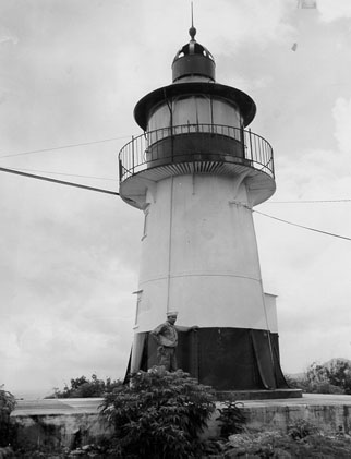
Hams Bluff Lighthouse
17° 46.2′ N · 64° 52.3′ W
A Danish cast-iron lighthouse (1915) on a 360-ft bluff at the island's northwest corner, reached by a short, steep forest trail with views over the Maroon hills, Hams Bay and the north shore.
Practical
Coordinate from Wikipedia/GeoHack (GoToStCroix gives 17.76917 N, 64.87139 W). Trail 1.6 miles round trip, 45 minutes to 1 hour, starting from parking at the National Guard facility (GoToStCroix). The old tower is abandoned; the working light (Fl(2) W every 30 seconds, 394 ft) is on a truss tower beside it. Coast Pilot: Hams Bluff is a conspicuous 100-ft cliff and the island's northwest extremity, the key landfall when coming from the west; the north-coast dangers are avoided by staying 1 mile or more off.
Best for
A short climb to a historic light