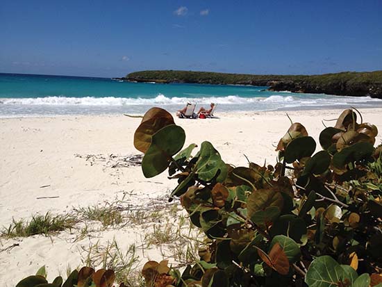
 Public domain, Wikimedia Commons (Susan Morse/USFWS)
Beach· Vieques· Virgin Islands (BVI, USVI and Spanish Virgins)
Red Beach (Playa Caracas)
18° 6.5′ N · 65° 24.8′ W
A white-sand cove on the refuge's south coast with clear water, tidal pools and a shallow reef for snorkeling, now reached by a paved road with gazebos and restrooms.
Practical
Coordinates from Wikipedia. Managed by the Vieques National Wildlife Refuge; the Tapón Trail (0.85 mile, moderate) runs from the Tapón Bay parking lot (18°06'38"N, 65°24'35"W) through mangroves to the beach, and a trail climbs the nearby hill for a view of the cove (USFWS, Wikipedia). By boat it is a daytime stop only, in settled weather; it lies within the 33 CFR 334.1480 south-coast restricted strip, so check current rules before anchoring. No drones, fires or camping in the refuge.
Best for
Snorkeling and picnics on the refuge's south shore
Nearby
- Playuela and Cerro Playuela trails0.6 NM away
- Puerto Ferro Anchorage (Vieques)0.7 NM away
- Puerto Ferro Lighthouse1 NM away
- Bahía de la Chiva Anchorage (Vieques)1.3 NM away
- Blue Beach (Bahía de la Chiva)1.5 NM away
- Vieques National Wildlife Refuge1.6 NM away
- Mosquito Bay Bioluminescent Bay1.9 NM away
- Playa Navío (Vieques)2 NM away