Pacific
Southern Gulf Islands & Sidney
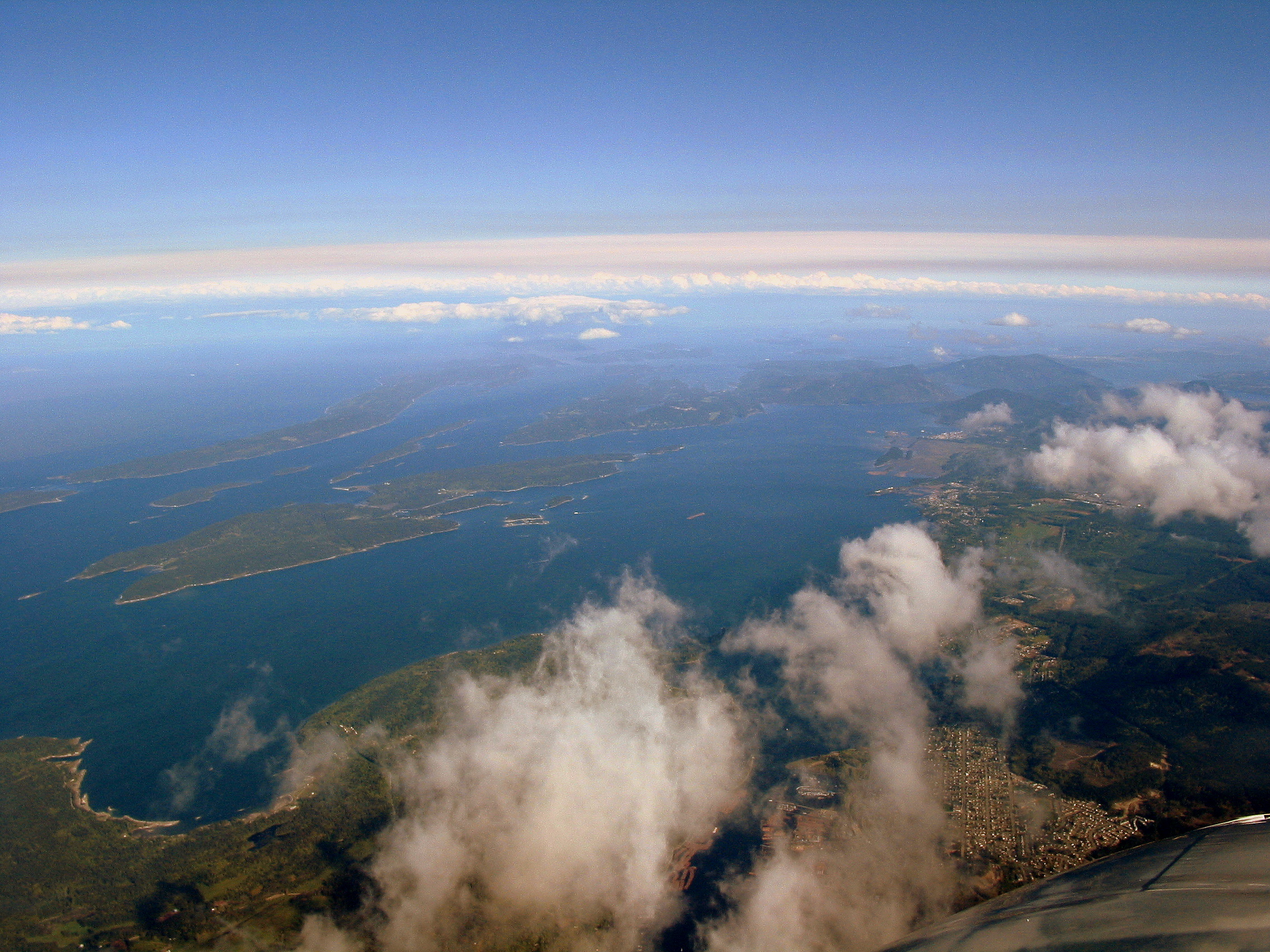
British Columbia's Gulf Islands, from the Sidney marinas past Pender, Saturna, Galiano and Salt Spring to Nanaimo. Marine parks with buoys and shell beaches, small harbour villages and a market in Ganges. Easy hops between islands, with whales offshore.
Best months
Difficulty
ModerateTidal passes, summer whale-protection zones and fog; hops are short and mostly sheltered.
Conditions
Summer is warm and dry with light winds, and fog is common in the morning. Active Pass and the narrows between islands run strong currents. Water is cold. In 2026 boats must stay 1,000 m from Southern Resident orcas, and seasonal vessel-restricted zones cover parts of Pender and Saturna.
Itineraries here
Area guide
Salish Sea — San Juans, Gulf Islands & Desolation Sound
United States · Canada
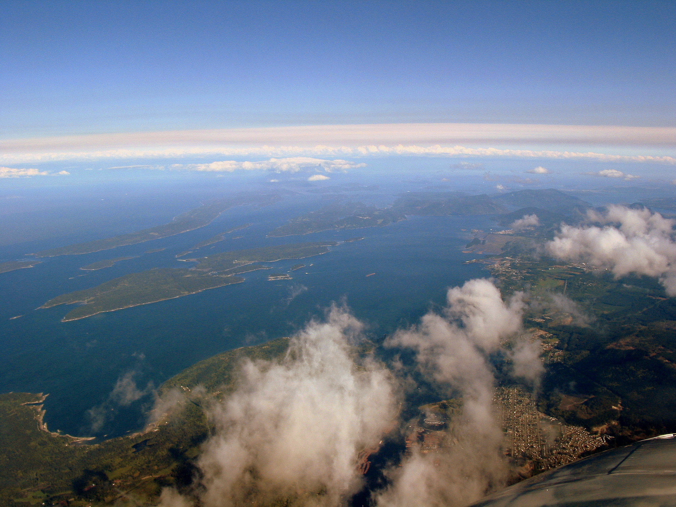
The Salish Sea is the sheltered inland sea shared by Washington and British Columbia, and three cruising grounds sit inside it. The San Juan Islands, on the US side, are a cluster of forested islands between Anacortes and Vancouver Island with a string of boat-only state parks (Sucia, Matia, Stuart, Jones, Patos) and lively harbour towns at Friday Harbor and Roche Harbor. A few miles across Haro Strait and Boundary Pass, the Canadian Gulf Islands (Pender, Saturna, Mayne, Galiano, Salt Spring, Thetis and their neighbours) run up the inside of Vancouver Island to Nanaimo, with farm-market villages, marine parks and the Gulf Islands National Park Reserve. About 100 nm further north, past the open Strait of Georgia, Desolation Sound and the Discovery Islands offer deep fjord-like inlets under the Coast Mountains, warm sheltered swimming water in high summer, and stern-tie anchorages such as Prideaux Haven. Day hops are short (5-20 nm), the summer weather is usually dry with moderate afternoon breezes, and there are marinas and fuel in every corner of the south. What makes it different from a tropical charter is the water itself: a tidal range of 2-5 m, currents of 6-10 kn in the narrow passes that must be timed for slack, cold sea water (around 10-13 °C outside the sheltered bays), floating logs and deadheads, summer and autumn fog, big-ship lanes and frequent ferries. Crossing between the US and Canada is easy but is a formal border crossing: you must report to customs each way, carry passports, and check that your charter company allows it. No licence is required by law for a bareboat charterer here; companies judge your experience instead, and they look hard for time in tidal waters.
Top of the list
- 1Sucia IslandHorseshoe of sculpted sandstone bays (Echo, Fossil, Shallow and Fox Cove) that is all state park, with buoys, floats and island-wide trails; the favourite stop in the San Juans.
- 2Prideaux Haven (Desolation Sound)A maze of rocky coves (Melanie Cove, Laura Cove) inside Desolation Sound Marine Park under the peaks of the Coast Mountains; stern-tie to shore, swim in warm water and paddle at dawn. Packed in August.
- 3Roche Harbor (San Juan Island)Historic lime-works resort with a big marina, a sculpture park and an evening flag-lowering ceremony in summer; also a US arrival point using the CBP ROAM app.
- 4Montague Harbour (Galiano)Well-sheltered harbour with BC Parks buoys and a dock, a white shell beach, a short walk round Gray Peninsula and famous sunsets over Trincomali Channel.
- 5Stuart Island (Reid Harbor & Prevost Harbor)Two long, quiet state-park harbours on the US-Canada line; walk the island road to Turn Point Lighthouse to watch ships and orcas in Haro Strait.
- 6Tod Inlet & Butchart Gardens (Saanich Inlet)Anchor in a narrow wooded inlet in Gowlland Tod Provincial Park and take the dinghy to the Butchart Gardens' small boat dock; an easy first or last night out of Sidney.
- 7Ganges (Salt Spring)The Gulf Islands' main village: marinas, galleries, good provisioning and the Saturday Market in the park by the harbour from spring to autumn.
- 8Pirates Cove (De Courcy)Tiny, almost landlocked marine-park anchorage with a tricky reef at the entrance (follow the range marks); trails around the point and a classic stop before Dodd Narrows.
- 9Friday Harbor (San Juan Island)The San Juans' only real town, with the Whale Museum, restaurants, ferries and a staffed US Customs office for in-person clearance; a big port marina.
- 10Tenedos Bay (Desolation Sound)Deep bay with stern-tie spots and a short trail to Unwin Lake, the best freshwater swim in Desolation Sound.
- 11Saysutshun / Newcastle Island (Nanaimo)Car-free provincial marine park across the harbour from Nanaimo, with a dock, buoys and an anchorage in Mark Bay; walk the island, then dinghy to town to provision.
- 12Victoria Inner Harbour (Vancouver Island)Moor in front of the Empress Hotel and the BC Legislature in the middle of the capital; busy with floatplanes and water taxis, so keep to the harbour's traffic lanes and speed limits.
When to go
The charter season runs from about May to late September, with some fleets operating in April and October. July and August are the peak: long dry days (16 hours of daylight around the June solstice), air temperatures in the low to mid 20s °C (70s °F) and usually light to moderate afternoon breezes. Late June and the first half of September are local favourites, with fewer boats and room at the docks and buoys; September brings more morning fog and cooler nights. Desolation Sound is at its best from early July to early September, when its sheltered bays warm up for swimming (often around 20 °C in late summer) and the stern-tie anchorages fill. May, June and late September are cheaper but bring more rain, more southerly fronts and cool nights; heaters on charter boats are worth asking about. October to April is the wet, stormy season: frequent southeasterly gales, short days, and some park floats and docks pulled out for the winter (Gulf Islands National Park Reserve removes the Sidney Spit and Princess Bay docks from October 1 to May 14). There is no fixed changeover day; most companies let you start on any day, with longer minimums in peak season.
Weather and hazards
SUMMER WINDS: Fair-weather summer days usually start calm, then a sea breeze fills in by early afternoon. In the Strait of Georgia and around the Gulf Islands it is mostly a northwesterly of 10-20 kn that eases at dusk; inside the islands and in Desolation Sound the wind is often light and fluky, so expect to motor some of the time. The Strait of Juan de Fuca is the big exception: cool ocean air is drawn up the strait toward the warm land, and on a hot afternoon the westerly can build to 20-30 kn by late afternoon and evening, spilling into Haro Strait, the southern San Juans and Admiralty Inlet. When that wind runs against an ebbing tide the seas become short, steep and dangerous for small boats. Plan crossings of the strait and of open stretches such as Haro Strait, Rosario Strait and the Strait of Georgia for the morning. In the Strait of Georgia watch also for 'Qualicum' winds, sudden strong southwesterly gusts that pour across from Vancouver Island near Qualicum Beach, usually in the evening behind a passing front. FRONTS AND GALES: From autumn to spring, Pacific lows send southeasterly gales up the straits ahead of each front, followed by a westerly or northwesterly shift. Gales and occasional storms are common from October to March and can arrive in May, June and late September too. In winter, cold Arctic outflow winds can blast down the mainland inlets. FOG: Expect fog most often from August to October, thickest in the early morning and in the Strait of Juan de Fuca, Haro Strait, Rosario Strait and the approaches to Bellingham; it usually burns off by late morning but can hang in all day. Use radar and AIS if fitted, make sound signals, stay out of the shipping lanes, and listen to the Vessel Traffic Service channel. LOGS AND DEADHEADS: Floating logs, whole trees and 'deadheads' (waterlogged logs floating almost vertically, showing only an inch or two) are a real hazard, especially after big spring tides, after storms and near river mouths such as the Fraser. Keep a bow lookout, avoid running at speed at dusk or in a chop, and check the propeller after any thump. Kelp beds mark rocks; give them room. TIDAL CURRENTS AND RIPS: See tides_and_currents. The narrow passes (Deception Pass, Dodd Narrows, Gabriola, Porlier and Active Passes) can run at 6-10 kn and must be taken near slack; tide rips form off headlands and over shoals such as Cattle Point, Turn Point, Point Wilson, Race Rocks and around Discovery Island. SHIPS AND FERRIES: Haro Strait, Boundary Pass and Rosario Strait carry deep-sea ships, tugs with long tows and tankers in traffic separation schemes; cross the lanes at right angles and never assume a ship can stop or turn. Washington State Ferries run all day through Thatcher Pass, Harney Channel and Wasp Passage, and BC Ferries use Active Pass, Swanson Channel and the Nanaimo approaches at speed; keep clear early and give them the channel. Floatplanes take off and land in Victoria, Nanaimo, Ganges and Friday Harbor harbours. MILITARY AREA: Area 'WG' (Whiskey Golf), a Canadian Forces test range in the Strait of Georgia off Nanaimo, is closed to boats when active (often on weekdays during the day); check the Coast Guard broadcast and notices, or ask the Coast Guard or Winchelsea range control on VHF, before taking the direct line north from Nanaimo. WHALES: Southern Resident killer whales are protected by law. In Washington, stay 1,000 yards away, slow to 7 kn or less within that distance, and put the engine in neutral if one comes within 400 yards (in force since January 1, 2025). In Canada, keep 1,000 m from Southern Residents; from June 1 to November 30, 2026, vessel-restricted zones off the southwest coast of South Pender Island and the southeast end of Saturna Island are closed to boats. READING THE FORECASTS: In Canada, use Environment Canada's marine forecast for the South Coast areas: Juan de Fuca Strait (east, central, west), Haro Strait, Strait of Georgia south of Nanaimo, Strait of Georgia north of Nanaimo, Howe Sound and Johnstone Strait. Forecasts are issued four times a day (around 4 am, 10:30 am, 4 pm and 9:30 pm Pacific time) and give wind in knots. Read the warning line first: a strong wind warning means 20-33 kn, a gale warning 34-47 kn and a storm warning 48-63 kn. Then check the lightstation and buoy reports (for example Kelp Reefs, Race Rocks, Sisters Island) to see what is actually blowing. On the US side, the National Weather Service in Seattle forecasts by marine zone: PZZ133 (Northern Inland Waters including the San Juan Islands), PZZ132 (East Entrance of the Strait of Juan de Fuca), PZZ131 (Central Strait of Juan de Fuca), PZZ134 (Admiralty Inlet) and PZZ135 (Puget Sound and Hood Canal). A Small Craft Advisory on the inland waters means sustained winds of roughly 21-33 kn; a Gale Warning means 34-47 kn. The NWS Area Forecast Discussion explains the timing of fronts and westerly surges. Phone weather apps often underplay the afternoon westerly in the Strait of Juan de Fuca and local gap winds, so use them alongside the official forecasts.
Hurricane season
None. Tropical cyclones do not reach the Salish Sea. The storm season is autumn and winter (roughly October to March), when deep Pacific lows bring southeasterly gales, heavy rain and sometimes storm-force winds; the remains of western Pacific typhoons occasionally strengthen these autumn storms. Gales can still occur in spring and early autumn, so watch the forecasts at the edges of the charter season.
Entry and clearance
The border runs down Haro Strait and Boundary Pass, a few miles from most San Juan and Gulf Island anchorages, and every crossing is a formal entry. INTO CANADA: You must report to the Canada Border Services Agency (CBSA) without delay if you land, anchor, moor, or come alongside another boat in Canadian waters; simply passing through without stopping needs no report. Go straight to a designated marine reporting site, without stopping anywhere first. Only the skipper may step ashore; everyone else stays aboard until cleared. At a telephone reporting site, call the CBSA Telephone Reporting Centre (1-888-226-7277, 24 hours) and give each person's full name, date of birth, citizenship, ID and purpose and length of stay, and declare goods; you get a report number to keep, and officers may come to inspect. Reporting sites commonly used by charter boats include Bedwell Harbour on South Pender Island (next to Poets Cove Resort; seasonal, traditionally about May to September), the marinas of Sidney and North Saanich (Port Sidney, Van Isle Marina and Canoe Cove), Victoria (the Inner Harbour and Oak Bay Marina) and Nanaimo (Nanaimo Boat Basin). Sites, seasons and hours change, so check the CBSA directory before you go. Pre-arrival: if everyone aboard holds NEXUS, the skipper calls the NEXUS marine line (1-866-996-3987) between 30 minutes and four hours before arrival; the old CANPASS Private Boats programme has been closed to new and renewing members since 2018, so NEXUS is now the only pre-clearance option. Fines for failing to report start at C$1,000 and the boat can be seized. INTO THE US: US Customs and Border Protection (CBP) asks boaters to report with the free CBP ROAM app: set up traveller profiles and the trip before you leave, start the arrival report once in US waters, and an officer may video-call you before approving the entry or directing you to a port. Roche Harbor's customs float is no longer staffed and uses ROAM (with iPads in the booth); in-person clearance is at Friday Harbor, Anacortes and Point Roberts (and Port Angeles). A 2023 report gave summer in-person hours of 8 am to 8 pm (mid-May to mid-September) and 8 am to 5 pm otherwise; confirm current hours with CBP. CBP also lists a Puget Sound phone-in arrival line, 1-800-562-5943, used mainly by boats whose whole crew holds NEXUS or another trusted-traveller card. DOCUMENTS: Everyone needs a passport. US and Canadian citizens may instead use a NEXUS card, a US passport card or an enhanced driver's licence. Visitors from other countries need whatever they would need to fly in; note that the US Visa Waiver Program (ESTA) is generally not valid for arrival on a private boat, so overseas visitors planning to enter the US by boat from Canada should check with CBP and may need a B-2 visitor visa. Anyone with a criminal record (including old impaired-driving convictions) may be refused entry to Canada. FOOD, ALCOHOL, CANNABIS, FIREARMS: Both countries restrict fresh meat, poultry, eggs, some fruit and vegetables, plants and firewood, and the rules change with animal-disease outbreaks; carry little fresh food across and restock after clearing. Visitors of legal age (19 in BC) may bring into Canada duty-free about 1.5 L of wine, or 1.14 L of spirits, or 8.5 L of beer; declare anything more. Cannabis is legal in both Washington and BC but it is a serious crime to carry it across the border in either direction, including CBD and THC products; get rid of it before you cross. All firearms and weapons must be declared to CBSA; handguns and many other guns are prohibited, pepper spray is prohibited unless it is labelled for use on animals, and charter companies generally do not allow firearms aboard. CHARTER RULES: Many charter companies limit or condition border crossings: they may require advance notice and a passport list for the whole crew, restrict which boats or which clients may cross, or keep you on their side of the border. Get the company's crossing policy in writing before you book.
Permits and fees
US USER FEE DECAL: Private boats 30 ft or longer arriving in the US must carry a current CBP user fee decal, bought online through CBP's DTOPS system and valid for the calendar year. The fee was $36.94 for fiscal year 2026 and rises to $38.04 for purchases from October 1, 2026. Charter boats that cross normally already have one; confirm the decal is current before you head for Canada, because ROAM set-up asks for it. WASHINGTON STATE PARKS: The boat-in marine parks (Sucia, Matia, Patos, Stuart, Jones, James, Turn and others) charge for docks, floats and buoys from 1 pm to 8 am, year-round: $1 per foot of boat length at docks ($23 minimum) and $23 per night on a buoy. Pay at the park's self-registration station (some buoys can be paid by phone, for up to three nights). An annual moorage permit ($7 per foot, $80 minimum in 2026) covers park docks and buoys for the year; charter boats occasionally carry one, so ask. Anchoring in the parks is free. GULF ISLANDS NATIONAL PARK RESERVE: No entry fee for boaters, but buoys at Sidney Spit, Beaumont (South Pender), Cabbage Island and D'Arcy Island cost C$24 per night after 3 pm, and the Sidney Spit dock costs C$1.50 per foot per night after 3 pm. Pay at the red self-registration vaults ashore; one boat per buoy, no rafting, quiet hours 10 pm to 8 am. Camping at Beaumont and Cabbage Island is closed, and Sidney Island has a land closure from October 15, 2026 to February 14, 2027 (the offshore buoys stay open). BC PARKS: Anchoring in provincial marine parks such as Desolation Sound, the Copeland Islands, Pirates Cove and Wallace Island is free. Where BC Parks has buoys or docks (for example Montague Harbour and Saysutshun/Newcastle Island) the regulation allows C$9-14 per night per buoy and C$2 per metre for docks. Since May 15, 2026, visitors who do not live in BC pay an extra C$20 per vessel on top for BC Parks buoys and docks. MARINAS: Private and port marinas charge by the foot per night (more in July and August) plus power; book ahead for Friday Harbor, Roche Harbor, Ganges and Victoria in summer. BOATER CARDS FOR CHARTERERS: A bareboat charterer does not need to hold a Washington Boater Education Card or a Canadian Pleasure Craft Operator Card (PCOC) before arriving. In Washington the card is required only to run a boat with a 15 hp or larger engine, and renters are covered by completing the charter company's safety checklist and carrying the temporary card it issues; non-residents boating in Washington for less than 60 days are also exempt. In Canada, anyone running a Canadian-registered rented or chartered boat with an engine needs proof of competency, which can be a PCOC, the charter company's completed rental-boat safety checklist, or an operator card that meets the rules of your home state or country. A non-resident running a boat registered outside Canada (for example a US charter boat) for less than 45 consecutive days in Canada is outside the Canadian rule. In practice the companies cover this at check-out, but some prefer a PCOC (available online for a small fee) or a state card, so ask. What companies actually decide on is your sailing resume: recent skipper time on a similar-size boat, ideally in tidal waters, often backed by an ASA 104 / US Sailing Bareboat Cruising, ICC or RYA certificate, and a check-out sail. If your experience falls short they will require instruction or a hired skipper.
Tides and currents
Tides are mixed: two highs and two lows a day of very different heights. The range is about 2-3 m (7-10 ft) at springs around Victoria and the southern San Juans, rising to 4-5 m (13-16 ft) in the Strait of Georgia, Nanaimo and Desolation Sound. In summer the lowest tides of the month fall in the daytime, so check depth under the keel at anchor and leave plenty of slack in stern lines to shore. The tide drives strong currents through the channels between the islands. Key narrows to time for slack, with typical peak spring speeds: Deception Pass (between Whidbey and Fidalgo islands, about 6-8 kn), Dodd Narrows south of Nanaimo (up to about 8-9 kn, with a slack of only about 20 minutes), Porlier Pass (up to about 10 kn on the flood), Gabriola Passage (around 8 kn) and Active Pass (strong current plus ferries). In the San Juans, currents of 2-5 kn run in San Juan Channel (Cattle Pass at its south end), Spieden Channel, Mosquito Pass, Pole Pass, Obstruction Pass and Rosario Strait, with rips off the points. North of Desolation Sound, the Yuculta and Dent Rapids and Seymour Narrows (up to about 16 kn) are serious tidal gates beyond the usual charter loop. Slack water in a pass does not come at high or low tide, and the times are different at each pass, so use current predictions, not tide times. Predictions: NOAA Tides & Currents (tidesandcurrents.noaa.gov) for US stations such as Deception Pass, Rosario Strait and San Juan Channel; the Canadian Hydrographic Service (tides.gc.ca) for Canadian reference stations including Active Pass, Porlier Pass, Gabriola Passage, Dodd Narrows and Seymour Narrows. The annual booklet 'Ports and Passes' gathers both countries' predictions for the whole area in one place.
Money
US dollars (USD) in Washington and Canadian dollars (CAD) in British Columbia. Cards (Visa, Mastercard; Amex less often) and tap payment are taken almost everywhere, including marinas, fuel docks and island stores; carry a little cash in each currency for park self-registration envelopes, farm stands and small markets. US cash is sometimes accepted in BC tourist spots but at a poor rate. BC prices exclude sales taxes (GST and, on many items, PST), which are added at the till; Washington adds sales tax too.
Radio and phones
DISTRESS: VHF channel 16 (DSC on 70) is watched by the US Coast Guard (Sector Puget Sound, part of what has been called the Northwest District since 2025) and by the Canadian Coast Guard's MCTS Victoria; rescues are coordinated from Seattle and from JRCC Victoria (1-800-567-5111, or #727 from a mobile in BC). The US Coast Guard's working channel is 22A; tell the radio to use US channel mode in US waters and Canadian mode in Canada, because some channel numbers differ. VESSEL TRAFFIC SERVICE: Ships are managed by a joint US-Canada traffic service. Seattle Traffic uses channel 5A for the Strait of Juan de Fuca, Rosario Strait and waters north of Everett, and 14 for Puget Sound south of Everett. Victoria Traffic uses channel 11 for Haro Strait, Boundary Pass and the southern Strait of Georgia; Vancouver Traffic uses 12 for the Vancouver harbour approaches, and the northern Strait of Georgia sector has used 71 (confirm in the Coast Guard's Radio Aids to Marine Navigation). Small pleasure boats do not have to report, but listen on the local channel when crossing the shipping lanes, especially in fog. WEATHER BY RADIO: In US waters, NOAA Weather Radio broadcasts continuously on the WX channels. In BC, the Canadian Coast Guard's Continuous Marine Broadcast carries Environment Canada forecasts, warnings and lightstation reports on the weather channels and on 21B at some sites. Environment Canada's separate Weatheradio service has been shut down, so rely on the Coast Guard broadcast. MARINAS AND PHONES: Many marinas on both sides work on VHF 66A, but channels vary, so check the cruising guide. Mobile coverage is good around the San Juans, Gulf Islands, Victoria and Nanaimo, but patchy in the inner arms of Desolation Sound. Check your plan's roaming between the two countries; a satellite messenger is a good backup in the north.
Charter bases
- Anacortes MarinaFidalgo Bay, Anacortes, Washington (2415 T Avenue); about 1.5 hours by car or airport shuttle from Seattle-Tacoma airport (SEA)Anacortes Yacht Charters (sail, power and catamarans; skippered and instruction too)
- Skyline Marina (Flounder Bay)West Anacortes, Fidalgo Island, Washington, close to Burrows Bay and Rosario StraitABC Yacht Charters (long-established sail and power fleet; its website did not respond in October 2026, so confirm it is still operating)
- Squalicum HarborBellingham, Washington (2615 South Harbor Loop); 10 minutes from Bellingham airport (BLI), about 1 hour from Vancouver and 1.5 hours from SeattleSan Juan Sailing (sail; bareboat, skippered and flotillas), San Juan Yachting (its power-boat sister company), NW Explorations (power yachts and flotillas only)
- Deep Cove MarinaNorth Saanich, near Sidney on the Saanich Peninsula; about 15 minutes from Victoria airport (YYJ) and the Swartz Bay ferry terminalIsland Cruising (sail and power; office in Sidney)
- Sidney waterfrontSidney, Saanich Peninsula, Vancouver Island; near Port Sidney Marina and the Sidney customs reporting sites; 10 minutes from Victoria airport (YYJ)Seaport Yacht Charters (sail and power, 36-54 ft; marina not stated on its website), Big Blue Sailing at Canoe Cove Marina (skippered charters and training, not bareboat)
- Stones MarinaNanaimo, Vancouver Island (1690 Stewart Avenue), opposite Saysutshun/Newcastle Island; close to the Departure Bay ferry and Nanaimo airport (YCD)Nanaimo Yacht Charters & Sailing School (sail and power, 30-60 ft)
- Comox HarbourComox, Vancouver Island; about 20-25 nm across the Strait of Georgia from Lund and Desolation Sound; 10 minutes from Comox Valley airport (YQQ)Desolation Sound Yacht Charters (sail and power), Island Cruising (Comox base at Comox Bay Marina)
Getting there
- Seattle-Tacoma International — SEAThe main international gateway for the San Juans. About 1.5 hours to Anacortes and 1.5-2 hours to Bellingham by car, longer in Seattle traffic; scheduled airport shuttle buses also run north. Kenmore Air seaplanes fly from Lake Union to the San Juans and Victoria year-round, and its land planes fly from Boeing Field to Friday Harbor and Eastsound (Orcas).
- Bellingham International — BLISmall airport 10 minutes from Squalicum Harbor and about 45 minutes from Anacortes, with limited US domestic flights. Many Canadians fly from here; Vancouver (YVR) is about 1.5 hours away by road with the border crossing.
- Vancouver International — YVRThe main BC gateway. BC Ferries from Tsawwassen (about 30 minutes south) reach Swartz Bay next to Sidney (1.5 hours) and Duke Point near Nanaimo; from Horseshoe Bay, ferries go to Nanaimo's Departure Bay. Harbour Air floatplanes fly from Vancouver Harbour and the YVR South Terminal to Victoria, Nanaimo, Salt Spring (Ganges), Comox, Powell River and Campbell River; Comox also has short connecting flights from YVR.
- Victoria International — YYJOn the Saanich Peninsula, 10-15 minutes from the Sidney and North Saanich charter marinas. Flights from Vancouver, Seattle and across Canada. Harbour Air and Kenmore Air floatplanes also land in Victoria's Inner Harbour.
- Comox Valley — YQQTen minutes from the Comox charter bases for Desolation Sound; flights from Vancouver, Calgary and Edmonton.
- Nanaimo — YCDSmall airport south of Nanaimo with flights from Vancouver and other Canadian cities; Harbour Air also flies into Nanaimo Harbour.
Charts and guides
- NOAA electronic charts (ENCs) for the San Juans, Rosario Strait, Haro Strait and the Strait of Juan de Fuca; NOAA ended its traditional paper and raster charts around January 2025, and paper backups are now NOAA Custom Charts printed from ENC data by certified vendors
- Canadian Hydrographic Service charts, including the Gulf Islands small-craft chart book (chart 3313), the Jervis Inlet and Desolation Sound chart book (chart 3312) and the Haro Strait, Boundary Pass and Gulf Islands sheets; check current editions
- Waggoner Cruising Guide (updated every year) — Puget Sound, the San Juans, the Gulf Islands, Desolation Sound and beyond, with marina details and customs advice
- Dreamspeaker Cruising Guides by Anne and Laurence Yeadon-Jones — volumes for the Gulf Islands and Vancouver Island, Desolation Sound and the Discovery Islands, and the San Juan Islands
- Don Douglass and Réanne Hemingway-Douglass, Exploring the San Juan and Gulf Islands (Fine Edge)
- Ports and Passes — annual tide and current tables covering Washington and BC waters
- US Coast Pilot 7 (NOAA) and the CHS Sailing Directions PAC 200 and PAC 201 (Juan de Fuca Strait and Strait of Georgia)
- Environment Canada marine forecasts (weather.gc.ca/marine) and NWS Seattle marine zone forecasts (weather.gov/sew)
- CBP ROAM app (US arrivals) and the CBSA marine reporting pages (Canadian arrivals)
Sample routes
- 7-day San Juan Islands loop from AnacortesDay 1 · Anacortes Marina → Spencer Spit (Lopez) · 12 nmOut through Guemes Channel, across Rosario Strait and Thatcher Pass to a state-park spit with buoys and a lagoon walk.Day 2 · Spencer Spit (Lopez) → Friday Harbor (San Juan Island) · 10 nmUp Upright Channel and across San Juan Channel; the Whale Museum and town restaurants.Day 3 · Friday Harbor (San Juan Island) → Roche Harbor (San Juan Island) · 12 nmNorth up San Juan Channel and through Spieden Channel; sculpture park and the evening flag ceremony.Day 4 · Roche Harbor (San Juan Island) → Reid Harbor (Stuart Island) · 6 nmShort hop, then the walk to Turn Point Lighthouse to look over Haro Strait and Boundary Pass.Day 5 · Reid Harbor (Stuart Island) → Sucia Island · 12 nmThrough Johns Pass and along the north shore of Waldron and Orcas; Fossil Bay or Echo Bay and the island trails.Day 6 · Sucia Island → Rosario Resort (Orcas) · 12 nmRound Point Thompson and down East Sound; the Moran mansion and the trails of Moran State Park.Day 7 · Rosario Resort (Orcas) → Anacortes Marina · 16 nmThrough Obstruction Pass at a fair current, back across Rosario Strait before the afternoon breeze builds.
- 7-day Gulf Islands loop from SidneyDay 1 · Sidney → Princess Bay (Portland Island) · 6 nmEasy start in the national park reserve; walk the island trails and look across to Salt Spring.Day 2 · Princess Bay (Portland Island) → Ganges (Salt Spring) · 12 nmThrough Captain Passage; galleries, bakeries and, on Saturdays, the market by the harbour.Day 3 · Ganges (Salt Spring) → Montague Harbour (Galiano) · 10 nmAcross Trincomali Channel to the marine-park buoys; Shell Beach and the sunset.Day 4 · Montague Harbour (Galiano) → Pirates Cove (De Courcy) · 18 nmUp Trincomali Channel past Wallace Island; enter Pirates Cove on the range marks and stern-tie or anchor.Day 5 · Pirates Cove (De Courcy) → Saysutshun / Newcastle Island (Nanaimo) · 8 nmDodd Narrows at slack, then Nanaimo harbour; walk Newcastle Island and provision in town.Day 6 · Saysutshun / Newcastle Island (Nanaimo) → Telegraph Harbour (Thetis) · 14 nmBack through Dodd Narrows at slack and down Stuart Channel to a sheltered harbour between Thetis and Penelakut islands, with a marina and pub.Day 7 · Telegraph Harbour (Thetis) → Sidney · 26 nmThe long day: back through the islands by Houstoun Passage and Trincomali Channel, or down Stuart Channel and Sansum Narrows, with a lunch stop on the way; refuel in Sidney.
- 7-day Desolation Sound loop from ComoxDay 1 · Comox Harbour → Copeland Islands Marine Park · 24 nmEarly crossing of the Strait of Georgia past Savary Island and Lund; anchor among the small Copeland islets.Day 2 · Copeland Islands Marine Park → Prideaux Haven (Desolation Sound) · 15 nmRound Sarah Point into Desolation Sound; stern-tie in Melanie or Laura Cove and swim.Day 3 · Prideaux Haven (Desolation Sound) → Tenedos Bay (Desolation Sound) · 5 nmShort day: hike to Unwin Lake for a freshwater swim.Day 4 · Tenedos Bay (Desolation Sound) → Teakerne Arm (West Redonda) · 12 nmFuel and groceries at Refuge Cove on the way; anchor near the waterfall that drops from Cassel Lake.Day 5 · Teakerne Arm (West Redonda) → Squirrel Cove (Cortes) · 7 nmA big sheltered anchorage; the general store and the reversing tidal rapids into the inner lagoon.Day 6 · Squirrel Cove (Cortes) → Lund (Malaspina Peninsula) · 14 nmBack past Sarah Point to the boardwalk village at the end of the road; a harbour berth, or anchor off Savary Island's beaches.Day 7 · Lund (Malaspina Peninsula) → Comox Harbour · 22 nmEarly start across the Strait of Georgia; enter Comox Harbour around Goose Spit, keeping to the channel.
Places in Salish Sea — San Juans, Gulf Islands & Desolation Sound
- Active Cove (Patos Island)Anchorage · Patos
- Anacortes Ferry Terminal, Ship Harbor (Fidalgo Island)Service · Fidalgo (Anacortes)
- Anacortes Groceries (Anacortes)Stores · Fidalgo (Anacortes)
- Anacortes US Customs Office (Anacortes)Permit · Fidalgo (Anacortes)
- Beaumont Buoys (South Pender)Anchorage · North & South Pender
- Bedwell Harbour Customs Dock (South Pender)Permit · North & South Pender
- Bellingham Bay Anchorage (Bellingham)Anchorage · Bellingham (mainland)
- Bellingham Groceries near Squalicum Harbor (Bellingham)Stores · Bellingham (mainland)
- Bennett Bay (Mayne Island)Anchorage · Mayne
- Black Lake (Roscoe Bay)Hike · West Redonda
- Blakely Island Marina and Store (Blakely Island)Marina · Blakely
- Blind Bay and Blind Island (Shaw Island)Anchorage · Shaw
- Bluffs Park and Bellhouse Park (Active Pass)View · Galiano
- Bodega Ridge (Galiano Island)Hike · Galiano
- Bowman Bay and Sharpe Cove (Fidalgo Island)Anchorage · Fidalgo (Anacortes)
- Brown's Bay Marina (Discovery Passage)Marina · Quadra (Heriot Bay)
- Burrows Bay (Fidalgo Island)Anchorage · Fidalgo (Anacortes)
- Cabbage Island Buoys (Reef Harbour)Anchorage · Saturna
- Campbell Bay (Mayne Island)Anchorage · Mayne
- Canoe Cove Marina (North Saanich)Marina · Saanich Peninsula (Sidney)
- Cap Sante Marina (Anacortes)Marina · Fidalgo (Anacortes)
- Cap Sante Park Viewpoint (Anacortes)View · Fidalgo (Anacortes)
- Cassel Lake (Teakerne Arm)Hike · West Redonda
- Chuckanut Bay (Bellingham)Anchorage · Bellingham (mainland)
- Clam Bay (Thetis and Penelakut)Anchorage · Thetis
- Clark Island Marine State Park (Clark Island)Anchorage · Clark
- Comox Valley Harbour Authority Marina (Comox)Marina · Powell River & Comox (mainland and Vancouver Island)
- Conover Cove (Wallace Island)Anchorage · Wallace
- Copeland Islands Marine ParkAnchorage · Copeland Islands
- Cornet Bay (Whidbey Island)Marina · Whidbey (Deception Pass)
- Cortes Bay (Cortes Island)Anchorage · Cortes
- Curme Islands (Desolation Sound)Watersport · Desolation Sound Marine Park
- Cypress Head (Cypress Island)Anchorage · Cypress
- D'Arcy Island (Haro Strait)Anchorage · D'Arcy
- Deception Pass Bridge (Deception Pass)Landmark · Whidbey (Deception Pass)
- Deer Harbor Anchorage (Orcas Island)Anchorage · Orcas
- Deer Harbor Marina (Orcas Island)Marina · Orcas
- Degnen Bay (Gabriola Island)Anchorage · Gabriola
- Departure Bay (Nanaimo)Anchorage · Nanaimo & Newcastle Island
- Desolation Bluffs and Sarah PointView · Malaspina Peninsula (Lund)
- Desolation Sound Marine Park Rules and Camping FeesPermit · Desolation Sound Marine Park
- Desolation Sound Yacht Charters (Comox)Service · Powell River & Comox (mainland and Vancouver Island)
- Dinghy Dock Pub (Protection Island)Bar · Nanaimo & Newcastle Island
- Dionisio Point and Coon Bay (Galiano Island)Anchorage · Galiano
- Discovery Harbour Marina (Campbell River)Marina · Quadra (Heriot Bay)
- Drew Harbour Anchorage (Rebecca Spit, Quadra Island)Anchorage · Quadra (Heriot Bay)
- Driftwood Centre (North Pender)Stores · North & South Pender
- Drumbeg Provincial Park (Gabriola Island)Beach · Gabriola
- Eagle Harbor (Cypress Island)Anchorage · Cypress
- East Point (Saturna Island)Wildlife · Saturna
- Eastsound and Fishing Bay Anchorage (Orcas Island)Anchorage · Orcas
- Eastsound Groceries (Orcas Island)Stores · Orcas
- Echo Bay (Sucia Island)Anchorage · Sucia
- Fairhaven and Bellingham Cruise Terminal (Bellingham)Landmark · Bellingham (mainland)
- Feather Cove (Gifford Peninsula)Anchorage · Desolation Sound Marine Park
- Fernwood Dock (Salt Spring Island)Marina · Salt Spring (north)
- Fisherman Bay (Lopez Island)Anchorage · Lopez
- Fisherman's Wharf (Victoria)Eat · Victoria (Vancouver Island)
- Fossil Bay (Sucia Island)Anchorage · Sucia
- Friday Harbor Anchorage (San Juan Island)Anchorage · San Juan
- Friday Harbor Groceries (San Juan Island)Stores · San Juan
- Friday Harbor US Customs Dock (San Juan Island)Permit · San Juan
- Fulford Harbour (Salt Spring Island)Anchorage · Salt Spring (south)
- G.B. Church Wreck (Portland Island)Dive · Portland
- Gabriola Farmers Market (Gabriola Island)Event · Gabriola
- Galley Bay (Desolation Sound)Anchorage · Desolation Sound Marine Park
- Ganges Harbour Anchorage (Salt Spring Island)Anchorage · Salt Spring (south)
- Ganges Marina and Salt Spring Marina (Ganges)Marina · Salt Spring (south)
- Garrison Bay and English Camp (San Juan Island)Anchorage · San Juan
- Glenthorne Passage (Prevost Island)Anchorage · Salt Spring (south)
- Gooseberry Point, Hale Passage (Lummi Peninsula)Service · Lummi
- Gorge Harbour Anchorage (Cortes Island)Anchorage · Cortes
- Gorge Harbour Marina Resort (Cortes Island)Marina · Cortes
- Grace Harbour (Desolation Sound Marine Park)Anchorage · Desolation Sound Marine Park
- Guemes Island Ferry Landing (Anacortes)Service · Guemes
- Guemes Mountain Trail (Guemes Island)Hike · Guemes
- Hague Lake Beach (Cortes Island)Beach · Cortes
- Heriot Bay Inn and Marina (Quadra Island)Marina · Quadra (Heriot Bay)
- Heriot Bay Store (Quadra Island)Stores · Quadra (Heriot Bay)
- Hope Bay Public Wharf (North Pender)Marina · North & South Pender
- Hope Island Marine State Park (Skagit Bay)Anchorage · Whidbey (Deception Pass)
- Hunter Bay (Lopez Island)Anchorage · Lopez
- Iceberg Point (Lopez Island)Hike · Lopez
- Isabel Bay (Lancelot Inlet)Anchorage · Desolation Sound Marine Park
- Islands Marine Center (Lopez Island)Service · Lopez
- James Bay (Prevost Island)Anchorage · Salt Spring (south)
- James Island Marine State Park (James Island)Anchorage · James
- Jones Island Marine State Park (Jones Island)Anchorage · Jones
- Kanaka Visitors Wharf (Ganges, Salt Spring Island)Marina · Salt Spring (south)
- Kendrick Island Anchorage (Gabriola Passage)Anchorage · Gabriola
- Kiket Bay (Skagit Bay)Anchorage · Fidalgo (Anacortes)
- La Conner Marina, Swinomish Channel (La Conner)Marina · Fidalgo (Anacortes)
- Ladysmith Harbour Marinas (Ladysmith)Marina · Nanaimo & Newcastle Island
- Laura Cove (Prideaux Haven)Anchorage · Desolation Sound Marine Park
- Lime Kiln Point State Park (San Juan Island)View · San Juan
- Lopez Islander Resort Marina (Lopez Island)Marina · Lopez
- Lopez Village Market (Lopez Island)Stores · Lopez
- Lummi Island DNR Recreation Site (Lummi Island)Beach · Lummi
- Lummi Island Ferry and Islander Store (Lummi Island)Stores · Lummi
- Lund Harbour (Malaspina Peninsula)Marina · Malaspina Peninsula (Lund)
- Lyall Harbour (Saturna Island)Anchorage · Saturna
- Mackaye Harbor (Lopez Island)Anchorage · Lopez
- Malaspina Galleries (Gabriola Island)Landmark · Gabriola
- Mansons Landing (Cortes Island)Anchorage · Cortes
- Melanie Cove (Prideaux Haven)Anchorage · Desolation Sound Marine Park
- Miners Bay (Mayne Island)Marina · Mayne
- Montague Harbour Marina (Galiano Island)Marina · Galiano
- Montague Harbour Marine Park (Galiano Island)Anchorage · Galiano
- Mount Constitution, Moran State Park (Orcas Island)View · Orcas
- Mount Erie Viewpoint (Fidalgo Island)View · Fidalgo (Anacortes)
- Mount Galiano (Galiano Island)Hike · Galiano
- Mount Norman Trail (South Pender)Hike · North & South Pender
- Mount Parke (Mayne Island)Hike · Mayne
- Mount Warburton Pike (Saturna Island)View · Saturna
- Nanaimo Downtown Provisioning (Port Place)Stores · Nanaimo & Newcastle Island
- Nanaimo Port Authority Marina (Boat Basin)Marina · Nanaimo & Newcastle Island
- Nancy's Bakery (Lund)Eat · Malaspina Peninsula (Lund)
- Narvaez Bay (Saturna Island)Anchorage · Saturna
- Obstruction Pass State Park (Orcas Island)Anchorage · Orcas
- Okeover Harbour (Okeover Inlet)Marina · Malaspina Peninsula (Lund)
- Otter Bay Marina (North Pender)Marina · North & South Pender
- Parks Bay (Shaw Island)Anchorage · Shaw
- Patos Island Lighthouse Trail (Patos Island)Hike · Patos
- Pelican Beach and Eagle Cliff (Cypress Island)Anchorage · Cypress
- Pender Island Vessel Restricted Zone (Swanson Channel)Permit · North & South Pender
- Pendrell Sound (East Redonda Island)Anchorage · East Redonda
- Penelakut IslandPermit · Penelakut
- Pilot Bay (Gabriola Island)Anchorage · Gabriola
- Pirates Cove Marine Park (De Courcy Island)Anchorage · De Courcy
- Poets Cove Marina (Bedwell Harbour)Marina · North & South Pender
- Port Browning (North Pender)Anchorage · North & South Pender
- Port Browning Marina (North Pender)Marina · North & South Pender
- Port of Friday Harbor Marina (San Juan Island)Marina · San Juan
- Port Sidney Marina (Sidney)Marina · Saanich Peninsula (Sidney)
- Preedy Harbour (Thetis Island)Anchorage · Thetis
- Prevost Harbor (Stuart Island)Anchorage · Stuart
- Prideaux Haven (Desolation Sound Marine Park)Anchorage · Desolation Sound Marine Park
- Princess Bay (Portland Island)Anchorage · Portland
- Princess Cove (Wallace Island)Anchorage · Wallace
- Raymur Point Customs Dock (Victoria Harbour)Permit · Victoria (Vancouver Island)
- Rebecca Spit Marine Park (Quadra Island)Beach · Quadra (Heriot Bay)
- Refuge Cove General Store (West Redonda Island)Stores · West Redonda
- Refuge Cove Marina (West Redonda Island)Marina · West Redonda
- Reid Harbor (Stuart Island)Anchorage · Stuart
- Retreat Cove (Galiano Island)Anchorage · Galiano
- Roche Harbor Anchorage (San Juan Island)Anchorage · San Juan
- Roche Harbor Resort Marina (San Juan Island)Marina · San Juan
- Rolfe Cove (Matia Island)Anchorage · Matia
- Rosario Beach and Rosario Head (Fidalgo Island)Beach · Fidalgo (Anacortes)
- Rosario Harbor and Cascade Bay (Orcas Island)Marina · Orcas
- Roscoe Bay (West Redonda Island)Anchorage · West Redonda
- Royal Cove (Portland Island)Anchorage · Portland
- Russell Island (Fulford Harbour entrance)Anchorage · Salt Spring (south)
- Saddlebag Island Marine State Park (Padilla Bay)Anchorage · Saddlebag
- Salt Spring Saturday Market (Ganges)Event · Salt Spring (south)
- Saturna Lamb Barbecue (Winter Cove)Event · Saturna
- Saturna Point Store and Lighthouse Pub (Lyall Harbour)Bar · Saturna
- Saturna Vessel Restricted Zone (East Point)Permit · Saturna
- Savary Island (Keefer Bay)Beach · Savary
- Saysutshun Newcastle Island Marine Park (Mark Bay)Anchorage · Nanaimo & Newcastle Island
- Seafarers' Memorial Park Shore (Anacortes)Landmark · Fidalgo (Anacortes)
- Shallow Bay (Sucia Island)Anchorage · Sucia
- Sidney Spit (Sidney Island)Anchorage · Sidney Island
- Sidney Town Provisioning (Beacon Avenue)Stores · Saanich Peninsula (Sidney)
- Silva Bay (Gabriola Island)Marina · Gabriola
- Skagit Island Marine State Park (Skagit Bay)Anchorage · Whidbey (Deception Pass)
- Skyline Marina, Flounder Bay (Anacortes)Marina · Fidalgo (Anacortes)
- Snug Harbor Resort, Mitchell Bay (San Juan Island)Marina · San Juan
- Spencer Spit State Park (Lopez Island)Anchorage · Lopez
- Spieden Island (from the water)Wildlife · Spieden
- Squalicum Harbor (Bellingham)Marina · Bellingham (mainland)
- Squirrel Cove General Store (Cortes Island)Stores · Cortes
- Squirrel Cove Inner Anchorage (Cortes Island)Anchorage · Cortes
- Squirrel Cove Public Wharf (Cortes Island)Marina · Cortes
- Strawberry Bay (Cypress Island)Anchorage · Cypress
- Sturdies Bay (Galiano Island)Stores · Galiano
- Taylor Bay and Gabriola Sands (Gabriola Island)Beach · Gabriola
- Teakerne Arm and Cassel Lake Falls (West Redonda Island)Anchorage · West Redonda
- Telegraph Harbour (Thetis Island)Anchorage · Thetis
- Telegraph Harbour Marina (Thetis Island)Marina · Thetis
- Tenedos Bay (Desolation Sound Marine Park)Anchorage · Desolation Sound Marine Park
- The Laughing Oyster Restaurant (Okeover Inlet)Eat · Malaspina Peninsula (Lund)
- The Stock Pile Market (Lund)Stores · Malaspina Peninsula (Lund)
- The Whale Museum (Friday Harbor)Landmark · San Juan
- Theodosia Inlet (Lancelot Inlet)Anchorage · Malaspina Peninsula (Lund)
- Thetis Island Marina and PubBar · Thetis
- Transfer Beach Park (Ladysmith)Beach · Nanaimo & Newcastle Island
- Tribune Bay (Hornby Island)Beach · Powell River & Comox (mainland and Vancouver Island)
- Tumbo Island (Saturna)Landmark · Saturna
- Turn Island Marine State Park (San Juan Island)Anchorage · Turn Island
- Turn Point Lighthouse Hike (Stuart Island)Hike · Stuart
- Unwin Lake Trail (Tenedos Bay)Hike · Desolation Sound Marine Park
- Urban Pier (Sinclair Island)Anchorage · Sinclair
- Van Isle Marina (Tsehum Harbour, Sidney)Marina · Saanich Peninsula (Sidney)
- Vendovi Island Preserve (Vendovi Island)Hike · Vendovi
- Vesuvius Bay (Salt Spring Island)Beach · Salt Spring (north)
- Victoria Inner Harbour (GVHA Causeway and Wharf Street Marinas)Marina · Victoria (Vancouver Island)
- Von Donop Inlet (Hathayim Marine Park, Cortes Island)Anchorage · Cortes
- Wakes Cove (Valdes Island)Anchorage · Valdes
- Walsh Cove Provincial Park (West Redonda Island)Anchorage · West Redonda
- Washington Park (Anacortes)Hike · Fidalgo (Anacortes)
- Watmough Bay (Lopez Island)Anchorage · Lopez
- West Sound Marina (Orcas Island)Marina · Orcas
- Westcott Bay (San Juan Island)Anchorage · San Juan
- Westview Fuels (Powell River)Service · Powell River & Comox (mainland and Vancouver Island)
- Westview Harbour (Powell River)Marina · Powell River & Comox (mainland and Vancouver Island)
- Wildcat Cove, Larrabee State Park (Chuckanut)Beach · Bellingham (mainland)
- Winter Cove (Saturna Island)Anchorage · Saturna