 AI image
Bahamas
Exuma Cays
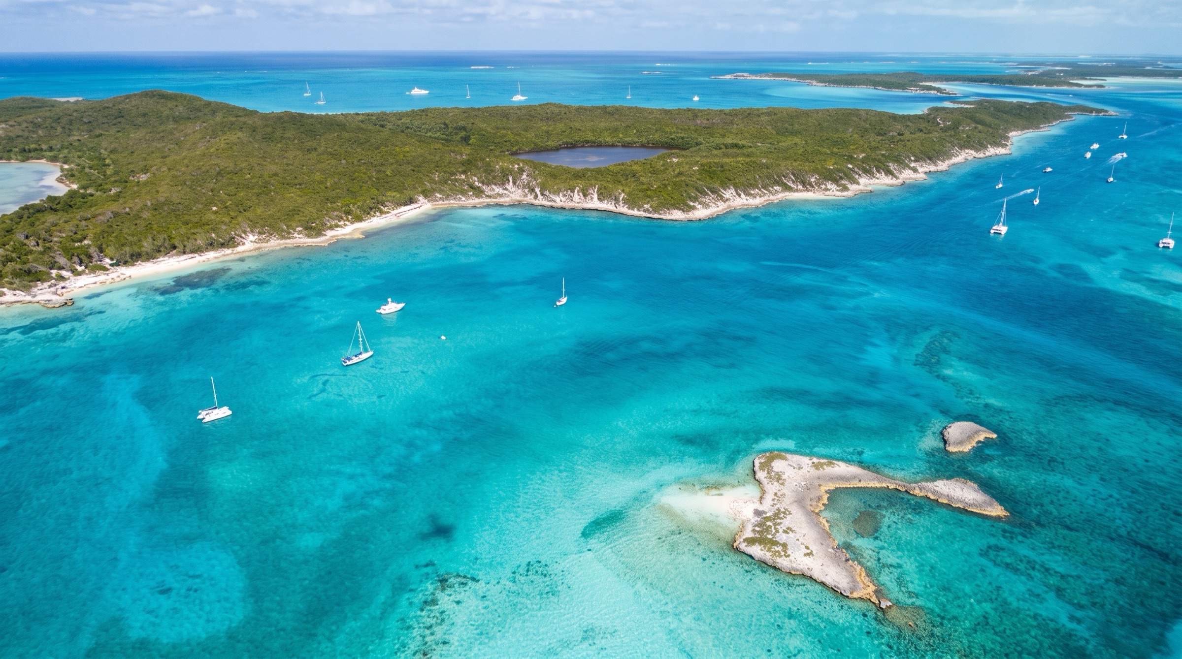
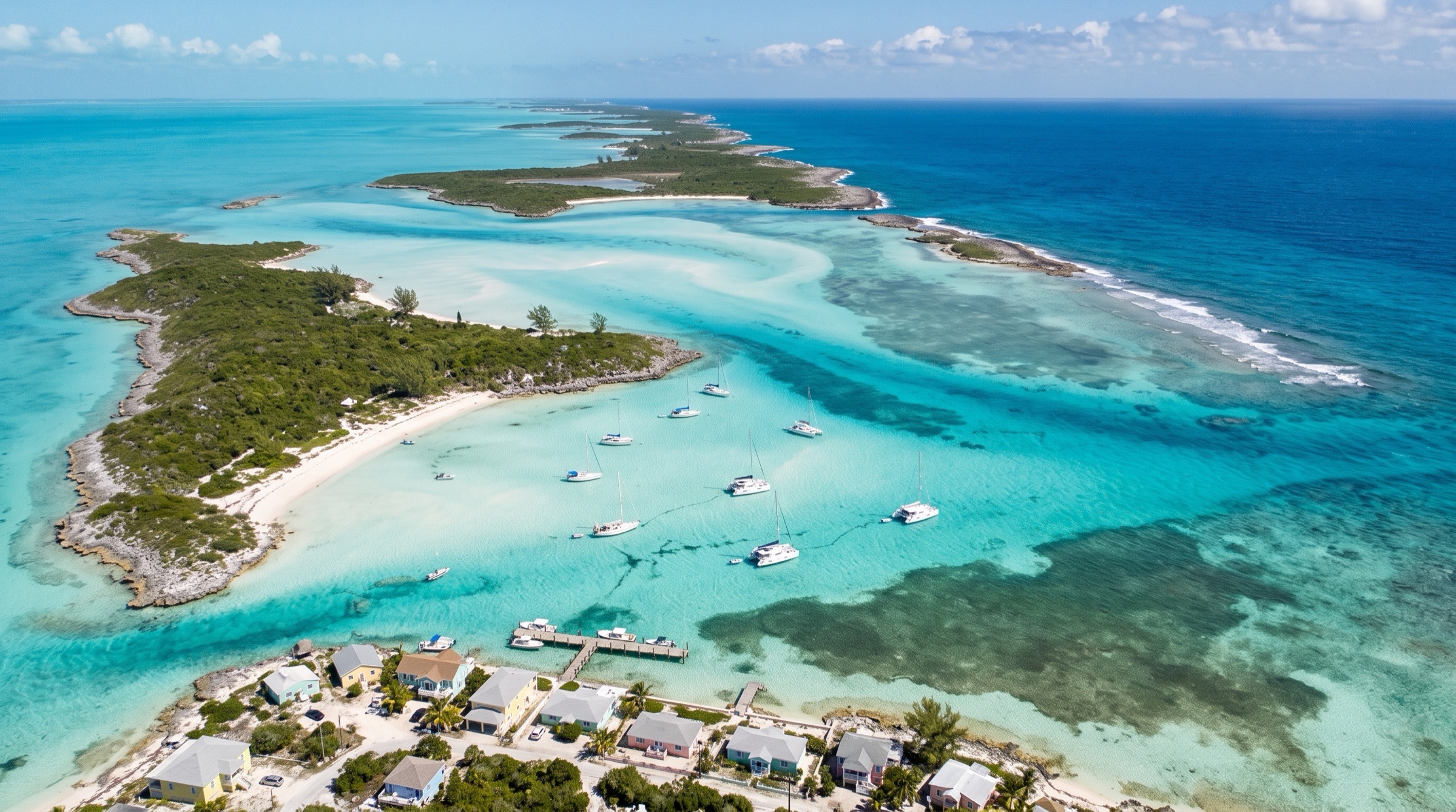
The Exuma Cays are a chain of low islands on the edge of the Great Bahama Bank, with water so clear that boats look suspended. The Exuma Cays Land and Sea Park protects reefs and a mooring field at Cambridge Cay, Staniel Cay has swimming pigs and Thunderball Grotto, and Highborough Cay is a quiet stop. Provisioning is limited, so plan ahead.
Best months
Difficulty
ModerateShallow banks, strong tidal cuts and weekly winter fronts require planning.
Conditions
Easterly trades of 10-20 knots. From December to March cold fronts every week or so swing the wind west and north at 20-30 knots, so pick anchorages for the shift. Banks side is shallow and calm; the Exuma Sound side is open. Cuts run strong tides, and shallow bank water needs good light.
Itineraries here
Area guide
Exuma Cays
Bahamas
The Exuma Cays: a chain of some 365 cays and sandbars running about 120 miles south-east from Ship Channel Cay to George Town, with the shallow Exuma Bank to the west and the deep Exuma Sound to the east. Most anchorages lie on the bank side in the lee of the trade winds; the cuts between the cays carry strong tidal current. The Exuma Cays Land and Sea Park is a no-take marine reserve.
When to go
December through April is the main season, with steady easterly trades. From December to March, cold fronts cross every week or so and the wind swings SE through S, W and NW to N, often 20-30 kt; choose an anchorage that is protected on the bank side for the shift. May and June are lighter and hot. July to October is hurricane season, with the peak from mid-August to mid-October; charter fleets thin out and many operators restrict summer bookings.
Weather and hazards
Cuts: the passages between the cays carry strong tidal current, and when wind or swell from the east opposes the ebb the seas stand up and break. Time every cut for slack or the flood, and do not use the ocean cuts in a strong easterly or a northerly swell. Banks navigation: the Exuma Bank is 6-15 ft with sand bores, grass and coral heads; read the water with the sun high and behind you, and expect to cross the bank between the cays at near-high tide if you draw over 4 ft. Exuma Sound, east of the chain, is deep and exposed to the open Atlantic. Anchorages: holding in tidal cuts is poor and the current reverses, so set the hook twice and swing room is often tight; Warderick Wells and other park moorings fill up in season. Exuma Cays Land and Sea Park is a no-take marine reserve with mooring fees and rules (no fishing, no shell collecting).
Hurricane season
Atlantic hurricane season runs June 1 to November 30, peaking mid-August to mid-October. The Exumas have few secure hurricane holes; most charter operators close or restrict bookings in the autumn. Watch NHC daily and have a plan before departure.
Entry and clearance
Complete the Click2Clear online application before arrival and keep the confirmation number. Fly the yellow Q flag and go straight to a port of entry; only the captain goes ashore to clear. Charter boats leaving Nassau are normally cleared by the charter company before departure, so confirm with the base. Ports of entry in or near the Exumas include Nassau (Palm Cay and others), Highbourne Cay, Staniel Cay, Black Point and George Town. Ports and hours change often, so call ahead. Visitors normally receive a 90-day stamp. Check the Bahamas cruising permit, anchorage and fishing fees on Click2Clear before departure, since they were raised in July 2025.
Tides and currents
Semi-diurnal tides with a range of about 2.5-3.5 ft. Current runs hard through the cuts between the cays, often 3-5 kt, and the tide on the bank lags the tide in the Sound, so plan cut transits for slack or the flood. Many shallow bank routes and sandbars are crossed only near half tide or better.
Charter bases
- Nassau (Palm Cay Marina)Southeast New Providence, about 28 nm from Highbourne Cay and the top of the ExumasDream Yacht Charter (Palm Cay base for Exuma itineraries, opened 2018 with partner Navtours), Navigare Yachting (Palm Cay base; Bali, Lagoon and Fountaine Pajot catamarans, about 40-54 ft; 3-day minimum, no fixed changeover day), Sunsail (announced Exuma charters out of Nassau in 2019 with Lagoon 424 and 454W catamarans; confirm the base is still operating)
Getting there
- Lynden Pindling International Airport (Nassau) — NASThe gateway for every Nassau-based Exuma charter; Palm Cay Marina is a short taxi ride. Direct flights from Miami, Fort Lauderdale and other US cities.
- Exuma International Airport (George Town) — GGTGreat Exuma; the southern end of the chain, and the usual airport for one-way charters finishing at George Town.
- Staniel Cay Airport — TYMSmall airstrip in the middle of the Exuma Cays, next to Staniel Cay Yacht Club; light aircraft and charter flights from Nassau.
- Black Point Airport — BPIGreat Guana Cay (Exuma); small-plane service from Nassau.
Charts and guides
- Explorer Chartbook Exumas (and Near Bahamas for the run from Nassau)
- The Exuma Guide (Stephen Pavlidis) / Waterway Guide Bahamas
- Navionics and Garmin ActiveCaptain community data
- Exuma Cays Land and Sea Park pages at bnt.bs for park rules and moorings
Places in Exuma Cays
- 5 Fs Festival and Farmer's Cay RegattaEvent
- Adderly CutLandmark
- Adler Beach, Hawksbill CayBeach
- Allan's Cay Anchorage (inside the lagoon)Anchorage
- Allen's Cay Rock Iguana Population (Southwest Allen's Cay)Wildlife
- Amberjack ReefDive
- Angelfish Blue HoleDive
- Austin Smith WreckDive
- Bahamas anchorage fee — separate chargePermit
- Bahamas Cruising Permit — 2026 fee schedulePermit
- Bahamas Sport Fishing PermitPermit
- Bahamian Hutia Colony, Warderick WellsWildlife
- Bahamian Music and Heritage Festival, George TownEvent
- Bahamian public holidays affecting a March tripEvent
- Banshee Creek Trail, Warderick WellsHike
- Barraterre SettlementStores
- Bell Island West BeachBeach
- Big D's Conch Spot, SteventonEat
- Big Majors Spot AnchorageAnchorage
- Bitter Guana Cay Iguana BeachWildlife
- Black Point — free water, trash, showers and WiFiStores
- Black Point BlowholeHike
- Black Point Government Dock (water and trash)Stores
- Black Point Settlement AnchorageAnchorage
- Bonefish Creek, Compass CayFishing
- Bonefish guides — George Town and Great ExumaFishing
- Boo Boo HillView
- Boot Cay Anchorage, Norman's CayAnchorage
- Cambridge Cay Mooring Field (ECLSP South)Anchorage
- Camp Driftwood Lookout, Shroud CayView
- Cash, ATMs and banking in the ExumasService
- Cave Cay and Cave Cay CutAnchorage
- Chat N Chill Beach Bar and GrillBar
- Children's Bay CayAnchorage
- Cistern Cay AnchorageAnchorage
- Click2Clear customs and immigration procedurePermit
- Closed seasons and per-vessel bag limitsPermit
- Club Peace and PlentyBar
- Coco Palm Beach, Lee Stocking IslandBeach
- Compass Cay AnchorageAnchorage
- Compass Cay MarinaMarina
- Compass Cay Nurse SharksWildlife
- Conch Cay Cut — Elizabeth Harbour EntranceLandmark
- Connectivity — BTC, Aliv, eSIM, Starlink and WiFiService
- Crab Cay and the Walker RuinsHike
- Crescent Beach, Compass CayBeach
- Cruisers Beach, Big Major SpotBeach
- Dive ExumaDive
- Dive Exuma, George TownDive
- Dog Rocks / The CathedralDive
- Dotham CutLandmark
- Driftwood Beach / The Washing Machine, Shroud CayBeach
- East Beach, Highbourne CayBeach
- Eddie's Edgewater Restaurant and BarEat
- Emerald Sunset View Bar and Grill, Black PointBar
- Excursion operators — day tours for arriving guestsTour
- Exuma Bank vs Exuma Sound — timing the cutsSeasonal
- Exuma Cays Land & Sea Park Fee & Rules SummaryLandmark
- Exuma Cays Land & Sea Park Headquarters, Warderick WellsLandmark
- Exuma Cays Land and Sea Park — fees and mooringsPermit
- Exuma International Airport (GGT)Service
- Exuma Markets and the free water dockStores
- Exuma Markets, George TownStores
- Exuma Park rules — no-take, jet skis, pets, trashPermit
- Exuma Sound Trolling Between the CutsFishing
- Exuma Sound Trolling Grounds off Highbourne & Norman's CutsFishing
- Exuma Yacht Club and MarinaMarina
- Farmer's Cay 5 Fs Festival and other Exumas regattasEvent
- Farmer's Cay CutLandmark
- Farmer's Cay Yacht ClubMarina
- Forbes Hill BeachBeach
- Fowl Cay Anchorage (Exuma Park)Anchorage
- Fuel in the Exumas — the three-stop realityService
- Galliot CutLandmark
- George Town Clearance, Banking and Water TaxiService
- George Town Cruising RegattaEvent
- Hamburger BeachBeach
- Harvey's Cay LighthouseLandmark
- Hawksbill Cay North Anchorage & MooringsAnchorage
- Highbourne Cay MarinaMarina
- Highbourne Cay North AnchorageAnchorage
- Highbourne Cay StoreStores
- Highbourne Cay Watersports RentalsWatersport
- Highbourne Cay West AnchorageAnchorage
- Highbourne CutLandmark
- Honeymoon Beach, Stocking IslandBeach
- Hoopers Bay Provisioning ClusterStores
- Hoopers Bay Sea TurtlesWildlife
- Hurricane Holes 1, 2 and 3, Stocking IslandAnchorage
- Isles General Store, Staniel CayStores
- Jet ski, kayak, SUP and small-boat rentalWatersport
- Kidd Cove AnchorageAnchorage
- Kiteboarding and wing foiling — March conditionsWatersport
- Leaf Cay Iguana BeachWildlife
- Leaf Cay IguanasWildlife
- Lee Stocking Island Research StationAnchorage
- Little Bay, Great Guana CayAnchorage
- Little Farmer's Cay AnchorageAnchorage
- Little Farmer's Cay Anchorage (west side)Anchorage
- Little Farmer's Cay CutLandmark
- Little Farmer's Cay Sea TurtlesWildlife
- Long Cay AnchorageAnchorage
- Lorraine's Cafe, Black PointEat
- MacDuff's Anchorage, Norman's CayAnchorage
- MacDuff's Beach Bar & Restaurant, Norman's CayBar
- Mailboats, airports and crew changesService
- March climate — air, water, wind and rainSeasonal
- March cold fronts and the clocking wind patternSeasonal
- March crowding in Elizabeth HarbourSeasonal
- Marina at Emerald BayMarina
- Marine repair, haul-out and BASRA emergencyService
- Minns Water SportsWatersport
- Monument Beach AnchorageAnchorage
- Monument Hill, Stocking IslandView
- Moriah Harbour Cay National ParkPermit
- Musha CayAnchorage
- Mystery Cave, Stocking IslandDive
- National Family Island RegattaEvent
- Norman's Cay - Sunken Airplane AnchorageAnchorage
- Norman's Cay MarinaMarina
- Norman's Cay Sunken Plane Wreck (Curtiss C-46 Commando)Snorkel
- Norman's Pond CayAnchorage
- O'Brien's Cay Sunken Plane WreckDive
- Ocean Cabin (Terry Bain's)Bar
- Octopus Garden Reef, Highbourne CaySnorkel
- Offshore and deep-drop charters, George TownFishing
- Oven Rock AnchorageAnchorage
- Oven Rock Cave, Great Guana CayHike
- Oven Rock Gemstone Cave HikeHike
- Oyster Cay (West) AnchorageAnchorage
- Perry Peak, Lee Stocking IslandView
- Pig Beach (Big Major Spot)Wildlife
- Pink Pearl Supermarket, Staniel CayStores
- Pipe Cay DECCA Station RuinsHike
- Pipe Creek and its sandbarsTour
- Pirate's Lair / Hog Cay South Mooring Field, Warderick WellsAnchorage
- Pirates Lair Cave and TrailsHike
- Prime Island Meats and Deli, Hooper's BayStores
- Propane refills in the ExumasService
- Rachel's Bubble BathWatersport
- Rat Cay and Rat Cay CutAnchorage
- Red Shanks Anchorage and BNT Mooring FieldAnchorage
- Rockside Laundry, Black PointStores
- Rocky Dundas CavesSnorkel
- Rolle Town TombsLandmark
- Rudder Cut Cay Anchorage and Sea CavesAnchorage
- Russell Family Loyalist Ruins Trail, Hawksbill CayHike
- Saint Francis Resort and MarinaMarina
- Sampson Cay and Norman's Cay — what is NOT thereService
- Sampson Cay Outer Harbour AnchorageAnchorage
- Sanctuary Creek, Shroud CayWatersport
- Sand Dollar Beach Anchorage and Mooring FieldAnchorage
- Santana's Grill PitEat
- Scorpio's Bar and Restaurant, Black PointBar
- Scuba tank fills — only two in the chainDive
- Seabird Nesting Cays, Exuma Cays Land & Sea ParkWildlife
- Shark reefs and Exuma Sound wall divesDive
- Ship Channel Cay AnchorageAnchorage
- Ship Channel Cay Shark & Stingray EncounterWildlife
- Shirley's at the Fish FryEat
- Shoreline Restaurant and Exuma Point, RollevilleEat
- Shroud Cay Mangrove Nursery WildlifeWildlife
- Shroud Cay Mooring FieldAnchorage
- Shroud Cay North AnchorageAnchorage
- Shroud Cay north creek — the classic kayak and SUP runWatersport
- Skipjack Point Anchorage, Norman's CayAnchorage
- Southwest Allen's Cay Anchorage (outside)Anchorage
- Spearfishing rules — Hawaiian sling onlyPermit
- Sperm Whale Skeleton, Warderick WellsLandmark
- St. Luke's Clinic, Staniel CayService
- Staniel Cay Adventures — dive shop and chartersDive
- Staniel Cay LaundromatStores
- Staniel Cay Moorings (Solomon Robinson)Anchorage
- Staniel Cay village stores and propaneStores
- Staniel Cay Yacht Club Bar and RestaurantBar
- Staniel Cay Yacht Club MarinaMarina
- Stingrays at Chat N ChillWildlife
- Tackle, bait and marine suppliesFishing
- Taste and Sea Cafe, Staniel CayEat
- The Musician — Underwater Piano and MermaidSnorkel
- The Sea Aquarium (O'Brien's Cay)Snorkel
- The Shoe Tree and Sound-side BeachesBeach
- The Washing Machine (Highbourne Cay dive site)Dive
- Three Sisters Beach and RocksBeach
- Thunderball GrottoSnorkel
- Tropic Breeze Beach Bar and GrilleBar
- Tropic of Cancer BeachBeach
- Ty's Sunset Bar and Grill, Little Farmer's CayBar
- Volleyball Beach AnchorageAnchorage
- Warderick Wells Blowholes & Exuma Sound TrailHike
- Warderick Wells Coral Gardens & Park Snorkel SitesSnorkel
- Warderick Wells CutLandmark
- Warderick Wells Emerald Rock Mooring Field & AnchorageAnchorage
- Warderick Wells North Mooring FieldAnchorage
- Water, Ice & Fuel Reality Check - Northern ExumasStores
- Wax Cay Cut - Northern Boundary, Exuma Cays Land & Sea ParkLandmark
- Weather resources and cruisers' netsSeasonal
- What is in season in the Exumas in MARCHSeasonal
- White Point, Great Guana CayBeach
- Williams Town Salt BeaconLandmark
- Xuma Restaurant & Bar, Highbourne CayEat