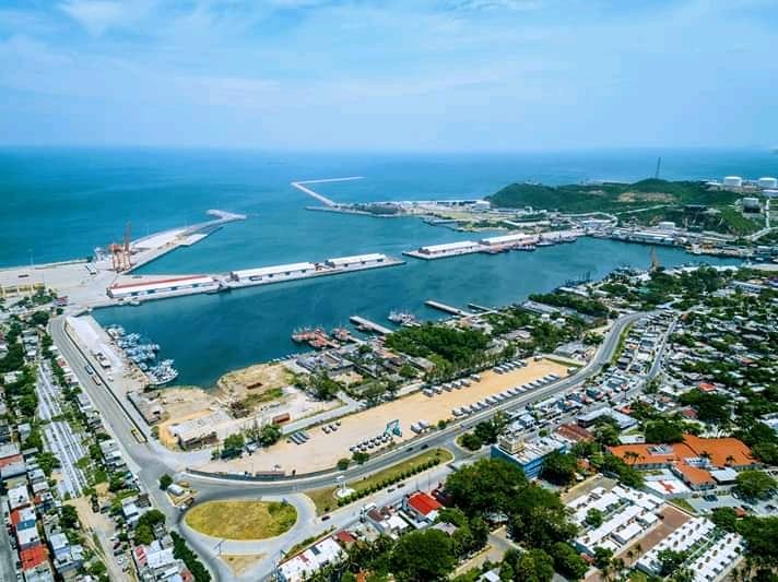
 CC0, Geografo01, Wikimedia Commons
Landmark· Gulf of Tehuantepec· Mexico
Salina Cruz
16° 11.0′ N · 95° 11.7′ W
Oaxaca's big commercial and oil port at the head of the Gulf of Tehuantepec, an artificial harbor built in 1907 for the trans-isthmus railway: a navigational landmark and emergency option, not a cruiser stop.
Practical
Coordinates from Wikipedia. The harbor is formed by two breakwaters with an entrance about 194 m (635 ft) wide. Entry requires Port Captain permission (Roads Less Traveled, 2012); Practical Sailor (2025) calls it not cruiser-friendly, with heavy tanker traffic nearby, so keep a sharp AIS and radar watch when passing. The Capitanía is near the port (OSM 16.1706, -95.1927).
Best for
A landmark and tanker hazard on the beach route
Nearby
- Bahía Chipehua Anchorage13.9 NM away
- Tehuantepecer Winds28.6 NM away
- Copalita Eco-Archaeological Park (Huatulco)55 NM away
- Bahía Conejos Anchorage (Huatulco)55.9 NM away
- Isla Montosa Dive Site (Bahía Conejos)57.1 NM away
- Bahía Tangolunda57.4 NM away
- Punta Arrocito Dive Site57.9 NM away
- Bahía Chahué Training and Night Dives58.9 NM away