 CC BY-SA 3.0, Yves Picq, Wikimedia Commons
Anchorage· Nuku Hiva· French Polynesia: Tuamotus, Marquesas, Gambier & Australs
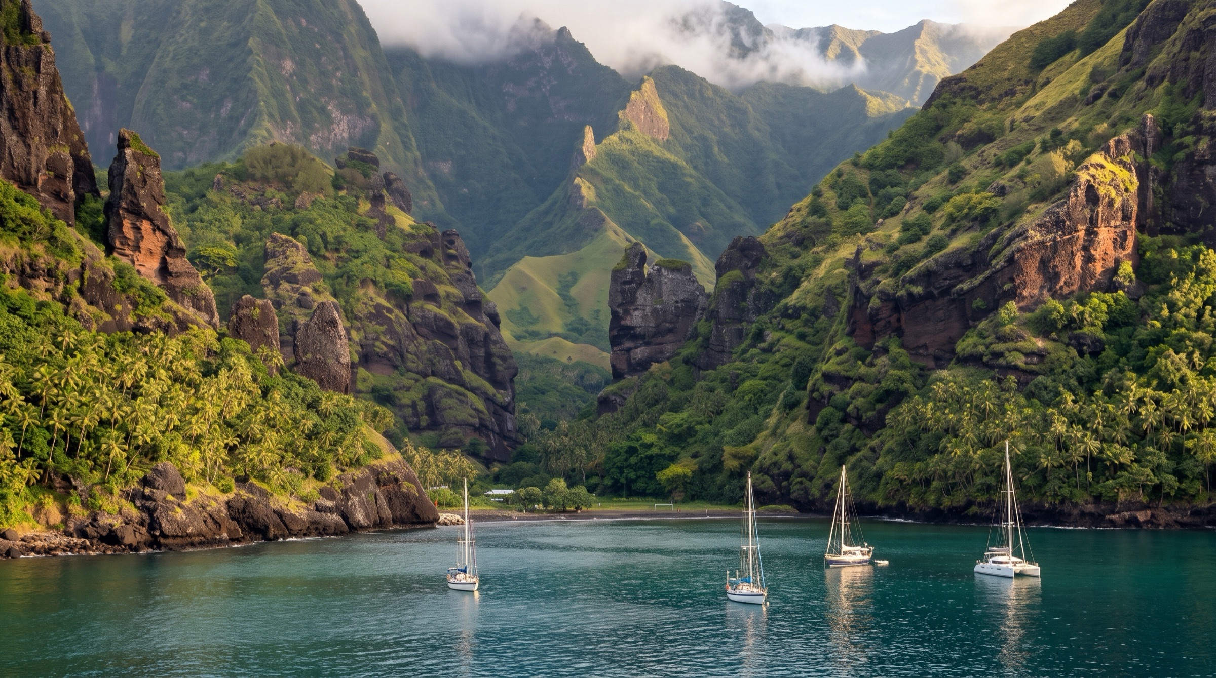
Hakatea Bay (Daniel's Bay, Nuku Hiva)
8° 56.7′ S · 140° 9.8′ W
A cliff-walled hidden bay an hour's sail west of Taiohae, entered through a narrow but deep gap; golden grass on dark ridges, mantas around the boat and the trailhead for the Vaipo waterfall. Many crews call it their favourite bay on Nuku Hiva.
Practical
Sugar Shack (Dec 2019) anchored at 08°56.71'S / 140°09.85'W in 9 m mud, good holding, and again at 08°56.72'S / 140°09.87'W in mud/sand; Taitonga (Dec 2018) at 08°56.66'S / 140°09.83'W in 7 m with 35 m chain. Nearer the beach is shallower. C-Map is accurate here. Much calmer than Taiohae, though swell reflects off the cliffs (2-3 on a 5-point roll scale) and winds swirl from all directions with gusts in the upper 20s; boats sometimes lie stern to stern. Visibility about 2 m in green water. Two local mooring buoys close to shore belong to residents. Leaving is a beat straight into wind and swell when it is SE. Land the dinghy on the beach (stern anchor or pull it up to the grass and tie to a tree: the tide floats dinghies off); at high tide you can drag over the sandbar into the river. Potable tap by the shack near the beach (ask the caretaker; NHYS confirmed drinkable, 2020); easiest to take the dinghy up the river at high tide. No phone signal, no rubbish disposal. Lots of flies on board and no-nos ashore. Official brief (2023): anchor in 4-8 m in the western part of Hakatea cove, land on the white-sand beach and walk 10-15 minutes to the hamlet (about 20 people); at high tide you can take the dinghy into the river to Hakaui. Sea-Seek (2024): keep 100-200 m off the cliffs to avoid backwash; the eastern cove (Uauka) is very open.
Best for
A calm, spectacular stop and the Vaipo waterfall hike
Season
Year-round; uncomfortable in strong S swell
Itineraries that stop here
Nearby
- Daniel's Bay East-Side SnorkelRight here
- Hakaui Valley Fruit TradingRight here
- Hakatea White-Sand Beach (Daniel's Bay)0.2 NM away
- Kua and Teiki's Garden Lunch (Hakaui)0.4 NM away
- Motu Mano Dive Site (Motumano Point)1.9 NM away
- Colette Bay Walk (Nuku Hiva)2.1 NM away
- Hakaui Valley and Vaipo Waterfall Hike (Nuku Hiva)2.3 NM away
- Motu Nui Dive Site (Taiohae)3.3 NM away