 CC BY-SA 4.0, Caalmali, Wikimedia Commons
Wildlife· Isla Natividad· Mexico
Isla Natividad
27° 52.5′ N · 115° 11.1′ W
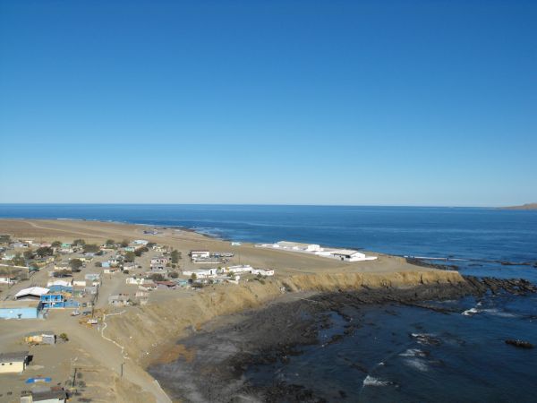
A low island off Punta Eugenia whose burrows hold one of the main breeding colonies of the black-vented shearwater, with an abalone-and-lobster fishing village at its south-east end.
Practical
Coordinate from Wikipedia. Village of about 380 people (2001) at the south-east end; goats, sheep, cats and dogs were removed in 1997-2001 to protect the shearwaters. The 4 nm gap between Natividad and Punta Eugenia (Canal de Dewey) is the usual route south - expect turbulent mixing currents there (The Log). No published yacht anchorage was found in our sources; treat any stop as day-only and ask the cooperative before landing.
Best for
Seabird watching while transiting the Eugenia channel
Nearby
- Punta Eugenia5.7 NM away
- Puerto Morro Redondo (El Morro Salt Port)9.3 NM away
- Isla Cedros South Bay Anchorage12.4 NM away
- Cedros IMSS Hospital13.1 NM away
- Cedros Village Harbor and Port Captain (Isla Cedros)13.1 NM away
- Cedros Village Provisions (La Popular)13.2 NM away
- Turtle Bay Village Tiendas19 NM away
- Bahía Tortugas (Turtle Bay) Anchorage19.1 NM away