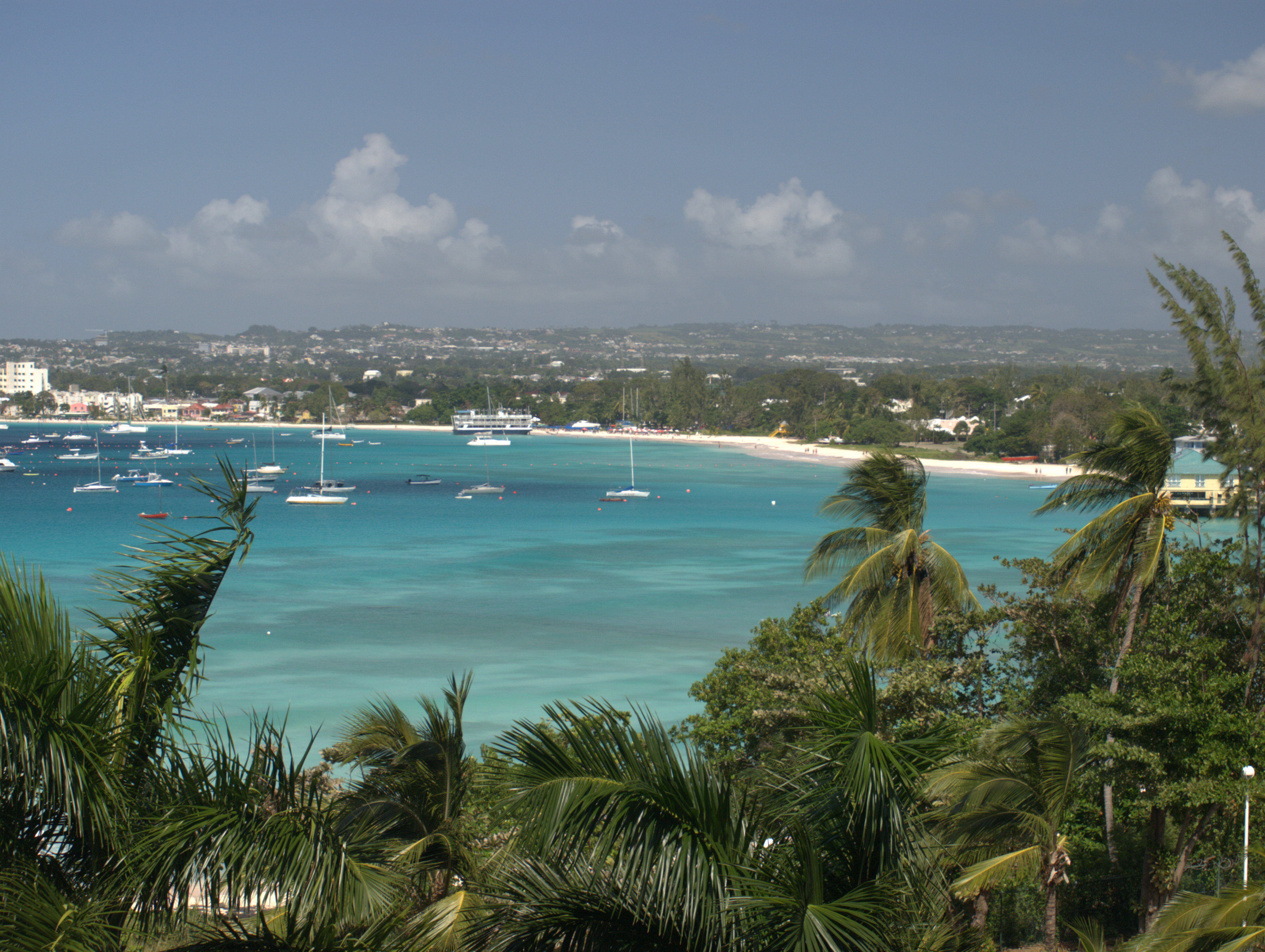
 CC0, Pontificalibus, Wikimedia Commons
Anchorage· Barbados· Windward Islands
Carlisle Bay Anchorage
13° 5.4′ N · 59° 36.8′ W
Barbados's main anchorage: a crescent of white sand at the edge of Bridgetown, where you drop the hook over turquoise water and sand, with turtles and six shallow wrecks of the marine park underneath. It is the classic first stop after an Atlantic crossing.
Practical
Position is Noonsite's anchorage waypoint (13°05.35'N, 59°36.83'W). Barbados Port Inc. asks foreign yachts to anchor in the area north of the Bandstand, near the Boatyard, and only after clearing in; in practice, cruisers report the Signal Station (VHF 12) has granted permission to anchor first and clear by dinghy the next morning. Sheltered from the east-north-east trades but open to the south-west and west, and Noonsite notes a rolling swell can come in even with no wind. The bay is crowded with private moorings (many unlit, so approach carefully at night) and busy with jet skis, tour boats and loud music from the beach bars, especially in high season. Dinghy landing: the Boatyard jetty (daytime fee redeemable at the bar, free after dusk, with toilets, showers and water), the beach (watch the surf), or into the Careenage under the first bridge and tie to the quay wall by the stainless steps (padlock dinghy and engine). Barbados Port Inc. lists a flat Carlisle Bay fee of BBD 110 for yachts under 50 m (verify locally). No fuel dock in the bay: jerry cans only (see the entries for fuel). Anchor in sand clear of the wrecks and reef in the marine park.
Best for
Big, easy landfall anchorage within walking distance of Bridgetown
Season
Year-round; rolly in winter north swells and with any southerly component
Nearby
- Atlantic Crossing Landfall Season (Dec-Jan)Right here
- Browne's Beach (Carlisle Bay)0.2 NM away
- Carlisle Bay Marine Park Wrecks0.2 NM away
- The Boatyard (Carlisle Bay)0.2 NM away
- Copacabana and Harbour Lights (Carlisle Bay Beach Bars)0.3 NM away
- Bridgetown Careenage (Constitution River)0.4 NM away
- Bridgetown Chandleries and Repair Yards0.4 NM away
- Bridgetown Supermarkets (Jordans and Massy Stores)0.4 NM away