 Photo: NASA · Public domain · Wikimedia Commons
Anchorage· Platte· Seychelles
Platte Island Approach (Northwest Reef Passages)
5° 51.4′ S · 55° 22.4′ E · approximate
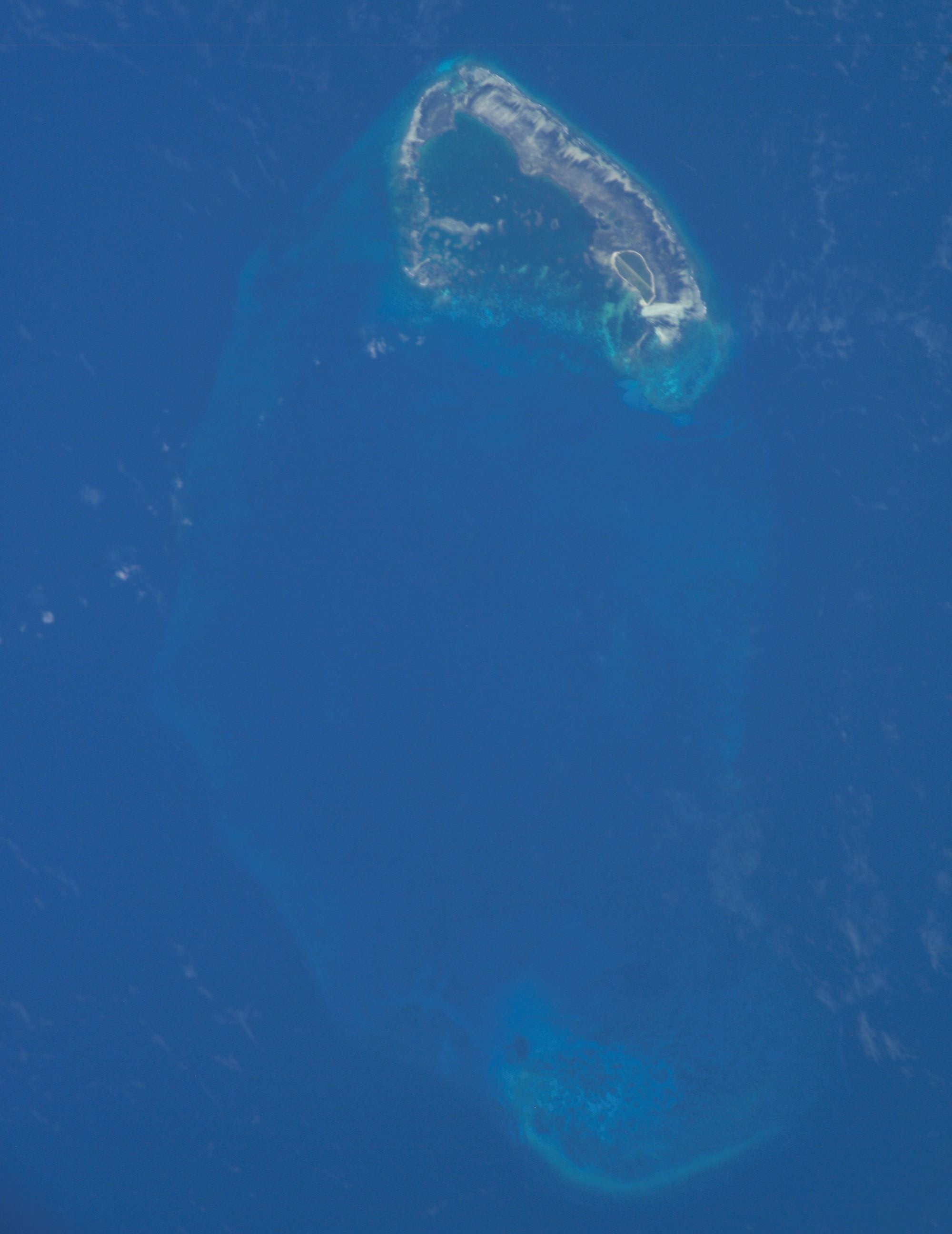
Ile Platte is a low wooded sand cay about 75 nm south of Victoria, inside a barrier reef that breaks heavily. The lagoon inside is smooth, and landing on the island is safe and easy.
Practical
Pub. 171 (2010) gives no anchorage: barrier reefs extend 3 nm N, about 0.5 nm E and 1.5 nm S of the island, numerous 2.7 m coral heads lie within 2 nm W, and two intricate passages through the reef on the NW side are for small vessels with local knowledge only. In 1864 the civil commissioner wrote that vessels of 500 tons could not approach nearer than 5 nm and that the island is almost inaccessible in the SE monsoon. La Perle Reef, with less than 4 m and observed breakers, lies about 10 nm SW. Landing needs IDC permission; the island is now mostly occupied by the Waldorf Astoria resort. Visible 10-12 nm. Coordinate is approximate: plotted off the NW side of the island outline in OpenStreetMap, where the passages are described. Do not use it as a waypoint without local pilotage.
Best for
Experienced, permitted crews with a local pilot only
Season
Calm transition months only; very difficult in the SE trades
Nearby
- Platte Island Hawksbill Nesting0.7 NM away
- Waldorf Astoria Seychelles Platte Island0.8 NM away
- Platte Island Flats Fly-Fishing1 NM away
- Platte Island NW-Monsoon Approach Window4.2 NM away
- Police Bay (No Swimming)63.9 NM away
- Intendance Rocks Dive64.4 NM away
- Anse Intendance (No Anchoring: Surf Beach)64.6 NM away
- Anse Intendance64.7 NM away
Place data includes © OpenStreetMap contributors (ODbL).