 CC BY-SA 4.0, Exec8, via Wikimedia Commons
Beach· Kalanggaman· Philippines
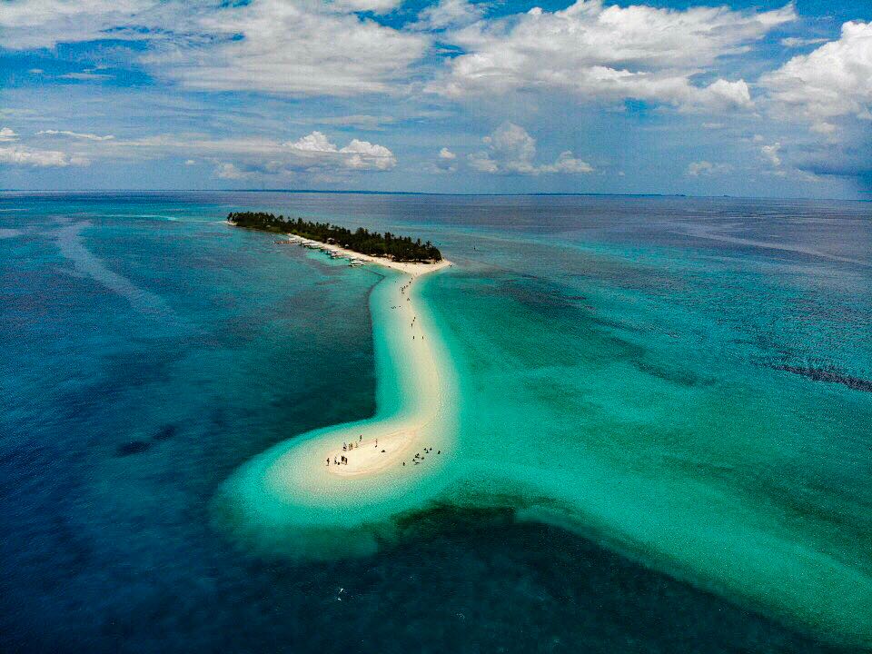
Kalanggaman Island
11° 6.9′ N · 124° 15.0′ E
A 750 m sliver of palm-covered island with long white sandbars streaming from both ends - a postcard stop in the open water between northern Cebu and Leyte, owned and run by the town of Palompon, Leyte.
Practical
Part of Leyte province (Palompon LGU), about 16 km from the Leyte mainland. Fees are set by Palompon and have risen sharply: Taack (Aug 2021) was asked 750 PHP to use a mooring and 500 PHP per person to land (dogs no longer permitted), up from 100 PHP per head six months earlier - verify locally. Use the moorings rather than anchoring on coral or seagrass. No electricity; cottages, restrooms and grills for day visitors. The DENR has raised concerns about visitor numbers. Typhoon Rai (2021) damaged island facilities. Sandbar shape changes with tide and season. Malapascua dive shops run day trips here.
Best for
A lunch-and-swim stop between Carmen or Malapascua and Leyte
Season
Calm weather; exposed to all directions
Nearby
- Kemod Shoal10.1 NM away
- Capitancillo Island11.4 NM away
- Monad Shoal Thresher Sharks12.4 NM away
- Malapascua Bounty Beach Anchorage14.7 NM away
- Maya Port (Malapascua Ferry)14.9 NM away
- Malapascua Beach Bars and Restaurants15 NM away
- The Craic House (Malapascua)15 NM away
- Bounty Beach (Malapascua)15.1 NM away