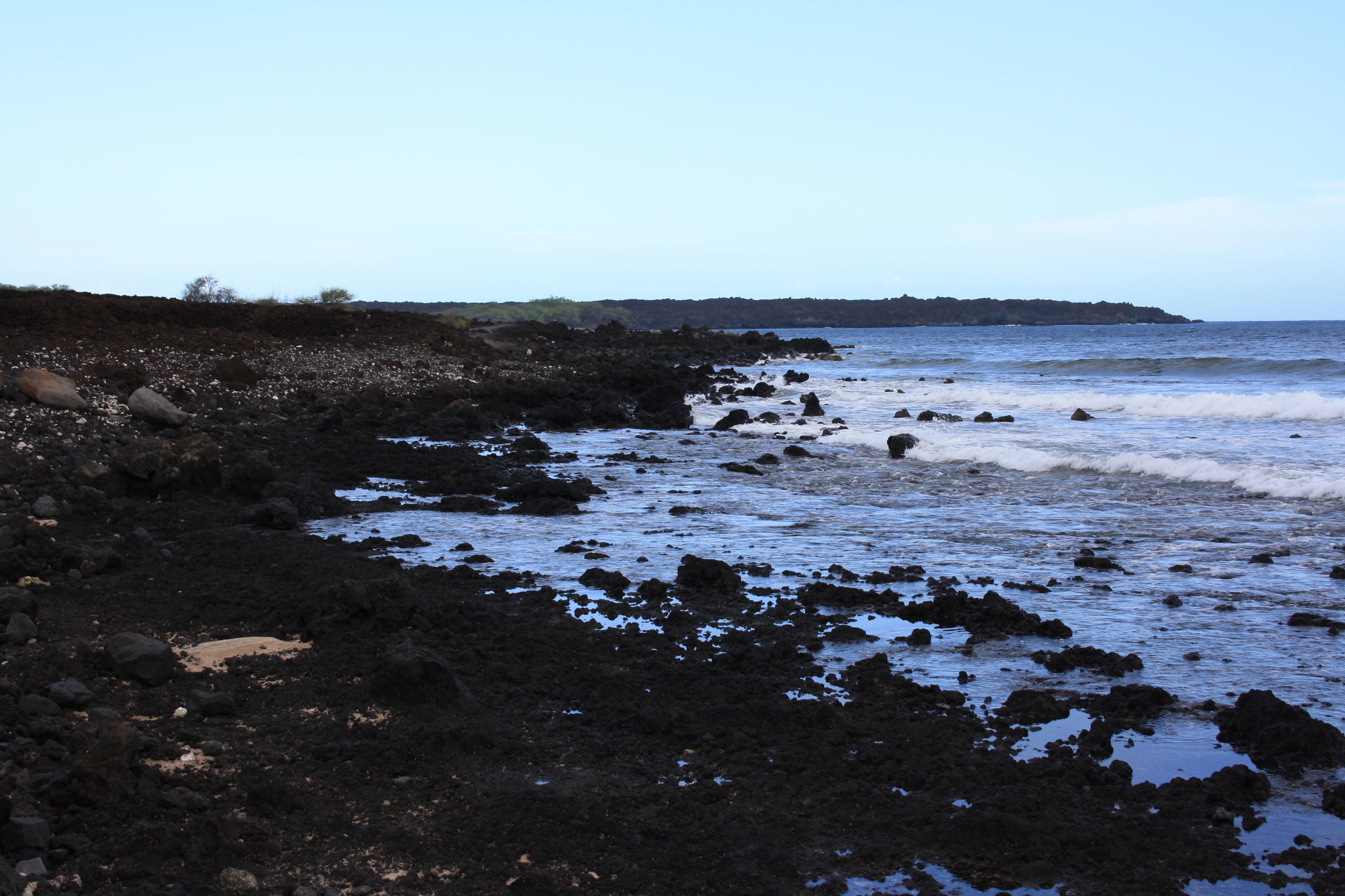
 CC BY-SA 3.0, Harrias, Wikimedia Commons
Anchorage· Maui· Hawaii
La Perouse Bay Anchorage
20° 35.7′ N · 156° 25.1′ W · approximate
A raw lava-ringed bay between Cape Kinau and Cape Hanamanioa at the end of the road, where La Perouse anchored in 1786; wind-swept but surprisingly comfortable in the trades, with spinner dolphins in the mornings and the King's Highway ashore.
Practical
Approx: plotted in the eastern half of the bay, inside the OpenStreetMap bay feature; Wikipedia gives the bay at 20.5983, -156.42. The bay is about 0.7 mile wide and indents 0.5 mile; a rock covered 10 ft lies in the middle of the entrance and a rocky outcrop on the northwest side (Coast Pilot, which advises strangers to exercise extreme caution). Sea-Seek: bottom sand, wind swept but pretty comfortable; boats may not anchor in the western half of the bay, which lies within the Ahihi-Kinau NAR (motorized vessels prohibited). Approach well offshore: give Cape Kinau about 1 mile berth (a 4.5 ft rock lies 400 yards off its north end). Hanamanioa Point Light (20°35'00"N 156°24'43"W) marks the southeast side. Strong gusts often blow across the bay in the afternoon. Spinner dolphins: stay 50 yards away and do not swim with them. No services; the nearest fuel and water are at Maalaea. Departure point for the Alenuihaha crossing to the Big Island.
Best for
A remote lava anchorage and Big Island jumping-off point
Season
Trade-wind season; exposed to south swell and kona winds
Nearby
- La Perouse Bay Spinner Dolphins0.1 NM away
- Hoapili Trail (King's Highway)0.3 NM away
- Hanamanioa Point Light0.8 NM away
- Ahihi-Kinau Natural Area Reserve1.2 NM away
- Big Beach (Makena State Park)2.7 NM away
- Puu Olai Cinder Cone Hike3 NM away
- Puu Olai Reef Dive (Makena)3.3 NM away
- Maluaka Beach (Turtle Town)3.4 NM away