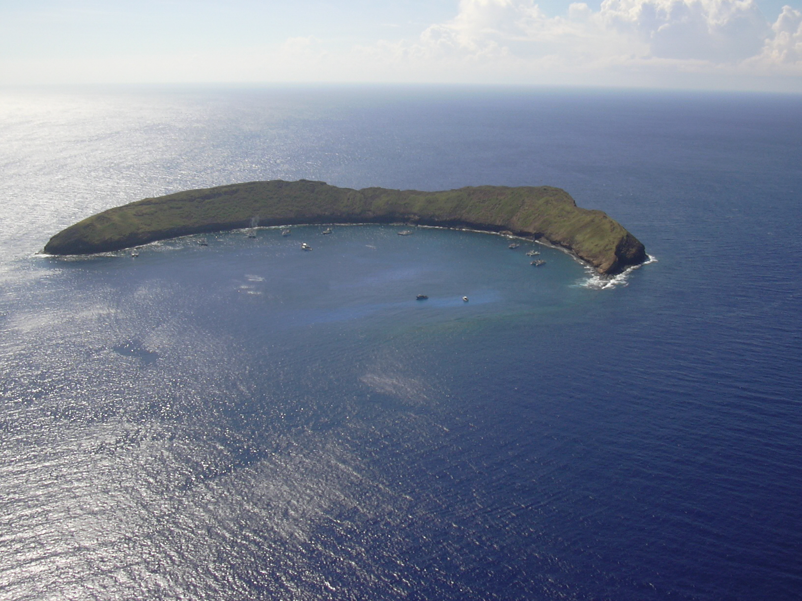
 CC BY 3.0, Forest and Kim Starr, Wikimedia Commons
Snorkel· Molokini· Hawaii
Molokini Crater Marine Life Conservation District
20° 37.9′ N · 156° 29.8′ W
A drowned crescent of volcanic crater rising in mid-Alalakeiki Channel, its cove sloping from shallow reef to about 100 feet before dropping away; about 250 fish species, 38 hard corals and water clarity that regularly runs 100-150 feet. It is the most famous snorkel in Hawaii, and from a private boat you can have it before the tour fleet arrives.
Practical
Position is the Sea-Seek guide's mooring-area waypoint (20°37.90'N 156°29.76'W); Molokini Island Light is at 20°37'50"N 156°29'51"W on the rim. The 77-acre MLCD (established 1977, HAR 13-31) has Subzone A (the cove inside a line from the end of the submerged ridge off Lalilali Point to Pahe'e o Lono Point) and Subzone B (100 yards seaward of the islet and Subzone A). No take of any marine life, no fish feeding, no collecting of sand, coral or rock; trolling for finfish is allowed only in Subzone B. Anchoring is prohibited inside the day-use mooring area (HAR 13-257-56); use one of 26 state day-use buoys (Molokini-A to -Z). Recreational boats have exclusive use of buoys marked with a surface float and may use vacant commercial buoys except 7:30 am to 9:30 am; 2.5-hour limit, no overnight mooring, slow-no-wake inside the mooring area. Sea-Seek notes the mooring floats can sit about 3 m below the surface, so someone may need to dive to retrieve the pennant. Landing on the islet (a federally owned state seabird sanctuary) is prohibited. Currents can be strong outside the cove and pick up inside in the afternoon as the wind rises; go early. Unexploded ordnance was reported near the islet in 1975 and 2020 (Coast Pilot): do not touch metal objects. No facilities.
Best for
Early-morning snorkel and dive in the clearest water in the islands
Season
Year-round, best on calm mornings; trades and afternoon wind make the cove choppy; humpbacks enter the cove in winter
Nearby
- Molokini Day-Use Moorings and Anchoring Ban0.1 NM away
- Molokini Backwall0.2 NM away
- Molokini Inner Crater Reef (Enenue)0.2 NM away
- Puu Olai Reef Dive (Makena)2.5 NM away
- Puu Olai Cinder Cone Hike2.6 NM away
- South Maui Kona Storm and South Swell Exposure2.6 NM away
- Makena Anchorage (Nahuna Point)2.7 NM away
- Big Beach (Makena State Park)2.8 NM away